Too much water in Western Washington!
The Aftermath of the January 6th-7th Storm.
We got a LOT of snow. Everyone here will remember how much snow there was. We were shut down!
For about two weeks, the storm hardly let up. Pipes froze and schools were closed.
During the final three or four days of the storm the temperature shot up 15 degrees (F) and the precipitation intensified.
Suddenly, the rain was coming down in heavy sheets and the snow was rapidly disappearing.
So much water. So much mud...
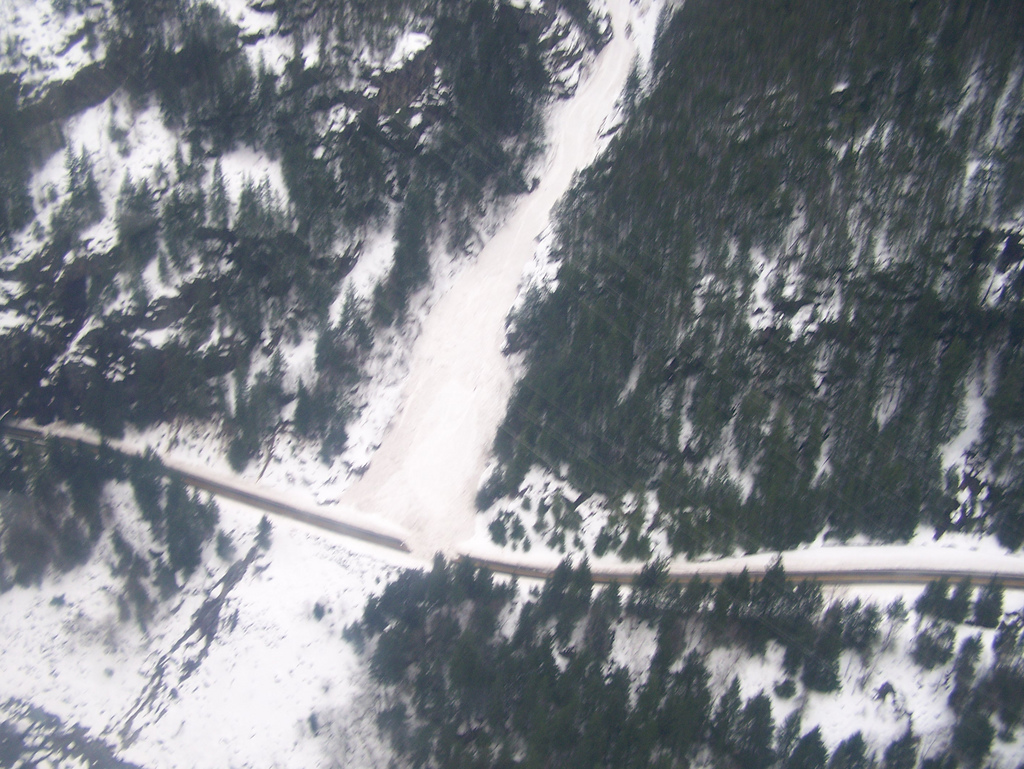
Avalanches on the North Cascades Highway
(SR 20)
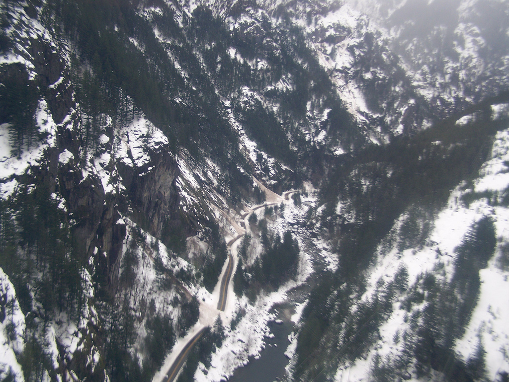
Photos from an aerial survey Jan 6th.
Photos from an aerial survey Jan 6th.
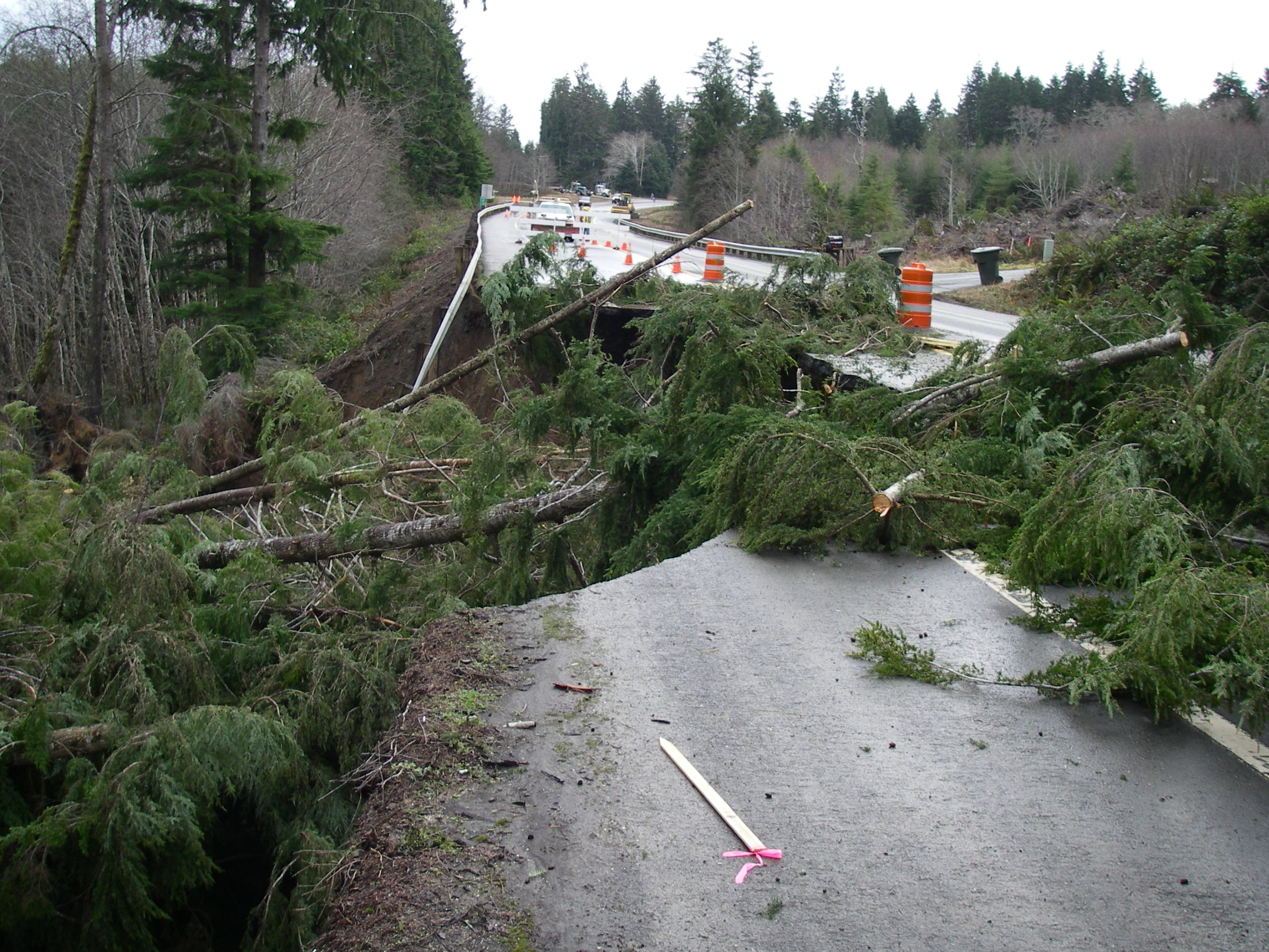
The Sleeping Giant Awakes!
(Sumas Landslide Corridor, Olympic Penninsula, SR 112)
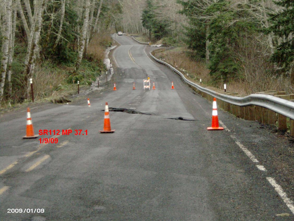
Day one.
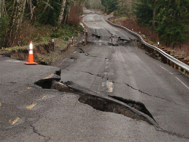
Day Two.
Day Three.
What can you do?
What I've been doing for the past couple of weeks...
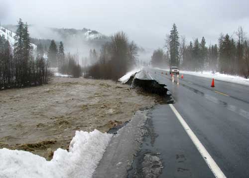
(The I-5 Closure, The Detour Route, and SR 12: White Pass)
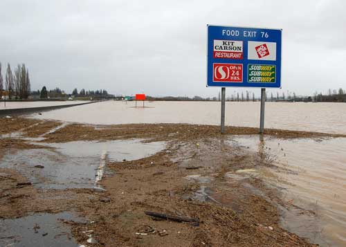
The Chehalis river flooded over I-5, forcing a full closure for days.
Doug Anderson and I were sent south of the flooding Chehalis, in order to be able to respond to the inevitable landslides that would accompnay the storm.
We were essentially trapped on the south side of the river until the flood receeded.
Our top prioroty was to open a detour route through the slide-ridden corridor that is SR 12 to SR 7.
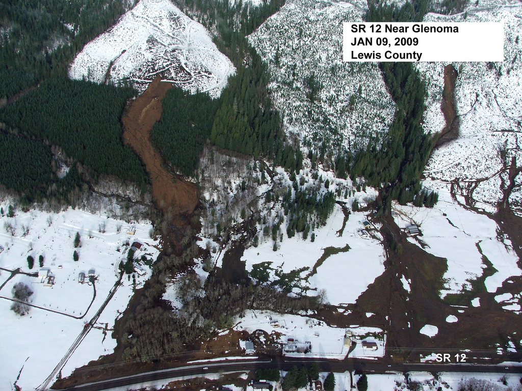
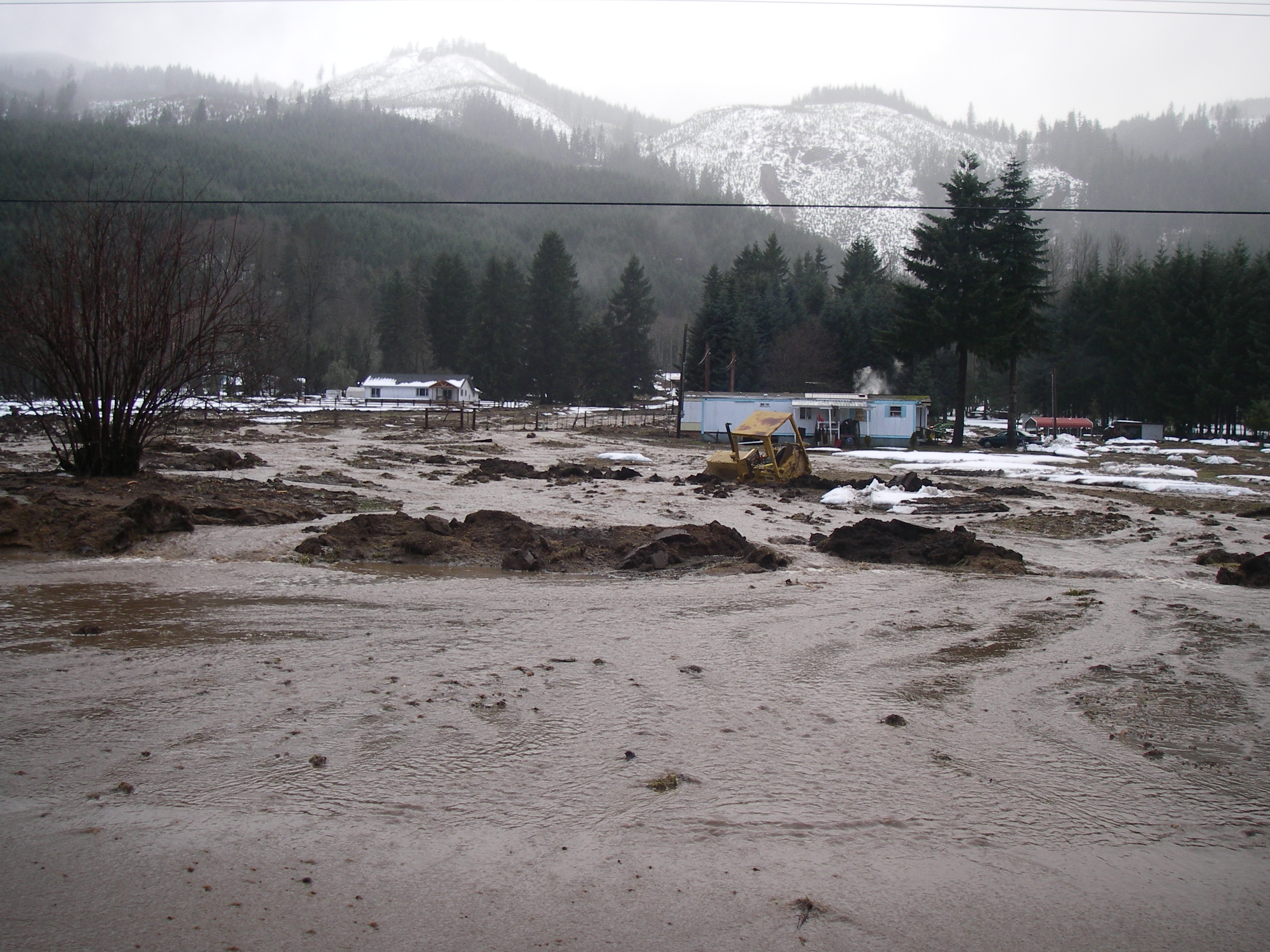
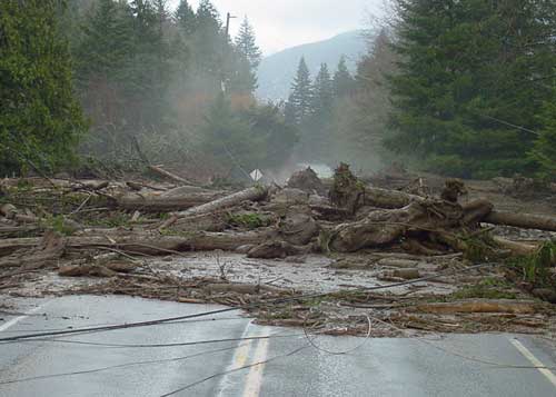
The foothills of the Cascades were falling apart, spilling mud, trees, rock, ice, and water down into their populated drainages.
Here's an air photo of the debris flows that hit the little town of Glenoma.
Here are some photos from the ground.

A Debris Slide: an enourmous slab of soil, rcok, and trees slides over the underlying bedrock on a sheet of stormwater!
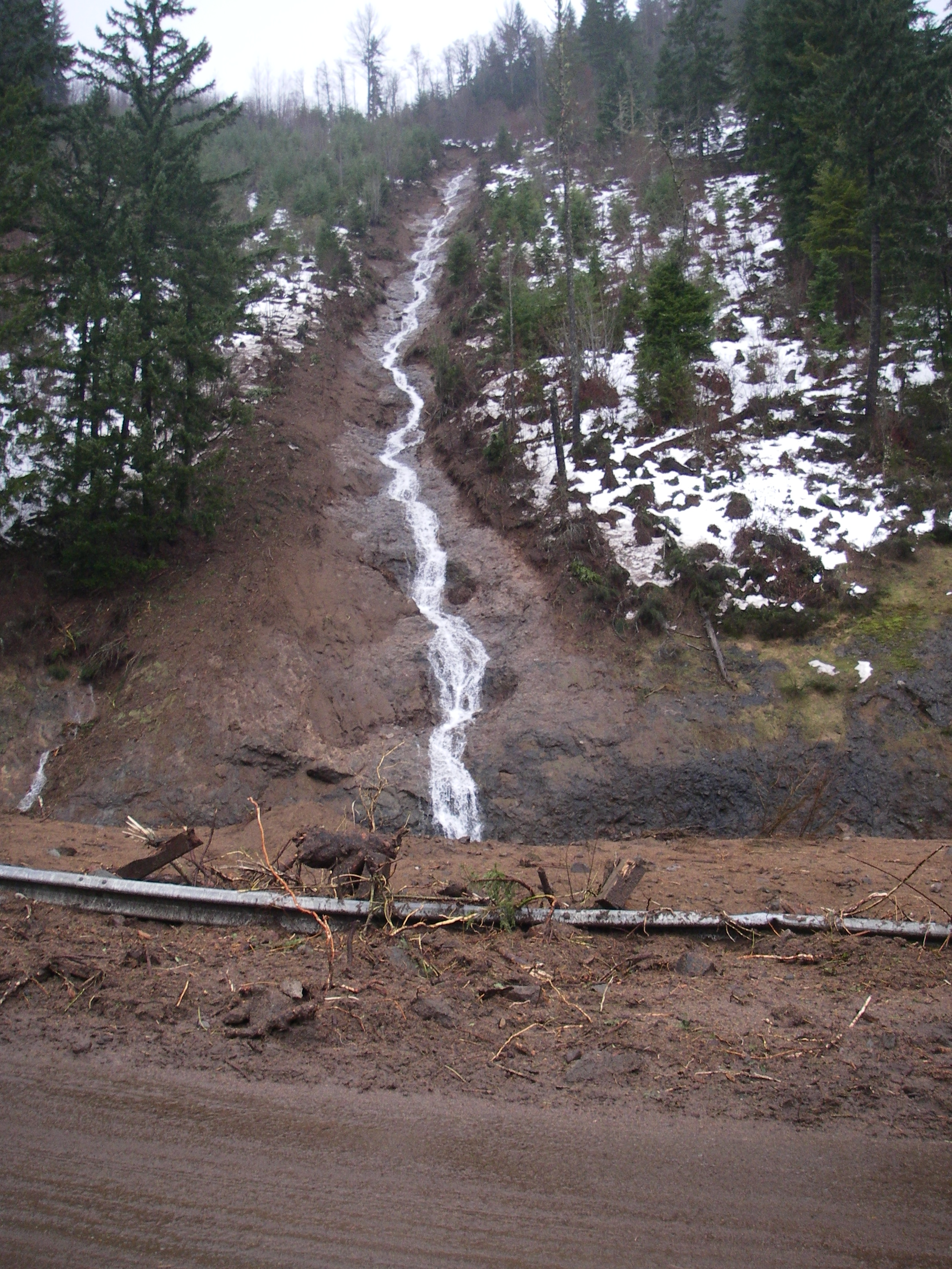
A Debris Flow: a flow of soil, water, trees, and whatever! They are channelized and rapid. These can travel for miles and are extremely dangerous to humans.
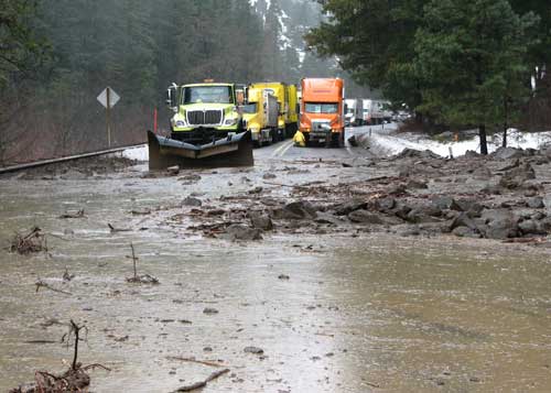
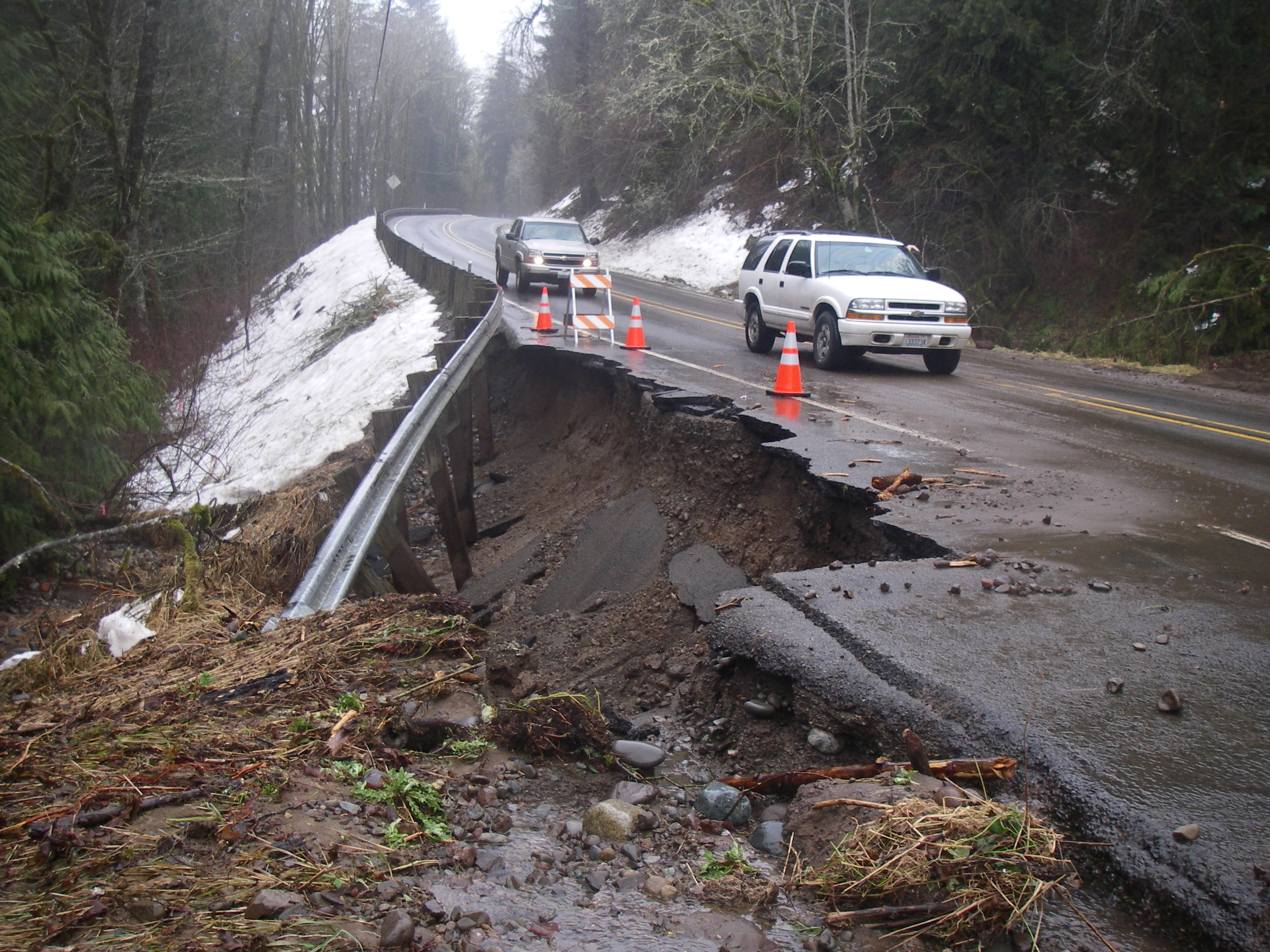
A debris flow came down Rainey Creek and went right over the bridge on SR 12.
In a vain and too-early effort to start the clean-up, this tractor was stuck on the scenic floodplain of Rainey Creek.
I-5 was re-opened later the same day.
All of the mountain passes, including White Pass, were closed for days.
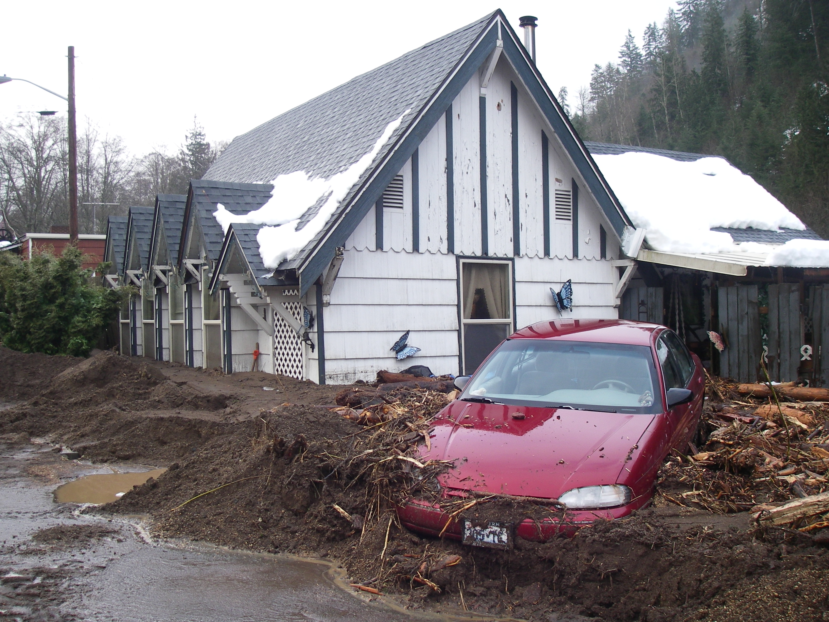
And now for a few gratuitous destruction shots:
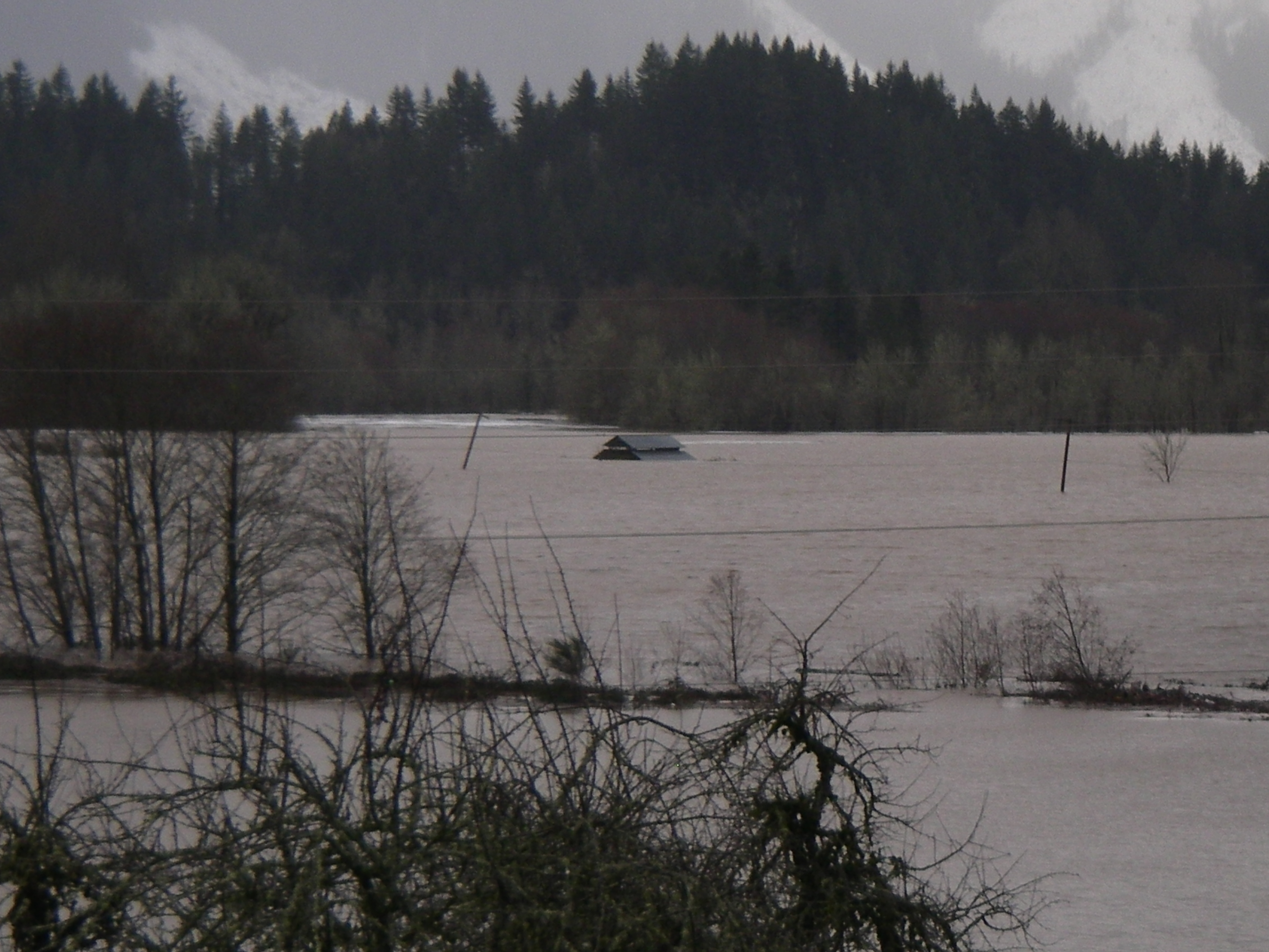
See the house out there? Yeah, they didn't build that in a lake...
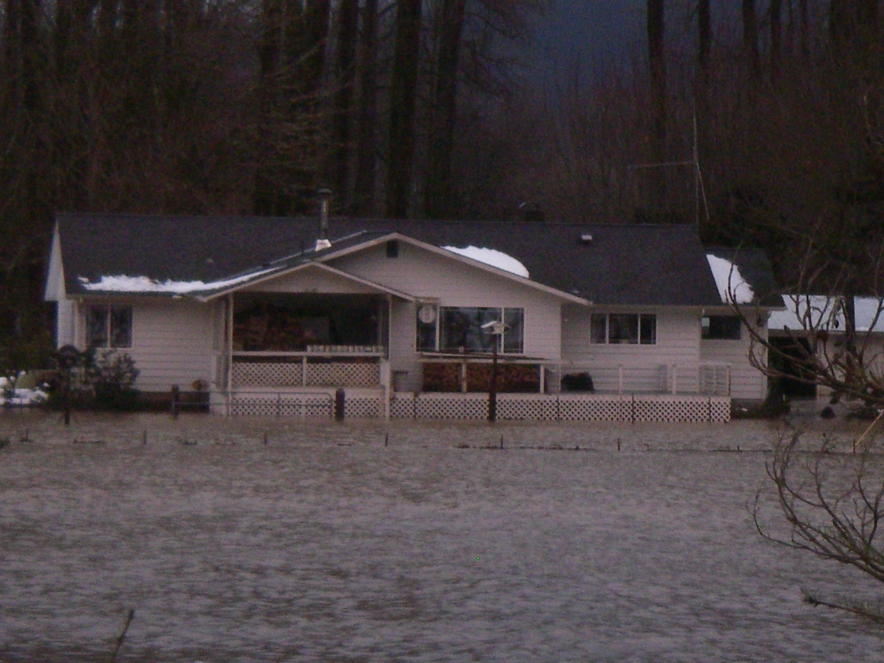
Suddenly, the 18 inches of water I got in my basement doesn't seem so bad.
A truly tragic event in the history of Glenoma.
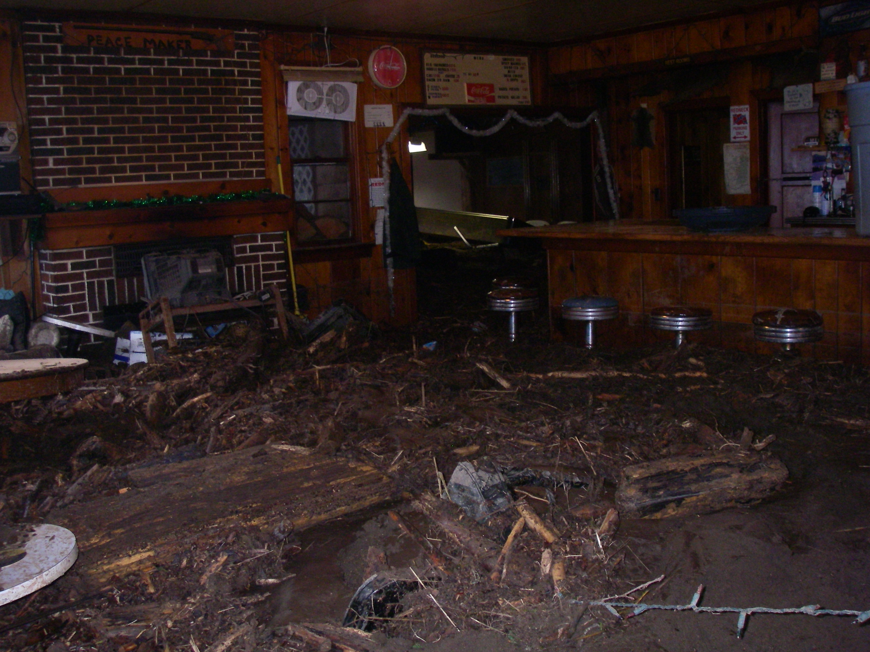
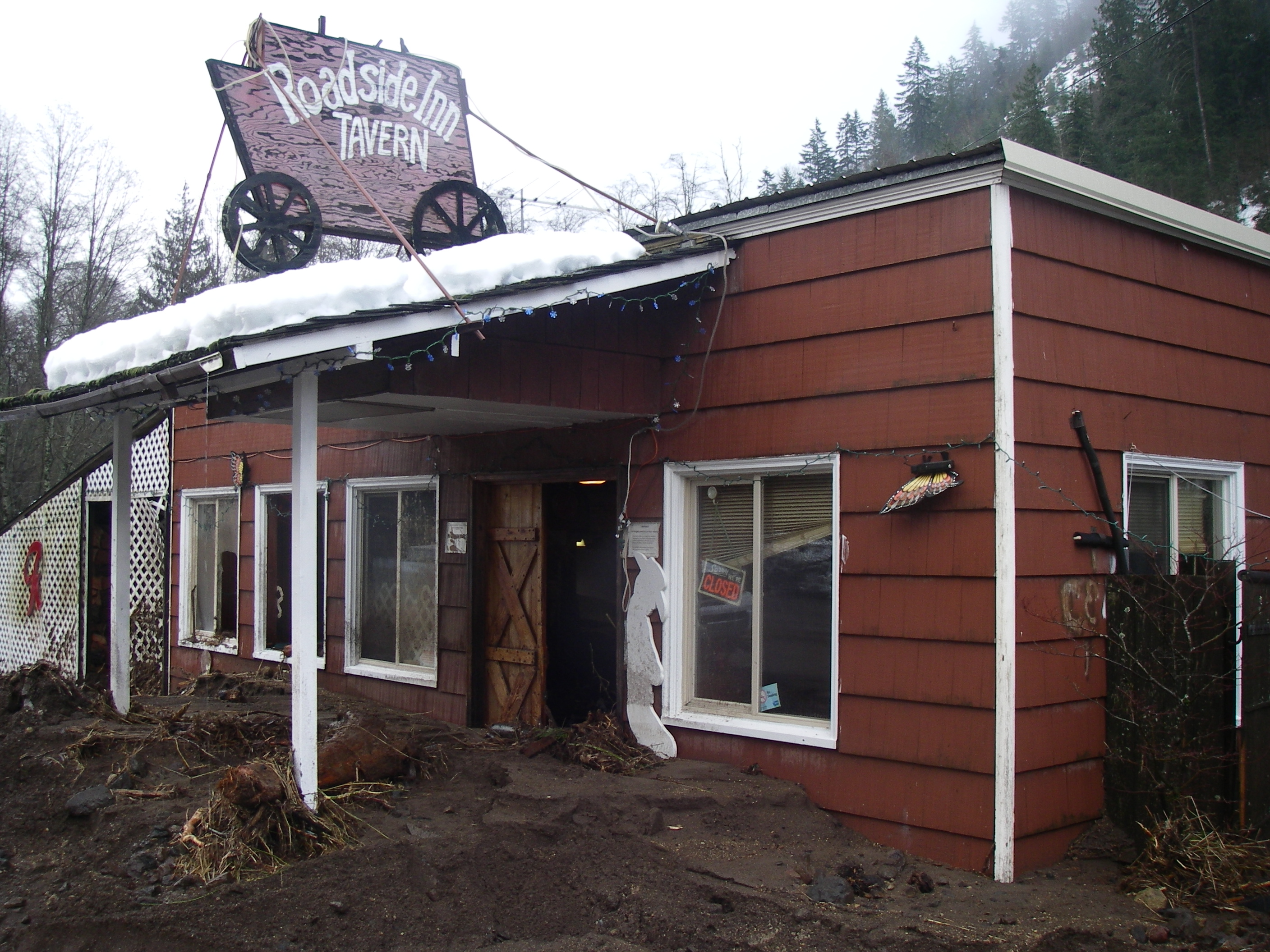
The taps were still on, but geologists looting beer is bad PR (though totally natural).
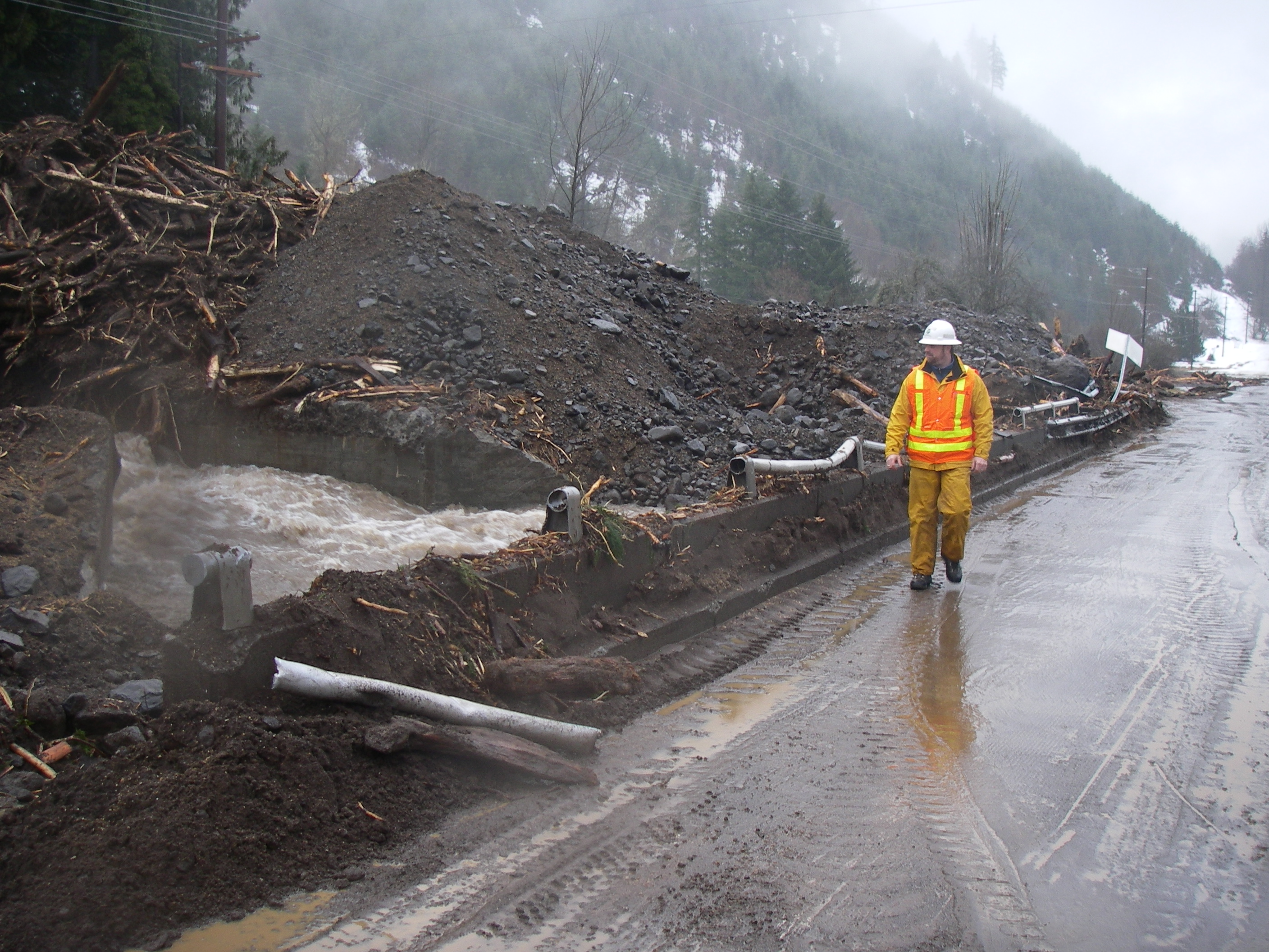
The scramble to clean it up and get it re-opened!
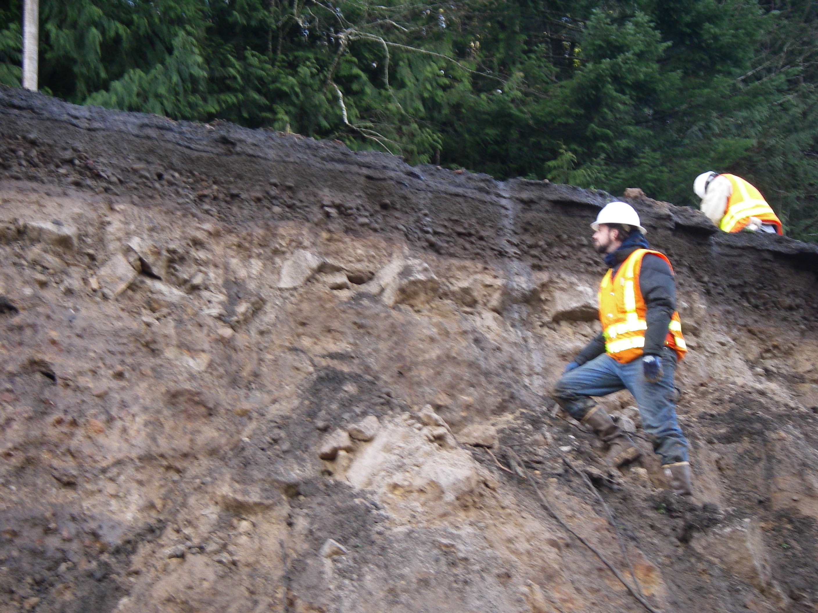
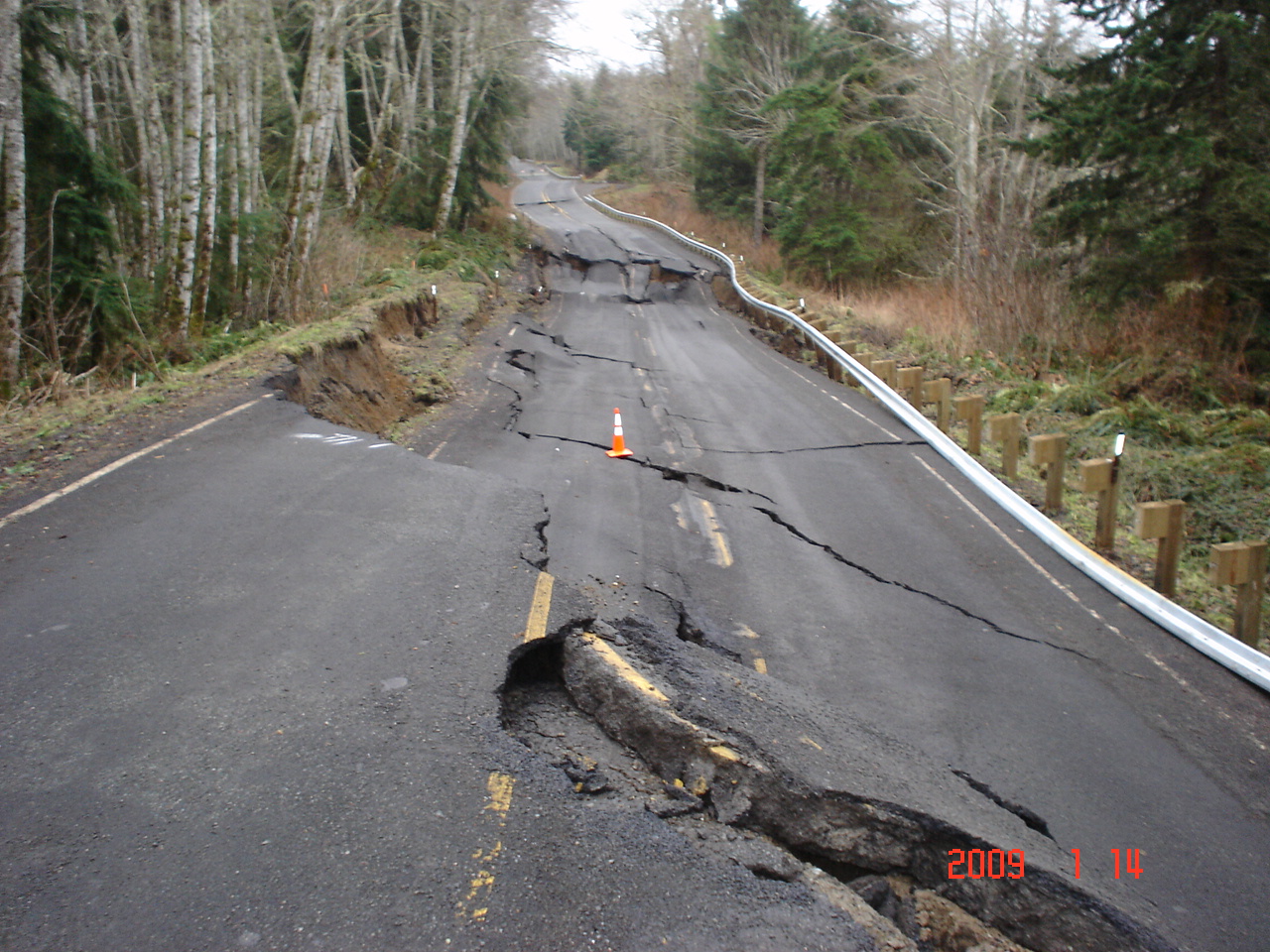
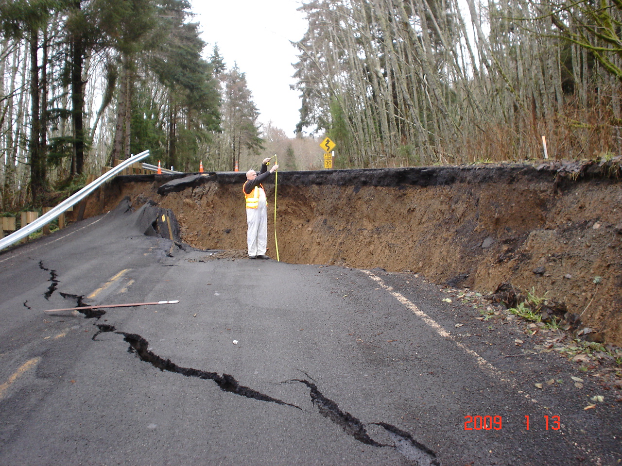
This landslide is one of my projects for this week.
We're down to one lane and they want to start rebuilding Monday.
The pressure is on!
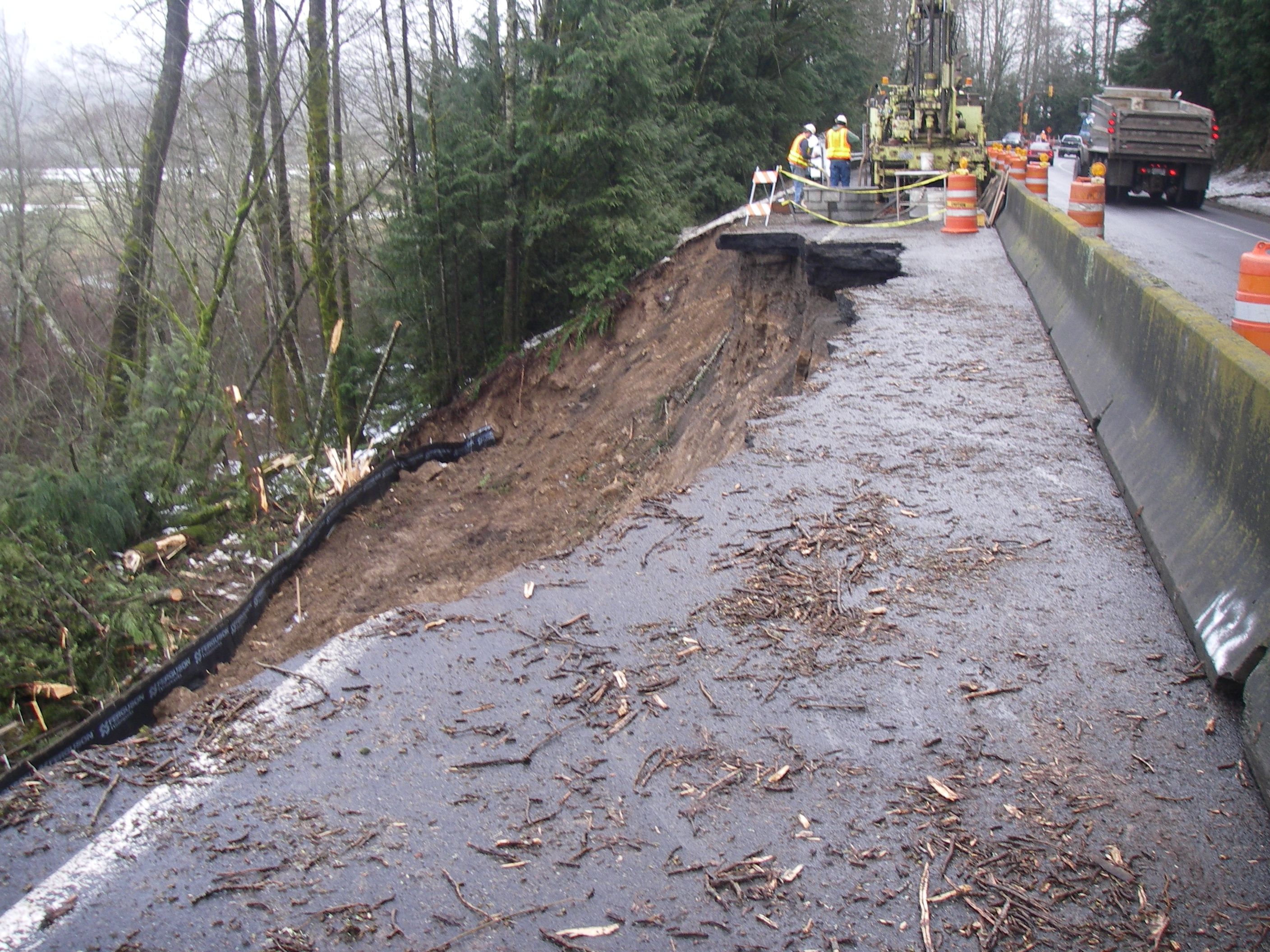
The drillers have arrived! They're going to find out what we have to build on down there.
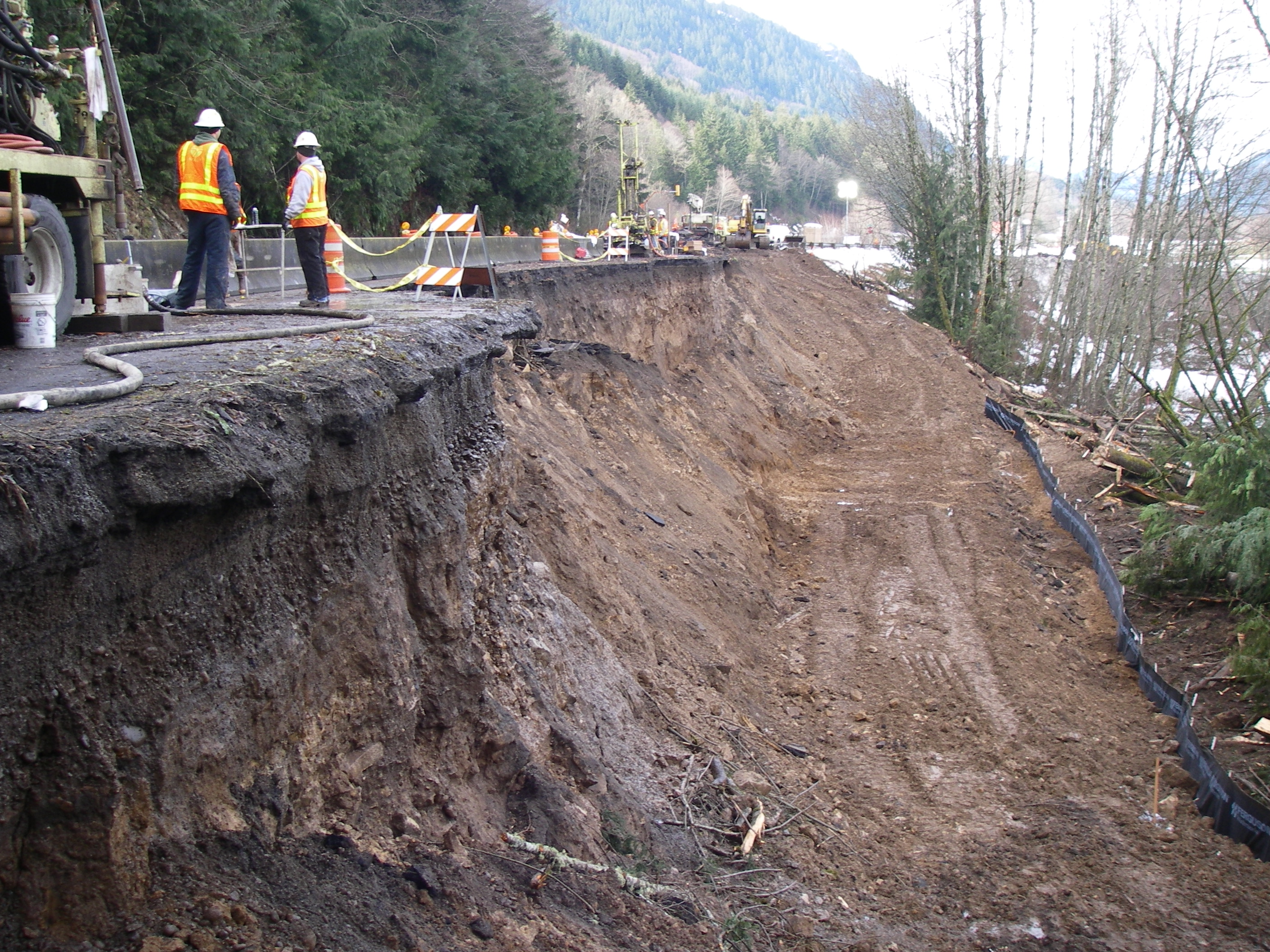
They'll also install a few wells that we can use to figure out where the groundwater is.
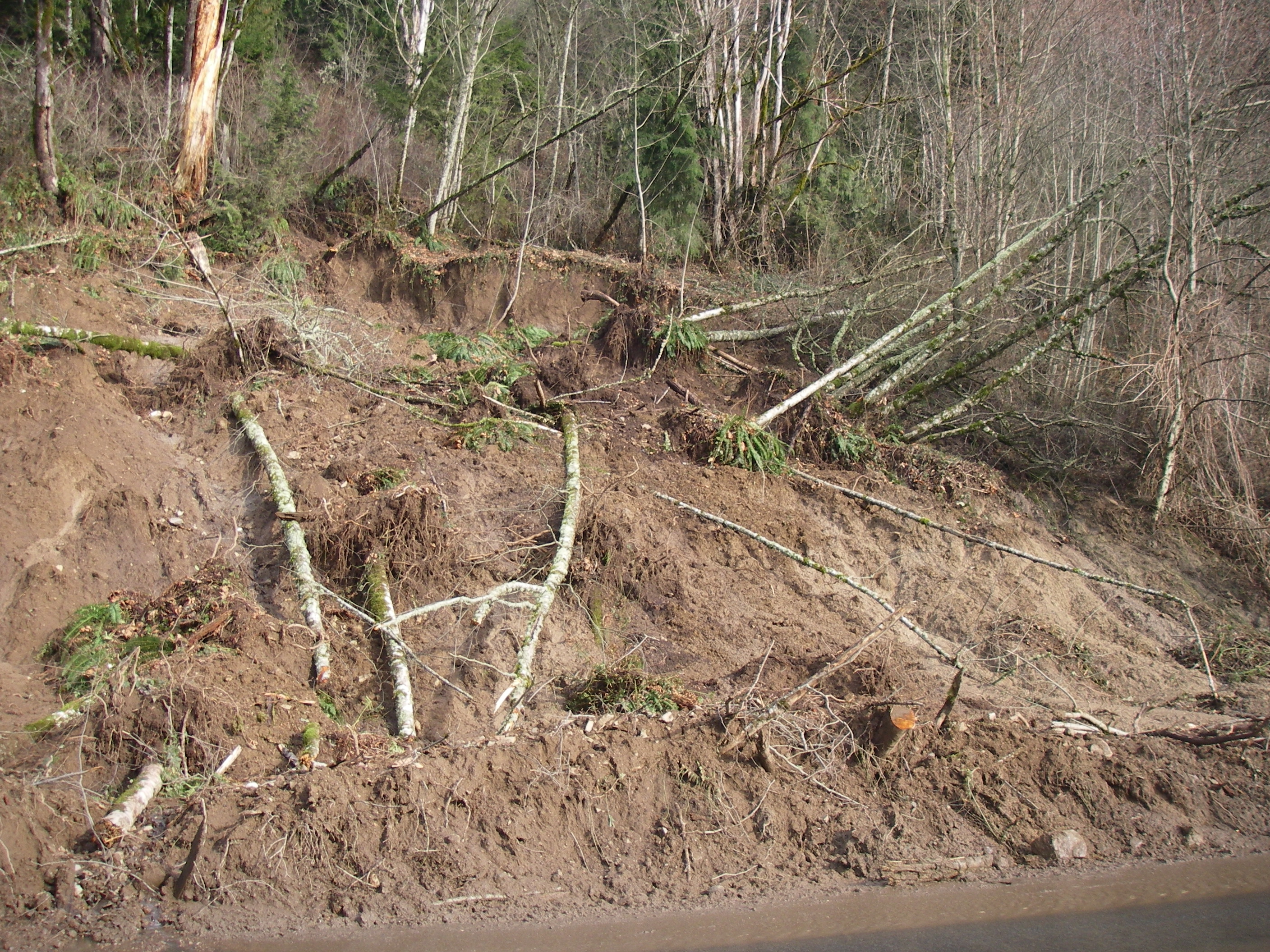
This is the other mess I have to figure out how to clean up.
It's big, wet, muddy, and not very photogenic.
A few more photos from around the state.
Blewett Pass (SR 97)
Near Bear Canyon (SR 508)
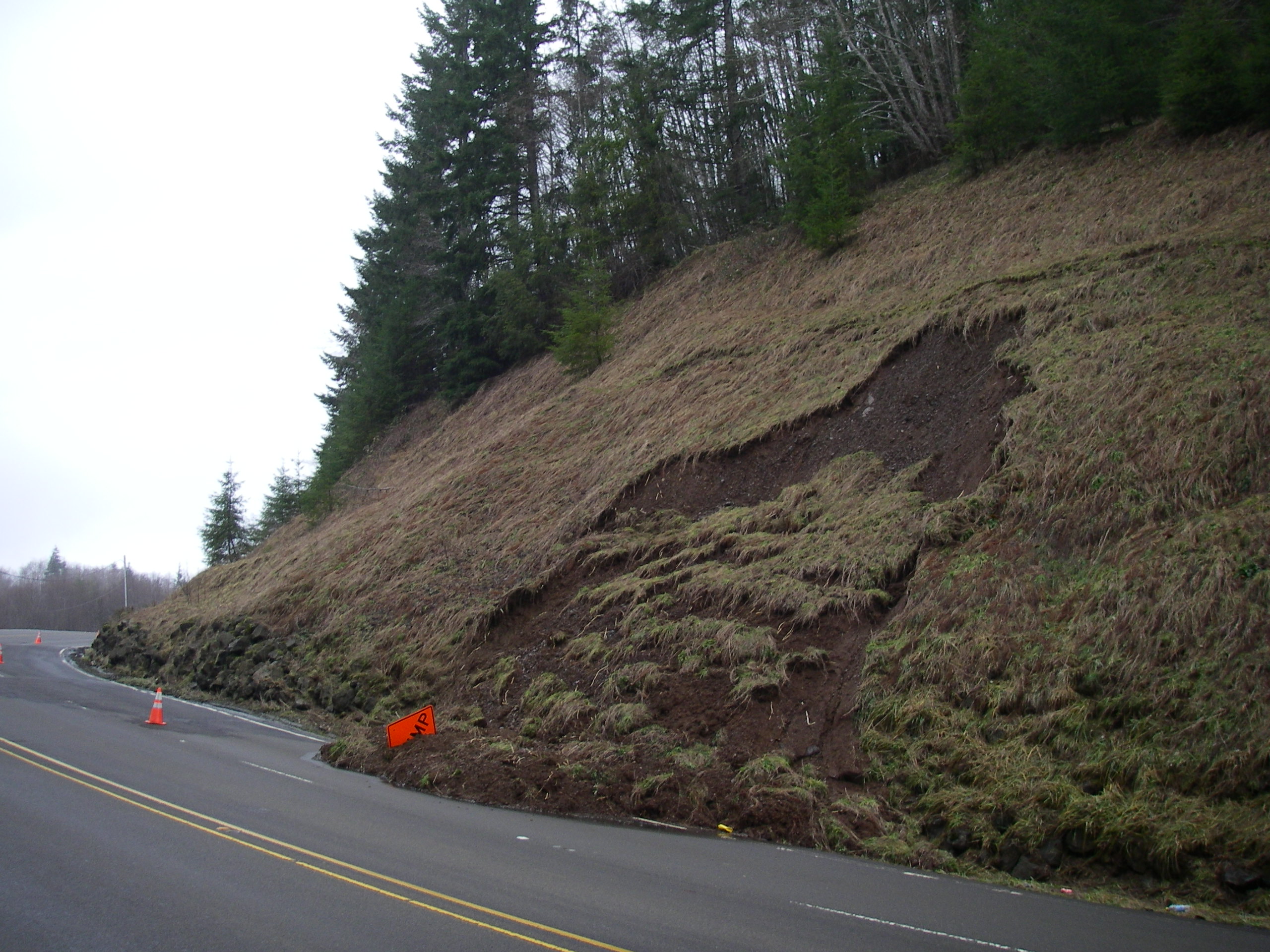
These things are everywhere.
I'm getting pretty used to these too.
And, finally, a few for the Bellinghamsters:
You probably didn't realize it, but there was no way you were going to drive up to Baker last Wednesday!
The Nooksack went berserk! There were at least two or three debris flows acros SR 542.
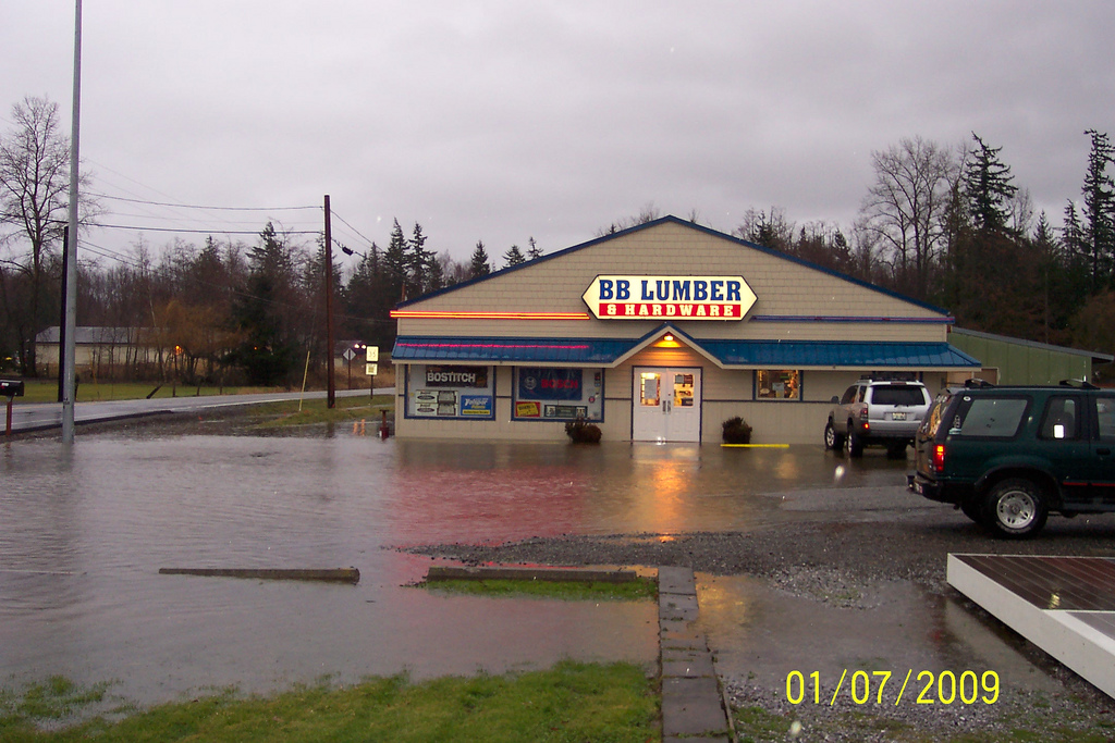
Businesses and homes on the Guide Meridian were getting flooded.
These guys always had that annoying sign...