The largest landslide of the season, so far, is this one.
This is the Pe Ell Landslide (pronounced "Pee El"), located on SR 6, west of the Town of Pe Ell.
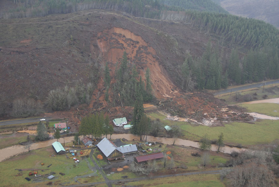
This is an airphoto of the slide, taken from a helicopter.
Notice the two lobes of the slide that come down from the top (head scarp).
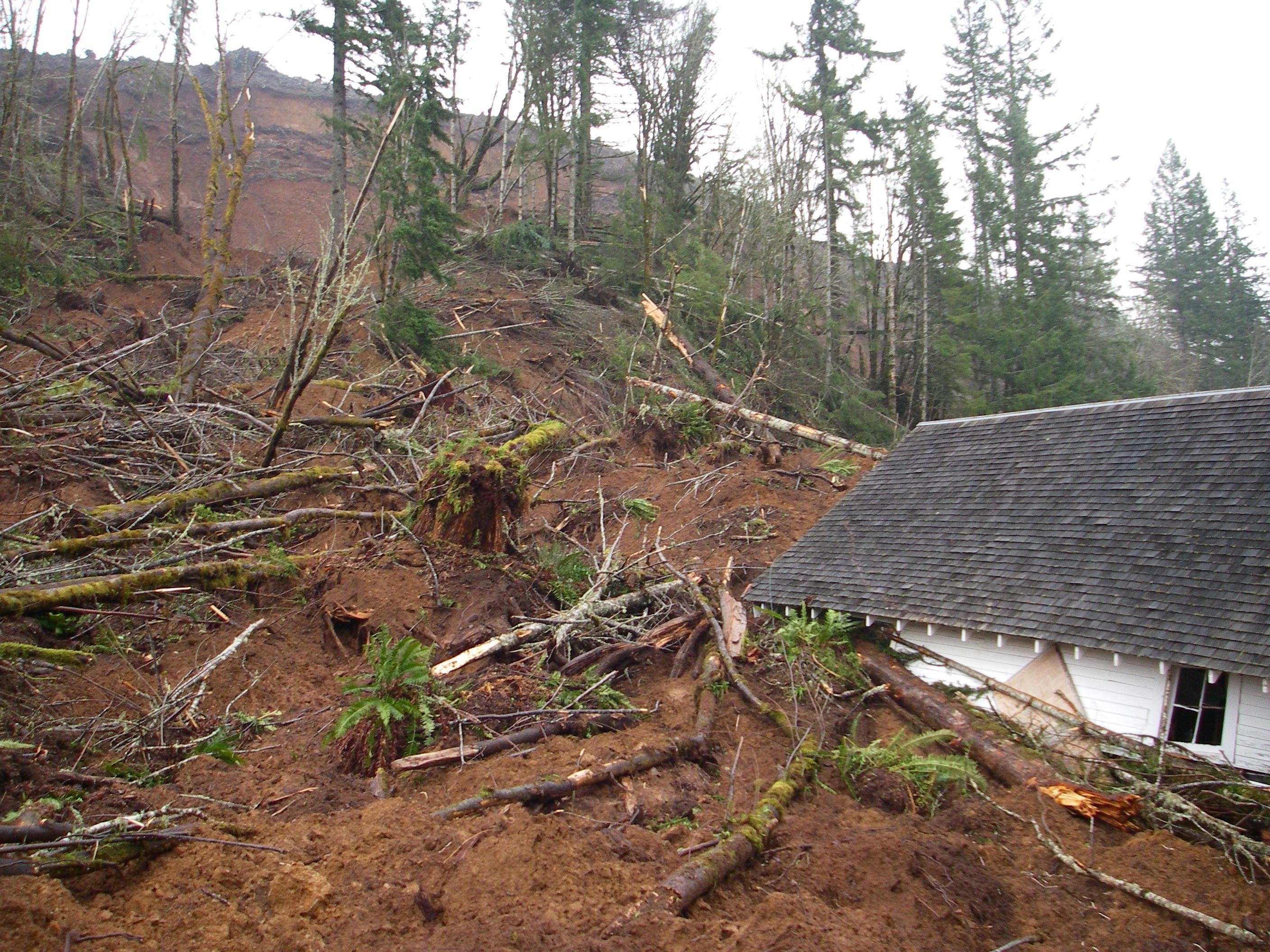
We approached this monster from the road on the right, then crossed in front of it around the debris. We then climbed up the left side, walked along the top, and came back down the right side, taking measurements and photographing the whole way along. The terrain was very diffcult to travel through, with deep soft mud and thick mats of small broken trees overlying the uneven and partially burnt surface of the recent clearcut.
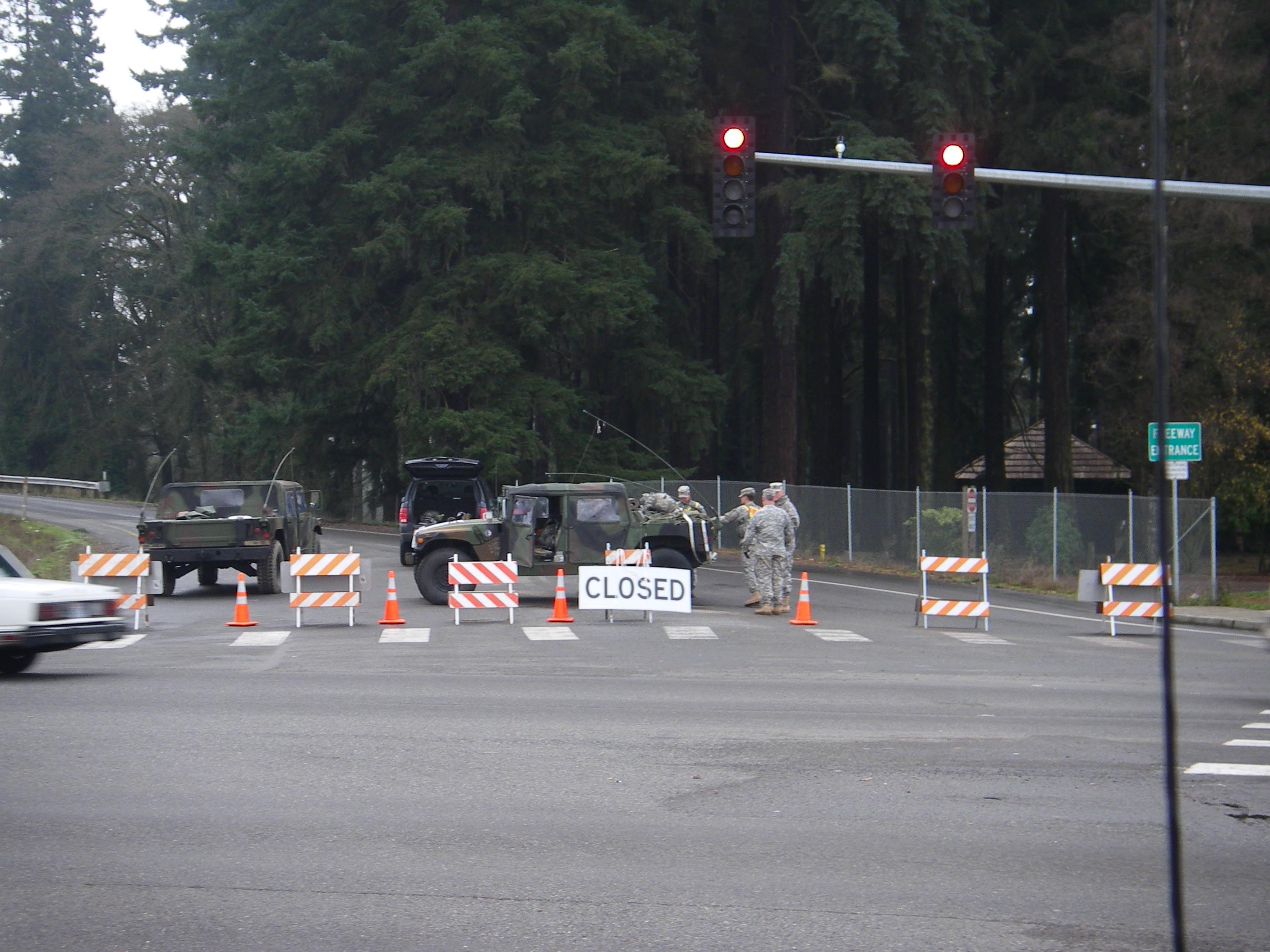
Due to flooding, Washington is officially in a Sttate of Emergency. Here's the National Guards' roadblock at the I-5 on ramp near Centralia. I get quite the power-trip when these guys wave me through.
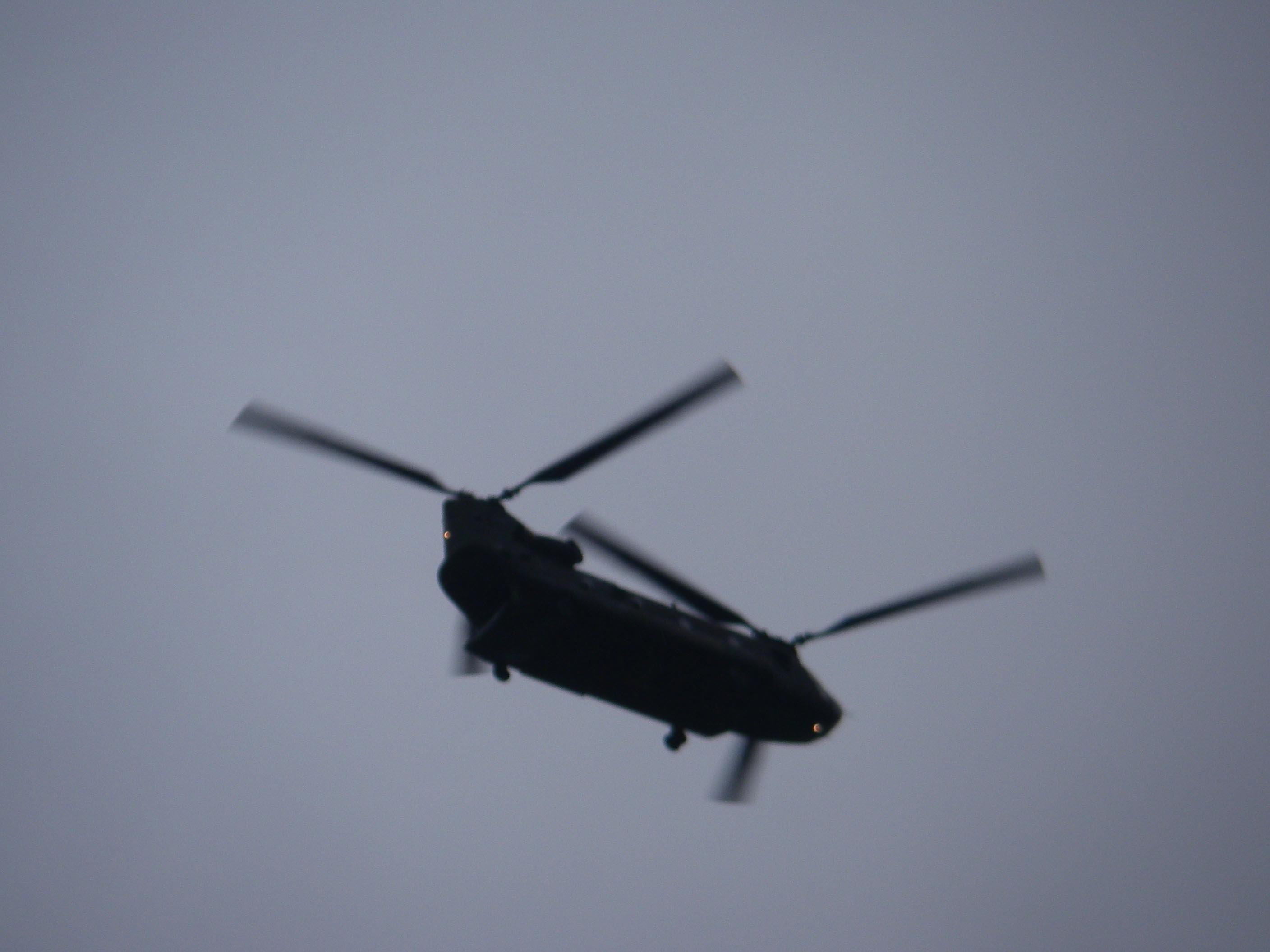
Driving down a flooded-out I-5 with no other cars anywhere is a really bizarre experience. Apocalypic fantasies naturally come to mind. This army chopper flew overhead. Apparently Governor Gregoire was taking in the sight in one of these yesterday.
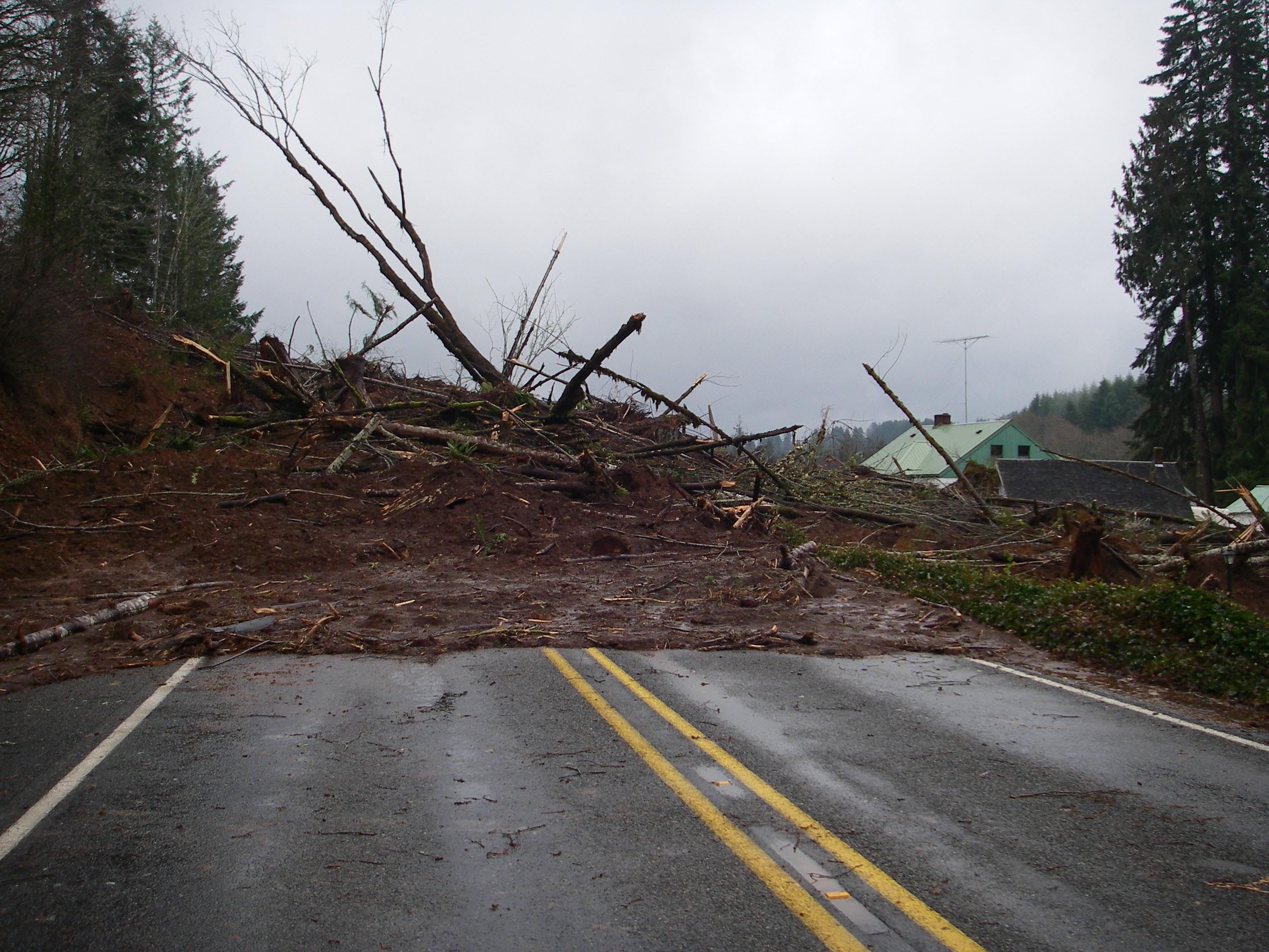
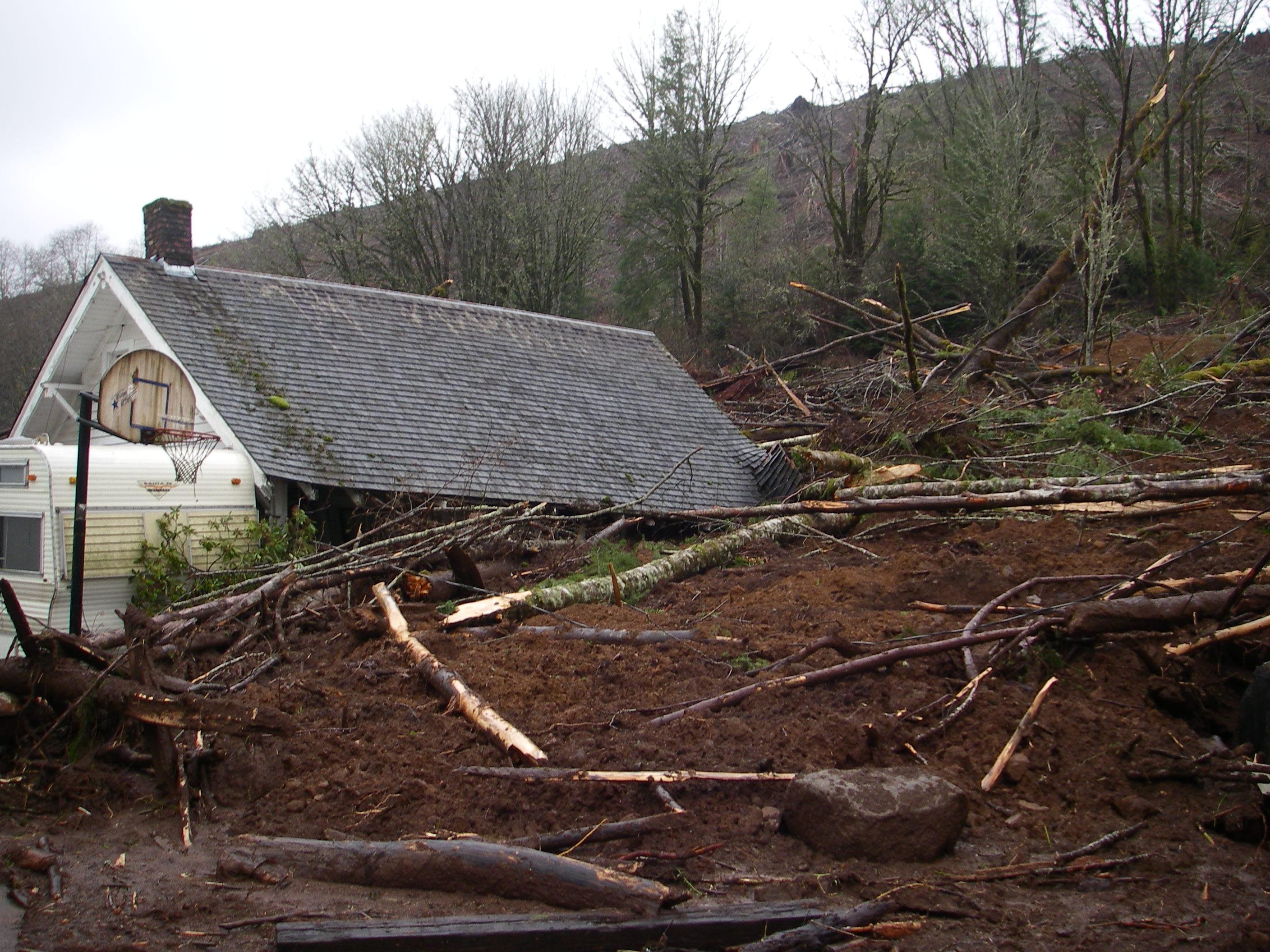
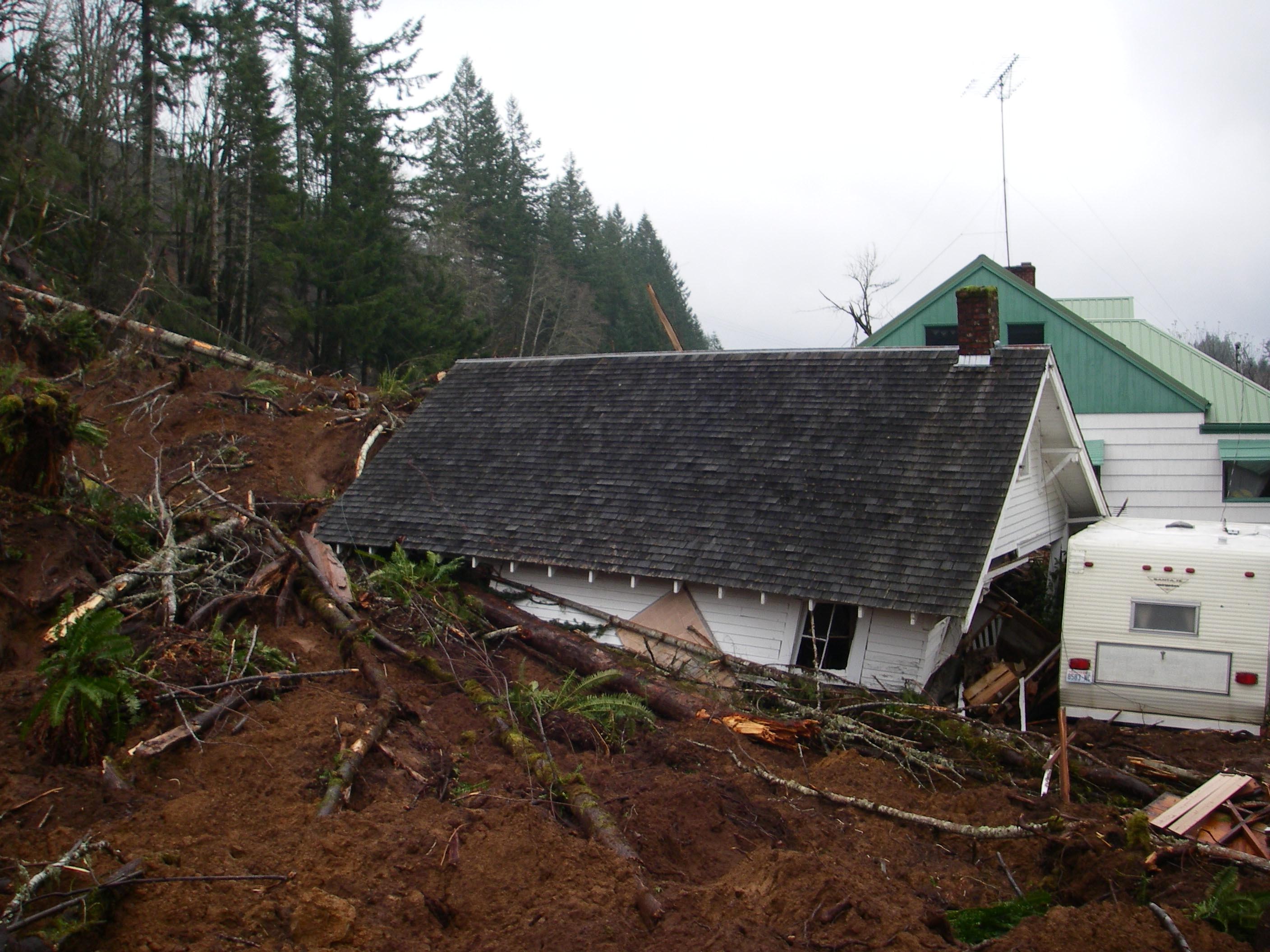
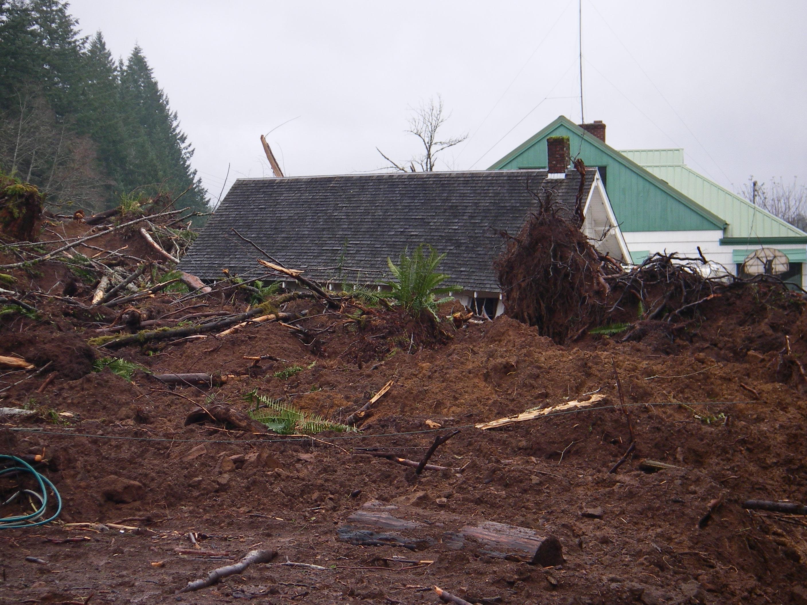
The picture doesn't show the extent of this debris. It is going to take a lot of machines and people to clear this mess.
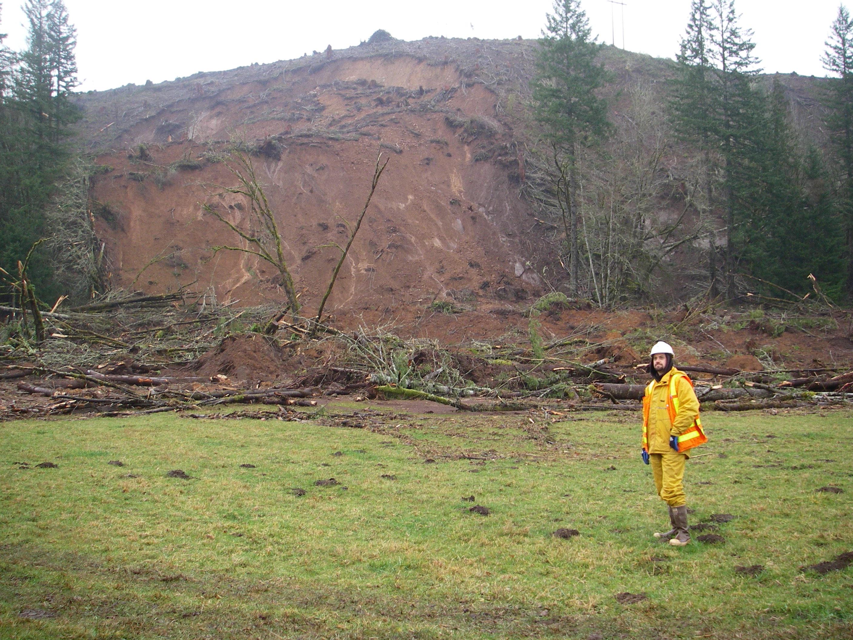
I'm working with Eric Smith, and he spends some time with the camera as well. I finally got in one of these photos!
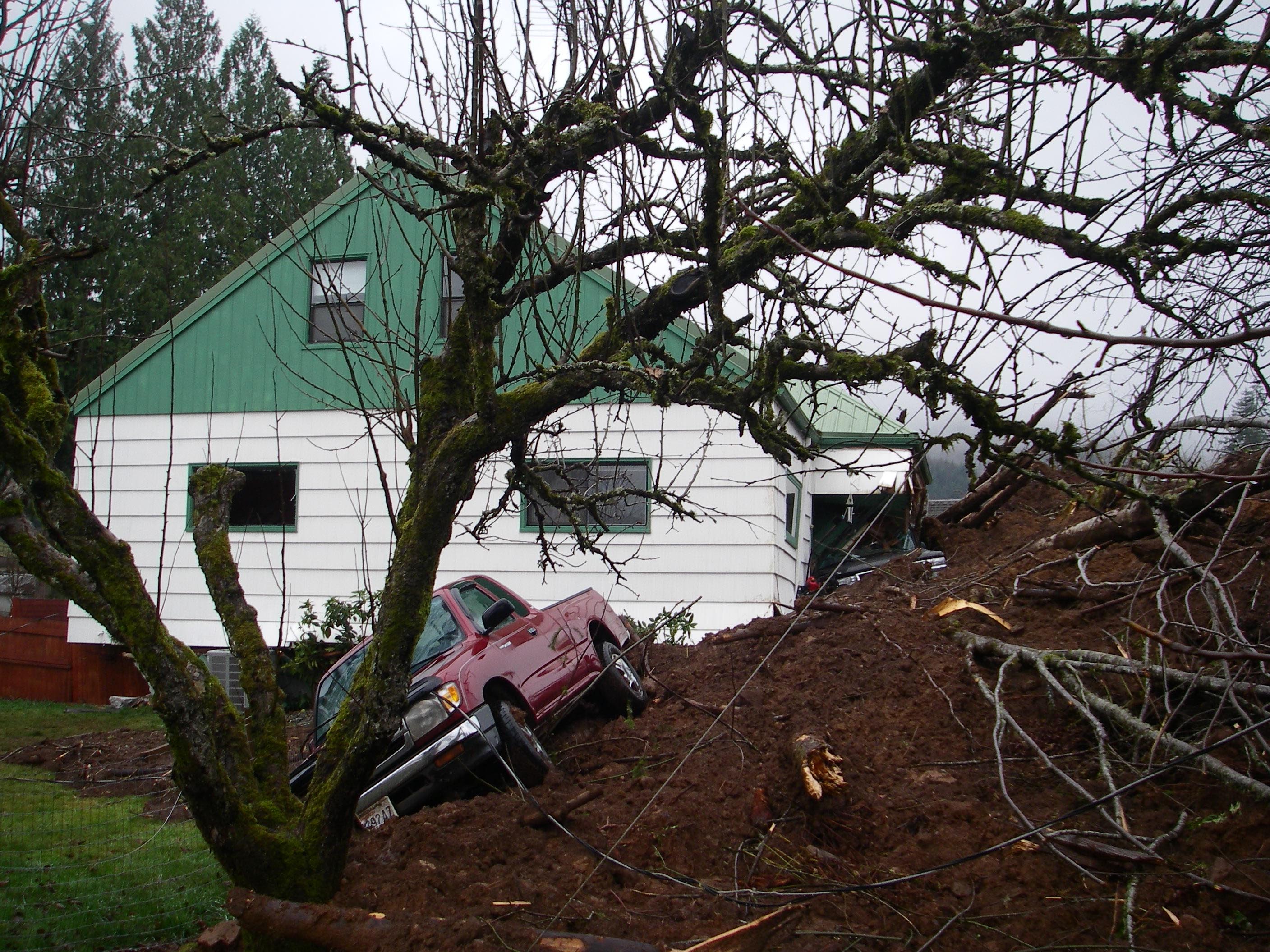
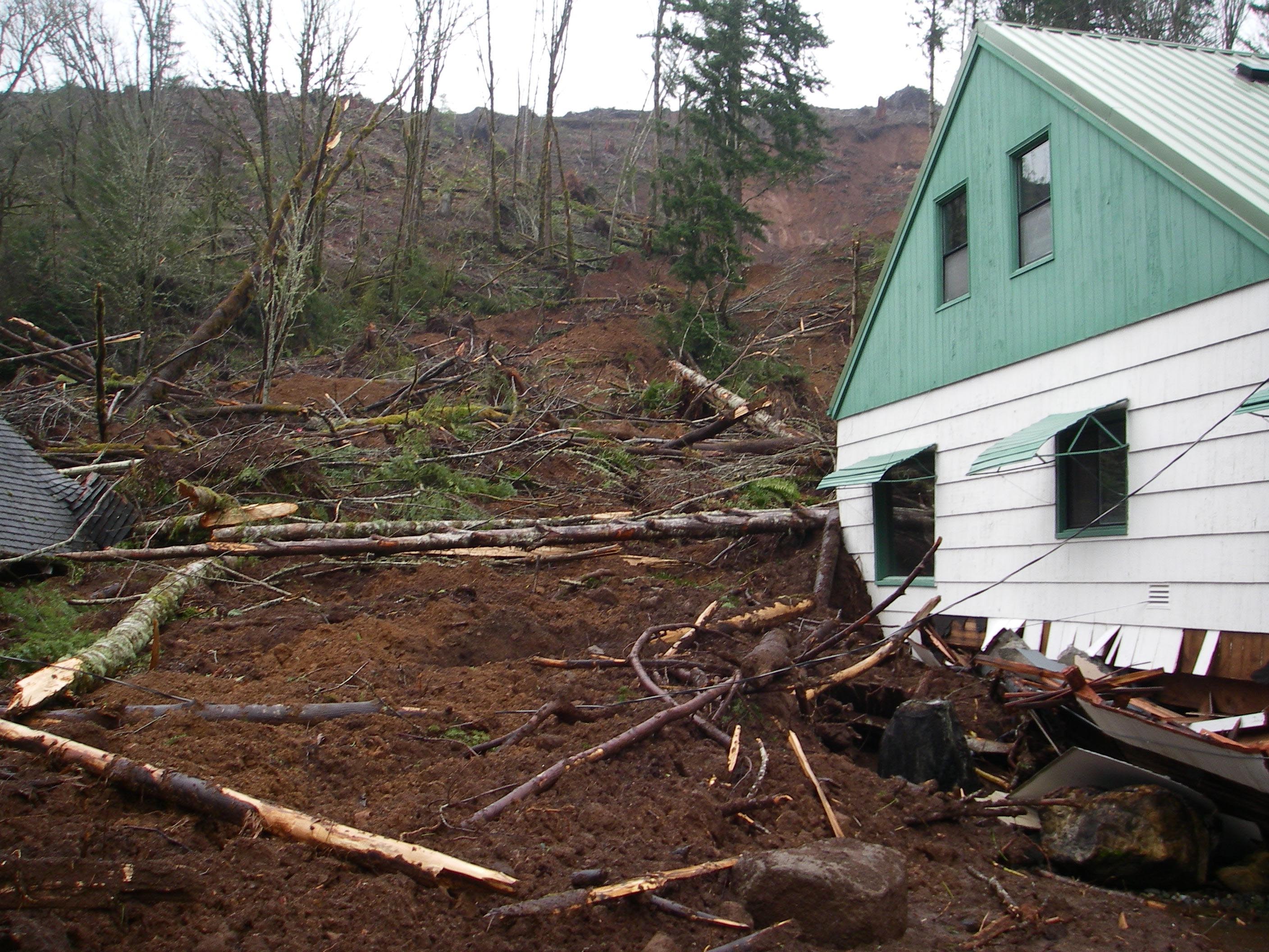
The people in this house were just leaving through the back door when the landslide came in unannounced.
No one was injured or killed. Notice that there are two cars in this photo?
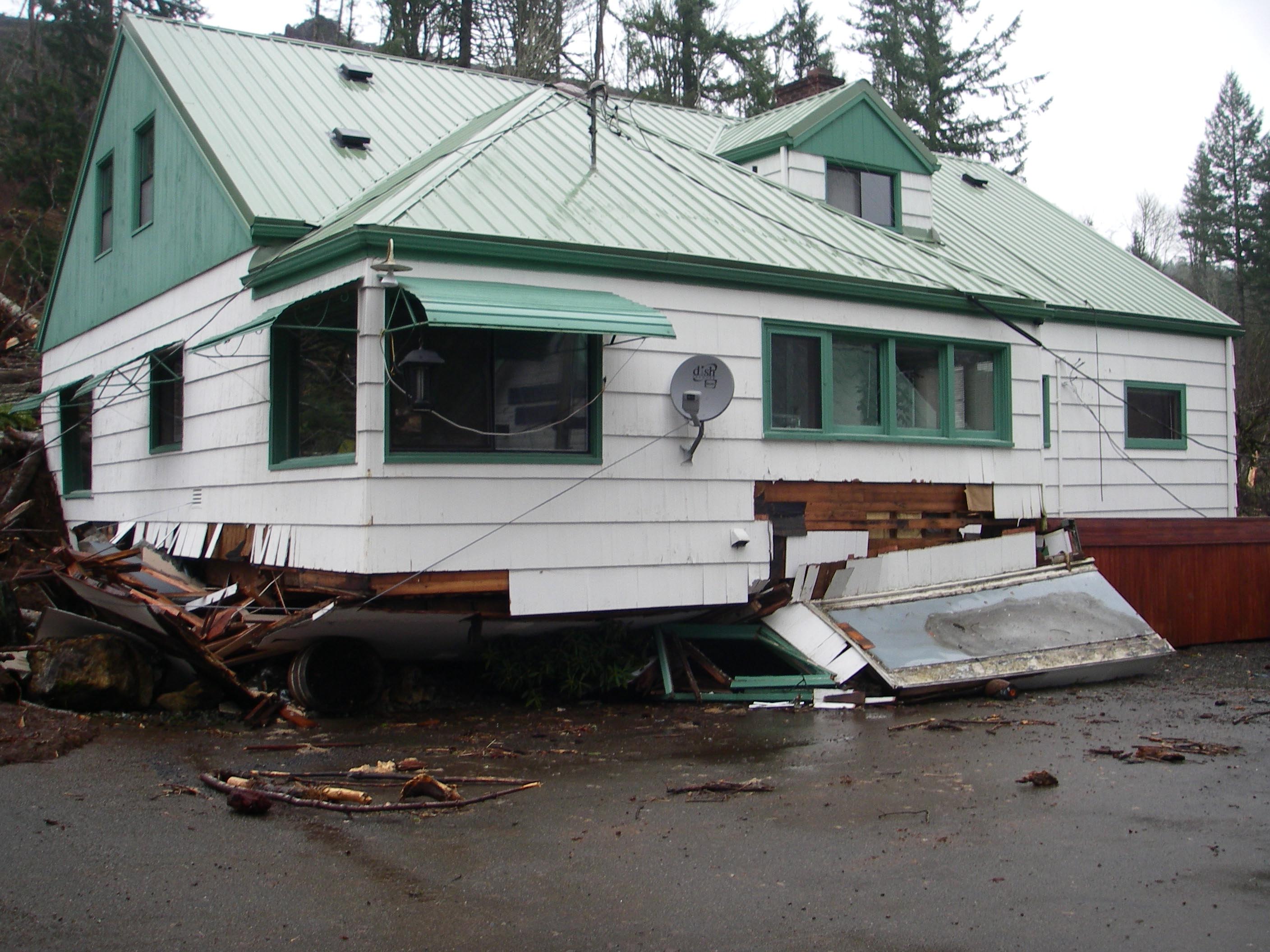
The force of the hit knocked the house off of its foundation.
You should check out the enlarged version of this one. You can see the landslide track that goes up one of Pe Ell's two chutes. The headscarp is that new vertical face at the top. It is about thirty feet high and eight hundred feet away.
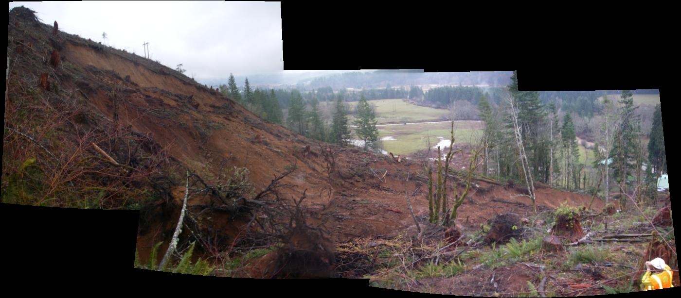
Panorama from the right lateral scarp, looking up at the head scarp.
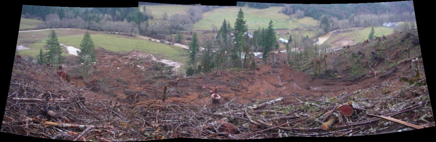
Panorama from the head scarp:
These were taken while standing at the head scarp and looking down the two debris flows. We are puzzling over the funnel shape of the right flow, as well as the nature of the seemingly resistant ridge between the two lobes of the slide, or is it a metastable mass of earth that is teetering on the edge?
Using our compasses, inclinometers, and laser ranger, we collected a lot of data on the geometry of this fresh geologic feature. I'll be drawing a map of it tomorrow morning, before I head back out ot look at more of the hammered Chehalis floodplain (on what would otherwise be my day off).