Unicorn Peak Tatoosh RangeMt. Rainier National ParkJuly 14-15, 2018
(All photos link to full resolution versions.)
|
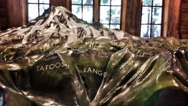 The Tatoosh Range is a lovely hunk of granite that protrudes above the surface just south of Mt. Rainier.
It includes eight significant peaks, and offers the best possible views of Mt. Rainier's south flank.
Unicorn Peak, at 6971 feet, is the tallest in the range. The climb is a classic mix of mountaineering elements, including a technical section at the summit.
After our great trip in the Goat Rocks last summer, Evan and Trevin and I wanted another alpine experience together.
I suggested a traverse of the western Tatoosh.
I have been in the Tatoosh twice before.
2006 - I traversed the western Tatoosh from Unicorn to Pinnacle with Kevin and Dan.
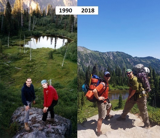
1990 - In the early days of my backpacking, I hiked to Snow Lake with my buddies Jon and Abe. We were about 16.
(See below!)
The Tatoosh Range is a lovely hunk of granite that protrudes above the surface just south of Mt. Rainier.
It includes eight significant peaks, and offers the best possible views of Mt. Rainier's south flank.
Unicorn Peak, at 6971 feet, is the tallest in the range. The climb is a classic mix of mountaineering elements, including a technical section at the summit.
After our great trip in the Goat Rocks last summer, Evan and Trevin and I wanted another alpine experience together.
I suggested a traverse of the western Tatoosh.
I have been in the Tatoosh twice before.
2006 - I traversed the western Tatoosh from Unicorn to Pinnacle with Kevin and Dan.
1990 - In the early days of my backpacking, I hiked to Snow Lake with my buddies Jon and Abe. We were about 16.
(See below!)
|
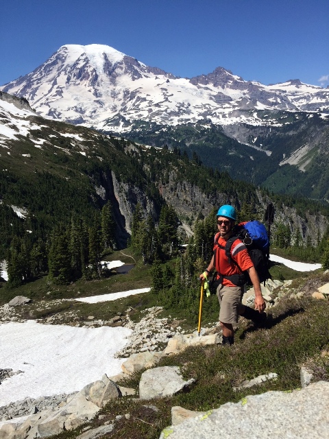
 16 year-old Gabe! I still rock the bandanna!
(Left) Abe Crittenden, one of my high school hiking buddies. (Right) Evan Horback with me, here in 2018.
Now in 2018, I am in my 28th year of backpacking, and my 20th year of mountaineering!
Alright. On with the trip report!
16 year-old Gabe! I still rock the bandanna!
(Left) Abe Crittenden, one of my high school hiking buddies. (Right) Evan Horback with me, here in 2018.
Now in 2018, I am in my 28th year of backpacking, and my 20th year of mountaineering!
Alright. On with the trip report!
|
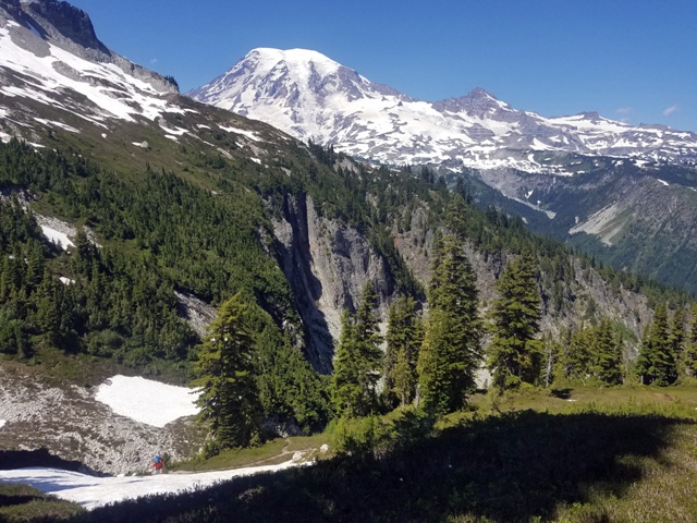
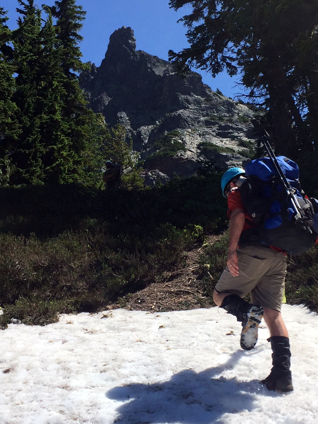
I am going to skip past the little 1.3 mile appraoch to Snow Lake, except to say that we stopped at the Bench so that I could get the right half of the above photo.
 Just above Snow Lake, we left the trail and the tourists behind.
We paused to gaze up the Unicorn Basin and pick out our route.
Reminder: All of these photos link to full-resolution versions!
Just above Snow Lake, we left the trail and the tourists behind.
We paused to gaze up the Unicorn Basin and pick out our route.
Reminder: All of these photos link to full-resolution versions!
|
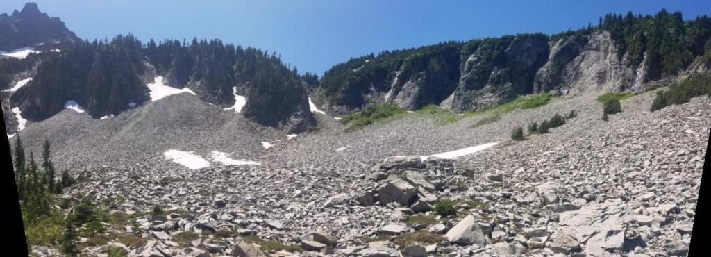 (Above) The Unicorn Basin from just above Snow Lake.
That is Unicorn Peak, over on the left.
Our first section of the climb would cross the talus and ascend through the Unicorn Creek slot canyon in the center of the above photo.
(Above) The Unicorn Basin from just above Snow Lake.
That is Unicorn Peak, over on the left.
Our first section of the climb would cross the talus and ascend through the Unicorn Creek slot canyon in the center of the above photo.
|
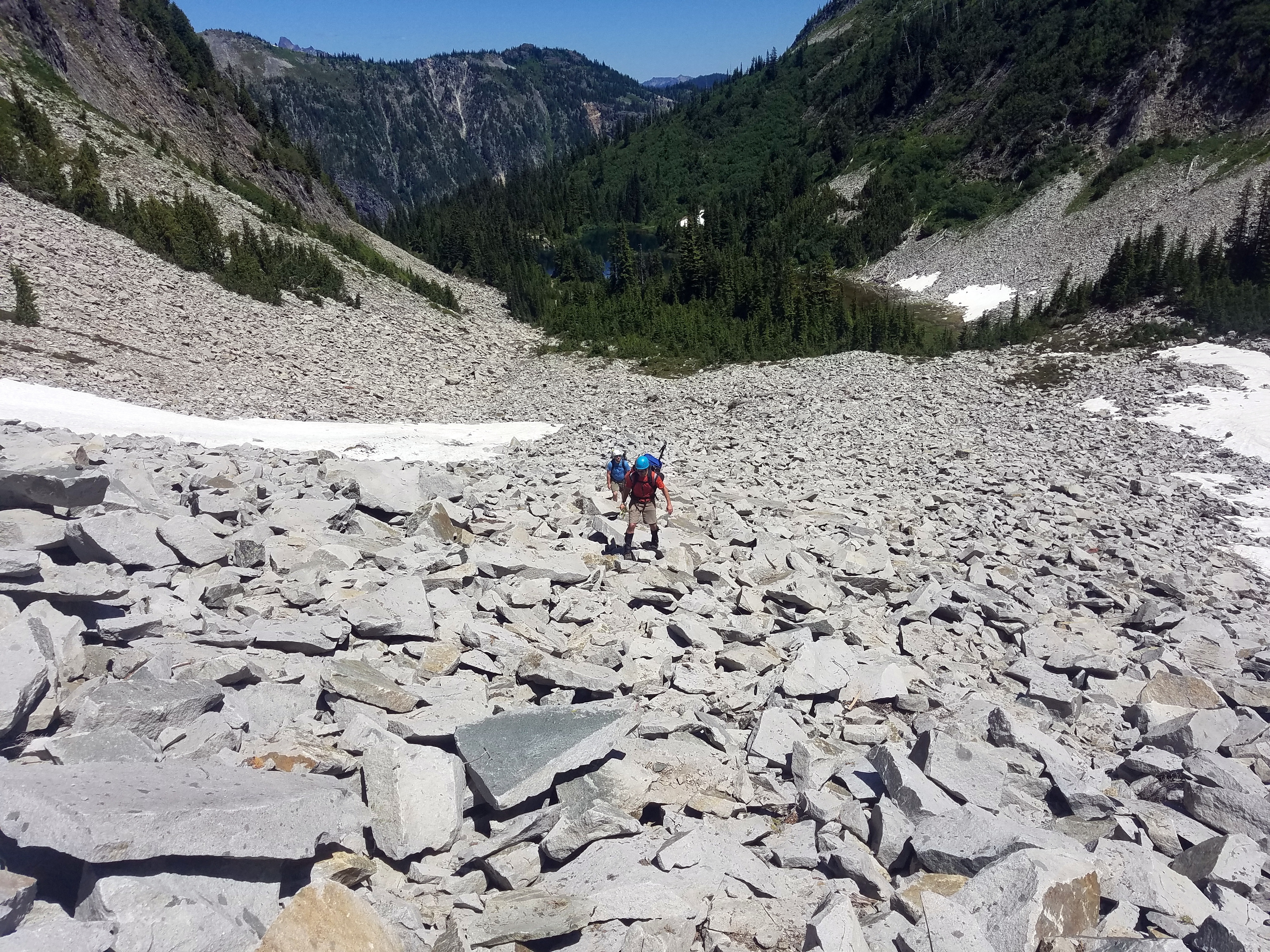
 I was in the lead, so I took a few photos of Evan and Trevin ascending behind me.
Up the talus...
I was in the lead, so I took a few photos of Evan and Trevin ascending behind me.
Up the talus...
|
 Into the slot canyon..
|
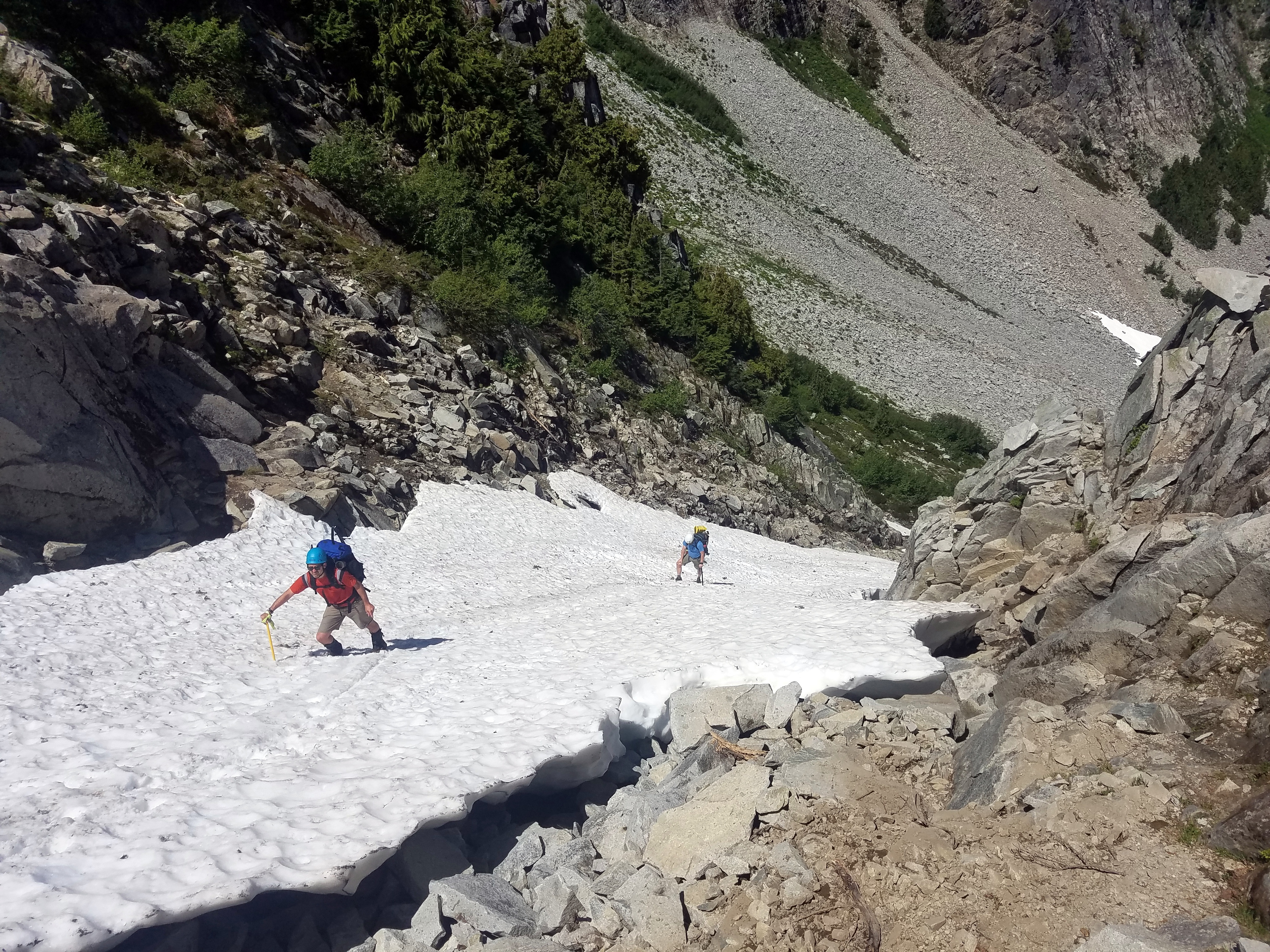
 Up the steep pitch of snow...
|
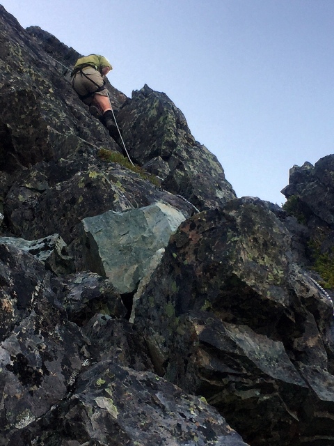
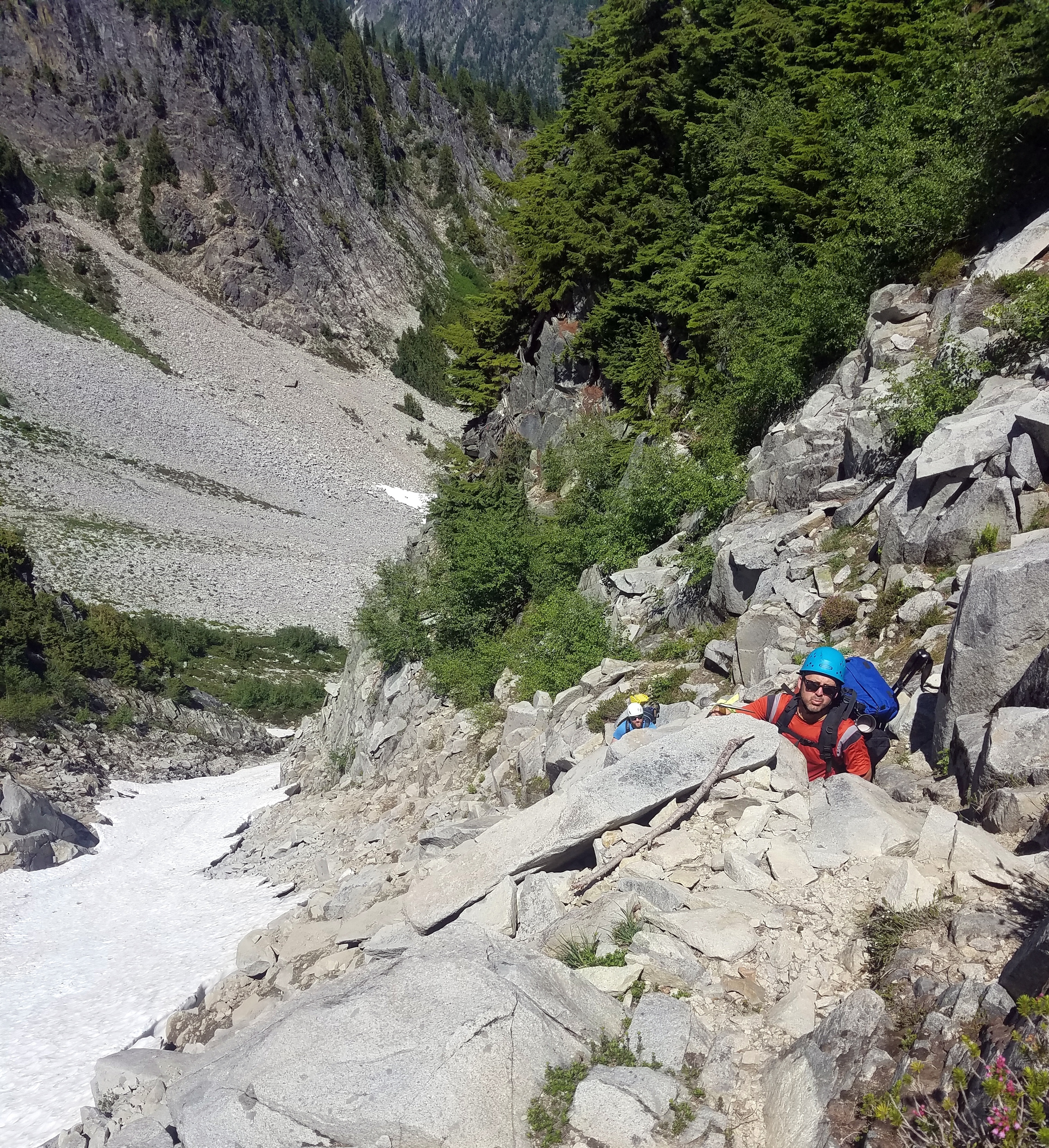
 Scrambling through the rock out of the slot canyon...
|
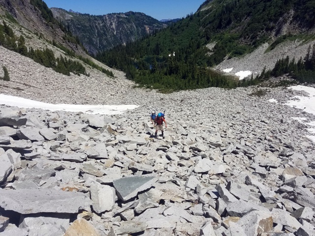
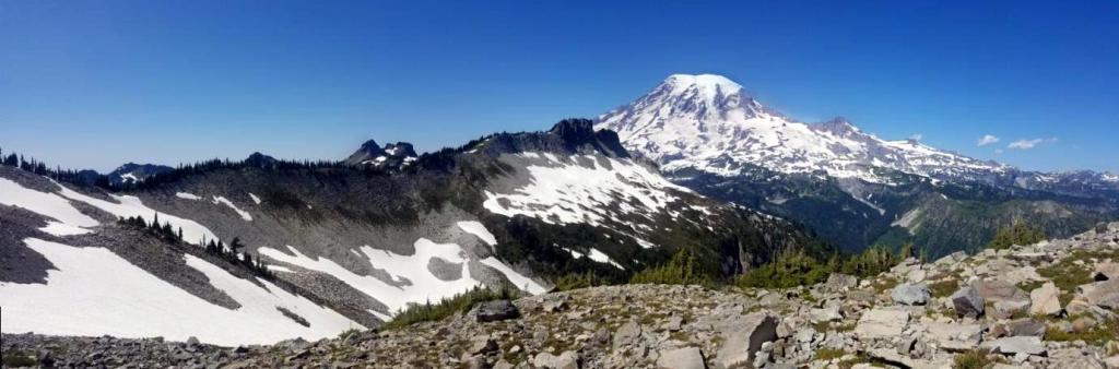
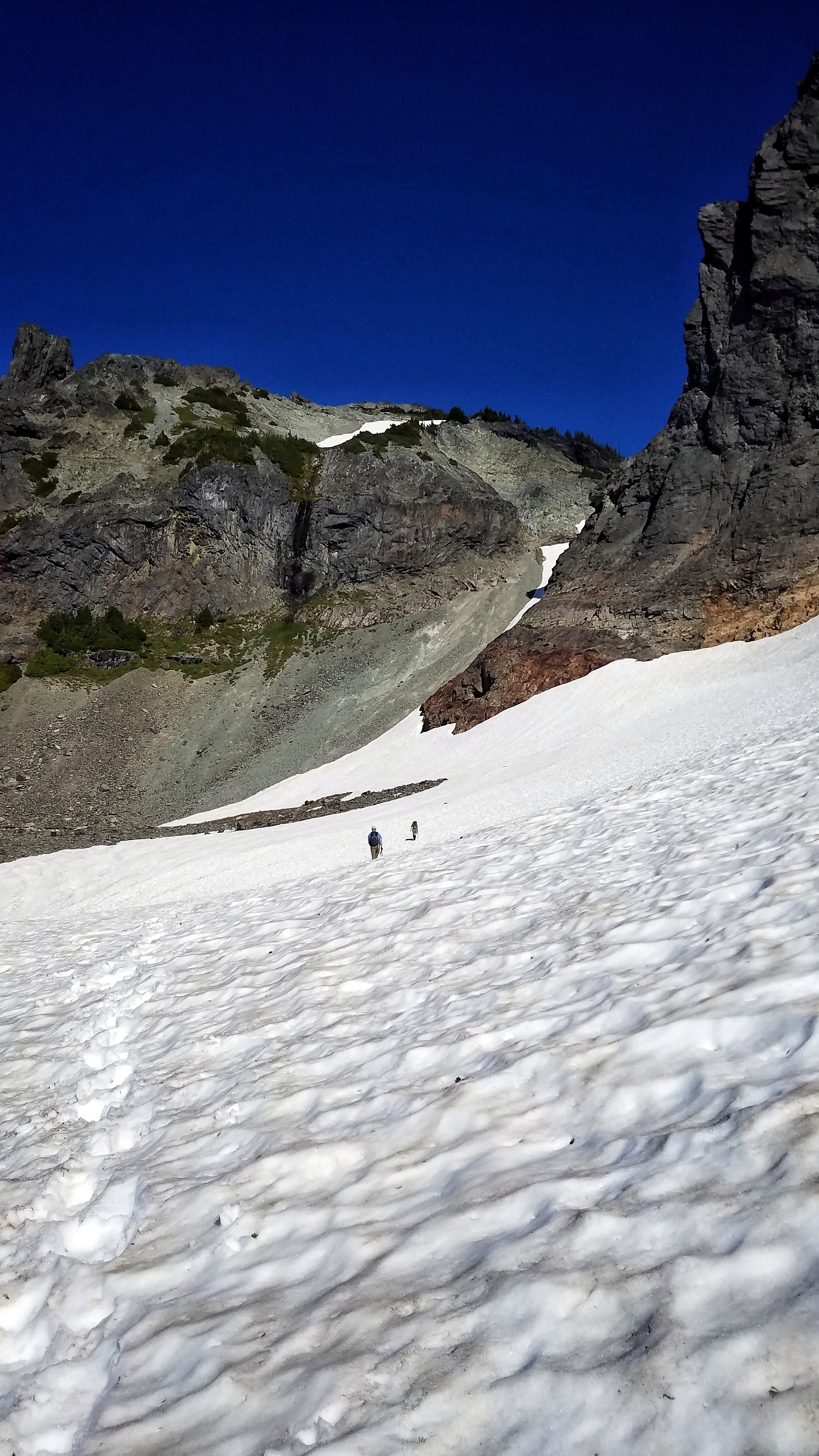
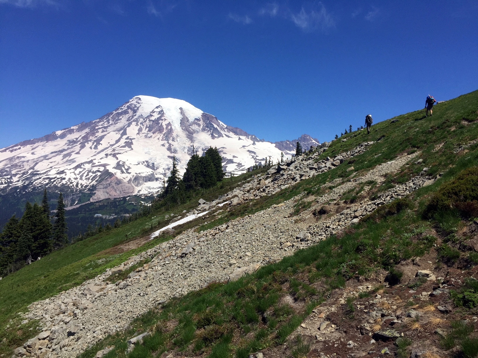
 Once we ascended through the slot canyon, the next section of the route was revealed.
We continued to climb through meadows, talus, and snow to ~6,000 feet.
Once we ascended through the slot canyon, the next section of the route was revealed.
We continued to climb through meadows, talus, and snow to ~6,000 feet.
|
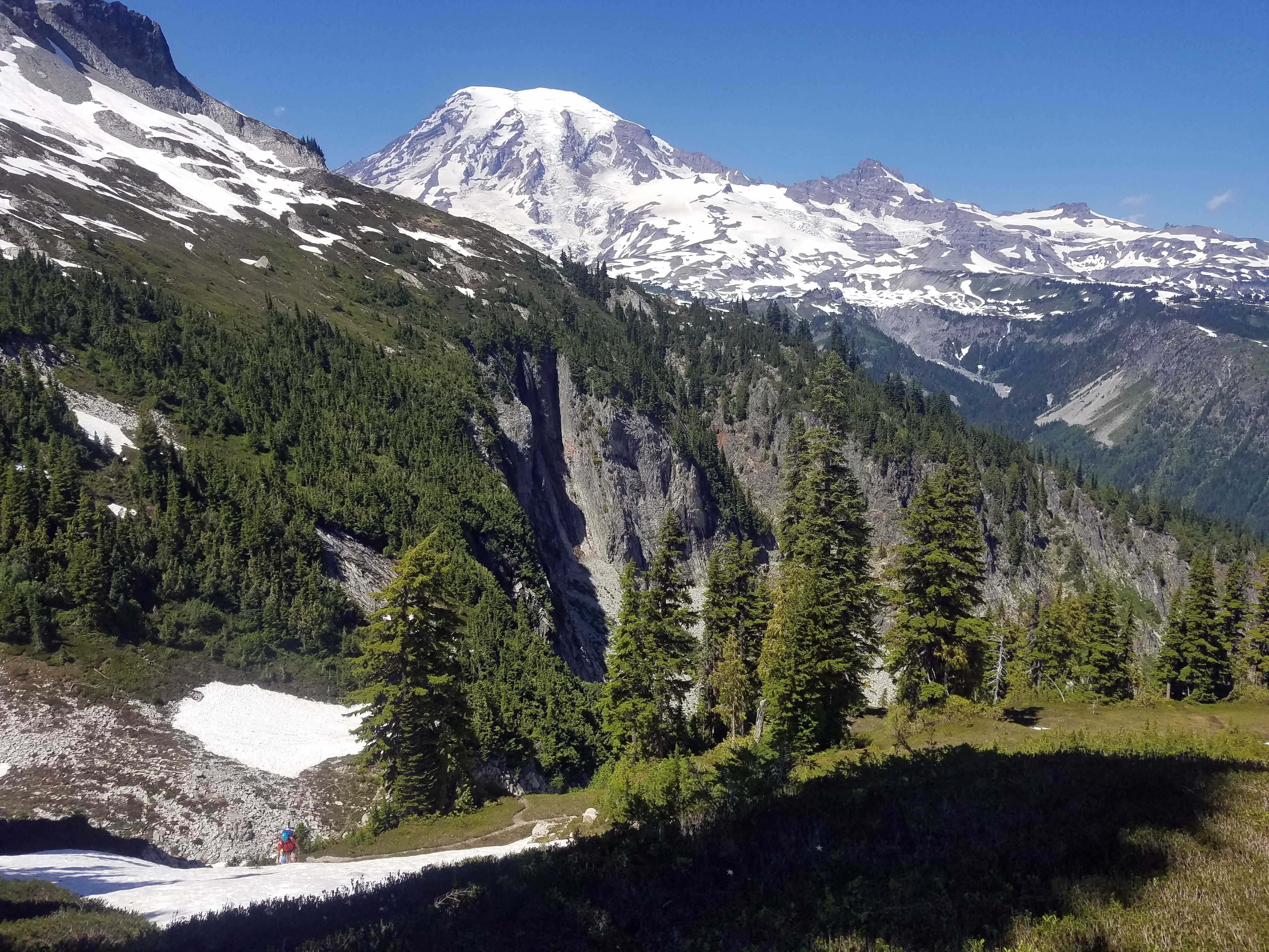
 Big views of Mt. Rainier began to open up to the north.
|
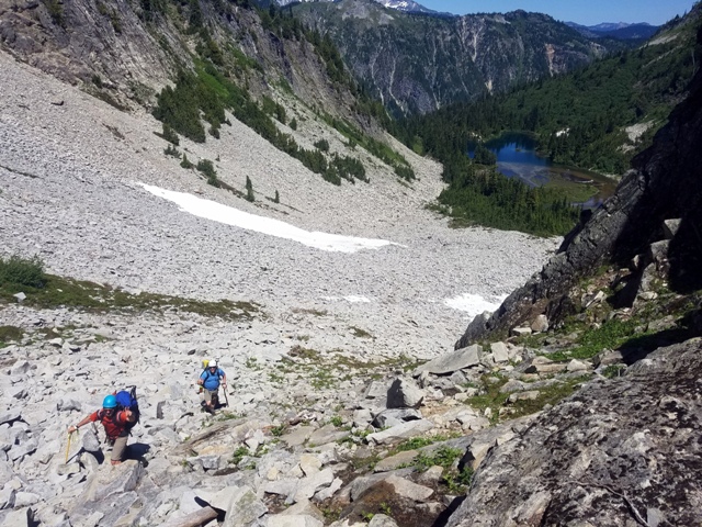
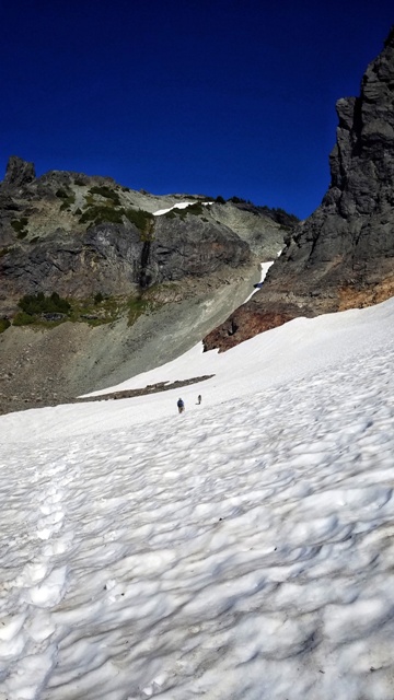
 We continued stomping up the Unicorn basin, toward the peak.
|
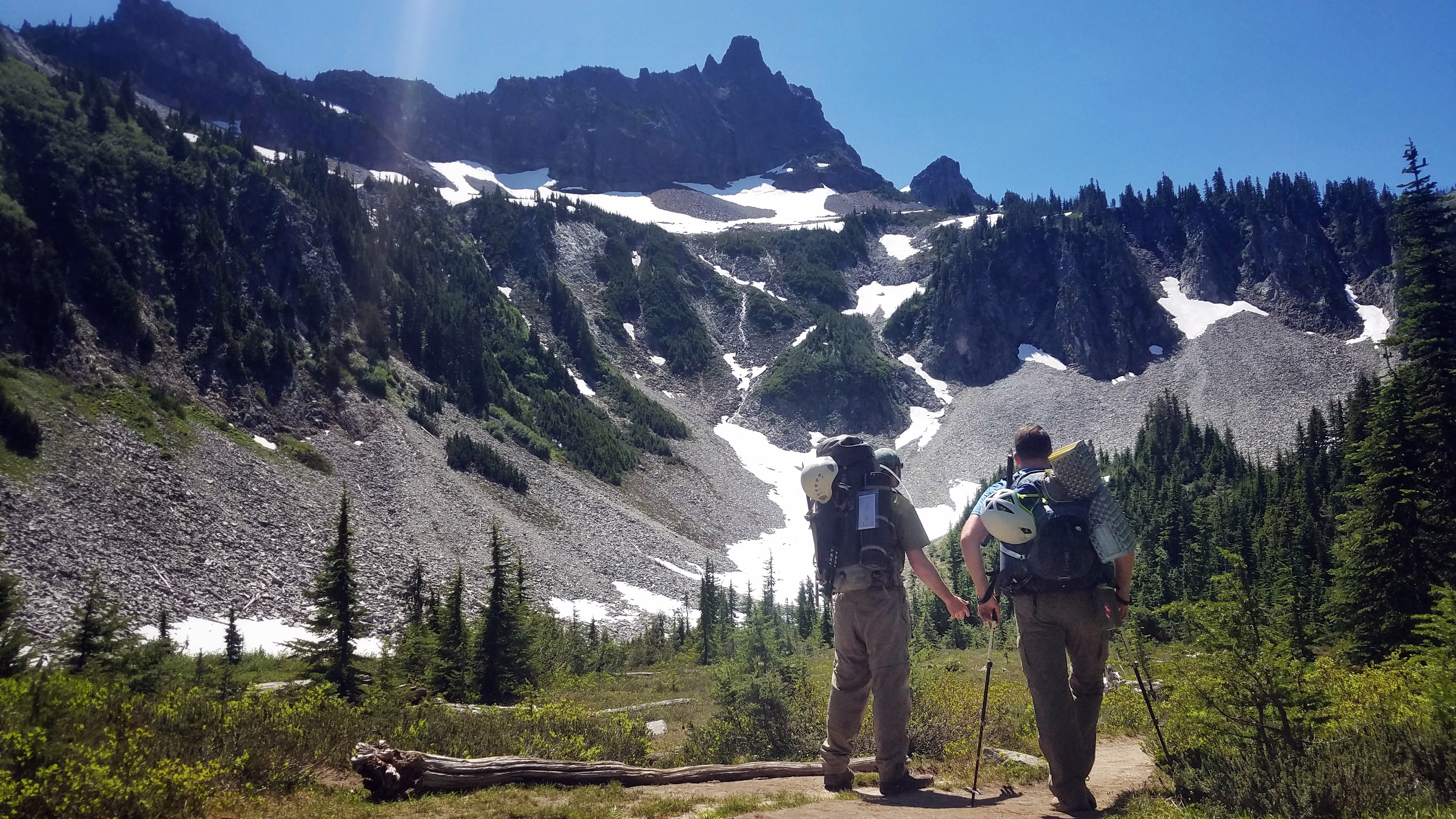
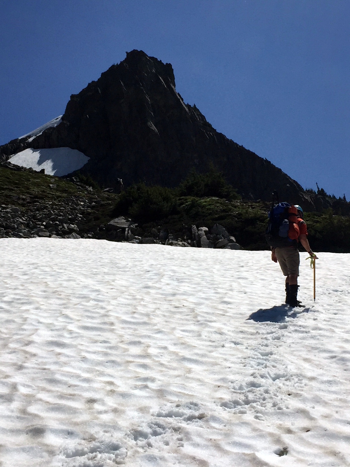
 Near the top of Unicorn Basin, and beneath the peak, we appraoched the chute that would lead toward the summit.
|
 The snow-filled gulley on the right of the above photo is the route to the summit.
It is steep and a few hundred feet high. The snow chute extends up to a ~30 foot-tall rocky cliff just below the saddle.
We were close, but man, those packs were heavy.
The snow-filled gulley on the right of the above photo is the route to the summit.
It is steep and a few hundred feet high. The snow chute extends up to a ~30 foot-tall rocky cliff just below the saddle.
We were close, but man, those packs were heavy.
|
 Evan calls a Time Out.
After a short discussion, we agreed to suspend the summit attempt so that we could set up camp on the south side of the ridge and have a break.
This was the previously agreed-upon plan.
Evan calls a Time Out.
After a short discussion, we agreed to suspend the summit attempt so that we could set up camp on the south side of the ridge and have a break.
This was the previously agreed-upon plan.
|
 This meant a detour over to the Unicorn Basin saddle (left of above photo).
I knew that there were good places to camp over there.
We would return here and resume our climb after we set up camp, had a rest, and took some weight off of our packs.
This meant a detour over to the Unicorn Basin saddle (left of above photo).
I knew that there were good places to camp over there.
We would return here and resume our climb after we set up camp, had a rest, and took some weight off of our packs.
|
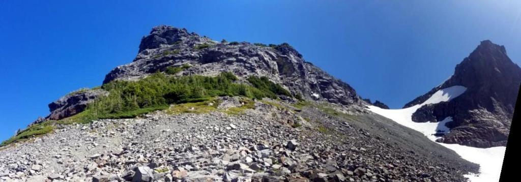
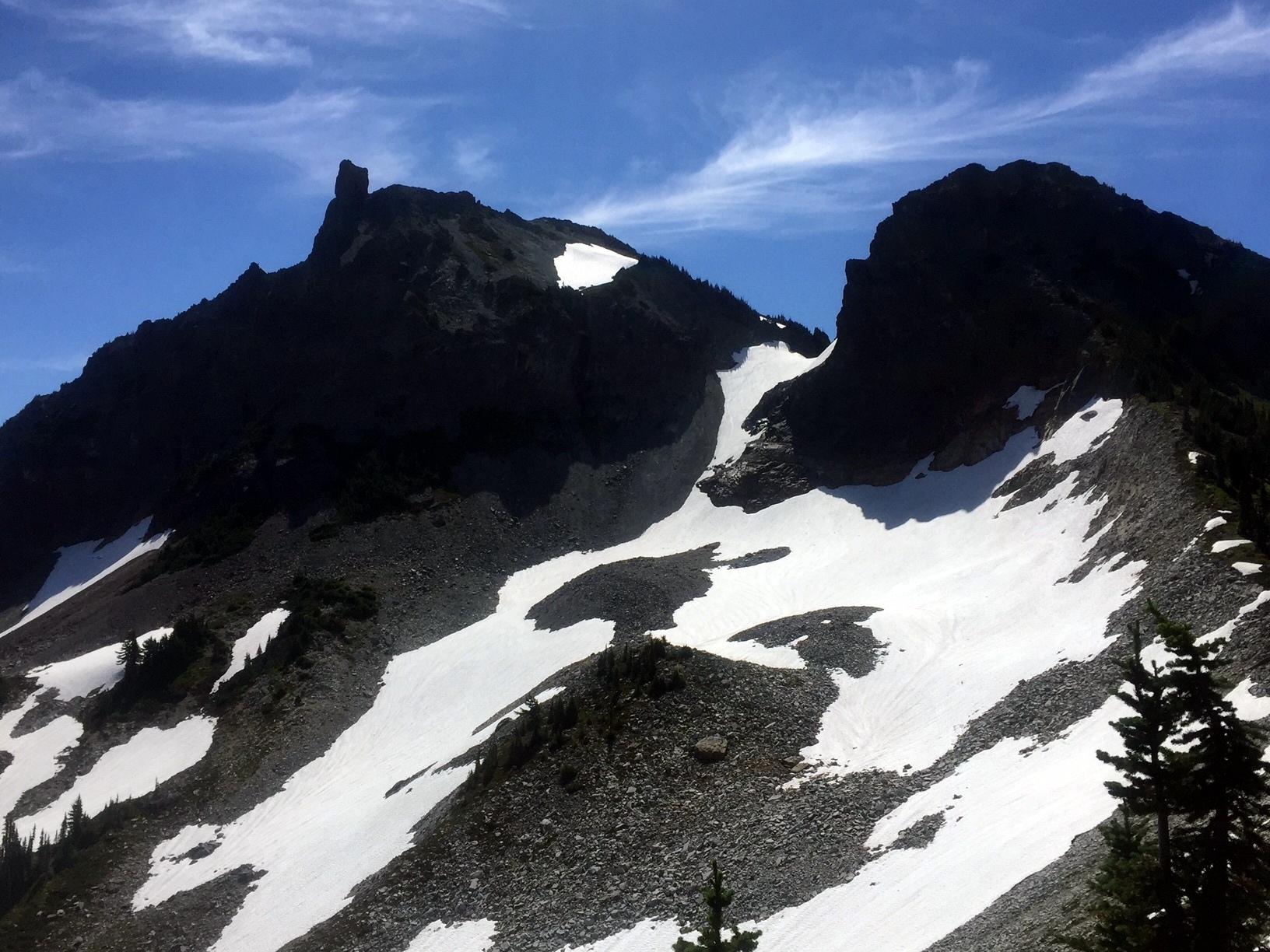
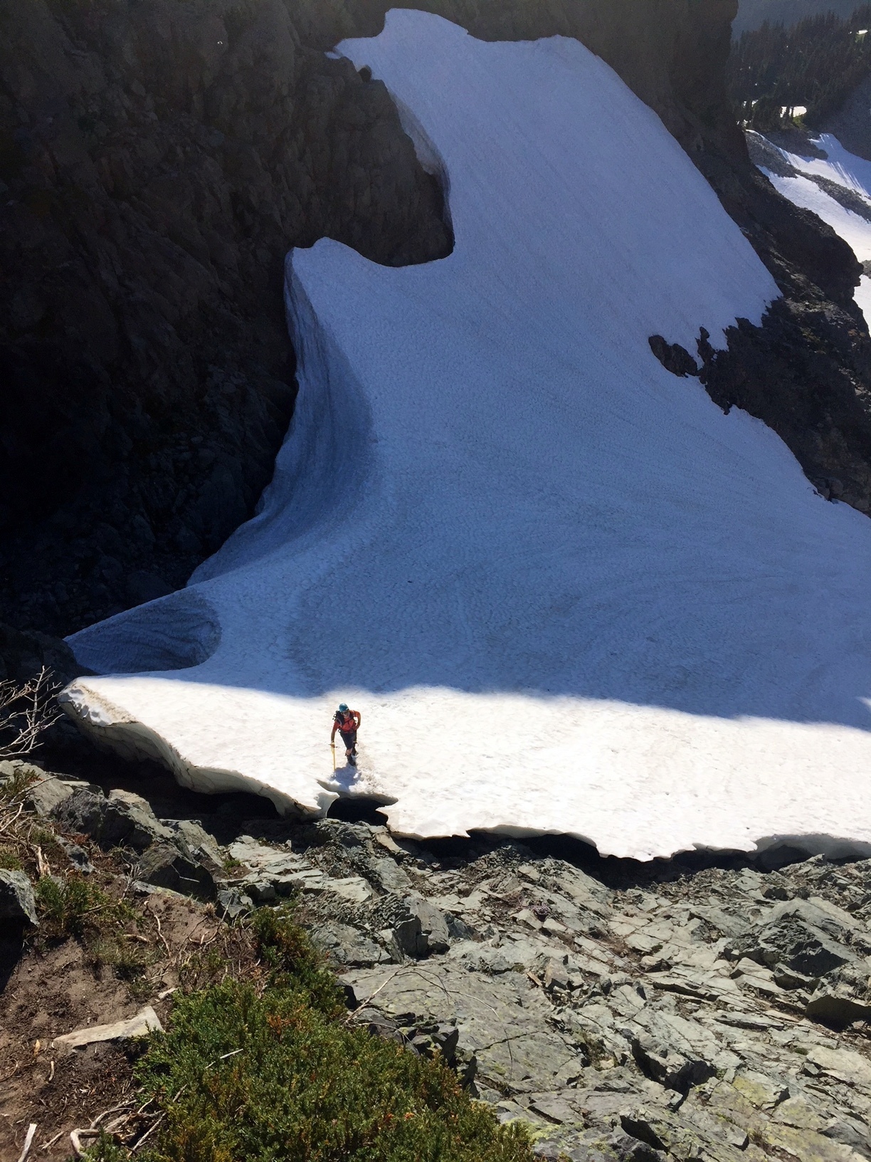
 We detoured over to the saddle to look for camp.
The above photo is from the saddle, looking back toward the summit route chute.
The above photo provides a great vantage of Unicorn Peak, including the ridge to the top and the summit 'horn'.
We detoured over to the saddle to look for camp.
The above photo is from the saddle, looking back toward the summit route chute.
The above photo provides a great vantage of Unicorn Peak, including the ridge to the top and the summit 'horn'.
|
 A couple of hours later, after setting up camp and taking a break, we returned to the summit route chute.
|
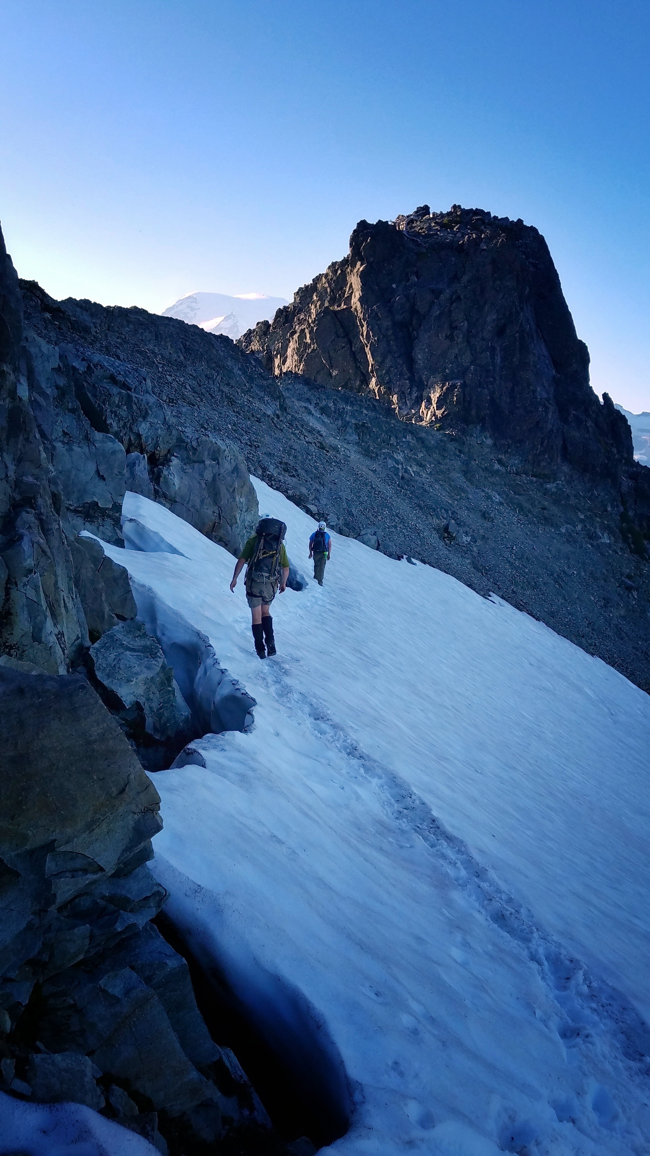
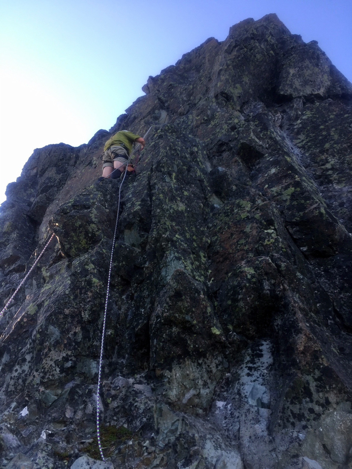
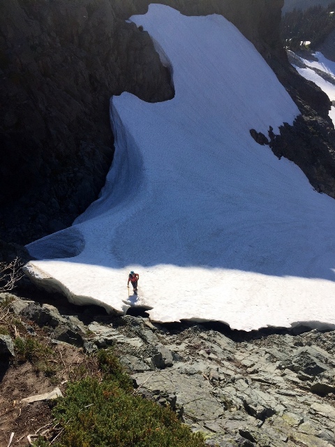 The climb up that chute was the hardest thing we had done all day, even with the lighter packs.
We didn't get any photos of the chute climb, but here (above) is a photo taken from the top of the cliff near the saddle.
That is Evan, finally at the top of the snow chute.
Now he has to climb up the rock to the saddle.
The climb up that chute was the hardest thing we had done all day, even with the lighter packs.
We didn't get any photos of the chute climb, but here (above) is a photo taken from the top of the cliff near the saddle.
That is Evan, finally at the top of the snow chute.
Now he has to climb up the rock to the saddle.
|
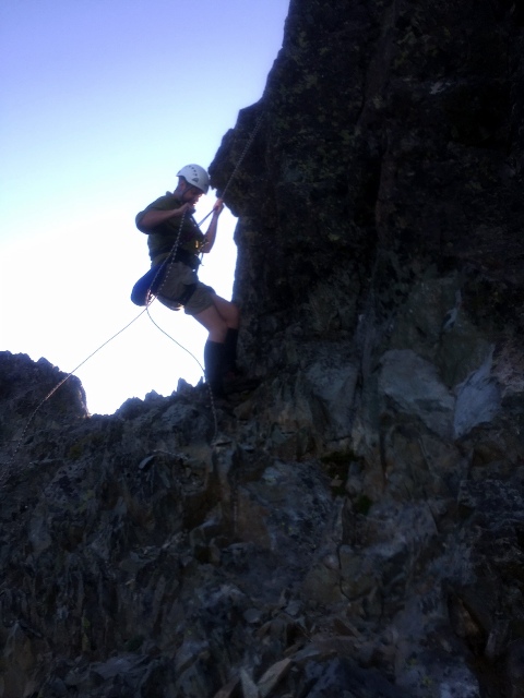
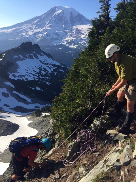 It was pretty steep so I tied into a tree and belayed Evan up.
|
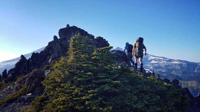 Now, on the back of the unicorn's neck, we climbed the ridge to the craggy mountaintop.
|
 ...and across the top of the unicorn's craggy head toward the horn!
|
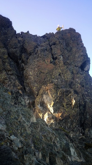
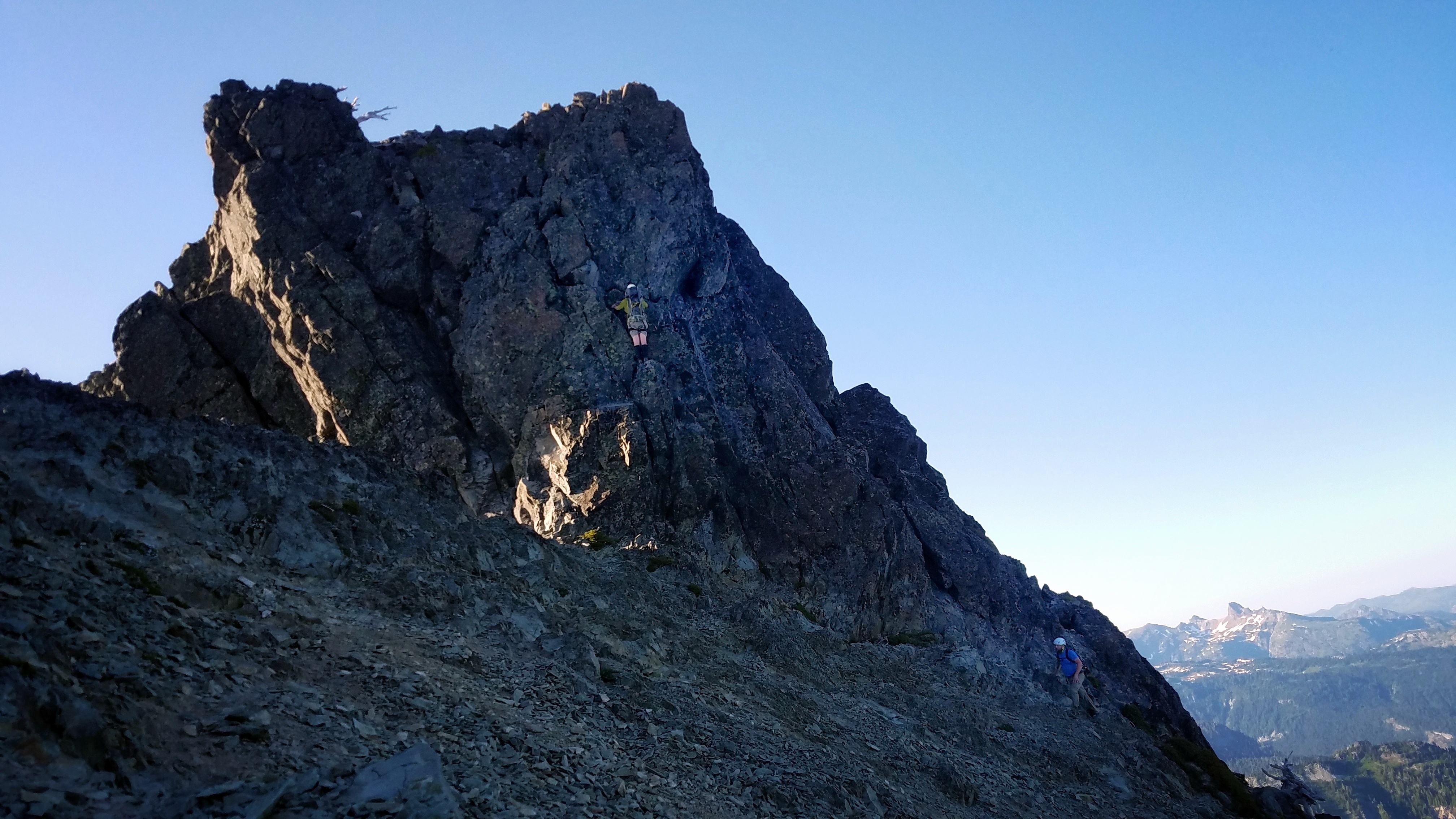
 The unicorn horn!
The plan was for me to lead climb this last section and to set up a belay for Trevin.
Evan was satisfied with the climb at this point and passed on the horn.
I got excited and climbed up the first available face of the summit block.
The unicorn horn!
The plan was for me to lead climb this last section and to set up a belay for Trevin.
Evan was satisfied with the climb at this point and passed on the horn.
I got excited and climbed up the first available face of the summit block.
|
 I found it to be too sketchy of a climb to lead without any protection, so I rappelled back down and went up another way.
|
 I went up a route on the far right, which is not one of the standard four routes that I see on summitpost.
My route went up to the right of the #4 route shown on summitpost and wrapped around the outside corner of the horn before going up.
It was ~5.3 to 5.5, I'd say. There is a cam in the crack above that outside corner.
Although the holds were bomber and straightforward, going around that outside corner did give me a chill.
I went up a route on the far right, which is not one of the standard four routes that I see on summitpost.
My route went up to the right of the #4 route shown on summitpost and wrapped around the outside corner of the horn before going up.
It was ~5.3 to 5.5, I'd say. There is a cam in the crack above that outside corner.
Although the holds were bomber and straightforward, going around that outside corner did give me a chill.
|
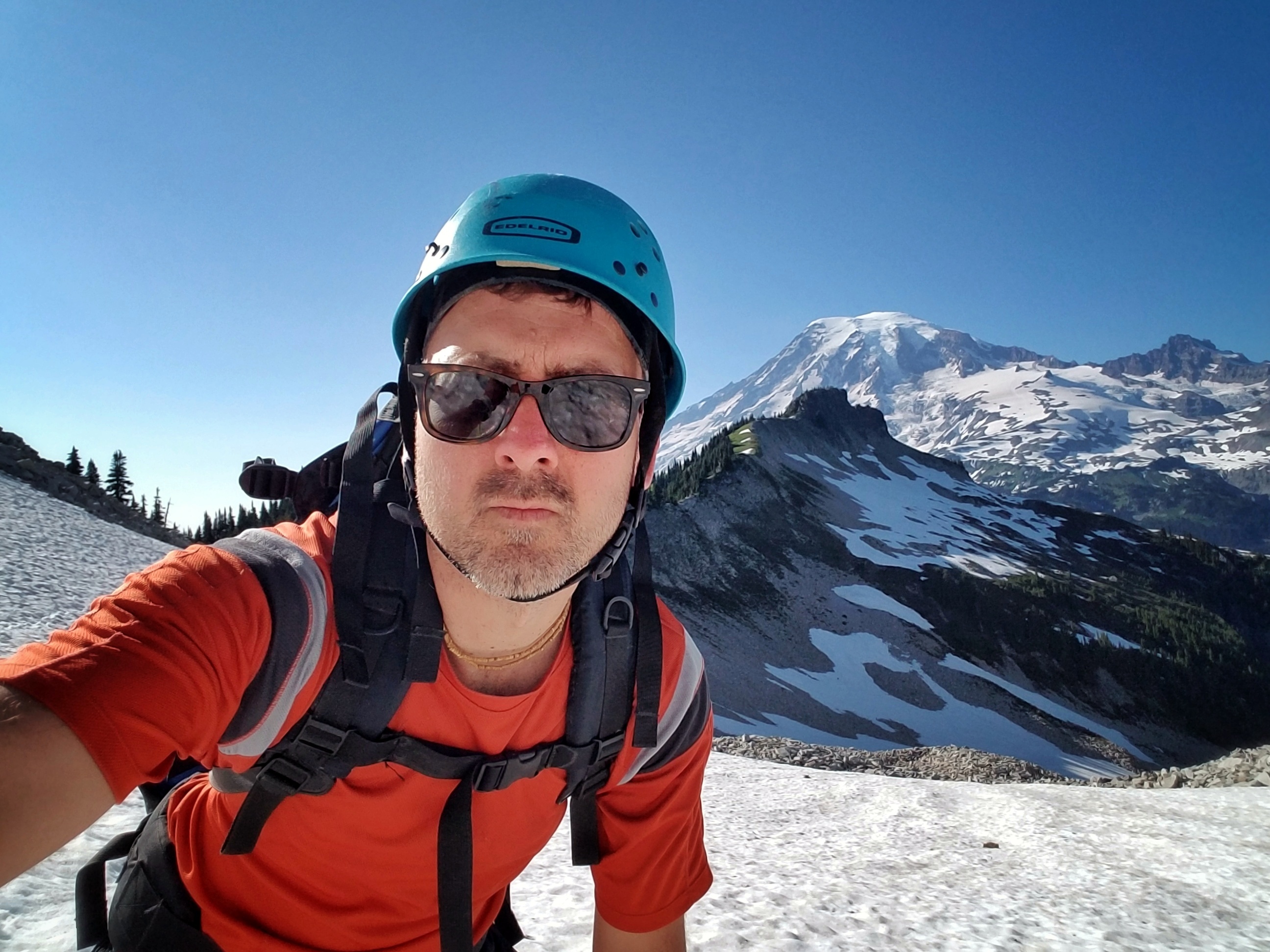
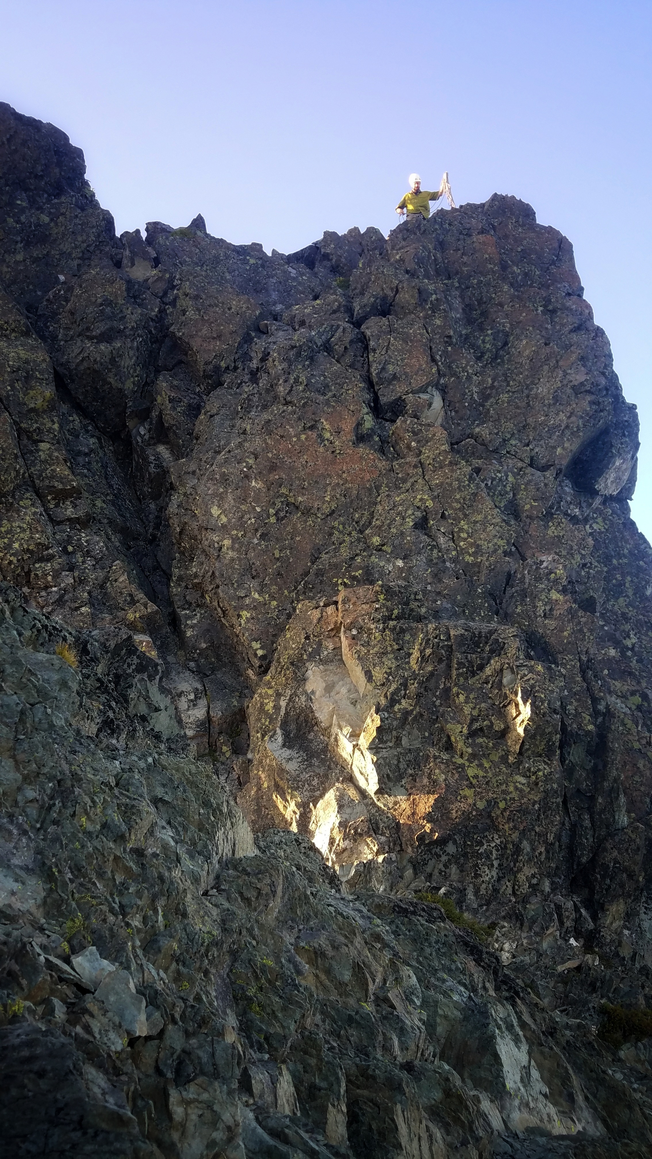
 I made it to the summit, but there wasn't any ceremony, as I was alone and it was getting really late.
|
 Trevin decided that today was not the day for him to climb the horn.
Getting to the top was harder than I had expected, and it had burned about 30-40 minutes. It was now ~7:45!
Also, Trevin didn't have a rappel device and felt somewhat unprepared for the task.
It was a little disappointing, but we knew that going down was the right move. It was unwise to stay up here any longer.
The sun was going to set soon and we were still perched on top of Unicorn Peak!
Trevin decided that today was not the day for him to climb the horn.
Getting to the top was harder than I had expected, and it had burned about 30-40 minutes. It was now ~7:45!
Also, Trevin didn't have a rappel device and felt somewhat unprepared for the task.
It was a little disappointing, but we knew that going down was the right move. It was unwise to stay up here any longer.
The sun was going to set soon and we were still perched on top of Unicorn Peak!
|
 I rappelled down and packed up.
We have since agreed to return in a couple of years and get all three of us to the top.
Evan and Trevin need a few more bits of gear and some practice with tying knots and rappelling.
I rappelled down and packed up.
We have since agreed to return in a couple of years and get all three of us to the top.
Evan and Trevin need a few more bits of gear and some practice with tying knots and rappelling.
|
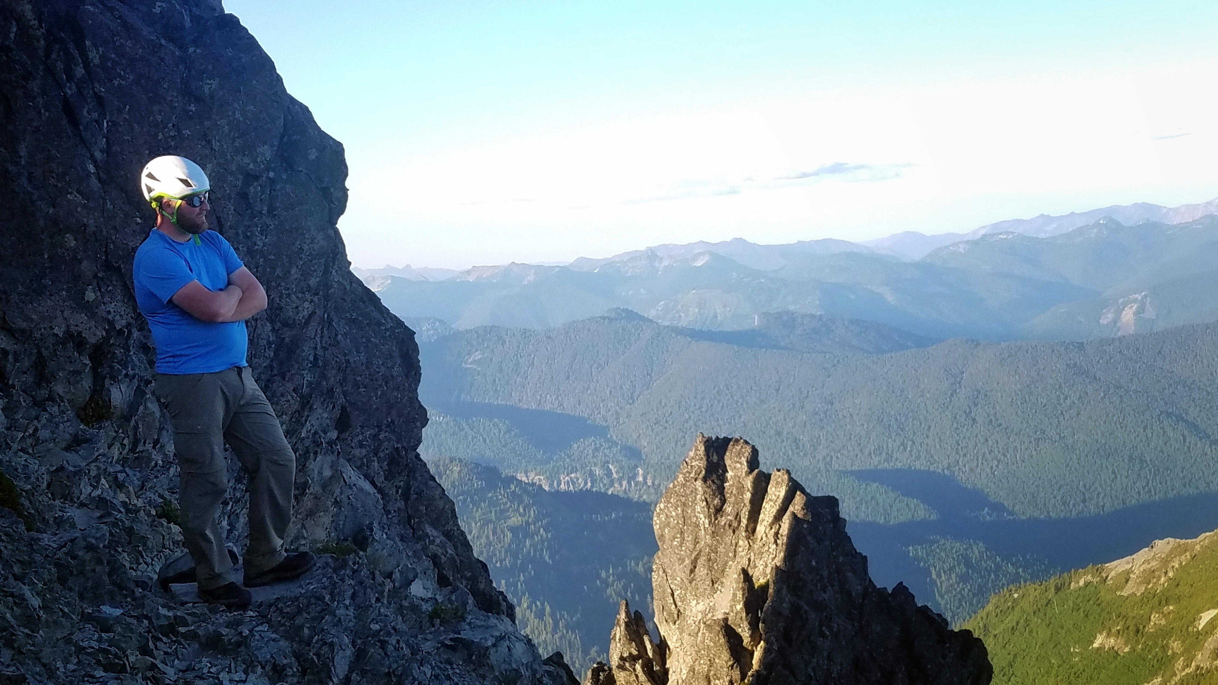
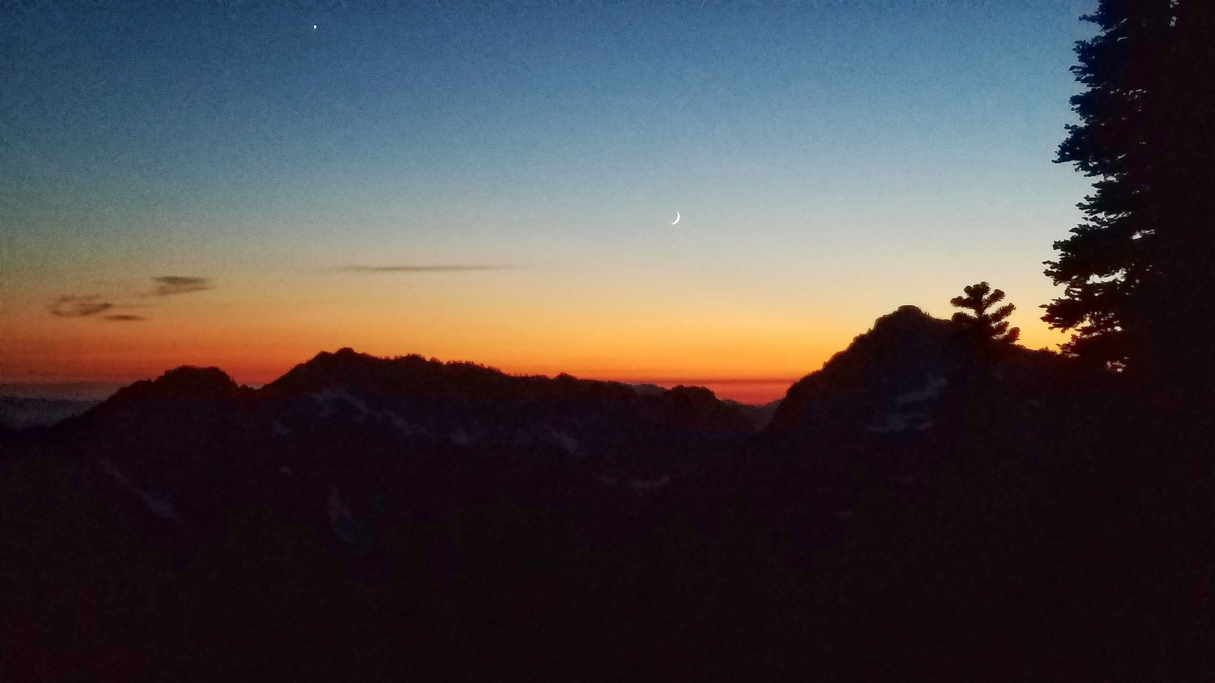
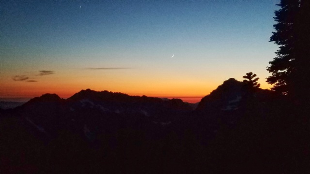 We returned to our camp and enjoyed a very pleasant evening with a huge view to the south.
The crescent moon set in the early evening and the stars came out.
We hung out until pretty late and then sacked out.
We returned to our camp and enjoyed a very pleasant evening with a huge view to the south.
The crescent moon set in the early evening and the stars came out.
We hung out until pretty late and then sacked out.
|
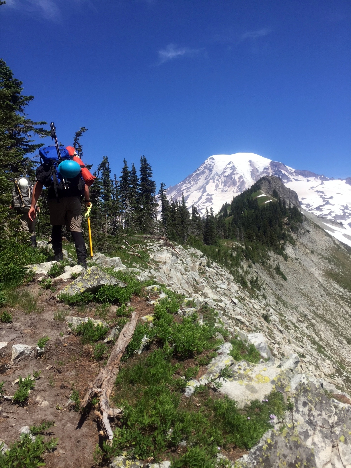
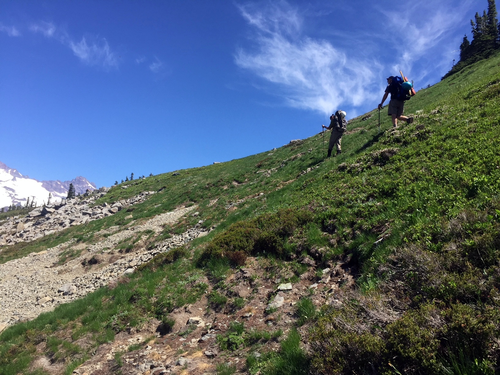
 The next day, we traversed along the ridge and the south slope all the way over to the Pinnacle Peak trailhead.
|
 We didn't climb any peaks that day. With our packs feeling heavy, and with very little shade from the hot sun, we traversed the ridge and contoured across the south slope.
The views were epic, but it was really hot and the route-finding was tricky at times.
We actually lost the trail between Foss and the Castle and accidentally dropped too far down the south slope.
We then traversed the south slope beneath the Castle and Pinnacle Peak to the Pinnacle Peak saddle and trail.
We didn't climb any peaks that day. With our packs feeling heavy, and with very little shade from the hot sun, we traversed the ridge and contoured across the south slope.
The views were epic, but it was really hot and the route-finding was tricky at times.
We actually lost the trail between Foss and the Castle and accidentally dropped too far down the south slope.
We then traversed the south slope beneath the Castle and Pinnacle Peak to the Pinnacle Peak saddle and trail.
|
 We were feeling worn out and overheated. We gladly descended the trail at the Pinnacle Peak saddle.
Happy and a little sore, we strolled down to the Pinnacle Peak/Reflection Lake Parking lot, where I hitched a ride back to retreive the car.
This was another great trip with Evan and Trevin, and another memorable experience in the Tatoosh!
We were feeling worn out and overheated. We gladly descended the trail at the Pinnacle Peak saddle.
Happy and a little sore, we strolled down to the Pinnacle Peak/Reflection Lake Parking lot, where I hitched a ride back to retreive the car.
This was another great trip with Evan and Trevin, and another memorable experience in the Tatoosh!
|
 The Tatoosh Range is a lovely hunk of granite that protrudes above the surface just south of Mt. Rainier.
It includes eight significant peaks, and offers the best possible views of Mt. Rainier's south flank.
Unicorn Peak, at 6971 feet, is the tallest in the range. The climb is a classic mix of mountaineering elements, including a technical section at the summit.
After our great trip in the Goat Rocks last summer, Evan and Trevin and I wanted another alpine experience together.
I suggested a traverse of the western Tatoosh.
I have been in the Tatoosh twice before.
2006 - I traversed the western Tatoosh from Unicorn to Pinnacle with Kevin and Dan.
1990 - In the early days of my backpacking, I hiked to Snow Lake with my buddies Jon and Abe. We were about 16.
(See below!)
The Tatoosh Range is a lovely hunk of granite that protrudes above the surface just south of Mt. Rainier.
It includes eight significant peaks, and offers the best possible views of Mt. Rainier's south flank.
Unicorn Peak, at 6971 feet, is the tallest in the range. The climb is a classic mix of mountaineering elements, including a technical section at the summit.
After our great trip in the Goat Rocks last summer, Evan and Trevin and I wanted another alpine experience together.
I suggested a traverse of the western Tatoosh.
I have been in the Tatoosh twice before.
2006 - I traversed the western Tatoosh from Unicorn to Pinnacle with Kevin and Dan.
1990 - In the early days of my backpacking, I hiked to Snow Lake with my buddies Jon and Abe. We were about 16.
(See below!)
 16 year-old Gabe! I still rock the bandanna!
(Left) Abe Crittenden, one of my high school hiking buddies. (Right) Evan Horback with me, here in 2018.
Now in 2018, I am in my 28th year of backpacking, and my 20th year of mountaineering!
Alright. On with the trip report!
16 year-old Gabe! I still rock the bandanna!
(Left) Abe Crittenden, one of my high school hiking buddies. (Right) Evan Horback with me, here in 2018.
Now in 2018, I am in my 28th year of backpacking, and my 20th year of mountaineering!
Alright. On with the trip report!
 Just above Snow Lake, we left the trail and the tourists behind.
We paused to gaze up the Unicorn Basin and pick out our route.
Reminder: All of these photos link to full-resolution versions!
Just above Snow Lake, we left the trail and the tourists behind.
We paused to gaze up the Unicorn Basin and pick out our route.
Reminder: All of these photos link to full-resolution versions!
 (Above) The Unicorn Basin from just above Snow Lake.
That is Unicorn Peak, over on the left.
Our first section of the climb would cross the talus and ascend through the Unicorn Creek slot canyon in the center of the above photo.
(Above) The Unicorn Basin from just above Snow Lake.
That is Unicorn Peak, over on the left.
Our first section of the climb would cross the talus and ascend through the Unicorn Creek slot canyon in the center of the above photo.
 I was in the lead, so I took a few photos of Evan and Trevin ascending behind me.
Up the talus...
I was in the lead, so I took a few photos of Evan and Trevin ascending behind me.
Up the talus...
 Into the slot canyon..
 Up the steep pitch of snow...
 Scrambling through the rock out of the slot canyon...
 Once we ascended through the slot canyon, the next section of the route was revealed.
We continued to climb through meadows, talus, and snow to ~6,000 feet.
Once we ascended through the slot canyon, the next section of the route was revealed.
We continued to climb through meadows, talus, and snow to ~6,000 feet.
 Big views of Mt. Rainier began to open up to the north.
 We continued stomping up the Unicorn basin, toward the peak.
 Near the top of Unicorn Basin, and beneath the peak, we appraoched the chute that would lead toward the summit.
 The snow-filled gulley on the right of the above photo is the route to the summit.
It is steep and a few hundred feet high. The snow chute extends up to a ~30 foot-tall rocky cliff just below the saddle.
We were close, but man, those packs were heavy.
The snow-filled gulley on the right of the above photo is the route to the summit.
It is steep and a few hundred feet high. The snow chute extends up to a ~30 foot-tall rocky cliff just below the saddle.
We were close, but man, those packs were heavy.
 Evan calls a Time Out.
After a short discussion, we agreed to suspend the summit attempt so that we could set up camp on the south side of the ridge and have a break.
This was the previously agreed-upon plan.
Evan calls a Time Out.
After a short discussion, we agreed to suspend the summit attempt so that we could set up camp on the south side of the ridge and have a break.
This was the previously agreed-upon plan.
 This meant a detour over to the Unicorn Basin saddle (left of above photo).
I knew that there were good places to camp over there.
We would return here and resume our climb after we set up camp, had a rest, and took some weight off of our packs.
This meant a detour over to the Unicorn Basin saddle (left of above photo).
I knew that there were good places to camp over there.
We would return here and resume our climb after we set up camp, had a rest, and took some weight off of our packs.
 We detoured over to the saddle to look for camp.
The above photo is from the saddle, looking back toward the summit route chute.
The above photo provides a great vantage of Unicorn Peak, including the ridge to the top and the summit 'horn'.
We detoured over to the saddle to look for camp.
The above photo is from the saddle, looking back toward the summit route chute.
The above photo provides a great vantage of Unicorn Peak, including the ridge to the top and the summit 'horn'.
 A couple of hours later, after setting up camp and taking a break, we returned to the summit route chute.
 The climb up that chute was the hardest thing we had done all day, even with the lighter packs.
We didn't get any photos of the chute climb, but here (above) is a photo taken from the top of the cliff near the saddle.
That is Evan, finally at the top of the snow chute.
Now he has to climb up the rock to the saddle.
The climb up that chute was the hardest thing we had done all day, even with the lighter packs.
We didn't get any photos of the chute climb, but here (above) is a photo taken from the top of the cliff near the saddle.
That is Evan, finally at the top of the snow chute.
Now he has to climb up the rock to the saddle.
 It was pretty steep so I tied into a tree and belayed Evan up.
 Now, on the back of the unicorn's neck, we climbed the ridge to the craggy mountaintop.
 ...and across the top of the unicorn's craggy head toward the horn!
 The unicorn horn!
The plan was for me to lead climb this last section and to set up a belay for Trevin.
Evan was satisfied with the climb at this point and passed on the horn.
I got excited and climbed up the first available face of the summit block.
The unicorn horn!
The plan was for me to lead climb this last section and to set up a belay for Trevin.
Evan was satisfied with the climb at this point and passed on the horn.
I got excited and climbed up the first available face of the summit block.
 I found it to be too sketchy of a climb to lead without any protection, so I rappelled back down and went up another way.
 I went up a route on the far right, which is not one of the standard four routes that I see on summitpost.
My route went up to the right of the #4 route shown on summitpost and wrapped around the outside corner of the horn before going up.
It was ~5.3 to 5.5, I'd say. There is a cam in the crack above that outside corner.
Although the holds were bomber and straightforward, going around that outside corner did give me a chill.
I went up a route on the far right, which is not one of the standard four routes that I see on summitpost.
My route went up to the right of the #4 route shown on summitpost and wrapped around the outside corner of the horn before going up.
It was ~5.3 to 5.5, I'd say. There is a cam in the crack above that outside corner.
Although the holds were bomber and straightforward, going around that outside corner did give me a chill.
 I made it to the summit, but there wasn't any ceremony, as I was alone and it was getting really late.
 Trevin decided that today was not the day for him to climb the horn.
Getting to the top was harder than I had expected, and it had burned about 30-40 minutes. It was now ~7:45!
Also, Trevin didn't have a rappel device and felt somewhat unprepared for the task.
It was a little disappointing, but we knew that going down was the right move. It was unwise to stay up here any longer.
The sun was going to set soon and we were still perched on top of Unicorn Peak!
Trevin decided that today was not the day for him to climb the horn.
Getting to the top was harder than I had expected, and it had burned about 30-40 minutes. It was now ~7:45!
Also, Trevin didn't have a rappel device and felt somewhat unprepared for the task.
It was a little disappointing, but we knew that going down was the right move. It was unwise to stay up here any longer.
The sun was going to set soon and we were still perched on top of Unicorn Peak!
 I rappelled down and packed up.
We have since agreed to return in a couple of years and get all three of us to the top.
Evan and Trevin need a few more bits of gear and some practice with tying knots and rappelling.
I rappelled down and packed up.
We have since agreed to return in a couple of years and get all three of us to the top.
Evan and Trevin need a few more bits of gear and some practice with tying knots and rappelling.
 We returned to our camp and enjoyed a very pleasant evening with a huge view to the south.
The crescent moon set in the early evening and the stars came out.
We hung out until pretty late and then sacked out.
We returned to our camp and enjoyed a very pleasant evening with a huge view to the south.
The crescent moon set in the early evening and the stars came out.
We hung out until pretty late and then sacked out.
 The next day, we traversed along the ridge and the south slope all the way over to the Pinnacle Peak trailhead.
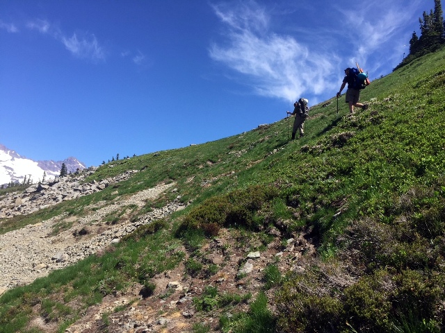
 We didn't climb any peaks that day. With our packs feeling heavy, and with very little shade from the hot sun, we traversed the ridge and contoured across the south slope.
The views were epic, but it was really hot and the route-finding was tricky at times.
We actually lost the trail between Foss and the Castle and accidentally dropped too far down the south slope.
We then traversed the south slope beneath the Castle and Pinnacle Peak to the Pinnacle Peak saddle and trail.
We didn't climb any peaks that day. With our packs feeling heavy, and with very little shade from the hot sun, we traversed the ridge and contoured across the south slope.
The views were epic, but it was really hot and the route-finding was tricky at times.
We actually lost the trail between Foss and the Castle and accidentally dropped too far down the south slope.
We then traversed the south slope beneath the Castle and Pinnacle Peak to the Pinnacle Peak saddle and trail.
 We were feeling worn out and overheated. We gladly descended the trail at the Pinnacle Peak saddle.
Happy and a little sore, we strolled down to the Pinnacle Peak/Reflection Lake Parking lot, where I hitched a ride back to retreive the car.
This was another great trip with Evan and Trevin, and another memorable experience in the Tatoosh!
We were feeling worn out and overheated. We gladly descended the trail at the Pinnacle Peak saddle.
Happy and a little sore, we strolled down to the Pinnacle Peak/Reflection Lake Parking lot, where I hitched a ride back to retreive the car.
This was another great trip with Evan and Trevin, and another memorable experience in the Tatoosh!