Caesar Peak Trinity Alps Wilderness, California June 15 - 21, 2014
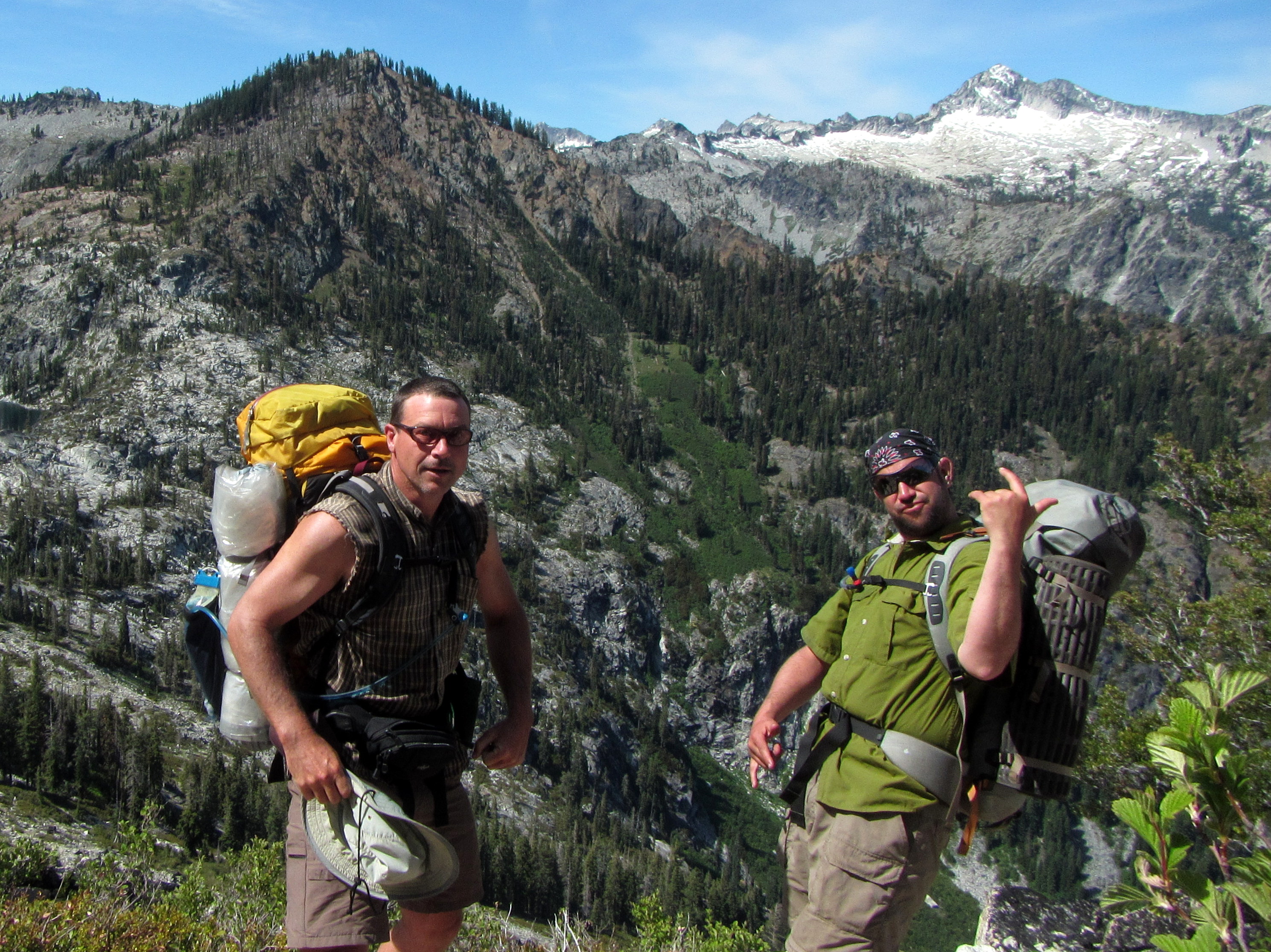
Blair, Gnawer of Granitoids, and I, the Cascadian Canadian, decided we really needed to meet up for another wilderness adventure. The last time we got together was in 2010 for our trek into the Rцssiап Щildеrпеss. After some deliberation about exactly where we were going, we decided to head into the Trinity Alps Wilderness. For one thing, the Trinity Alps trailhead we were interested in is a mere 9+ hour drive from my house. Other California alpine hikes that we were considering, like ones in the Sierras, would require much more driving, or possibly a flight. The Trinity Alps is a high point within the Klamath Range. The Klamath Range is at the southern end of Cascadia's Coast Range, equivalent to the Olympic Range on the north end. The Trinity Alps are gorgeous and dramatic peaks because they consist of a nice big ol' hunk of granite sticking up out of the earth. Mmmmm...tasty tasty granite... Good luck with this buggy Google map (above). You might have to pan around and zoom in to see the red marker. If it really screwed up, you might have to Refresh the page (F5). The red marker is on Caesar Peak, in the Trinity Alps of northern California. The star is on my house in Olympia, WA. California is in an 'exceptional drought', and the Trinity Alps only received 6% of its annual snowfall over the winter! We knew it would be on the dry side, so we left our ice axes at home. We were out there in mid-June, yet it seemed to us as if it was August! After a long drive on Father's Day down to Big Flat Campground (I saw a bear!), I met up with Blair, who I hadn't seen in 4 years. We crashed out (Blair in a mini-tent, me in my bivy) and the next day, we started into the wilderness, heading for the Caribou Basin.
Day 1: Big Flat to Caribou Basin
 The first day's hike was a nine mile trek (on trail pffft) up to Caribou Lakes Basin.
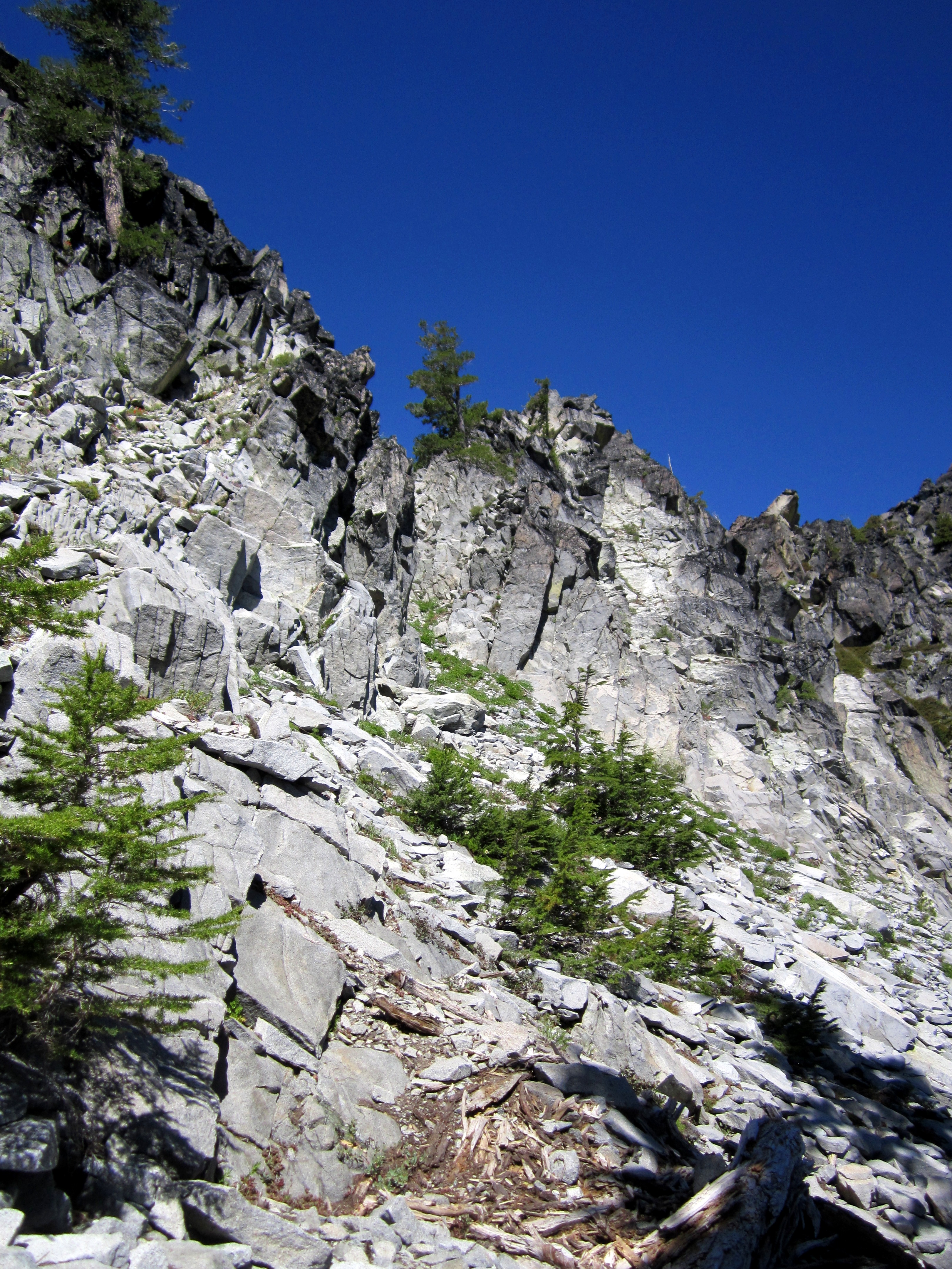
This took us up and over an unnamed peak that overlooks the lakes.
The first day's hike was a nine mile trek (on trail pffft) up to Caribou Lakes Basin.
This took us up and over an unnamed peak that overlooks the lakes.
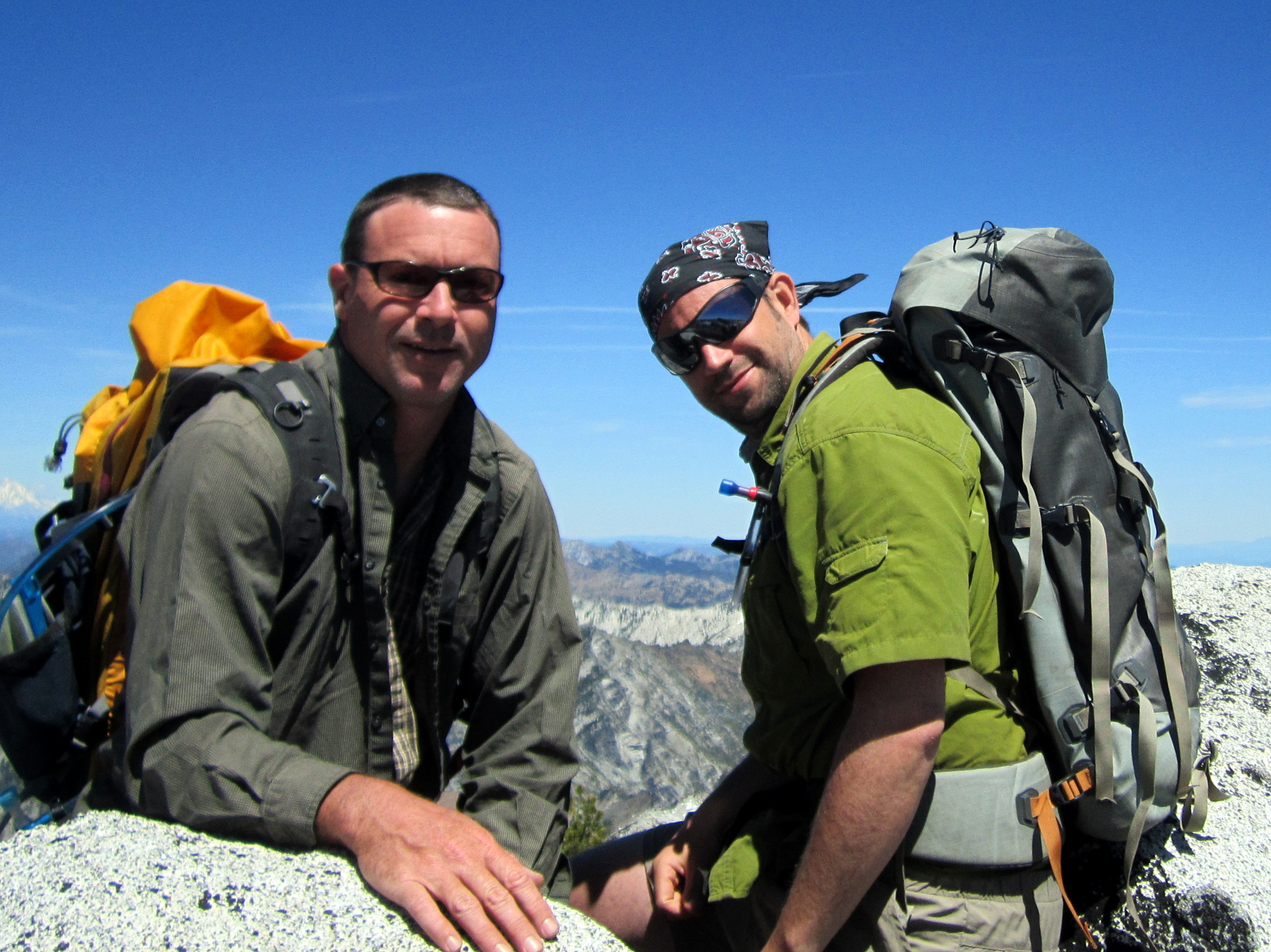
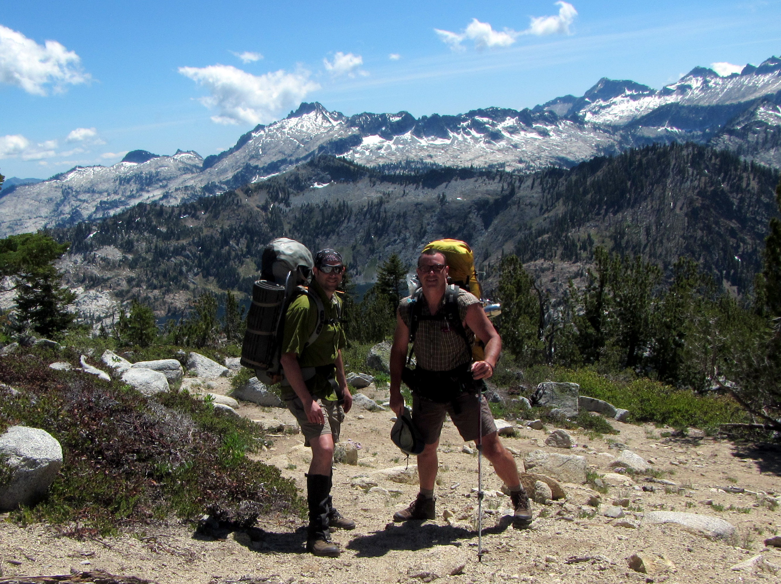 Blair and I at the unnamed peak after a few hours of hiking.
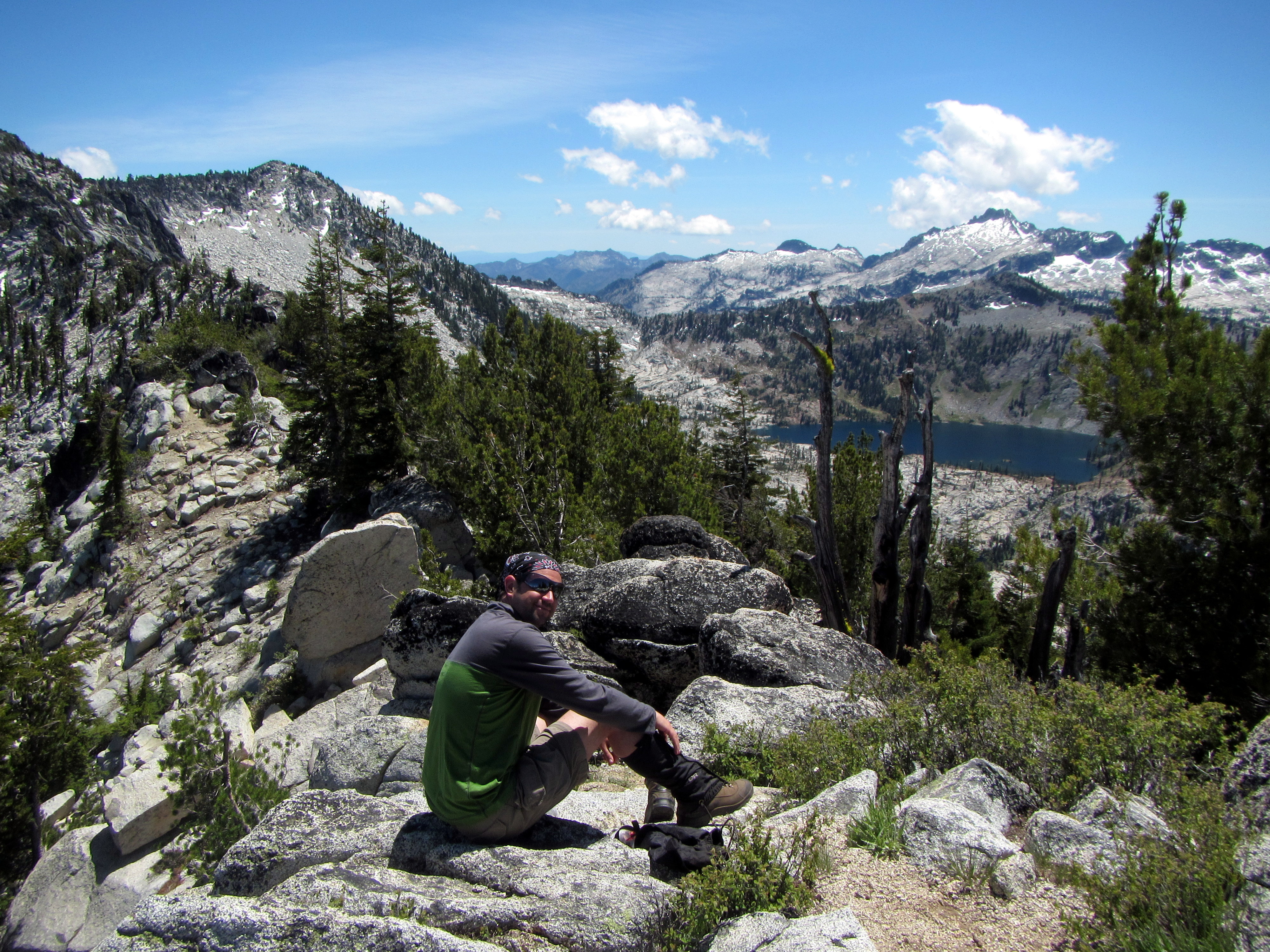
 A couple more shots from the unnamed peak.
We were both really excited for the hike. Aside from this stop, we barely paused the whole day.
A couple more shots from the unnamed peak.
We were both really excited for the hike. Aside from this stop, we barely paused the whole day.
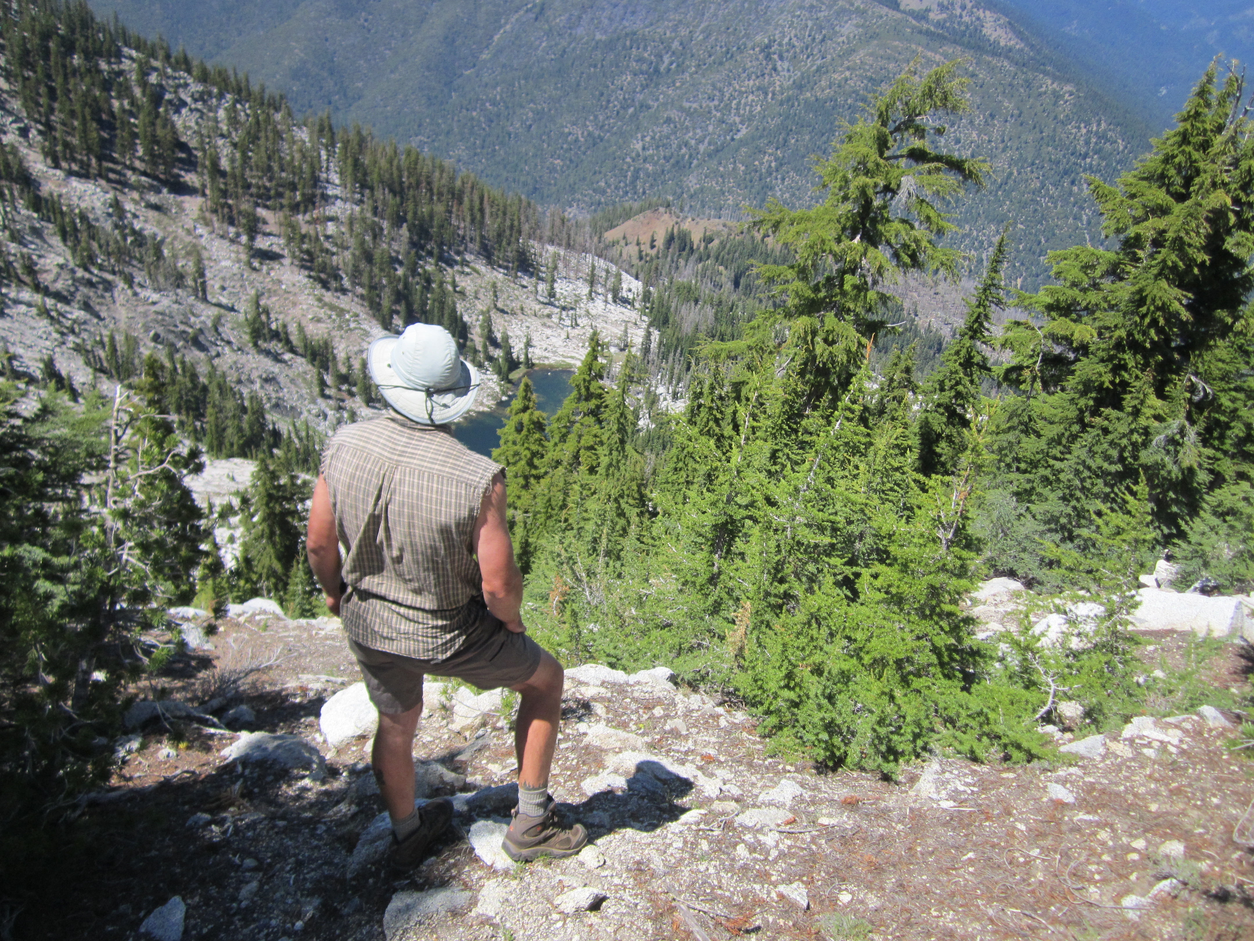
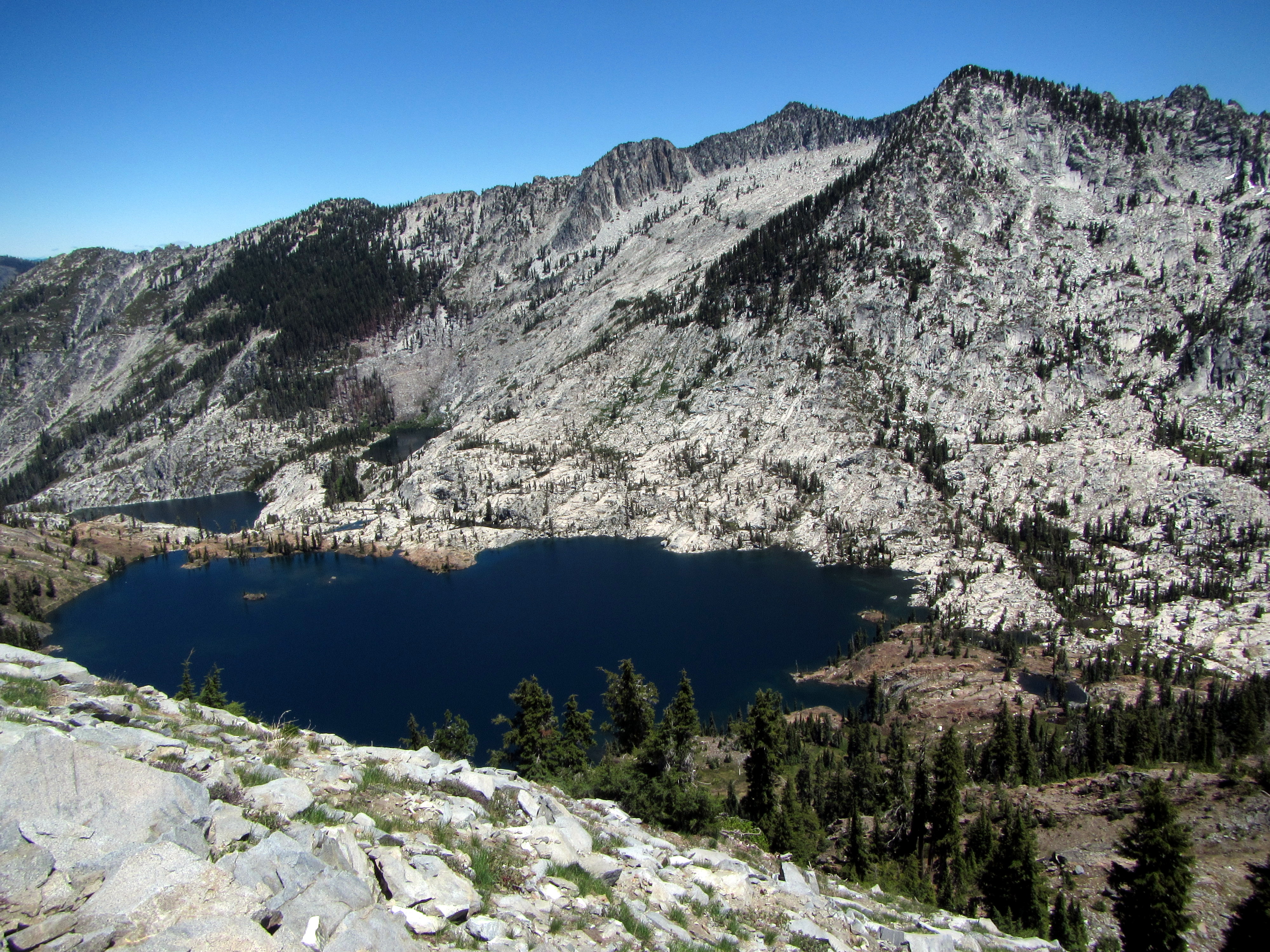
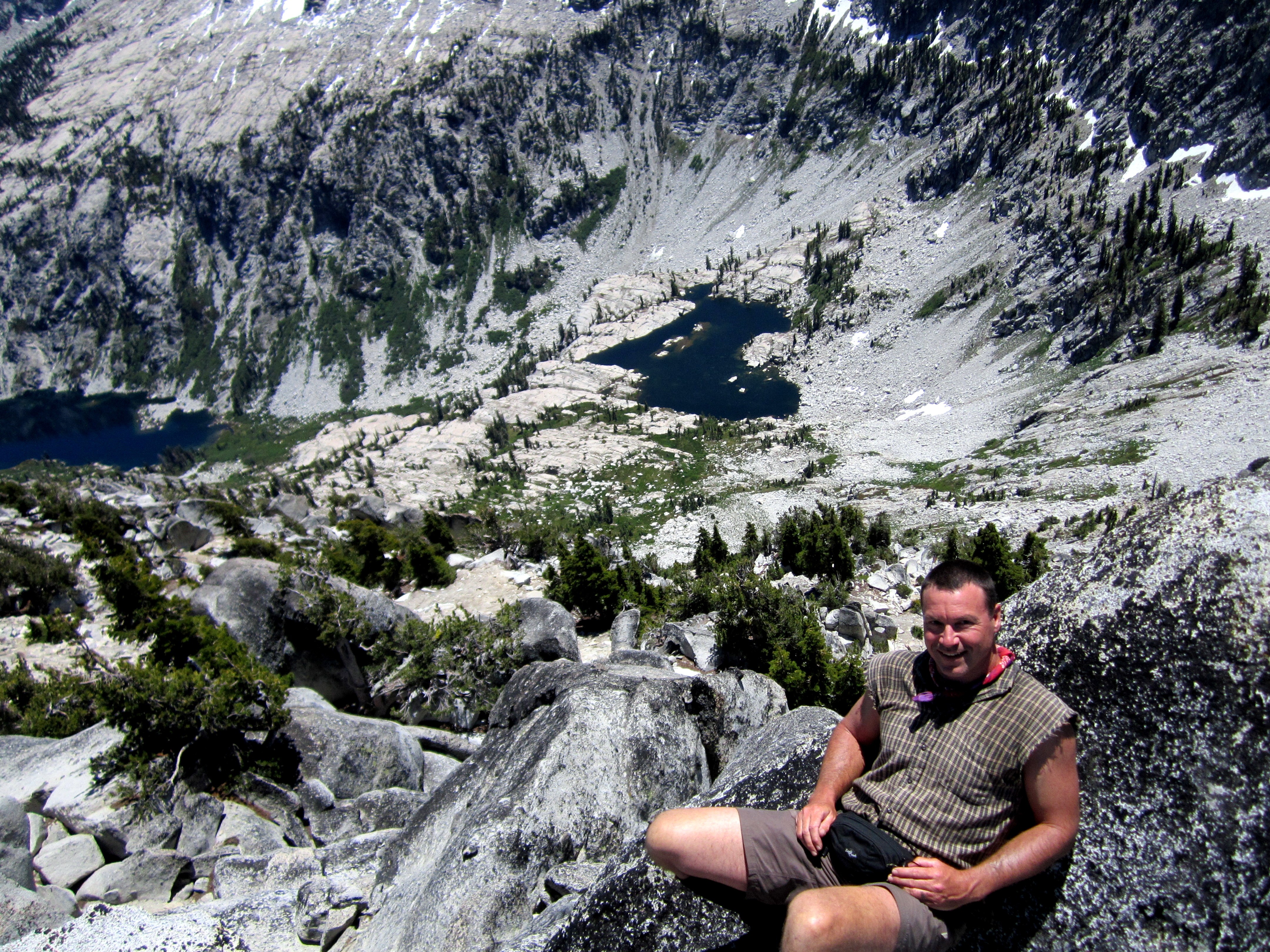
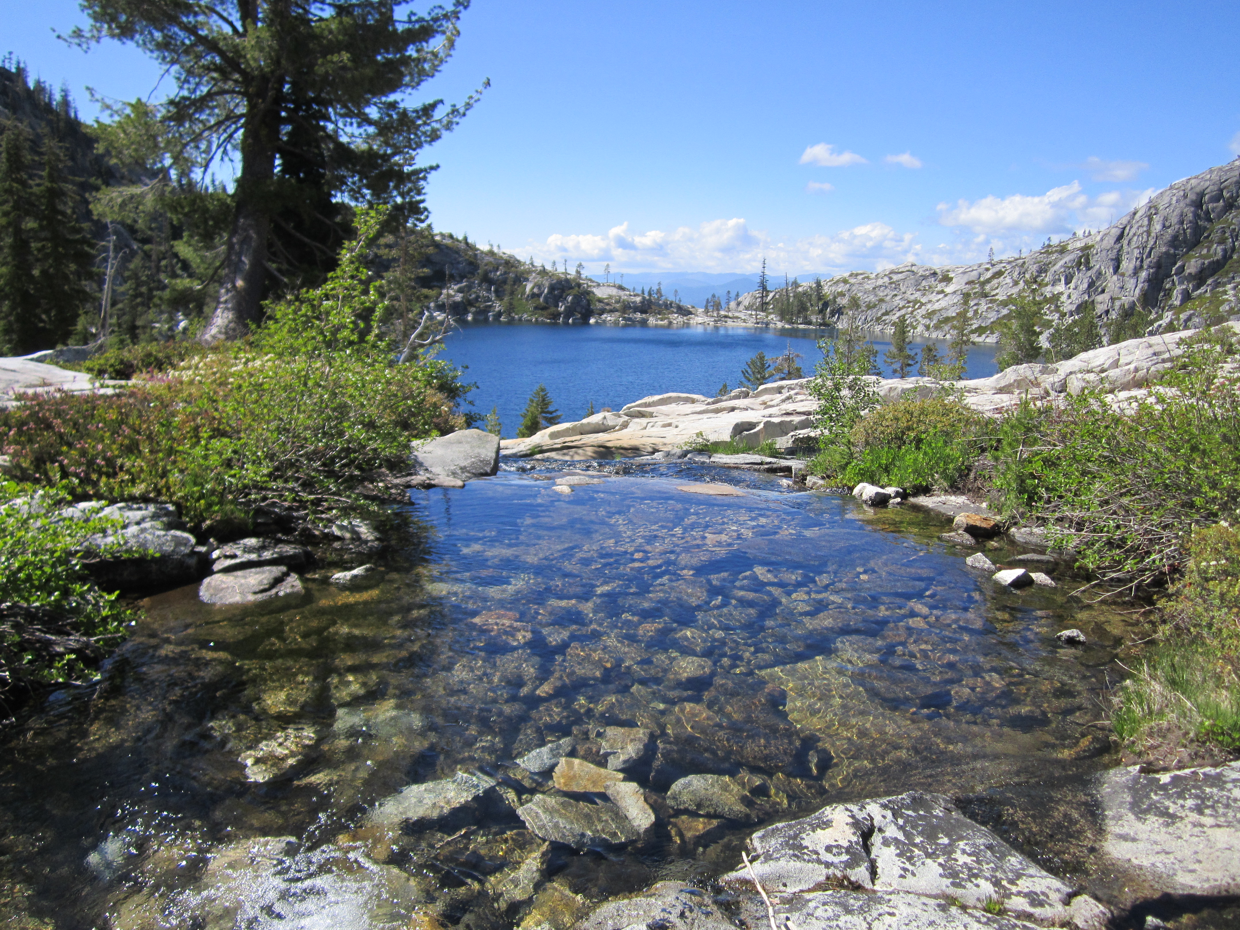 The Caribou Basin contains several lakes, including three fairly large ones.
Being full of energy and enthusiasm, we decided to camp at Upper Caribou Lake.
The Caribou Basin contains several lakes, including three fairly large ones.
Being full of energy and enthusiasm, we decided to camp at Upper Caribou Lake.
 We set up our camp on the granite shore and schemed on the following day.
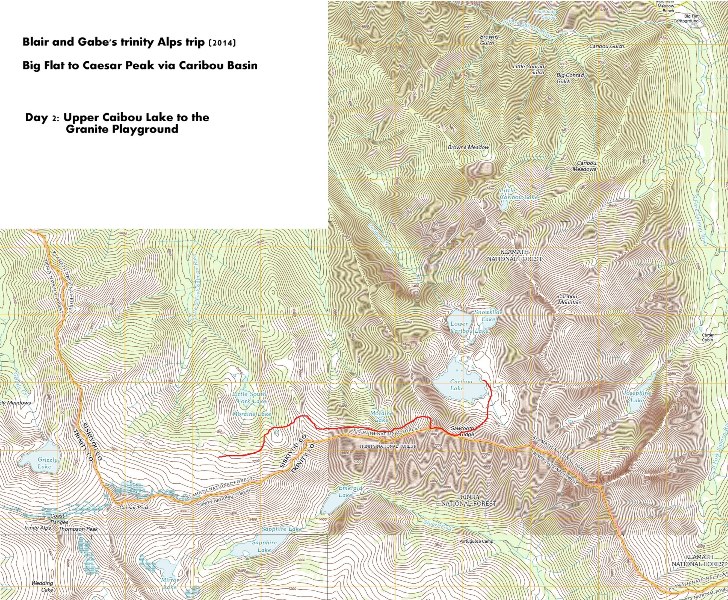
Day 2: Caribou Basin to the Granite Playground
 From here on out, we would be off-trail and finding our own route through the rugged terrain.
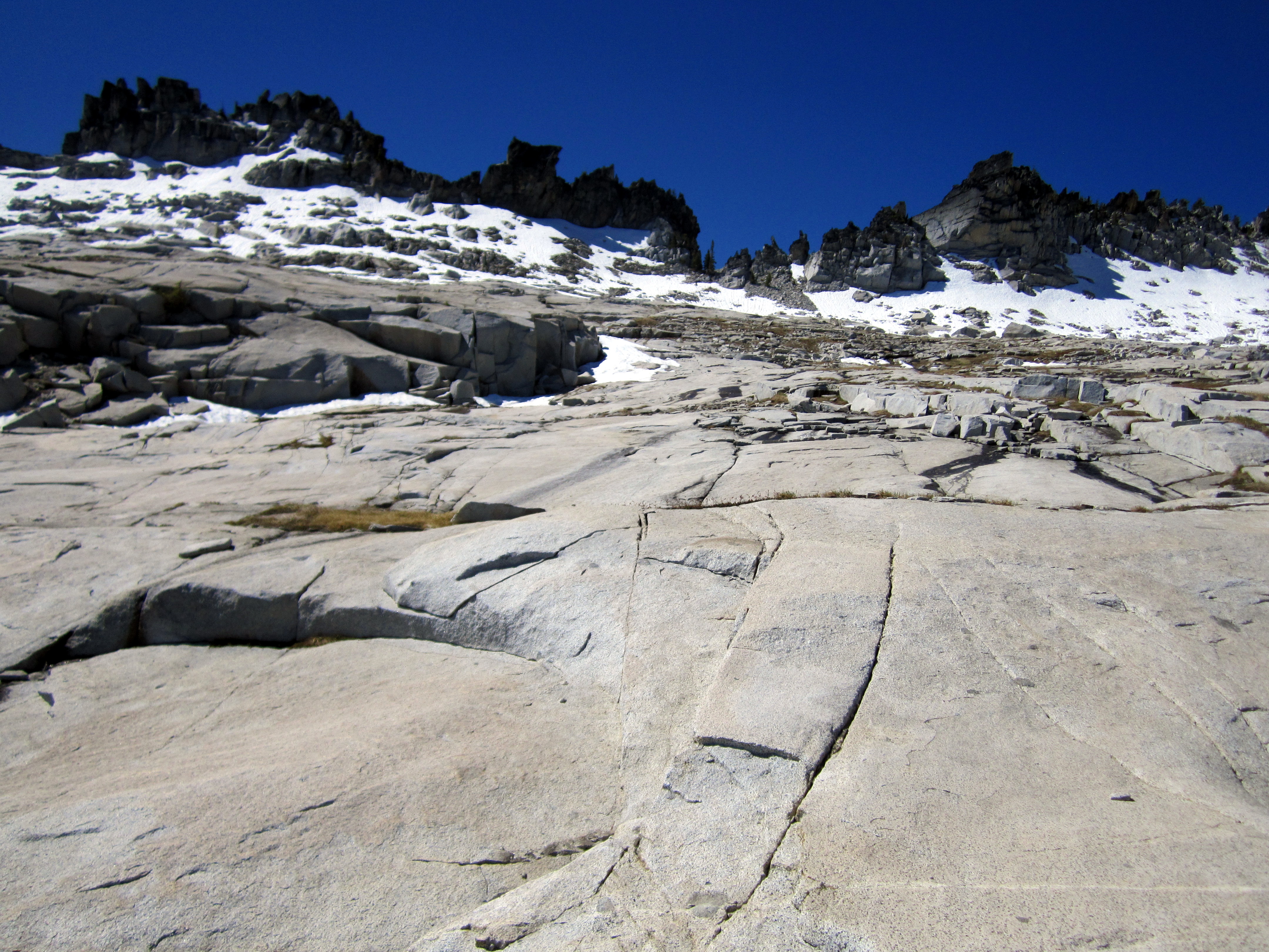
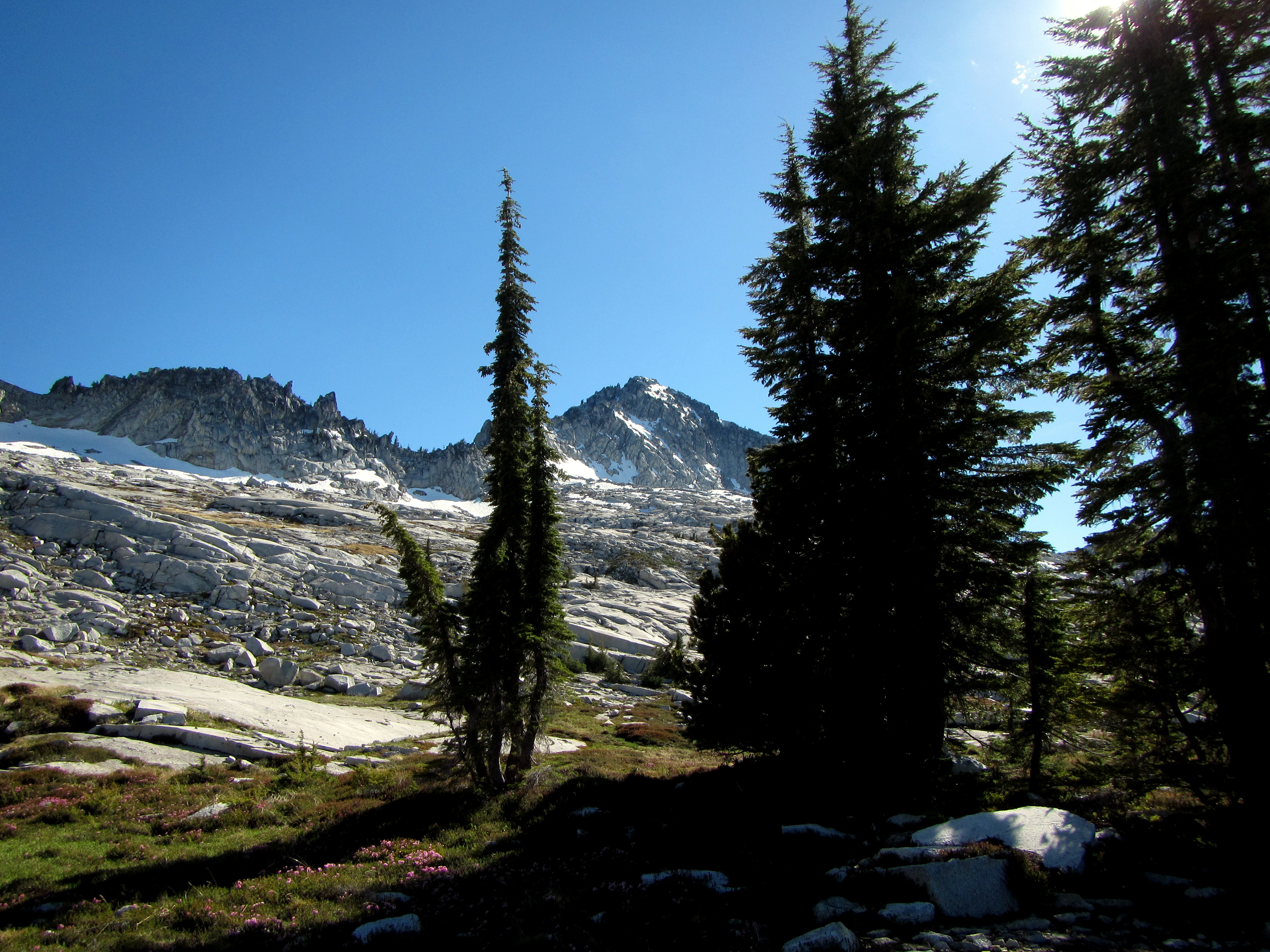
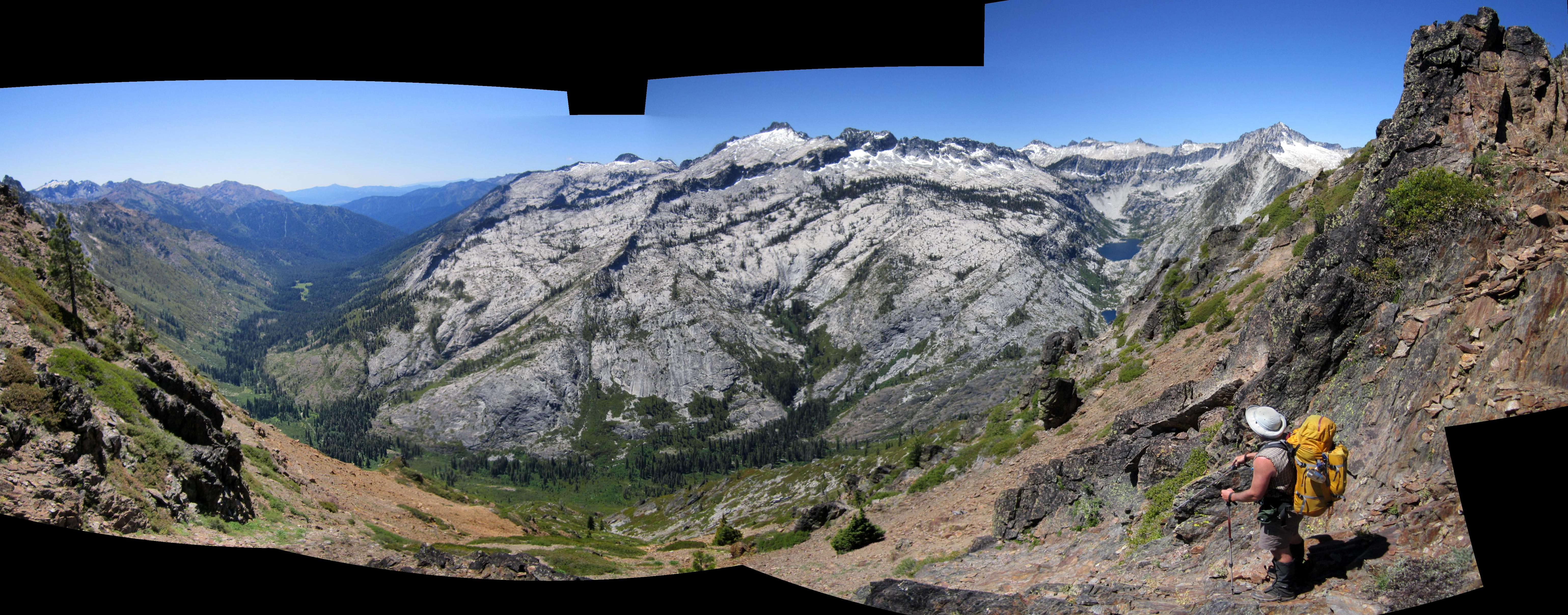 Our first move was to gain the ridge that separates Caribou Basin from the broad valley to the south.
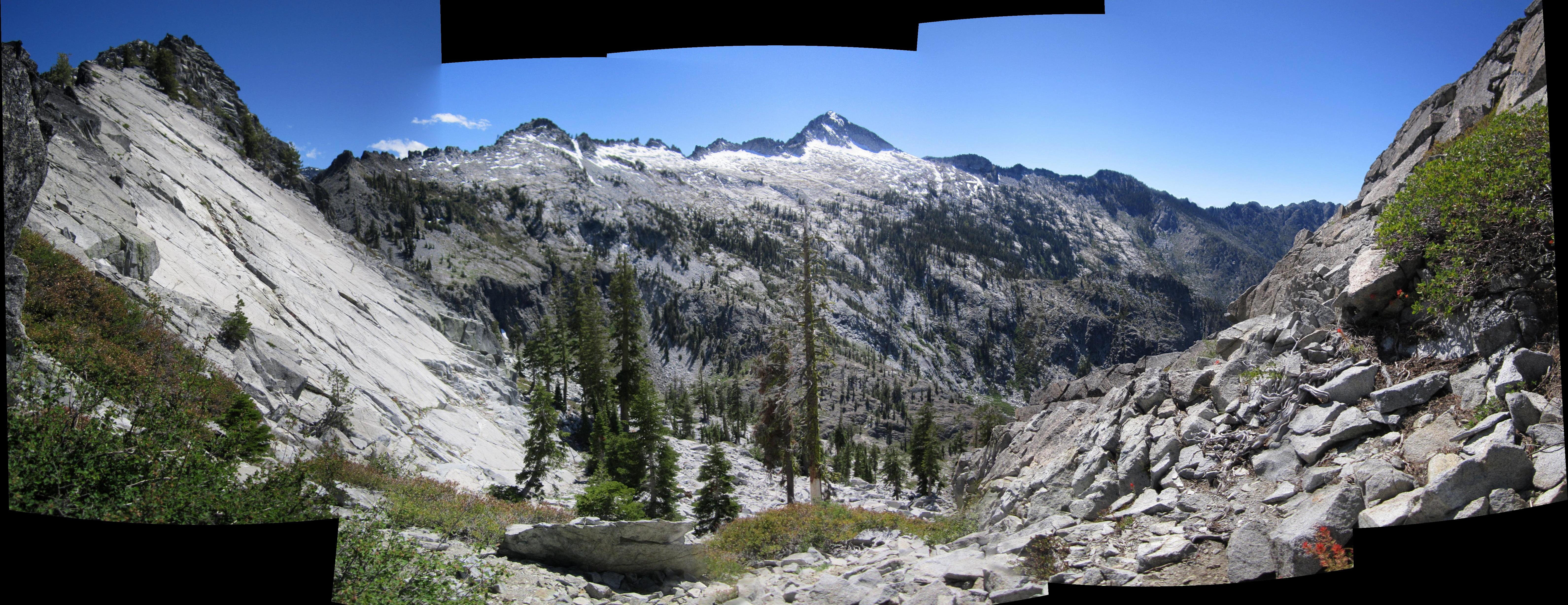
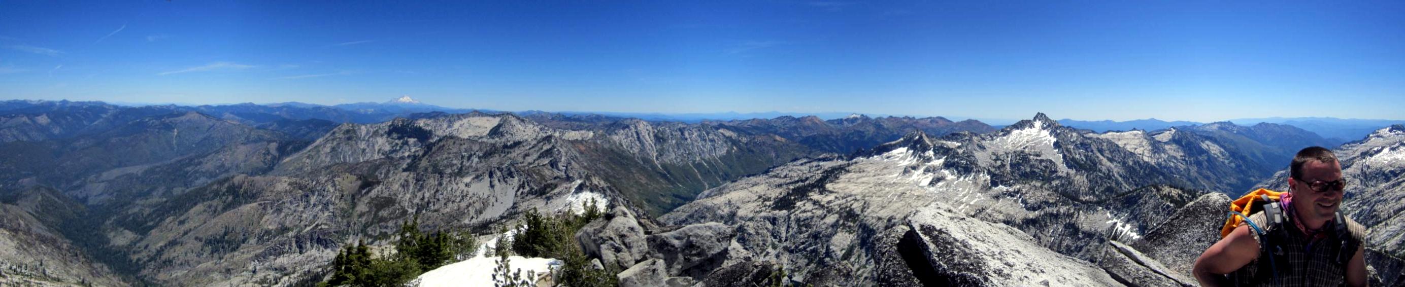
Here's a panorama of our view looking south from the top of the ridge.
Look at that alpine granite wonderland across the valley! Where's the snow?
Our first move was to gain the ridge that separates Caribou Basin from the broad valley to the south.
Here's a panorama of our view looking south from the top of the ridge.
Look at that alpine granite wonderland across the valley! Where's the snow?
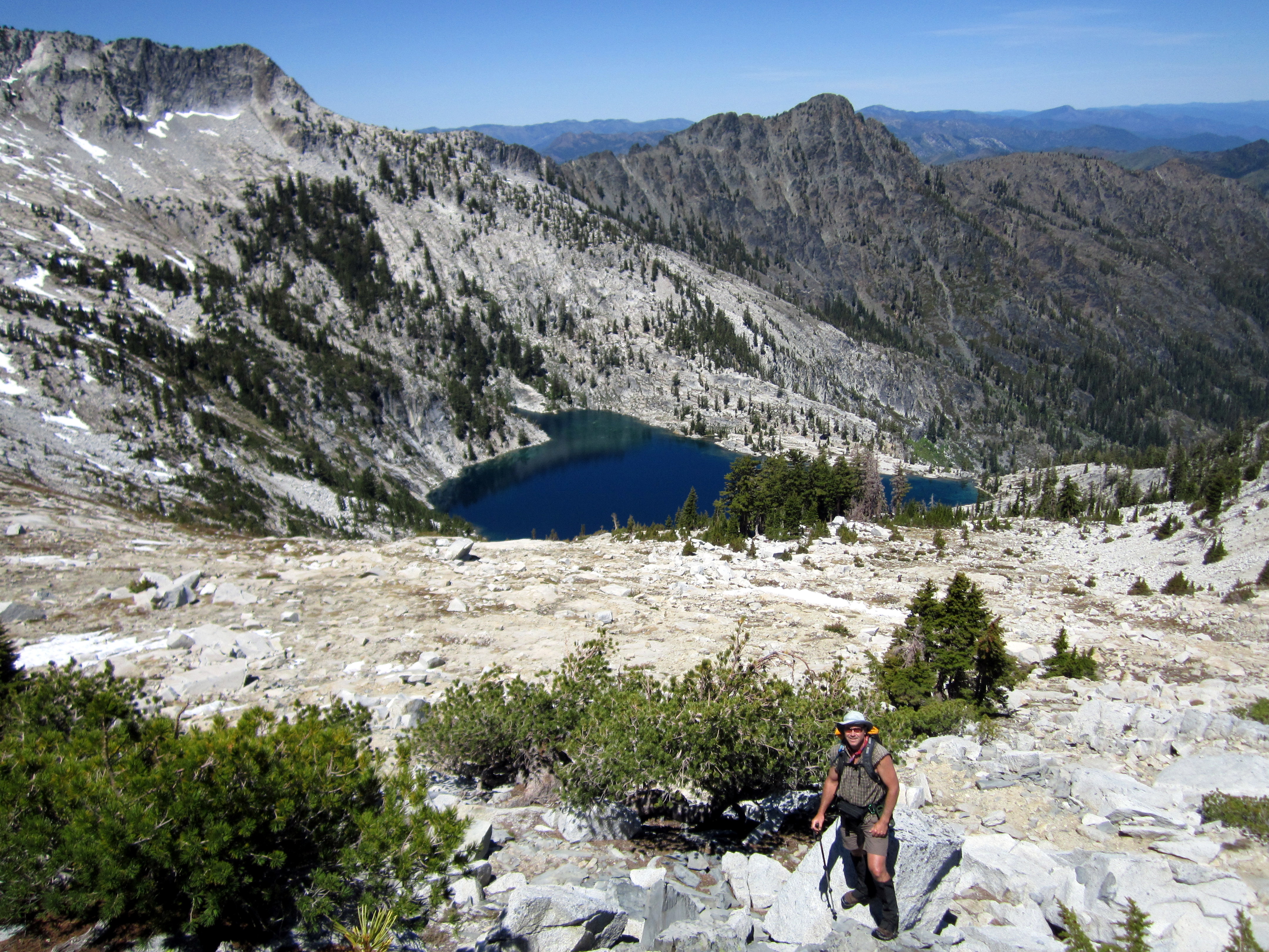
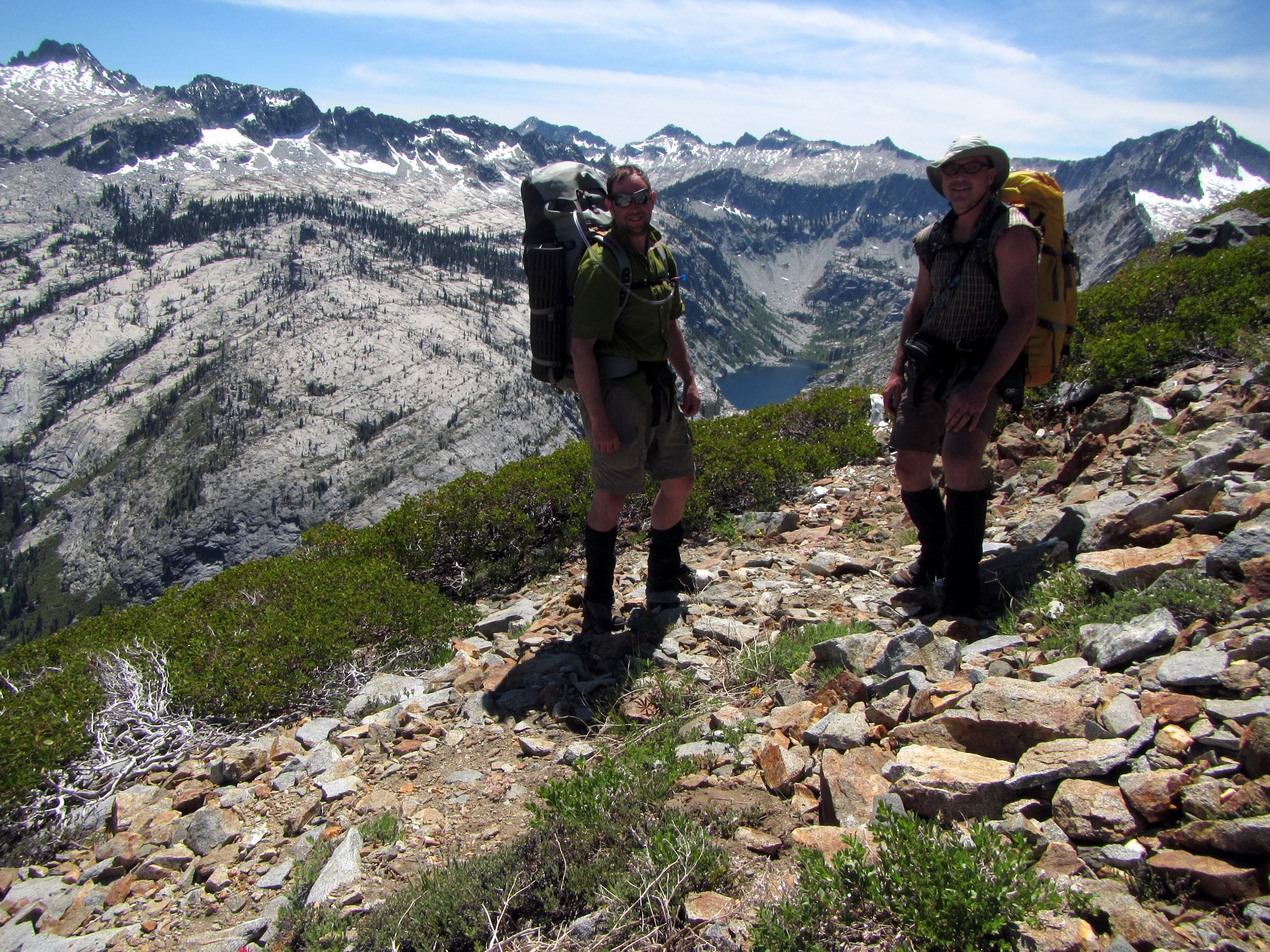
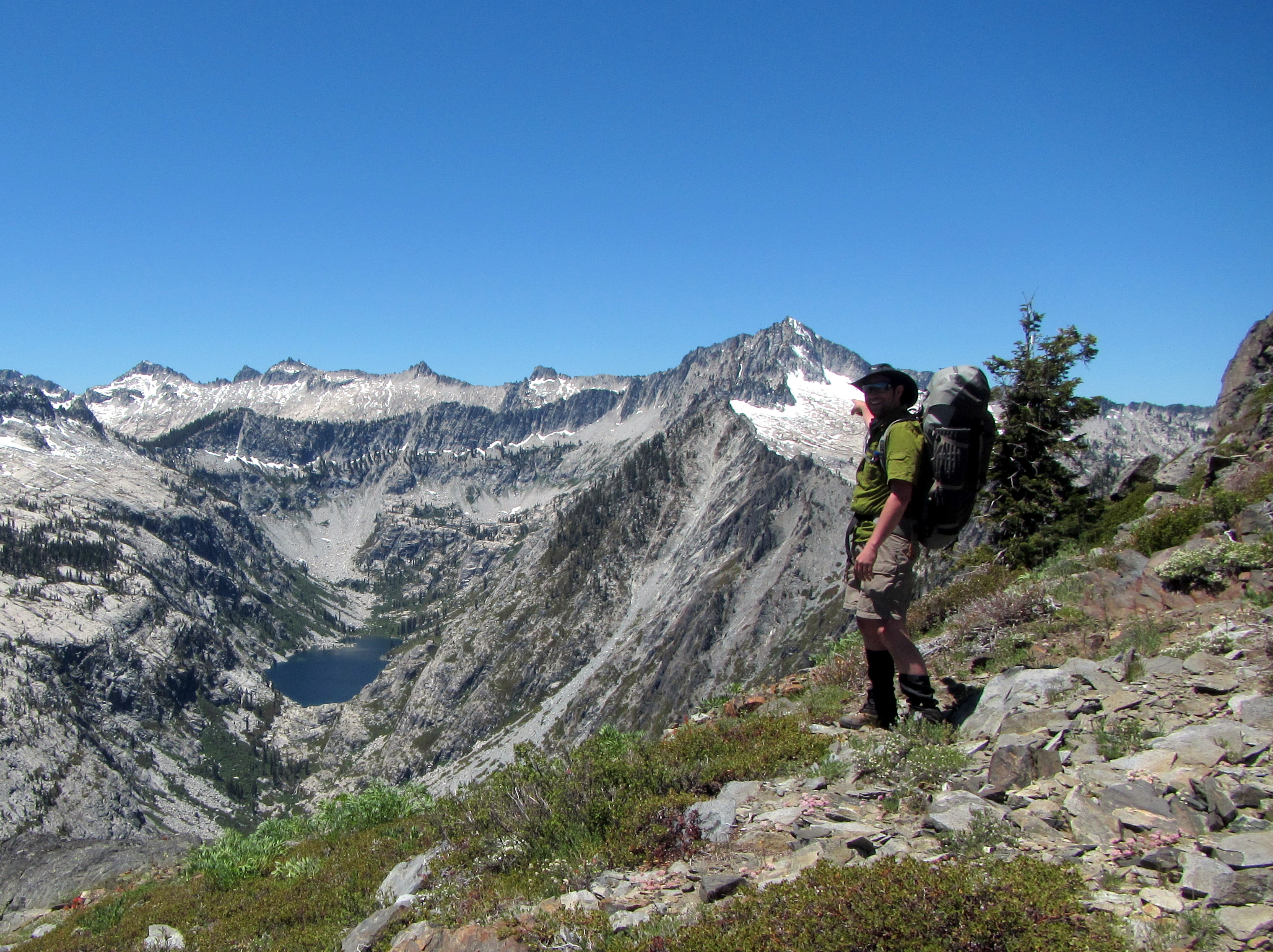 Here's a photo of me up on the ridge, pointing at our goal, Caesar Peak!
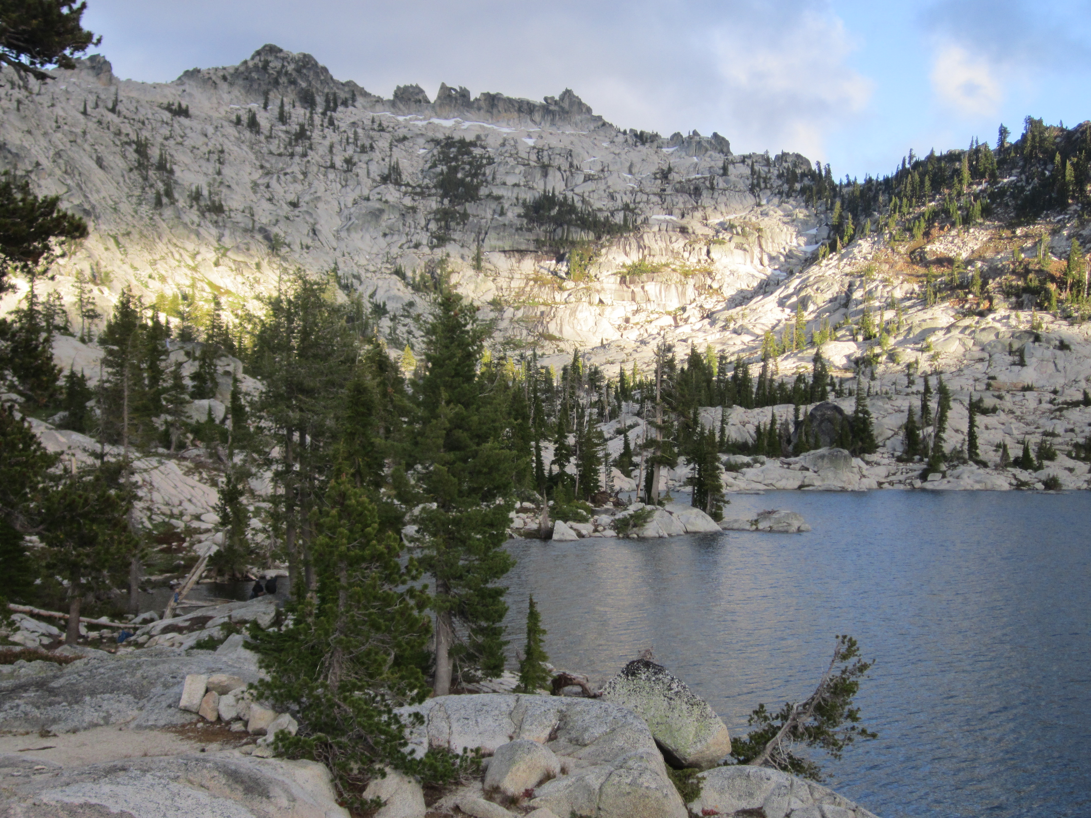
 ...and the view back toward Upper Caribou Lake from the ridge.
The prior evening we had camped on the right side of the lake, that is, on the correct side of the lake, in the granite.
You can easily see the contact between the granite and the red sedimentary rock.
...and the view back toward Upper Caribou Lake from the ridge.
The prior evening we had camped on the right side of the lake, that is, on the correct side of the lake, in the granite.
You can easily see the contact between the granite and the red sedimentary rock.
 There's another minor peak on the ridge above Caribou that we stopped at for awhile.
This minor peak, adorned with a gleaming white feldspar phallus, was a major landmark for us.
There's another minor peak on the ridge above Caribou that we stopped at for awhile.
This minor peak, adorned with a gleaming white feldspar phallus, was a major landmark for us.
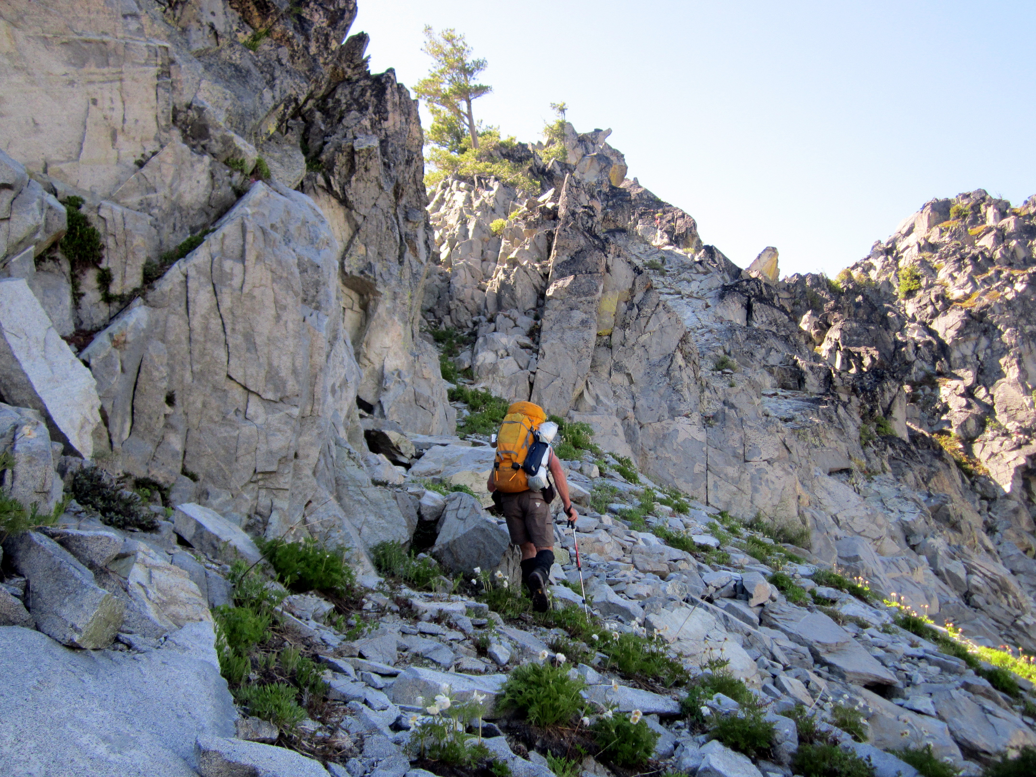
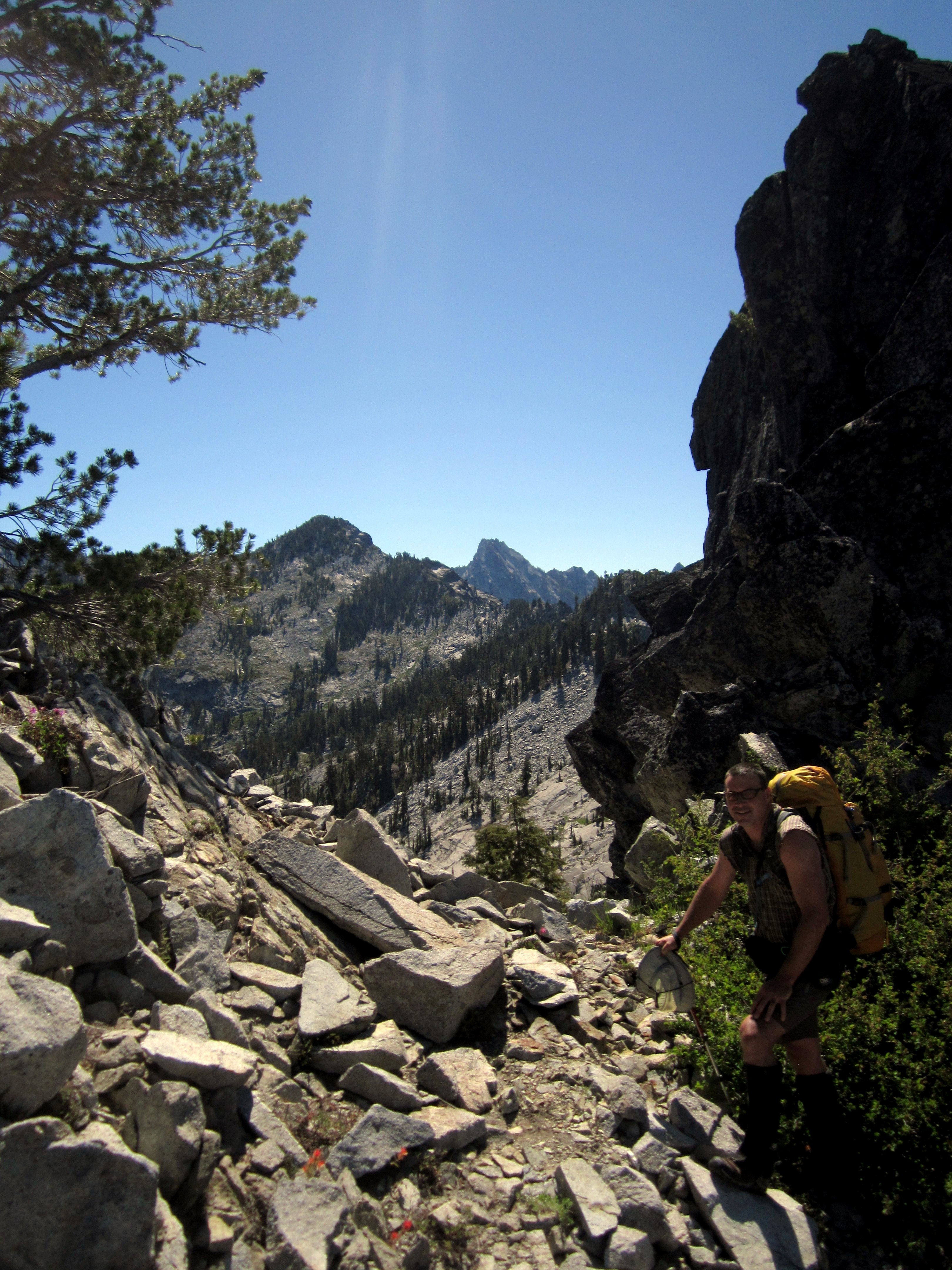
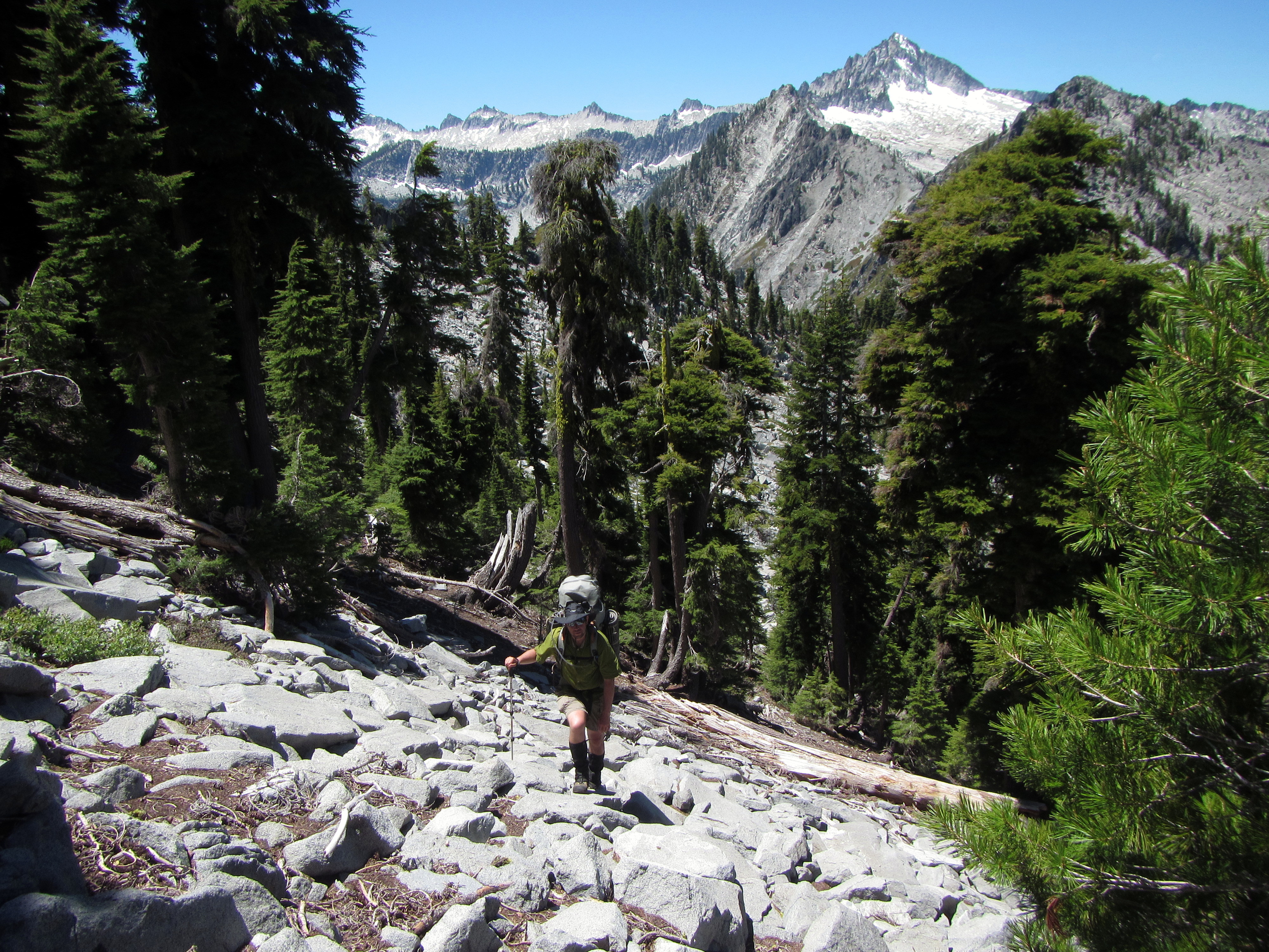
 The next portion of the route was along the headwall of the Middle Fork of Little South Fork (great name guys) drainage.
We didn't get many photos of this route, as we were focused on our footing and our dwindling water supply.
The traverse was across broad fields of talus and through steep forested slopes.
During the traverse, we were intent on 'staying high'. That is, we didn't want to lose any elevation as we approached 'The Notch', Blair's secret passage.
The drainage headwall was encircled by a tall band of cliffs. Blair has previously discovered a narrow notch in these cliffs, and we headed straight for it.
In the photo above you can see the sunshine in 'The Notch'.
The next portion of the route was along the headwall of the Middle Fork of Little South Fork (great name guys) drainage.
We didn't get many photos of this route, as we were focused on our footing and our dwindling water supply.
The traverse was across broad fields of talus and through steep forested slopes.
During the traverse, we were intent on 'staying high'. That is, we didn't want to lose any elevation as we approached 'The Notch', Blair's secret passage.
The drainage headwall was encircled by a tall band of cliffs. Blair has previously discovered a narrow notch in these cliffs, and we headed straight for it.
In the photo above you can see the sunshine in 'The Notch'.
 Blair approaching 'The Notch'.
Finding this was key to our route.
The Notch is the only way to get into the next drainage valley without dropping down many hundreds of feet.
Blair approaching 'The Notch'.
Finding this was key to our route.
The Notch is the only way to get into the next drainage valley without dropping down many hundreds of feet.
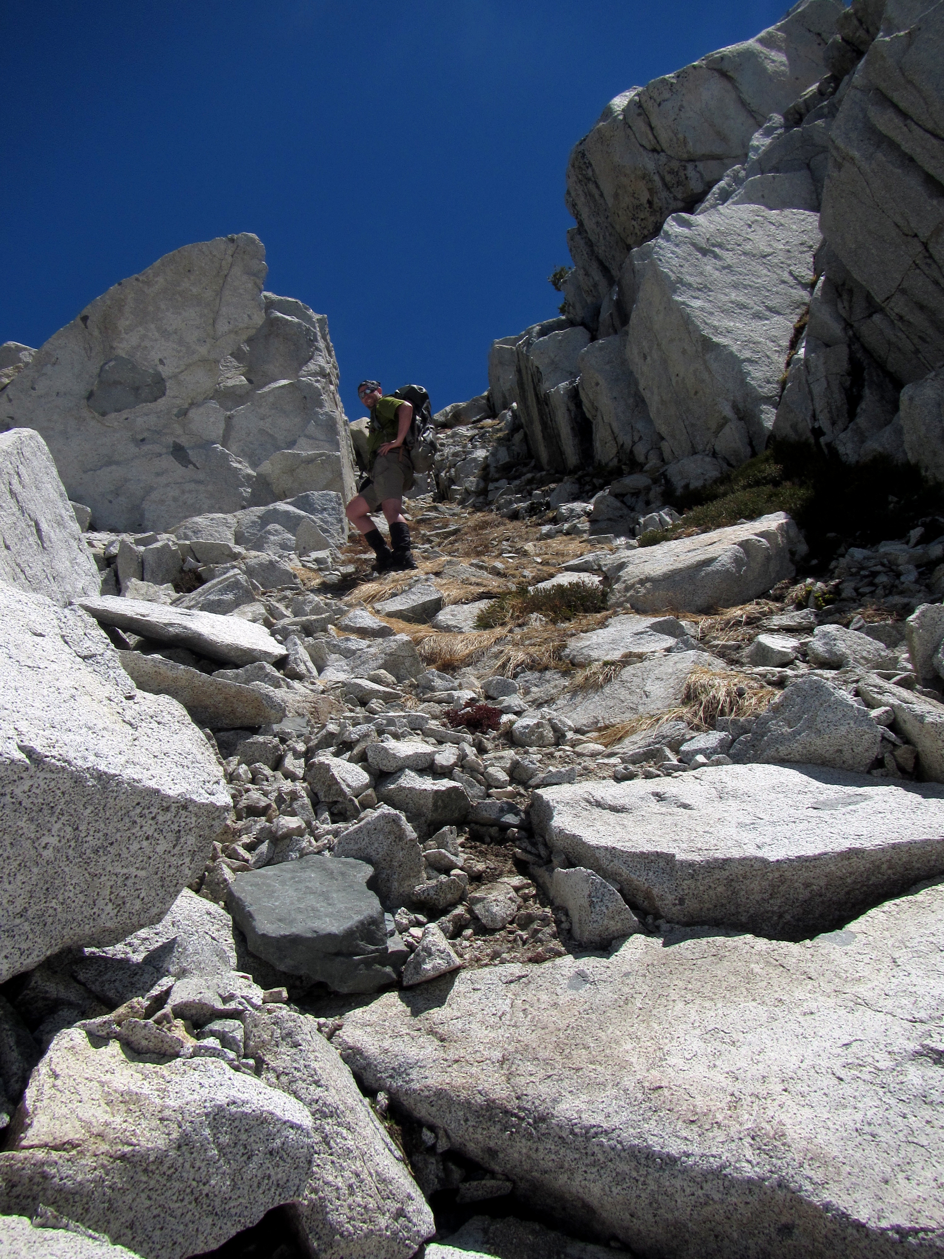
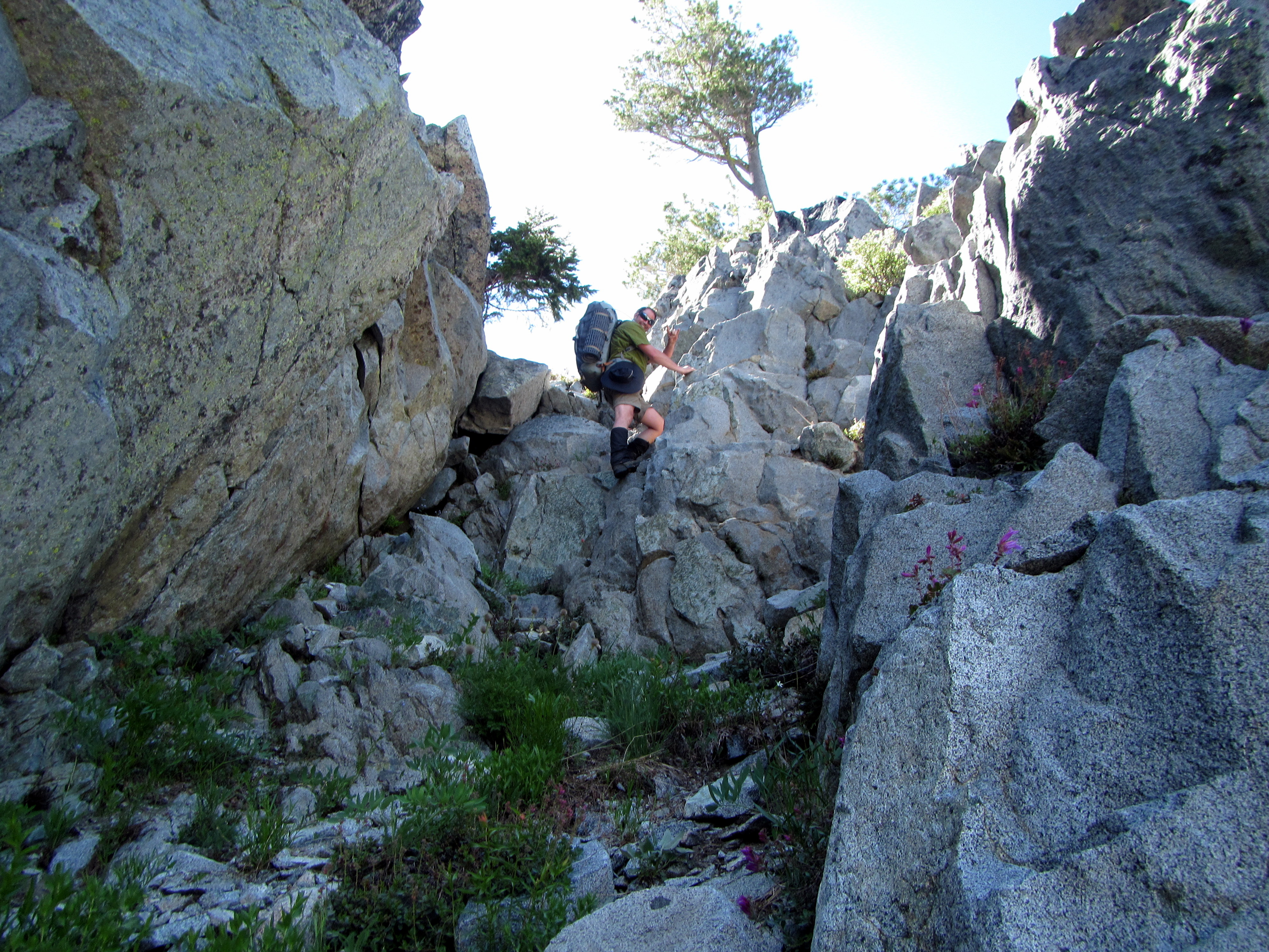 (Above) Blair gave me the honor of climbing through the Notch first. He took this photo of me scrambling up there.
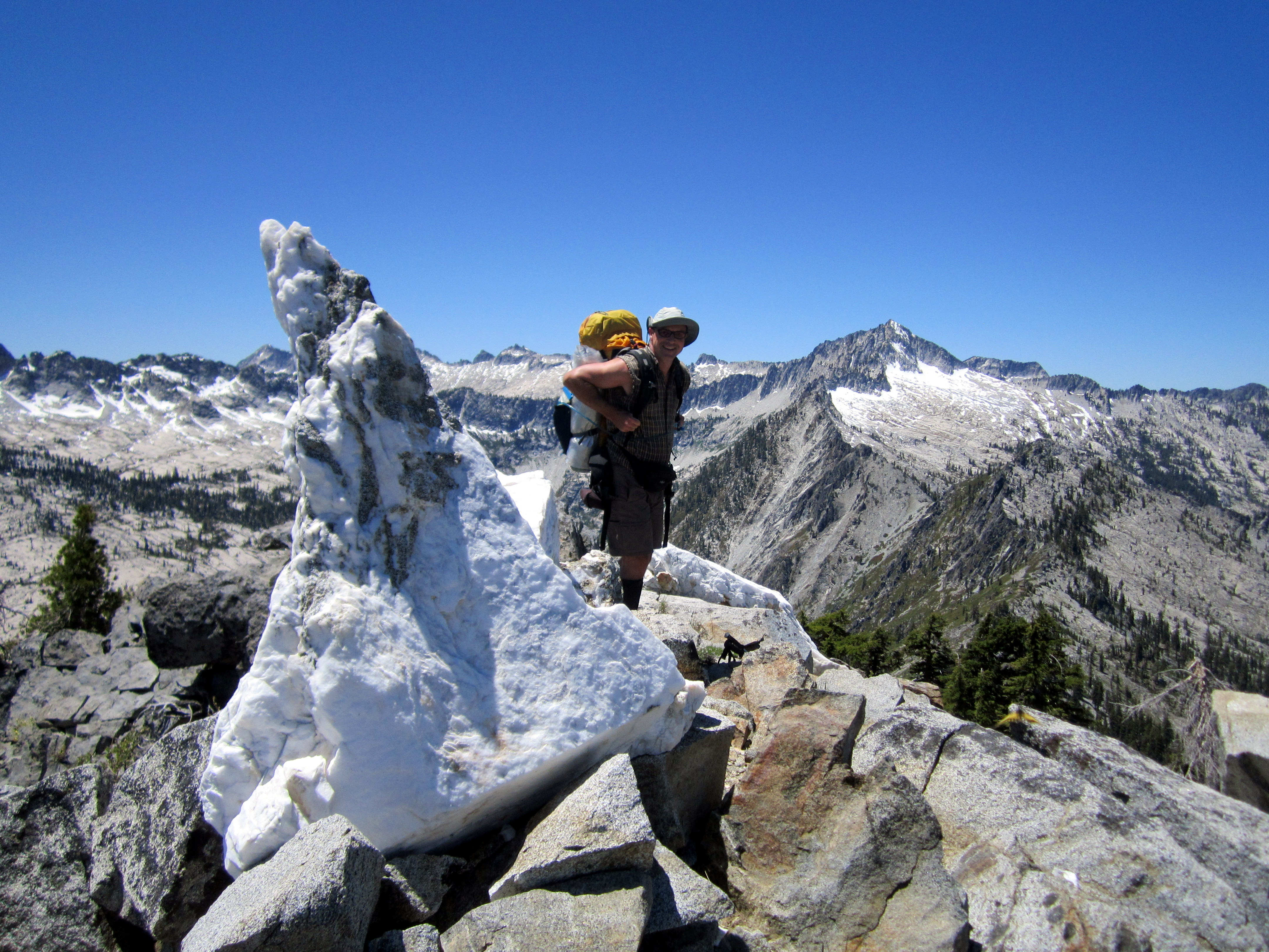
 I was notched! This was my view of the other side!
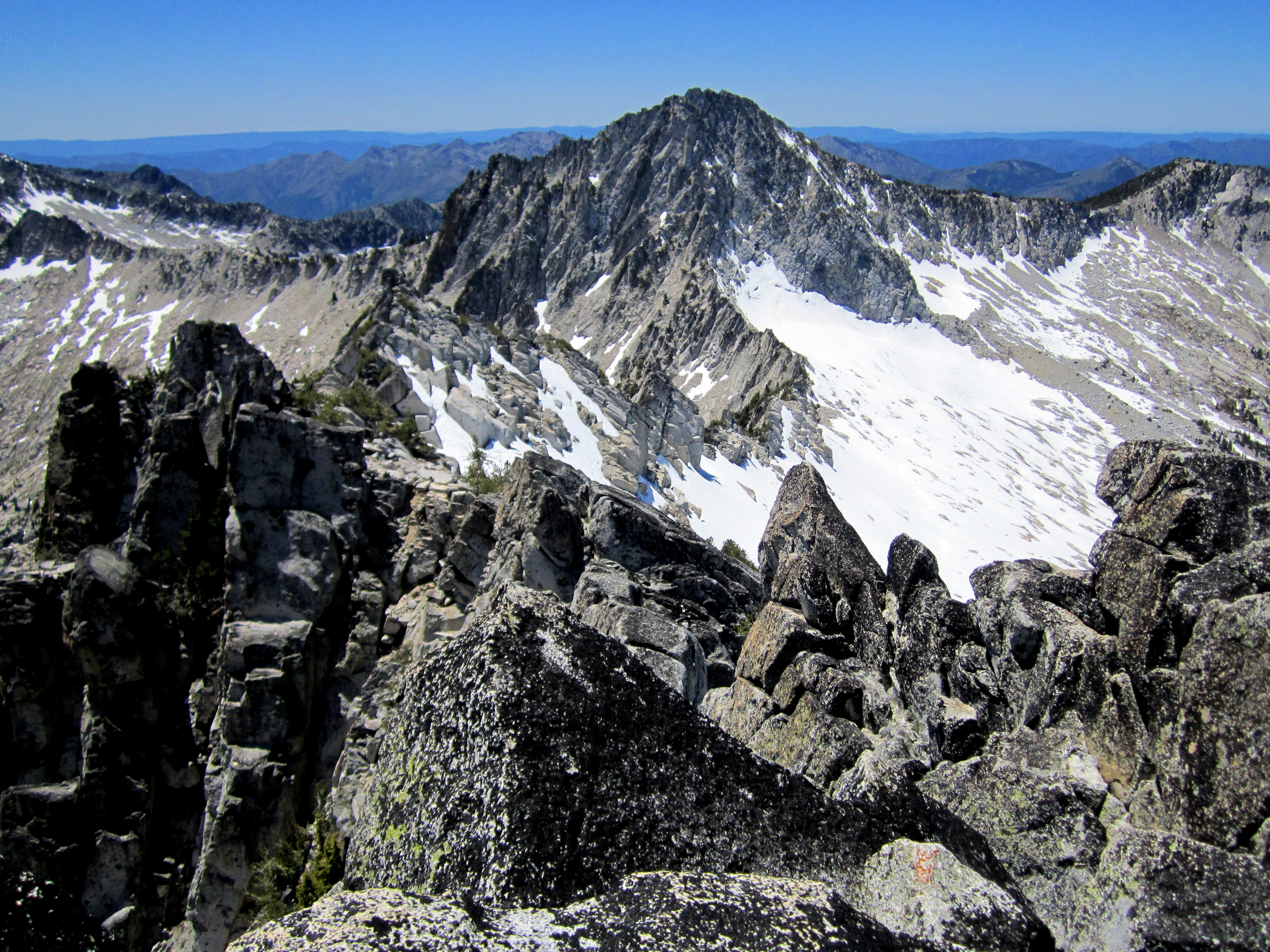
That's Caesar Peak over there (center of photo)! Getting closer!
We wanted to camp that night in the granite area just at the top of treeline, somewhere below the low spot in the ridge to the left of Caesar Peak.
I was notched! This was my view of the other side!
That's Caesar Peak over there (center of photo)! Getting closer!
We wanted to camp that night in the granite area just at the top of treeline, somewhere below the low spot in the ridge to the left of Caesar Peak.
 Blair making the scramble up into The Notch.
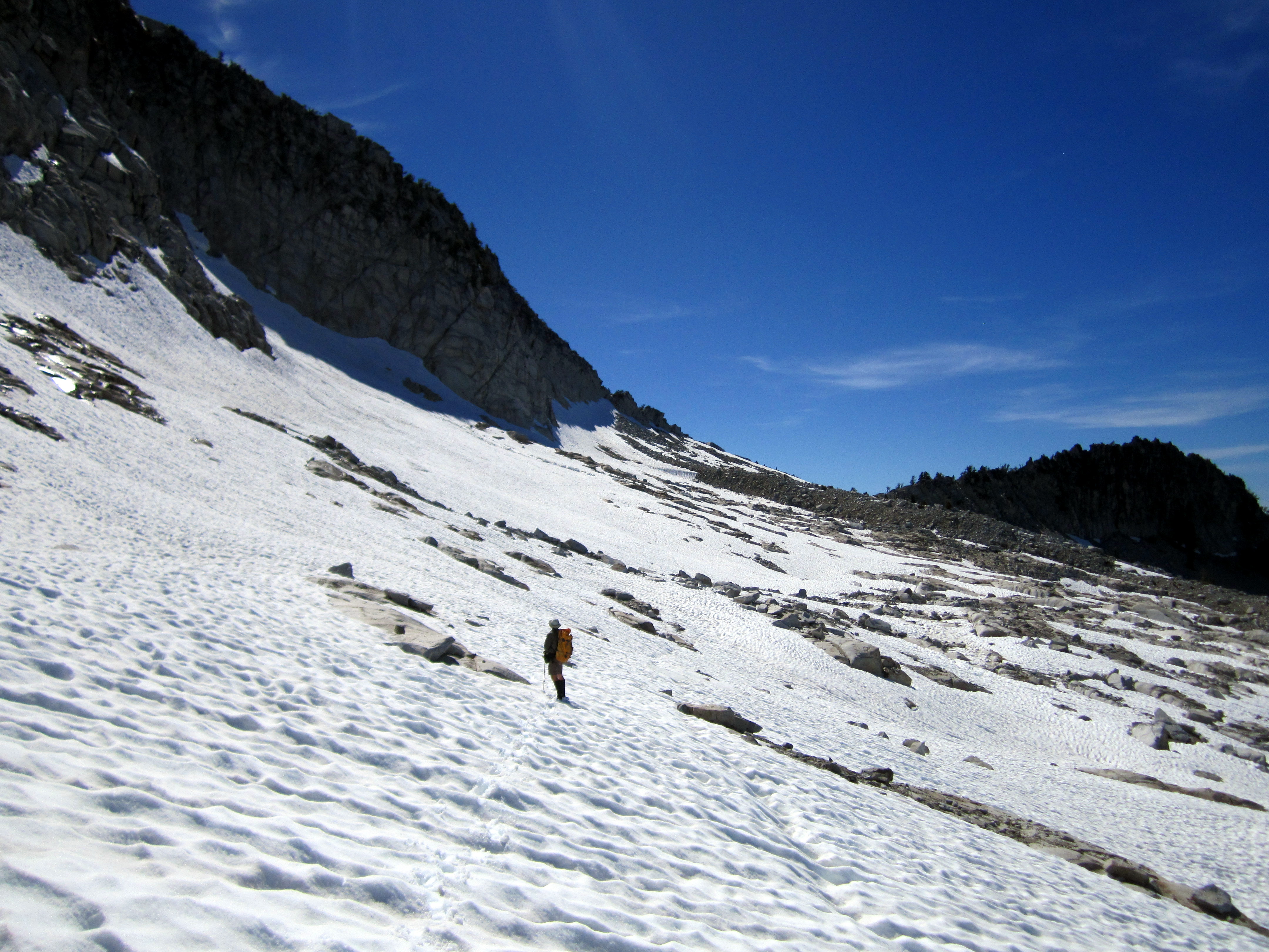
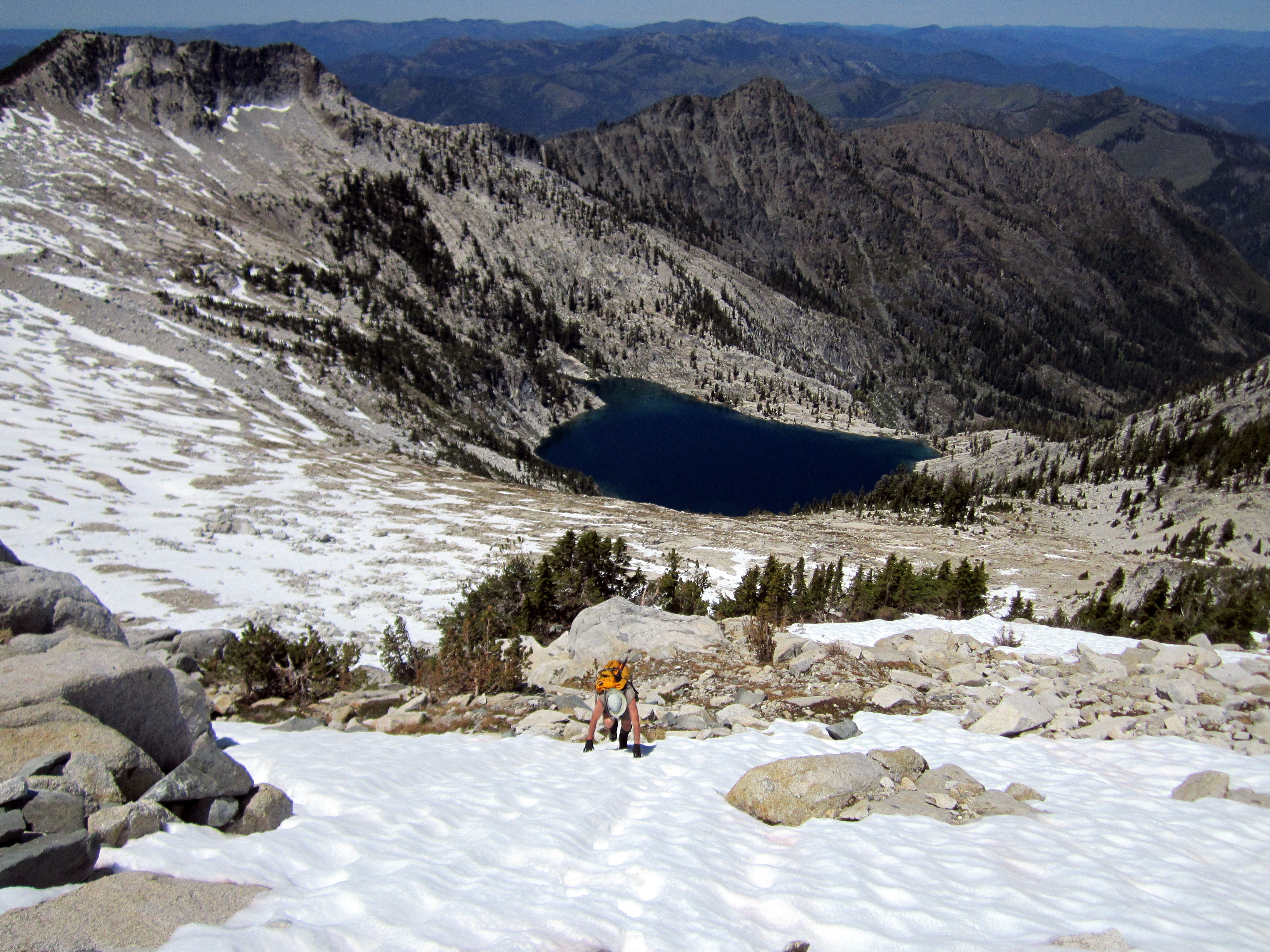
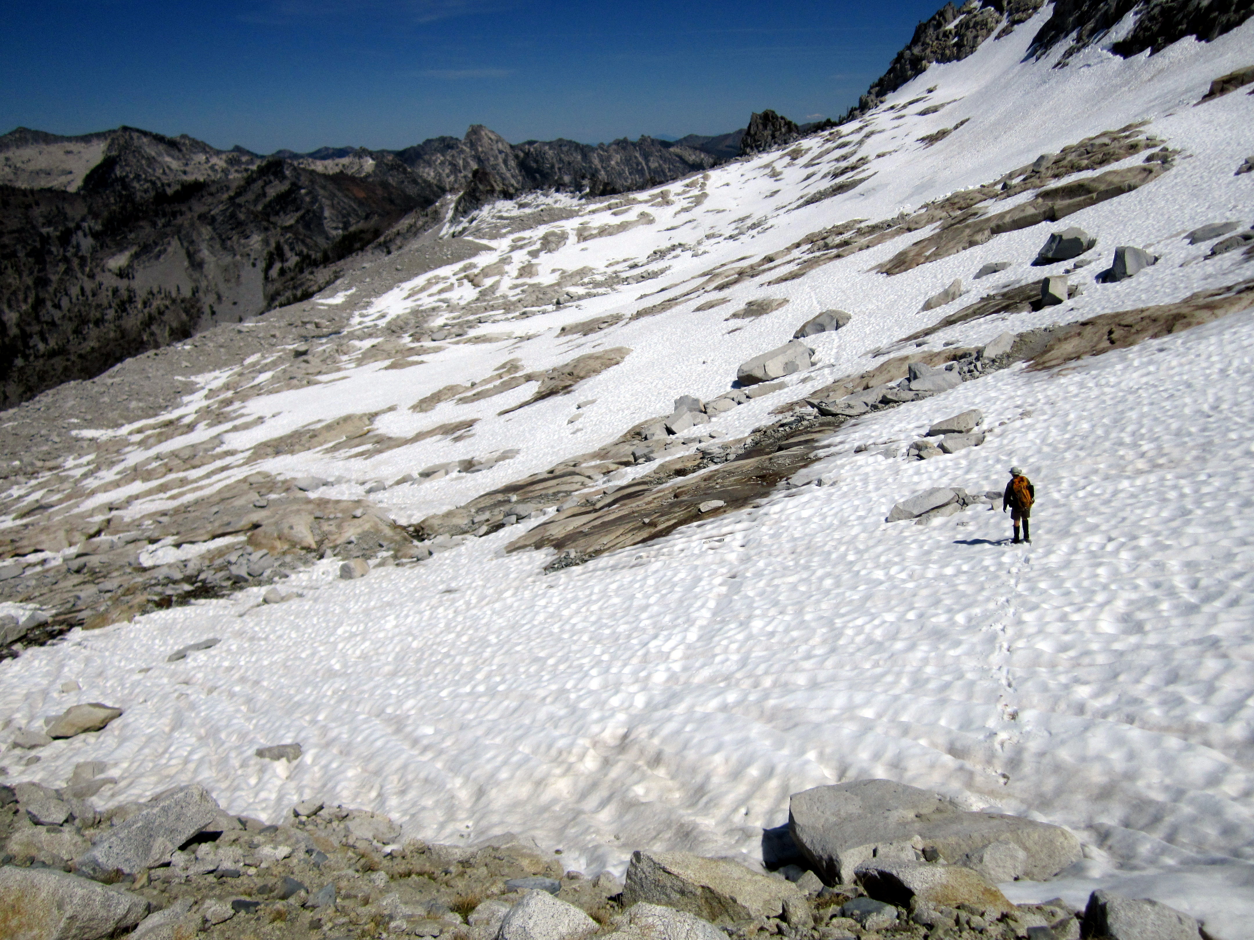
 The drop down from the Notch was very steep.
Unfortunately, we had to drop about a thousand feet down to the tarn (small lake) in order to cross over to the other side.
From there it was a straight shot, back up, to the Granite Playground on the north flank of Caesar Peak.
The drop down from the Notch was very steep.
Unfortunately, we had to drop about a thousand feet down to the tarn (small lake) in order to cross over to the other side.
From there it was a straight shot, back up, to the Granite Playground on the north flank of Caesar Peak.
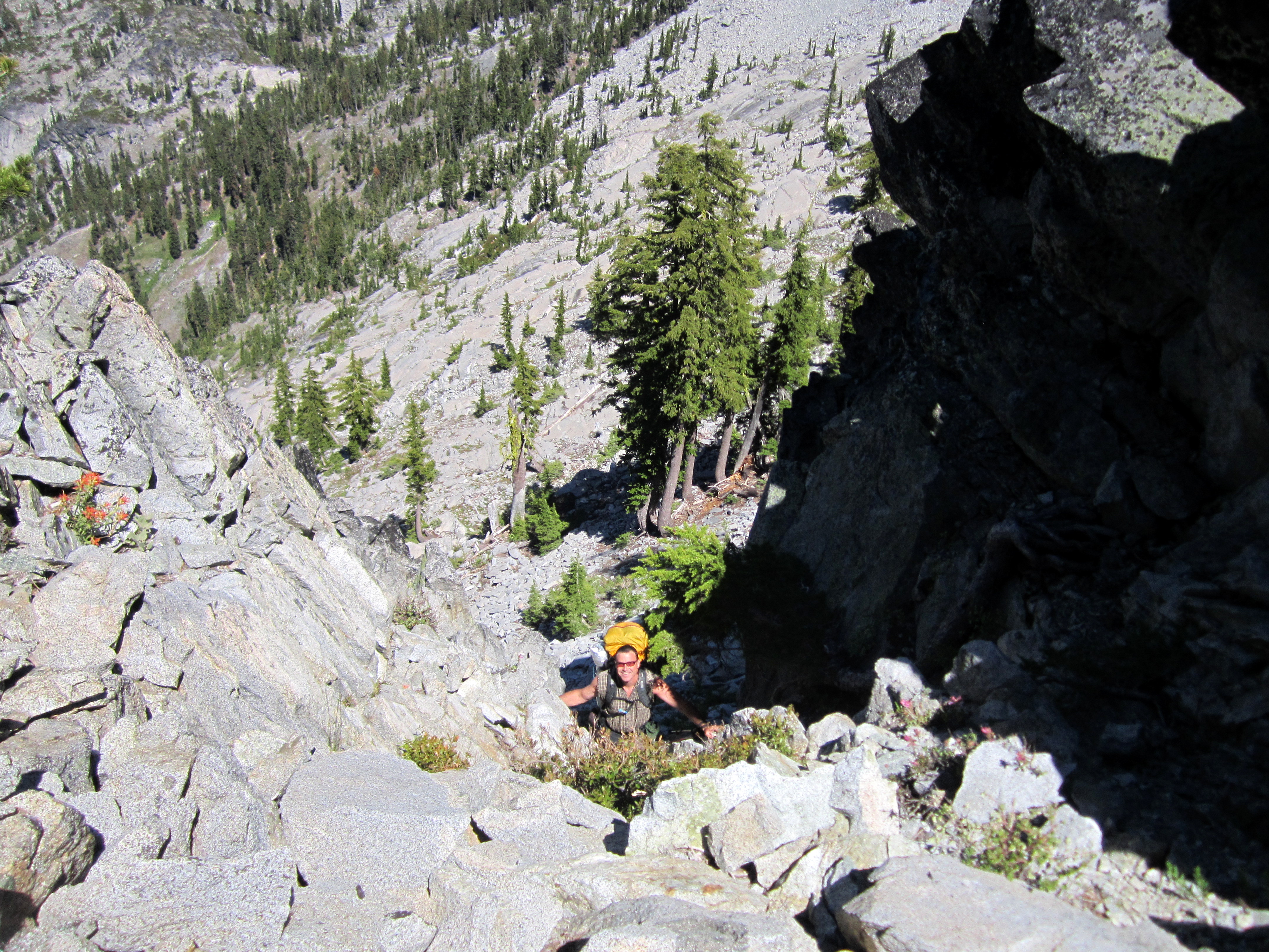
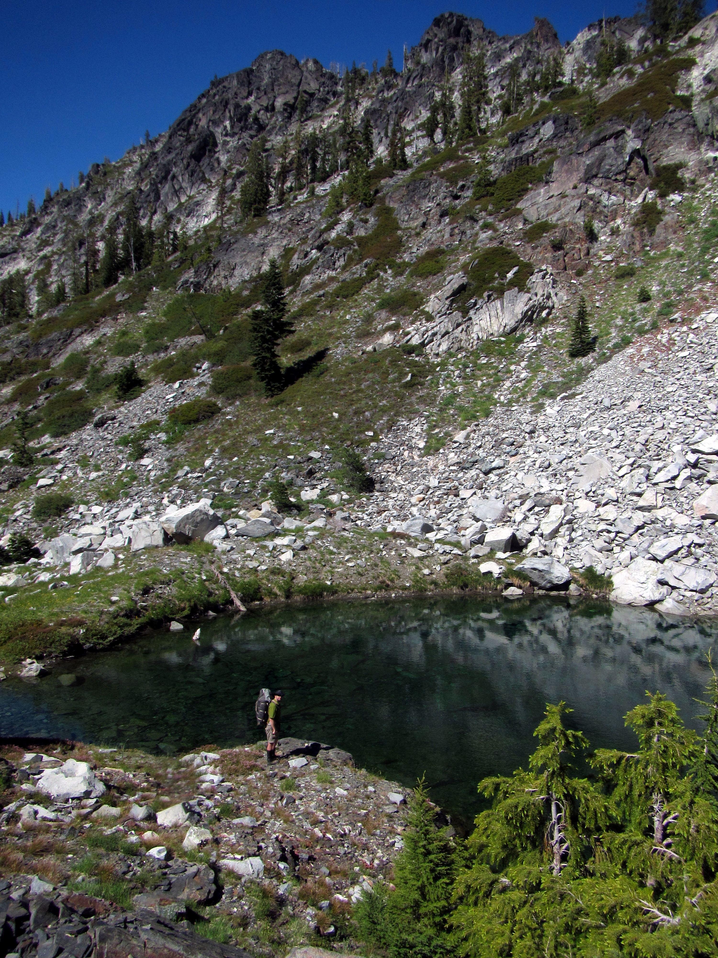 Here's a picture of me at the tarn, looking back across toward the Notch.
We were feeling pretty beat at this point.
We just needed to regain our thousand feet and find somewhere to camp in the Granite Playground.
Here's a picture of me at the tarn, looking back across toward the Notch.
We were feeling pretty beat at this point.
We just needed to regain our thousand feet and find somewhere to camp in the Granite Playground.
 About an hour later: "How's this look, Gabe?"
 My pack drops from my shoulders in a heap. "Looks like home, Blair."
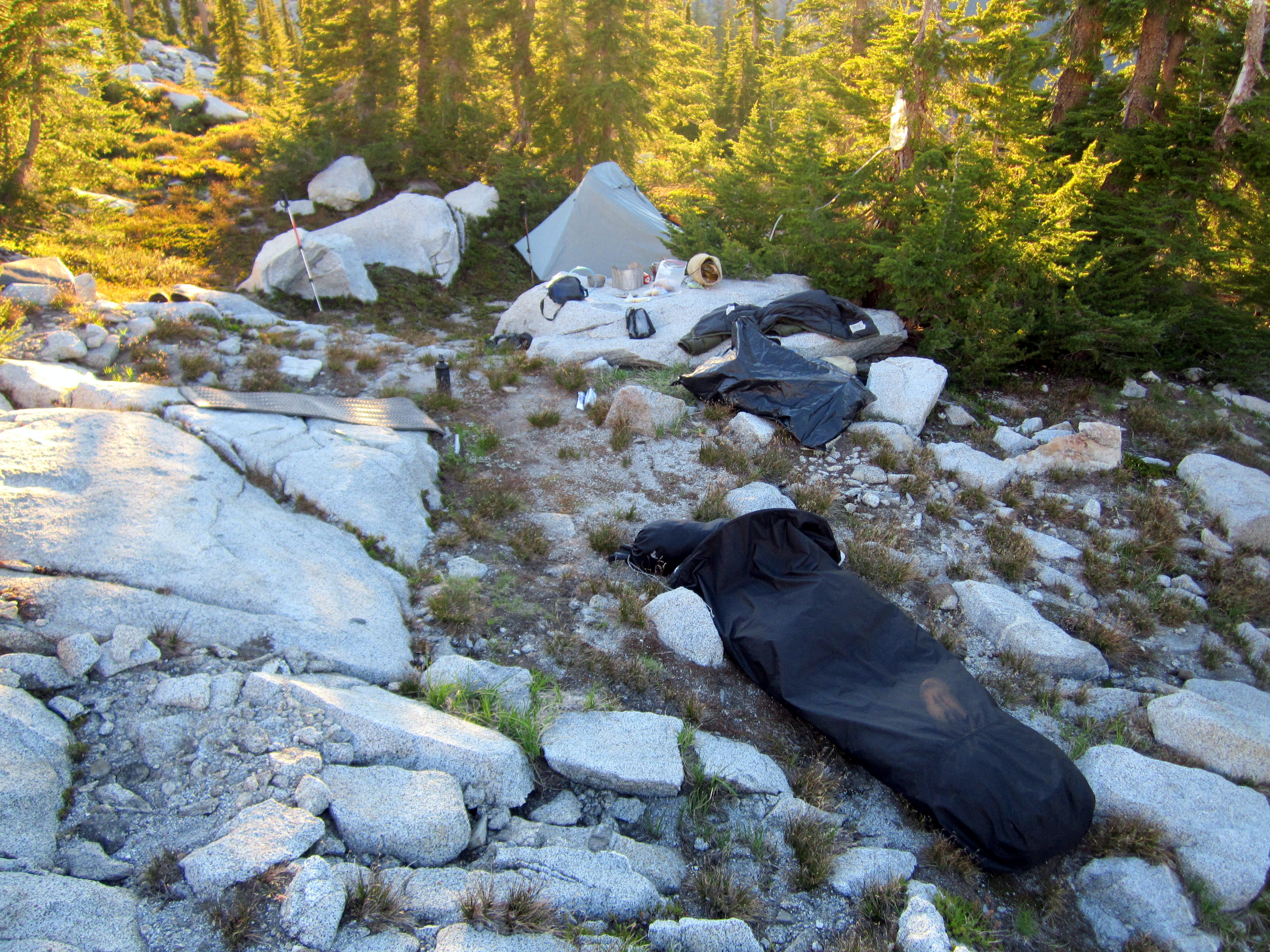
This spot was our camp for two nights.
That's Blair's mini-tent in the background,and my bivy in the foreground. The kitchen was in-between.
My pack drops from my shoulders in a heap. "Looks like home, Blair."
This spot was our camp for two nights.
That's Blair's mini-tent in the background,and my bivy in the foreground. The kitchen was in-between.
Day 3: Summit Day
 This was the day I was itching for. The light-weight pack, the snow, the scramble, the summit!
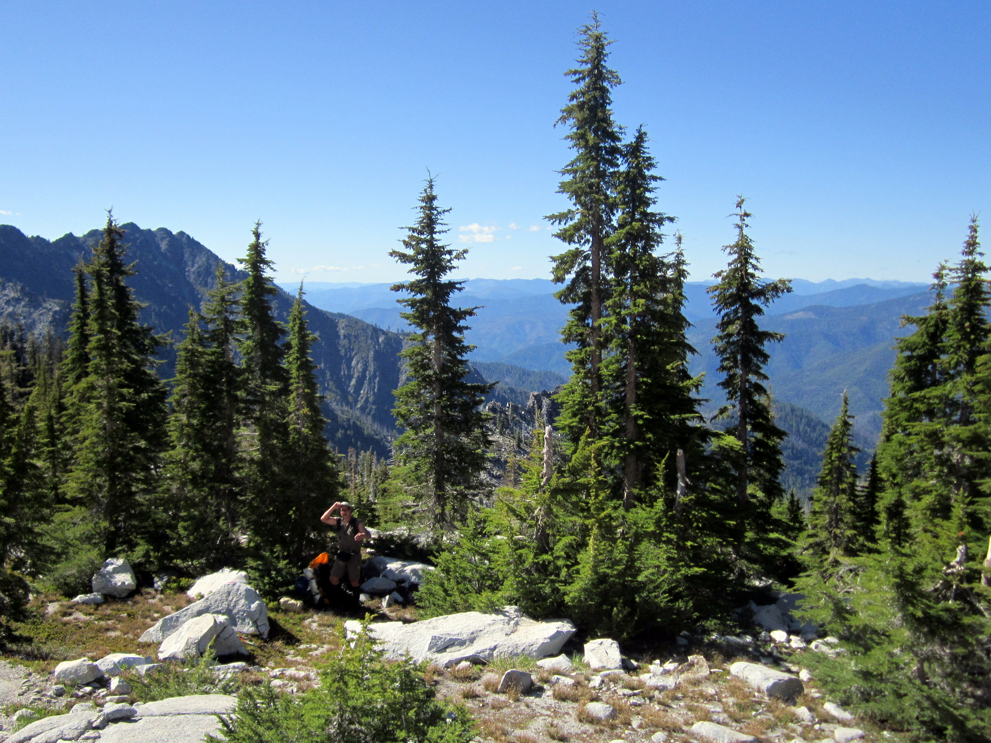
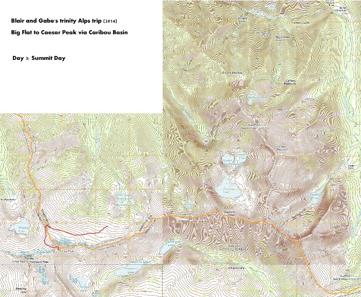
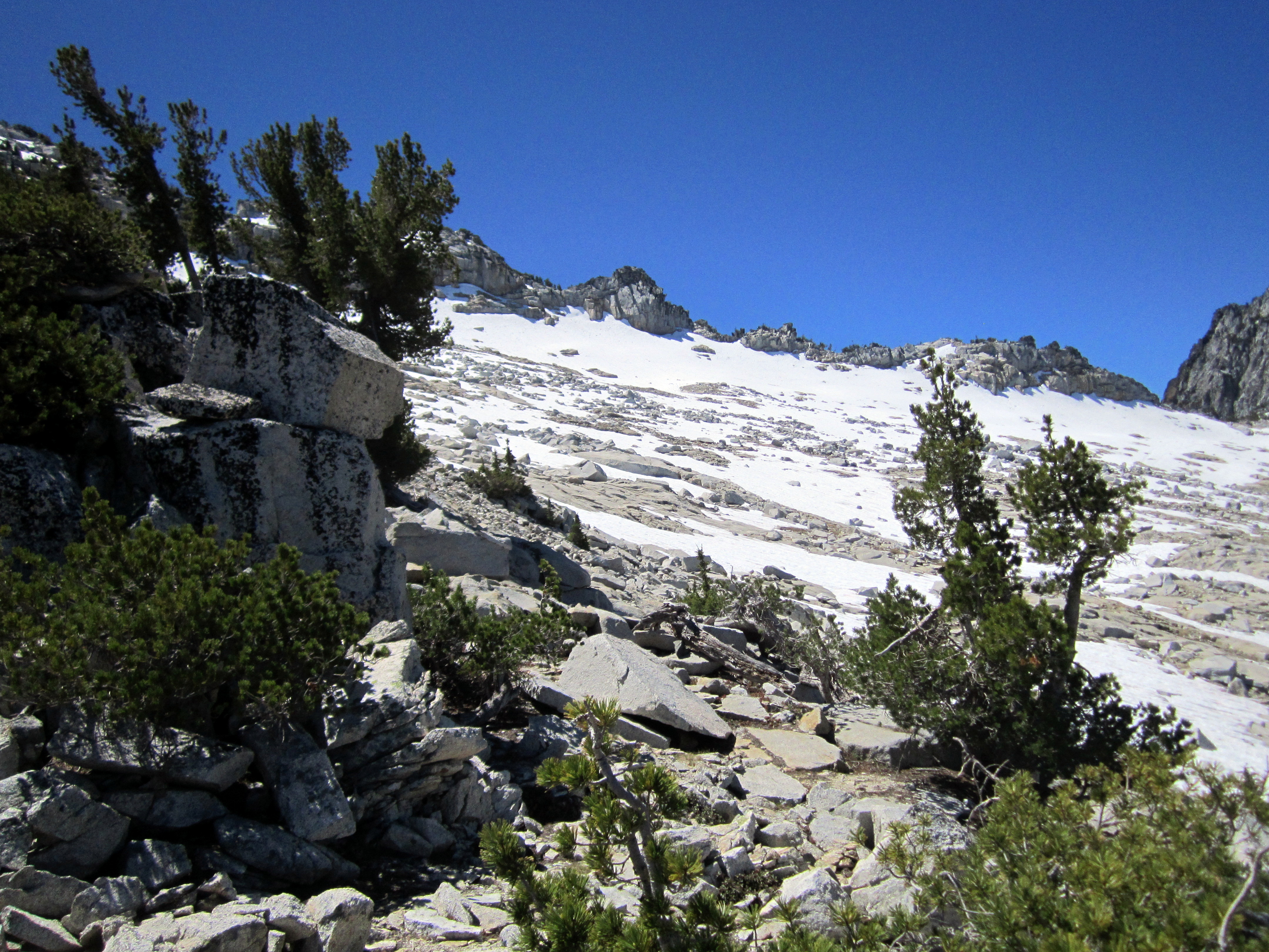
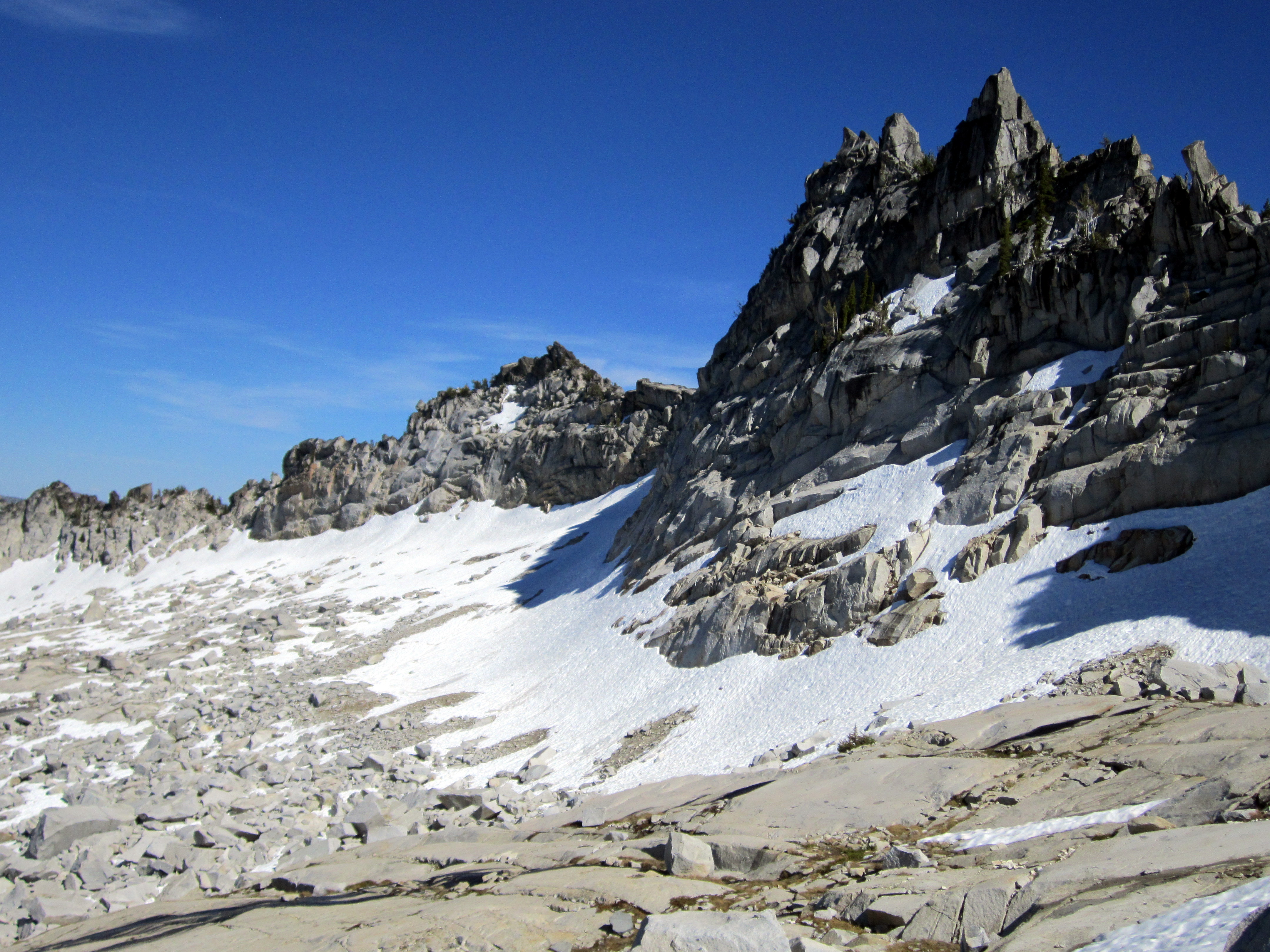
 The day began in terrain like this, right at the upper edge of the sub-alpine.
From there, we climbed up above the vegetation into open granite wonderland!
The day began in terrain like this, right at the upper edge of the sub-alpine.
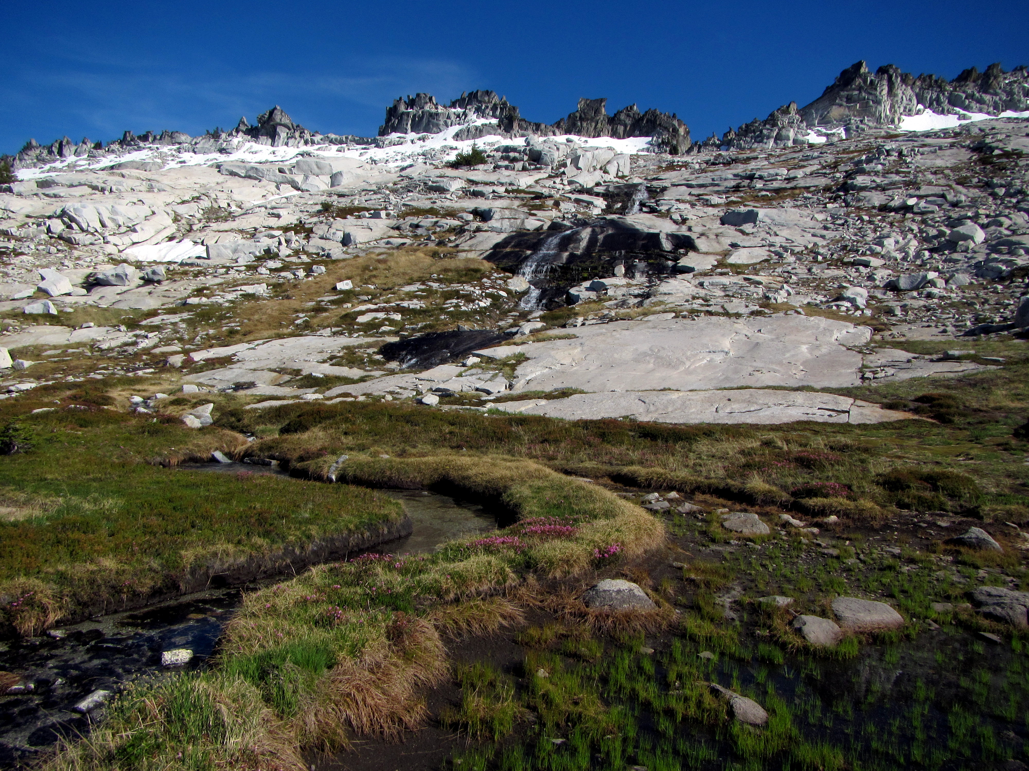
From there, we climbed up above the vegetation into open granite wonderland!
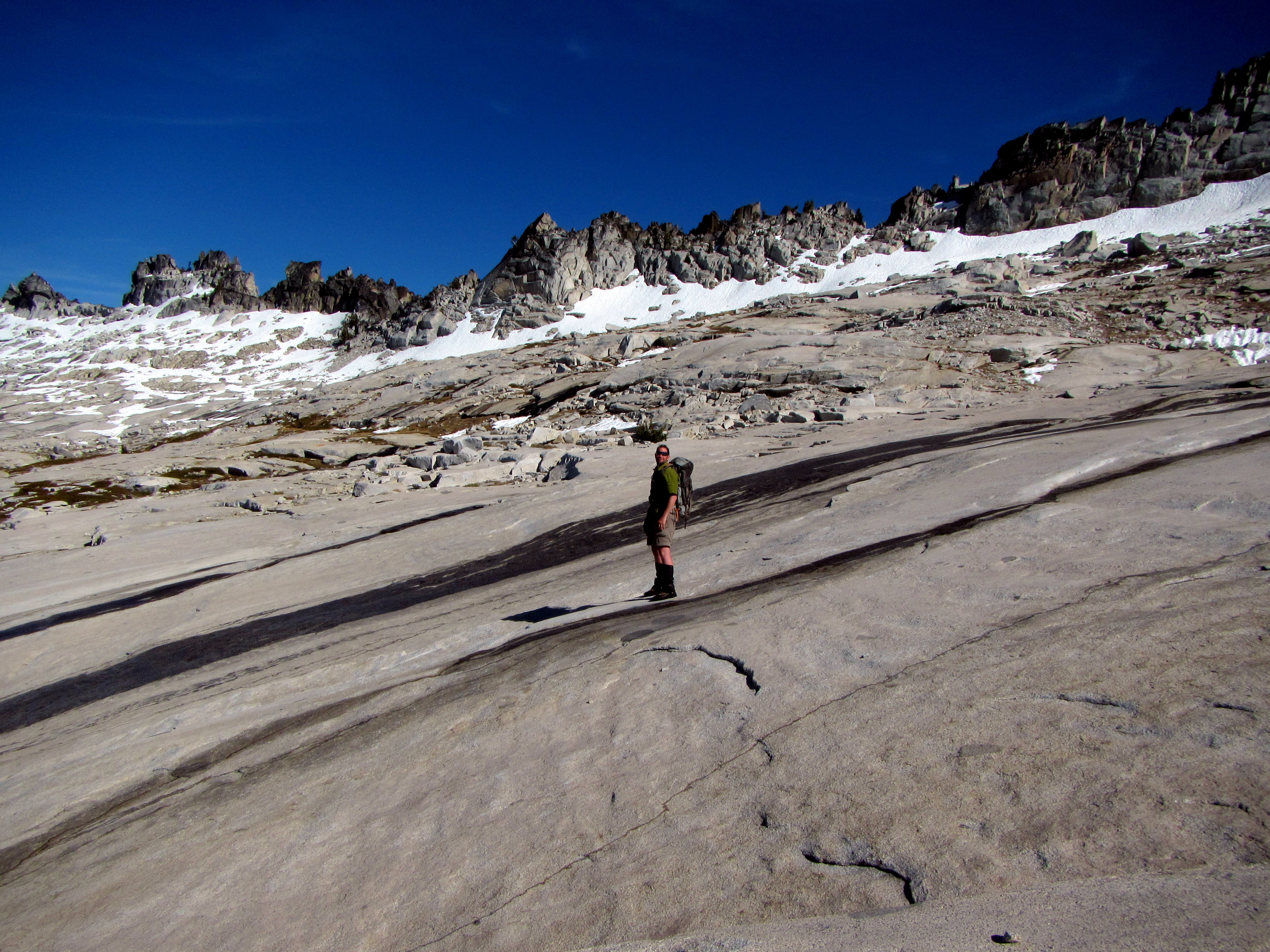
 Oh yeah! I love this kind of terrain!
We couldn't head straight for the summit, it was guarded by very steep cliffs.
We had to make for Grizzly pass and then hope for an easier route up the east face.
Oh yeah! I love this kind of terrain!
We couldn't head straight for the summit, it was guarded by very steep cliffs.
We had to make for Grizzly pass and then hope for an easier route up the east face.
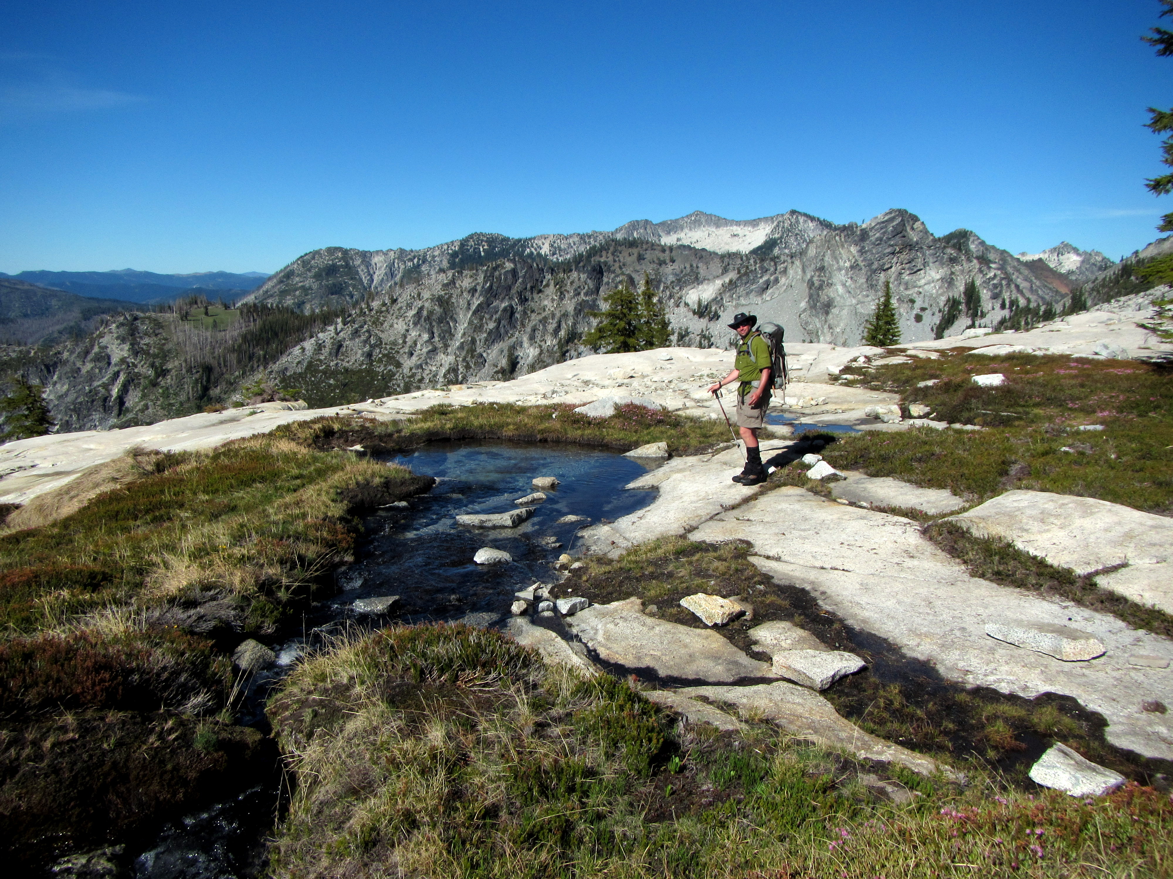
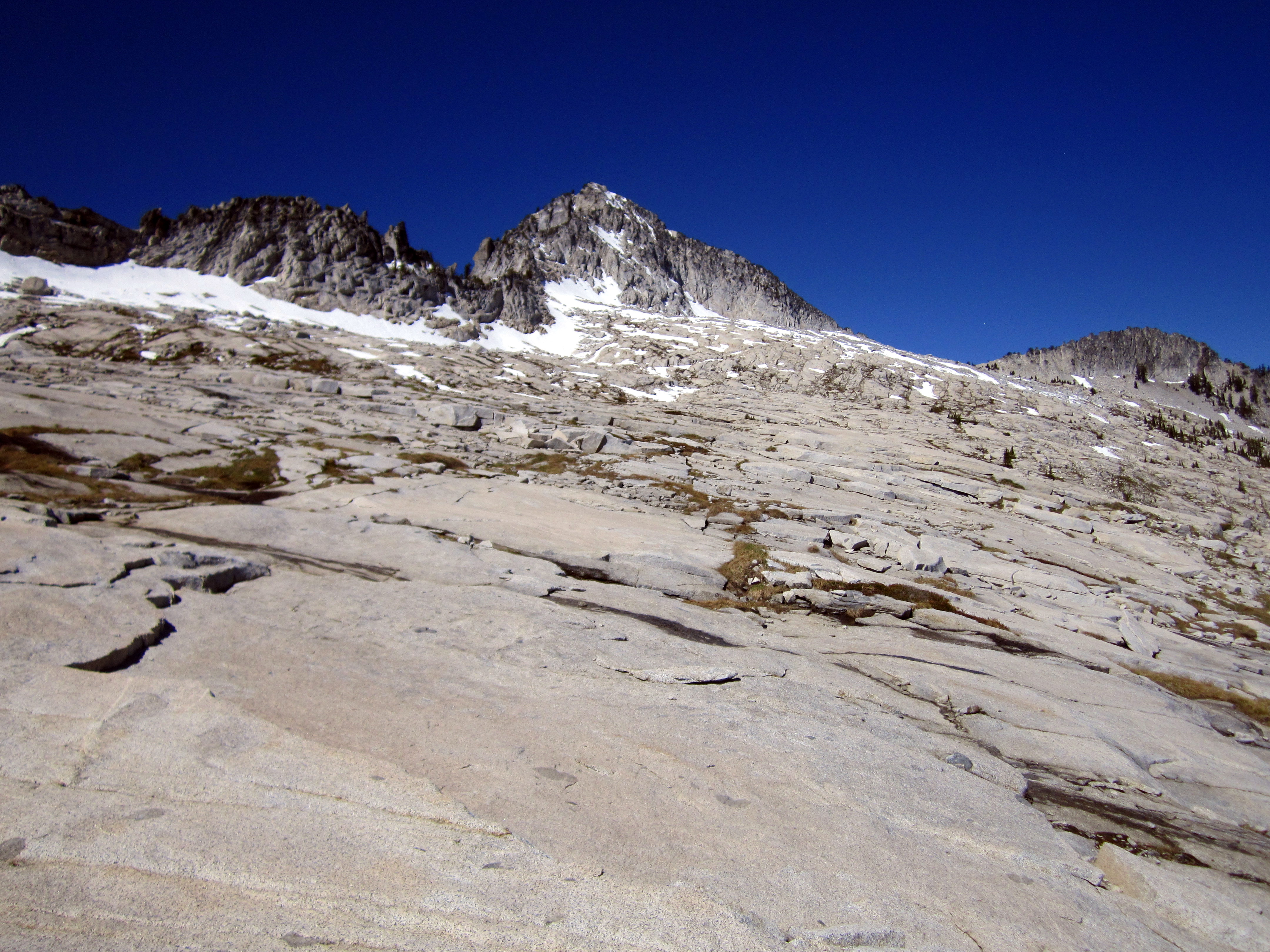
 Heading across the Upper Playground below Caesar Peak toward Grizzly Pass.
We finally hit some snow. I started feeling a zest with the cool crunchy stuff beneath my boots!
Apologies to my beloved ice axe, you missed this one! I'll make it up to you later this summer!
Grizzly Pass is the low point on the horizon. Grizzly Lake is on the other side.
Heading across the Upper Playground below Caesar Peak toward Grizzly Pass.
We finally hit some snow. I started feeling a zest with the cool crunchy stuff beneath my boots!
Apologies to my beloved ice axe, you missed this one! I'll make it up to you later this summer!
Grizzly Pass is the low point on the horizon. Grizzly Lake is on the other side.
 I reached Grizzly Pass (actually a little above it on the left).
I peered around the corner, looking up (to the left), seeking a route to the summit.
I reached Grizzly Pass (actually a little above it on the left).
I peered around the corner, looking up (to the left), seeking a route to the summit.
 A quick look back the way we came.
 Blair at Grizzly Pass, with Grizzly Lake behind and below him.
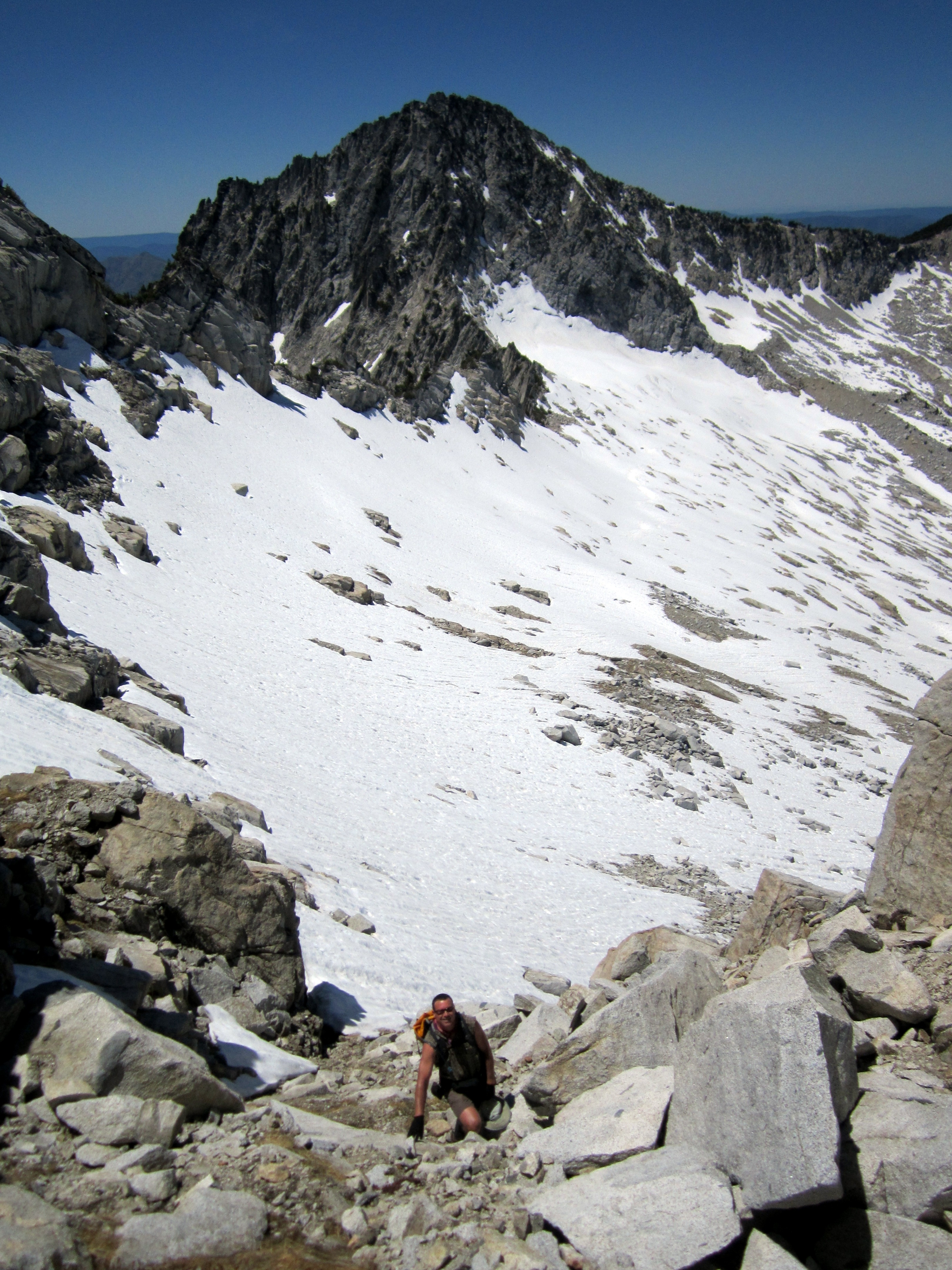
 The scramble to the summit was not quite as easy as we had hoped for.
The east face was also ringed by cliffs near the top, but we saw a few ramps that led up to the ridge, and from there, a path to the top.
We got into some steep snow, which was sketchy without the ice axes.
The scramble to the summit was not quite as easy as we had hoped for.
The east face was also ringed by cliffs near the top, but we saw a few ramps that led up to the ridge, and from there, a path to the top.
We got into some steep snow, which was sketchy without the ice axes.
 Above the snow, it was a fun scramble through the granite knobs, talus fields, and snow to the summit!
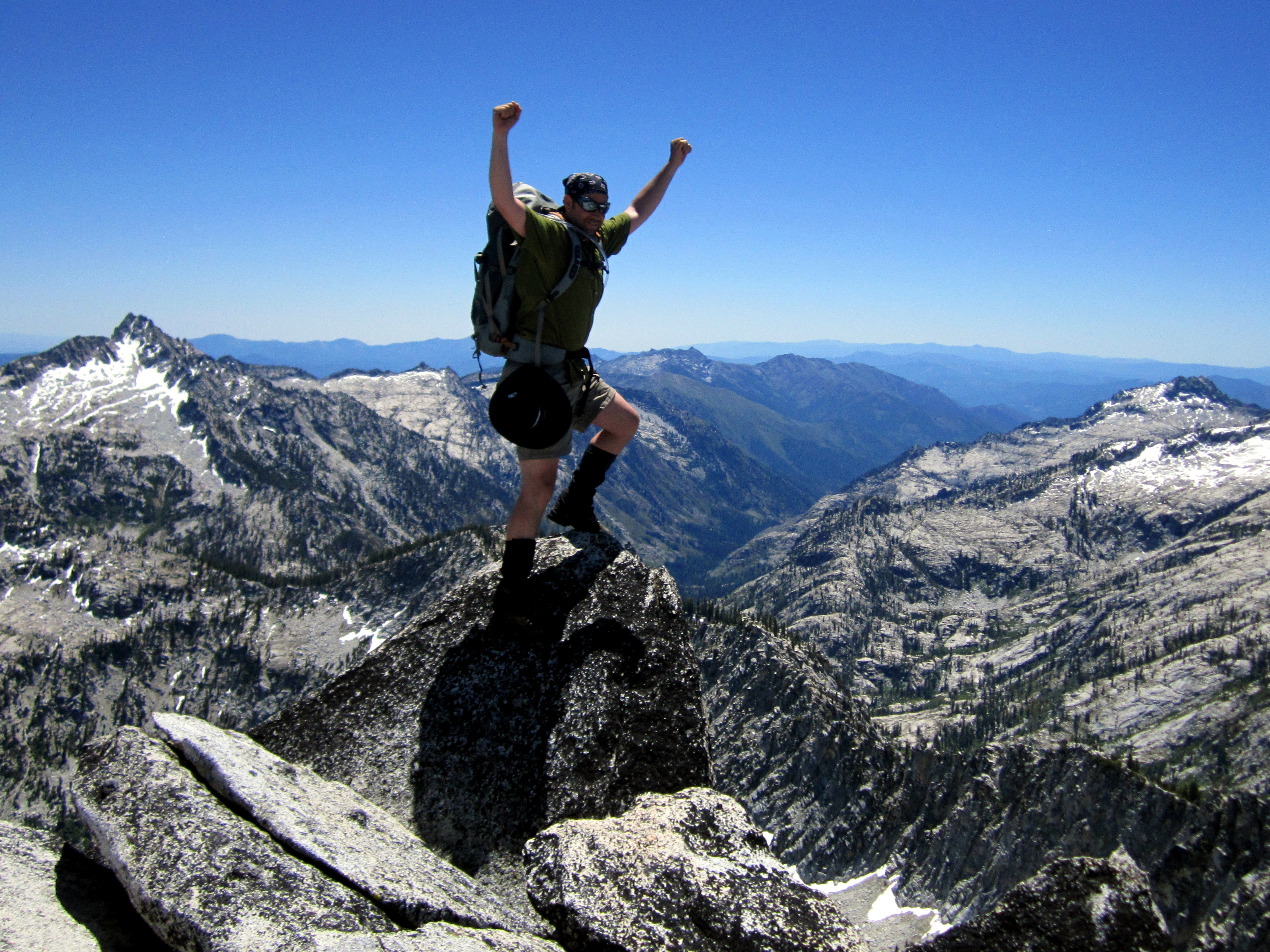 Rawwrrr!!!! Summit Glory!
 Blair and Gabe on the summit of Caesar Peak.
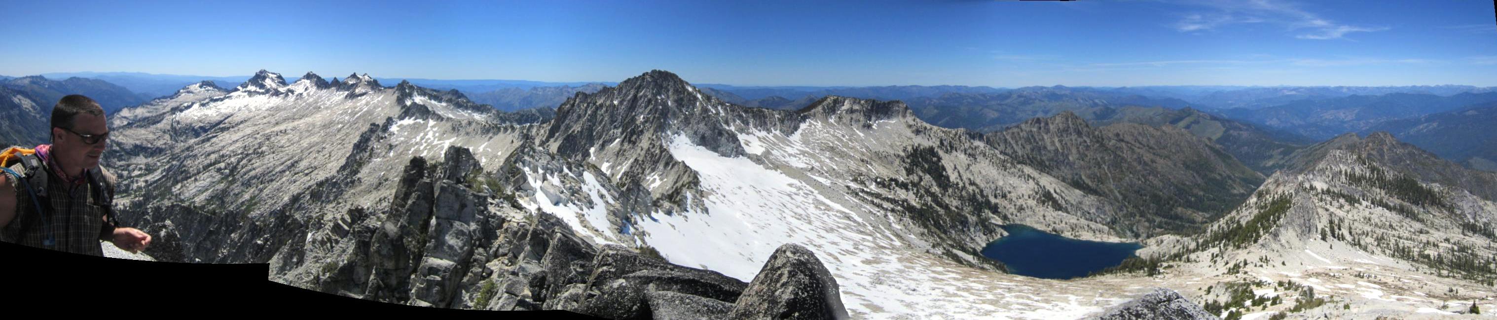
 A panorama from the summit. Blair is in the same place in both photos.
We could see as far north as Mt. McLoughlin in southern Oregon, and as far south as the Central Valley of California.
A panorama from the summit. Blair is in the same place in both photos.
We could see as far north as Mt. McLoughlin in southern Oregon, and as far south as the Central Valley of California.
 I'll take a quick aside here to officially document my declaration that the Thompson Glacier (above center) is DEAD!
From now on, it shall be referred to as the Thompson snowfield.
I'll take a quick aside here to officially document my declaration that the Thompson Glacier (above center) is DEAD!
From now on, it shall be referred to as the Thompson snowfield.
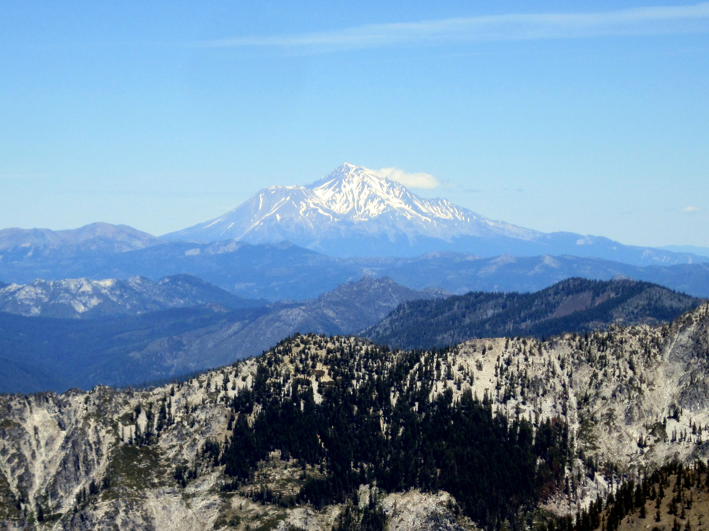 Mt. Shasta, one of the jewels of Cascadia.
Shasta is looking pretty brown and earthen these days. This drought is bad news.
Mt. Shasta, one of the jewels of Cascadia.
Shasta is looking pretty brown and earthen these days. This drought is bad news.
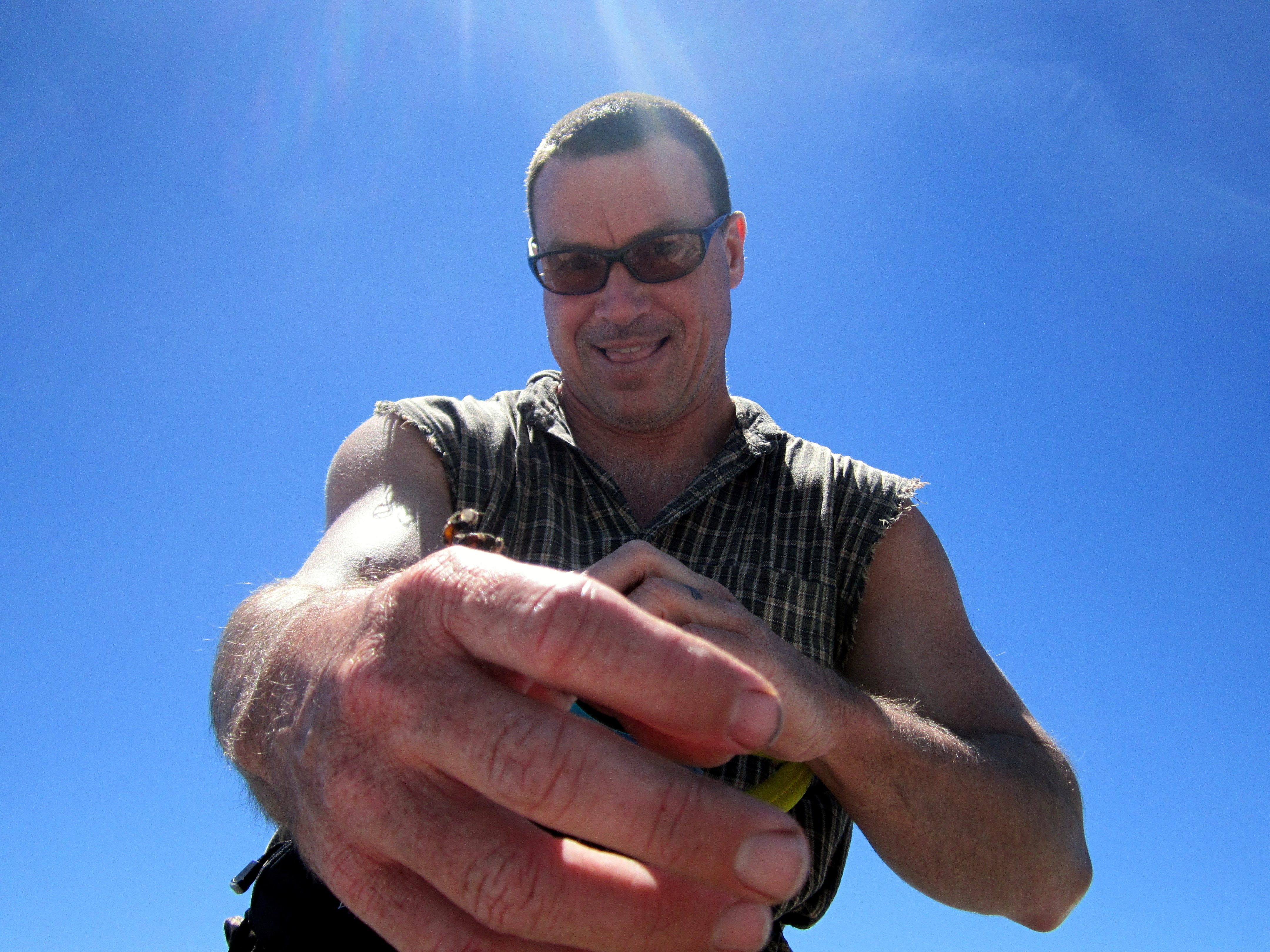 It was an insect orgy up there! Butterflies and bees were mating, on the rocks and in mid-air, all around the summit.
These two bees got it on right on Blair's hand!
It was an insect orgy up there! Butterflies and bees were mating, on the rocks and in mid-air, all around the summit.
These two bees got it on right on Blair's hand!
 We spent a lot of time up on the summit of Caesar Peak that day, at least an hour.
 The wind was very calm and the sun was out. The views were amazing and we didn't want to leave.
Video loading... Please be patient
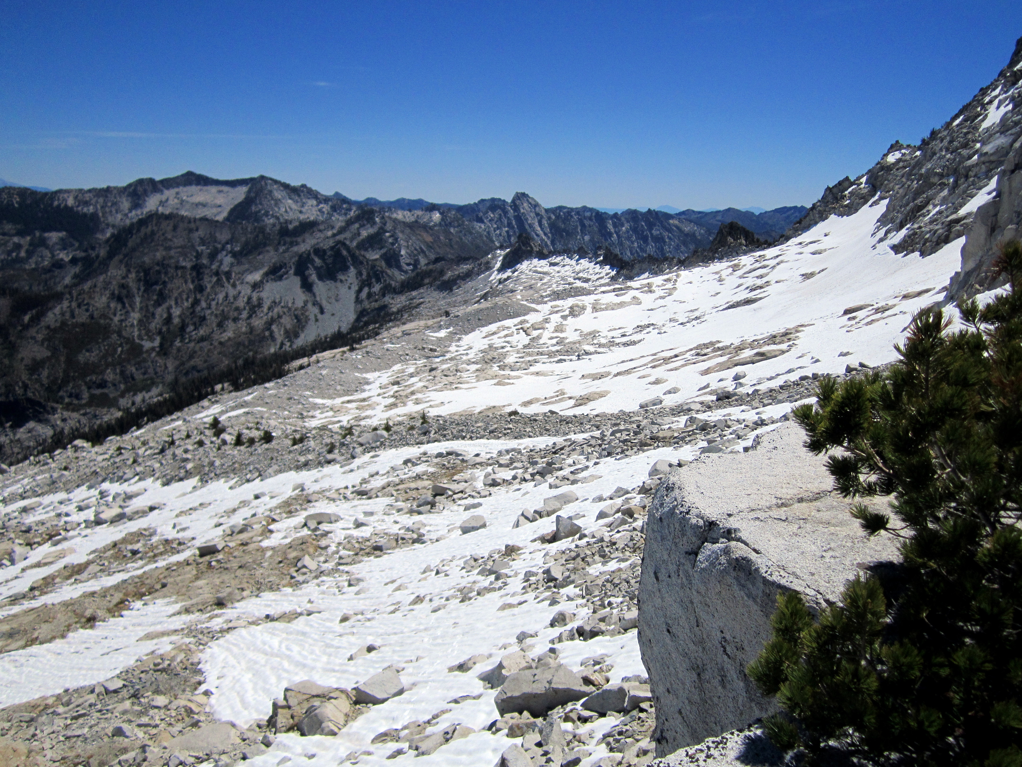
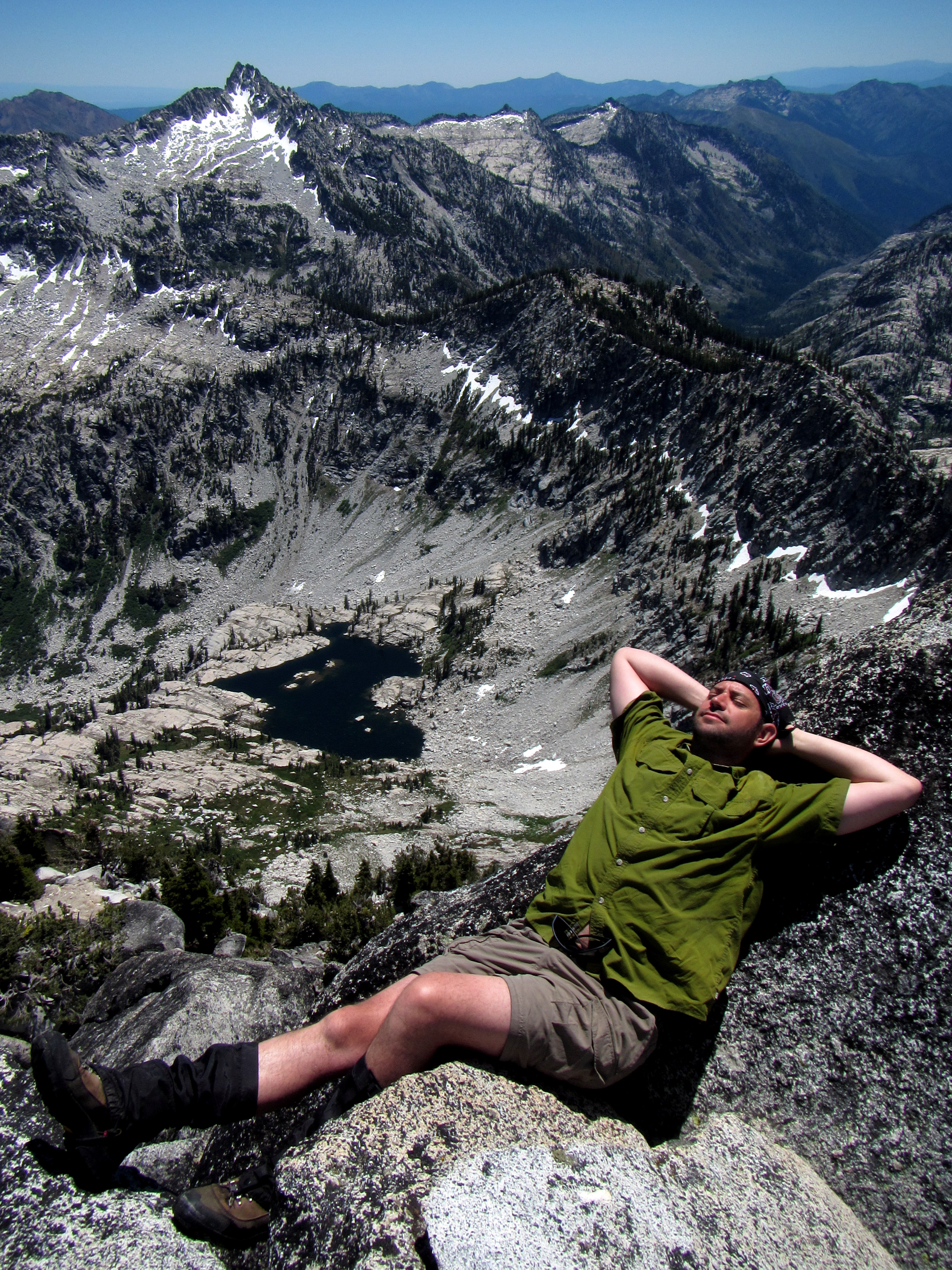
 The way back to camp was a pleasure.
We strolled through granite and snow, amazed at the scenery around us.
The way back to camp was a pleasure.
We strolled through granite and snow, amazed at the scenery around us.
 Gradually, we made our way back down to the sub-alpine, checking out potential campsites along the way (for next time).
 These look pretty awesome.
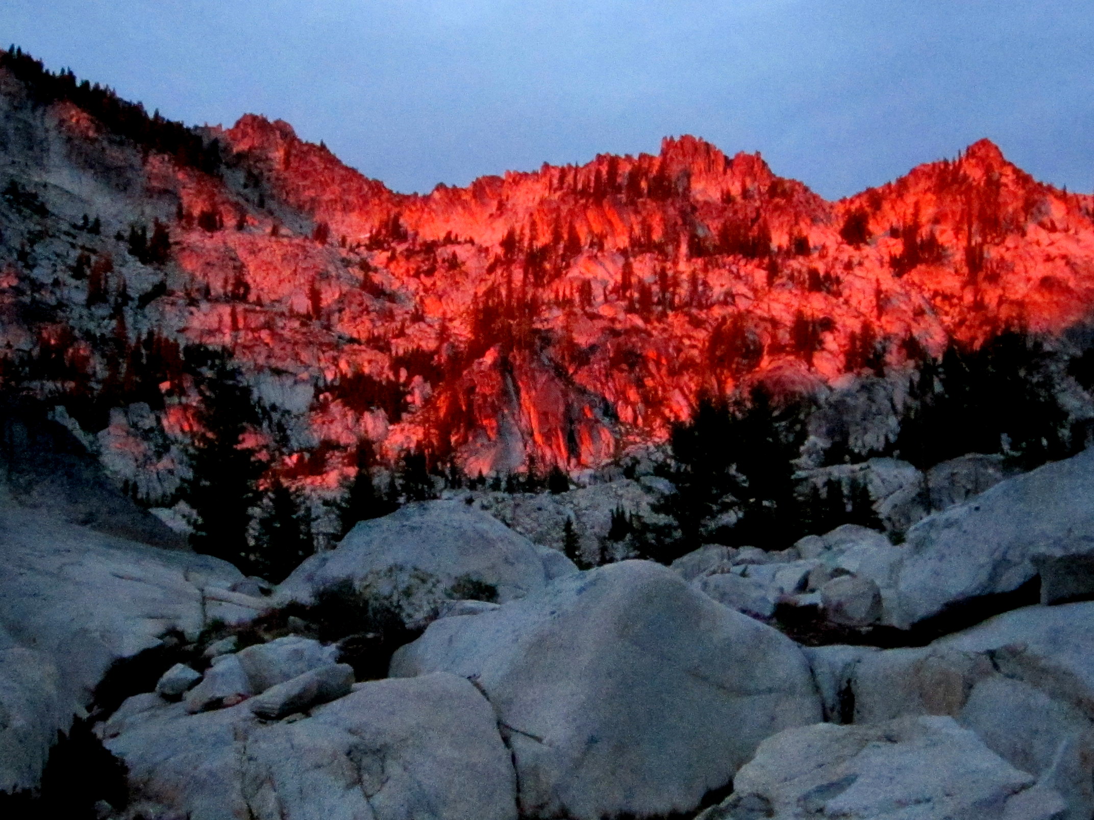
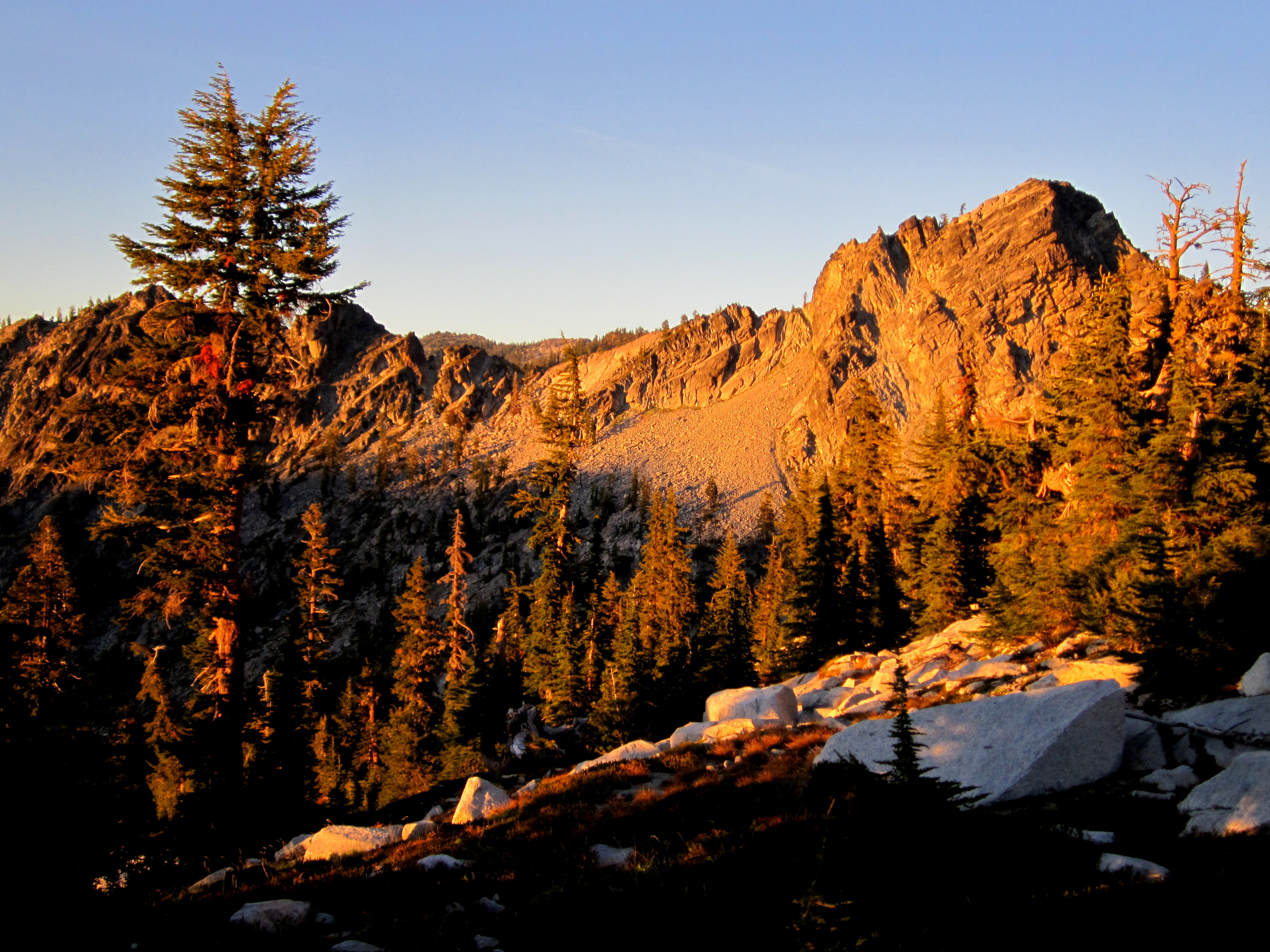 Back at camp, we ate some dinner and watched the alpenglow creep across the granite crags.
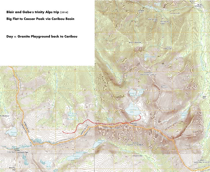
Day 4: Granite Playground to Caribou Basin
 We set off the next morning, back down to the tarn.
Here's a photo of me looking back toward Caesar peak on the way down to the tarn.
We set off the next morning, back down to the tarn.
Here's a photo of me looking back toward Caesar peak on the way down to the tarn.
 We had to get a little psyched up for the scramble back up to the Notch.
 Blair back up at the Notch on the return trip.
I have to give Blair some kudos for finding this route. It's not at all obvious that you can pass through it until you get close.
Blair back up at the Notch on the return trip.
I have to give Blair some kudos for finding this route. It's not at all obvious that you can pass through it until you get close.
Video loading... Please be patient
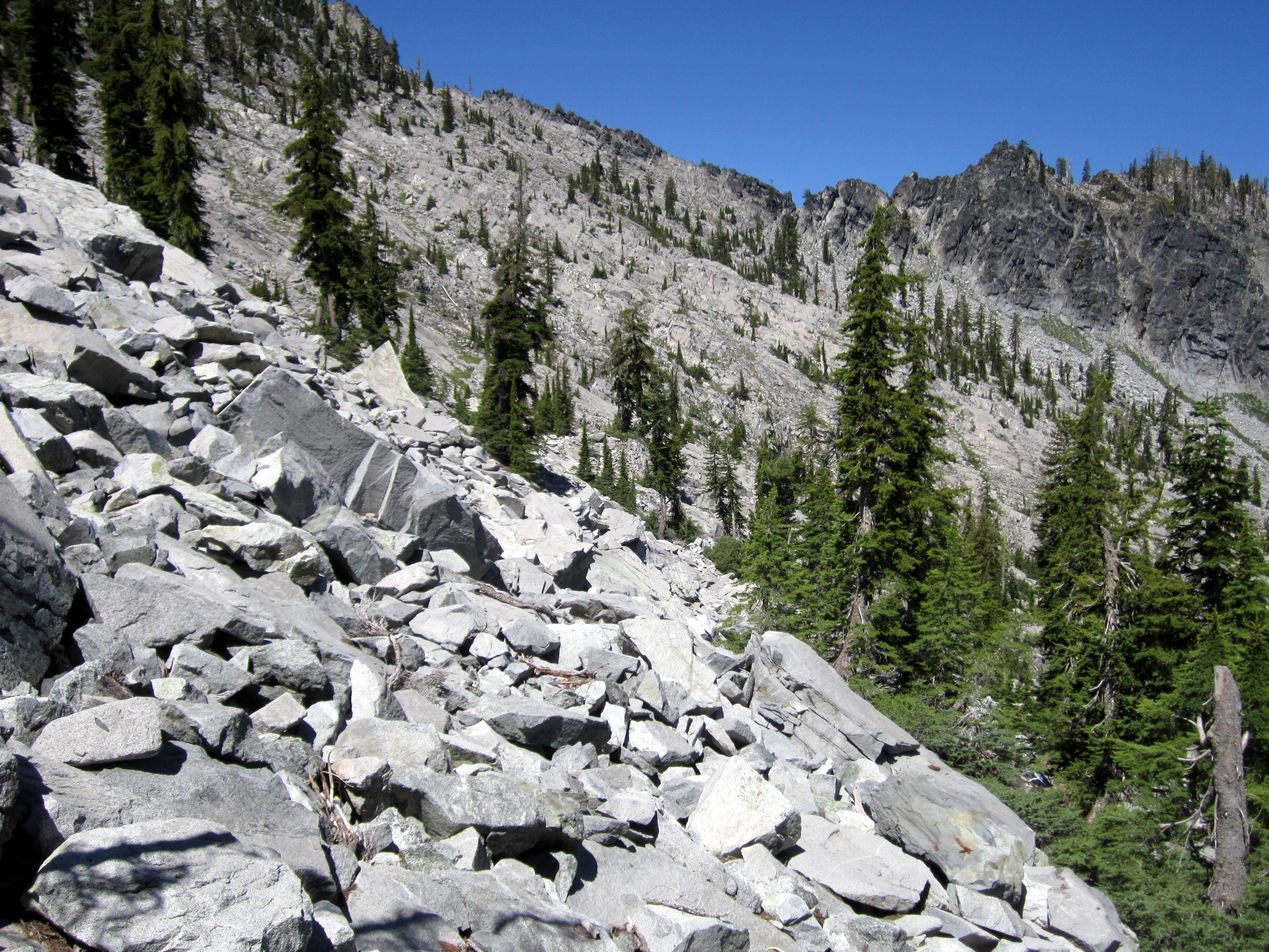 Looking back toward the Notch from our route back along the headwall.
Once again, we stayed high to avoid regaining elevation while traversing across the rough talus.
Looking back toward the Notch from our route back along the headwall.
Once again, we stayed high to avoid regaining elevation while traversing across the rough talus.
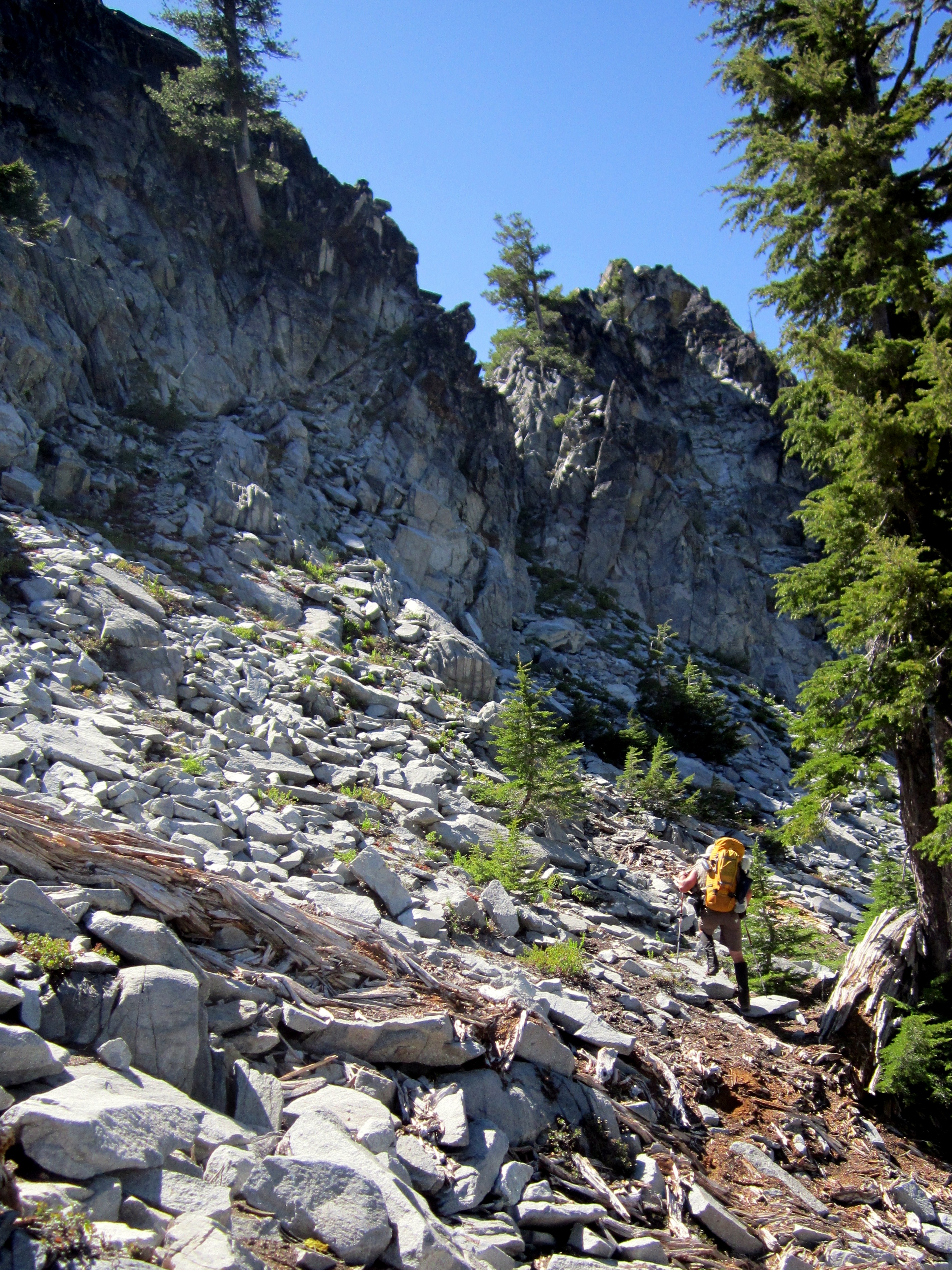
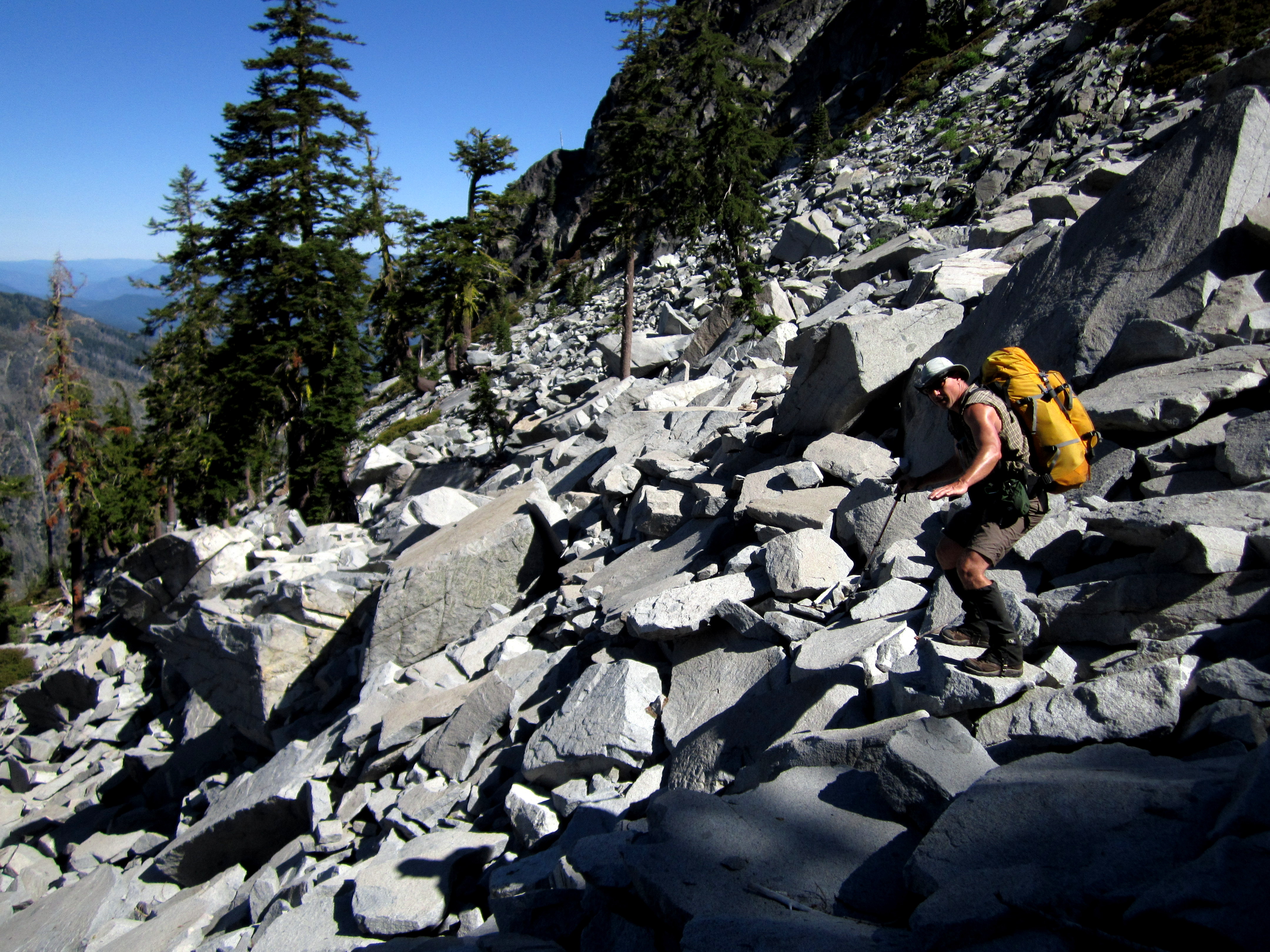 Blair negotiating the talus.
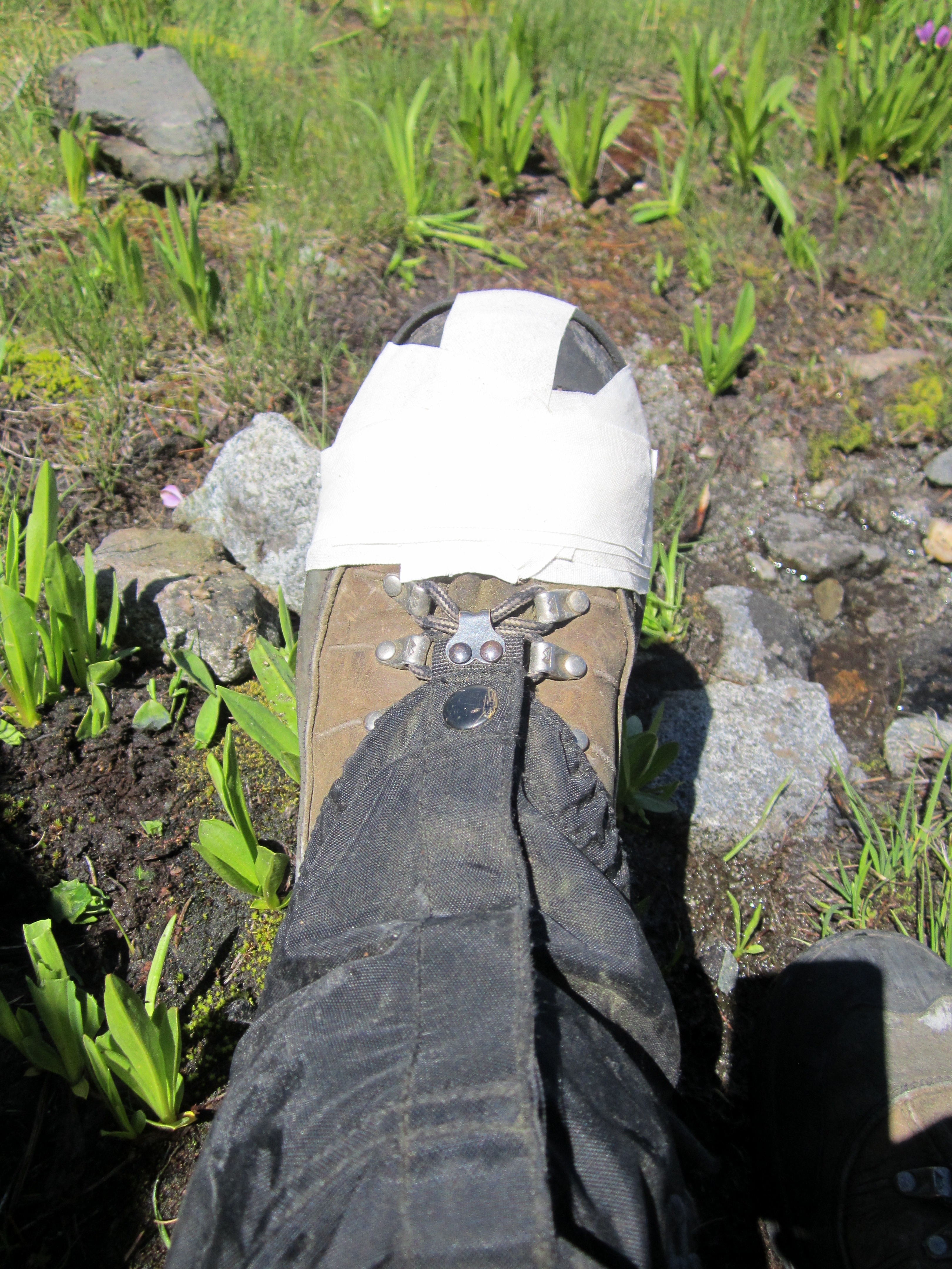 It was at this time that my left boot blew out. Damn!
I had been watching the gap between the sole and the rand grow for the last couple of days.
When it blew out, I had to tape it up with medical tape.
I was pretty worried about it falling apart on me in the middle of nowhere. I really needed them!
My repair job actually held up pretty well.
It was at this time that my left boot blew out. Damn!
I had been watching the gap between the sole and the rand grow for the last couple of days.
When it blew out, I had to tape it up with medical tape.
I was pretty worried about it falling apart on me in the middle of nowhere. I really needed them!
My repair job actually held up pretty well.
 We ran out of water during this portion of the trek. We really really didn't want to drop all the way down to the lake for water.
After searching around for about 30 minutes, we found a trickle running over a granite slab.
We spent about an hour collecting about three liters of water from the trickle. Good enough. Onward!
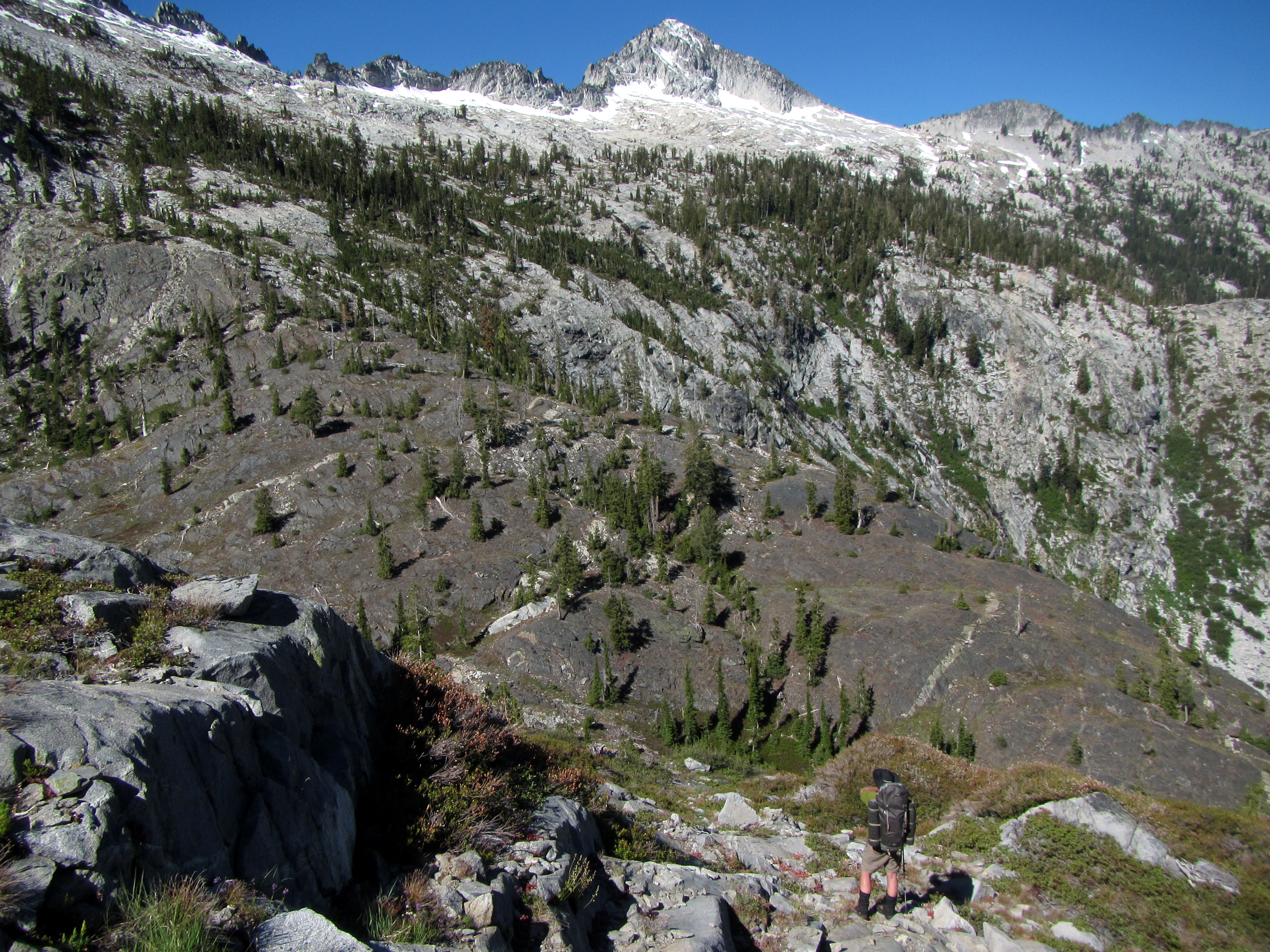
(Above) The long traverse is almost complete. I'm trudging up to that minor peak above Caribou here.
That's Caesar Peak in the background.
We ran out of water during this portion of the trek. We really really didn't want to drop all the way down to the lake for water.
After searching around for about 30 minutes, we found a trickle running over a granite slab.
We spent about an hour collecting about three liters of water from the trickle. Good enough. Onward!
(Above) The long traverse is almost complete. I'm trudging up to that minor peak above Caribou here.
That's Caesar Peak in the background.
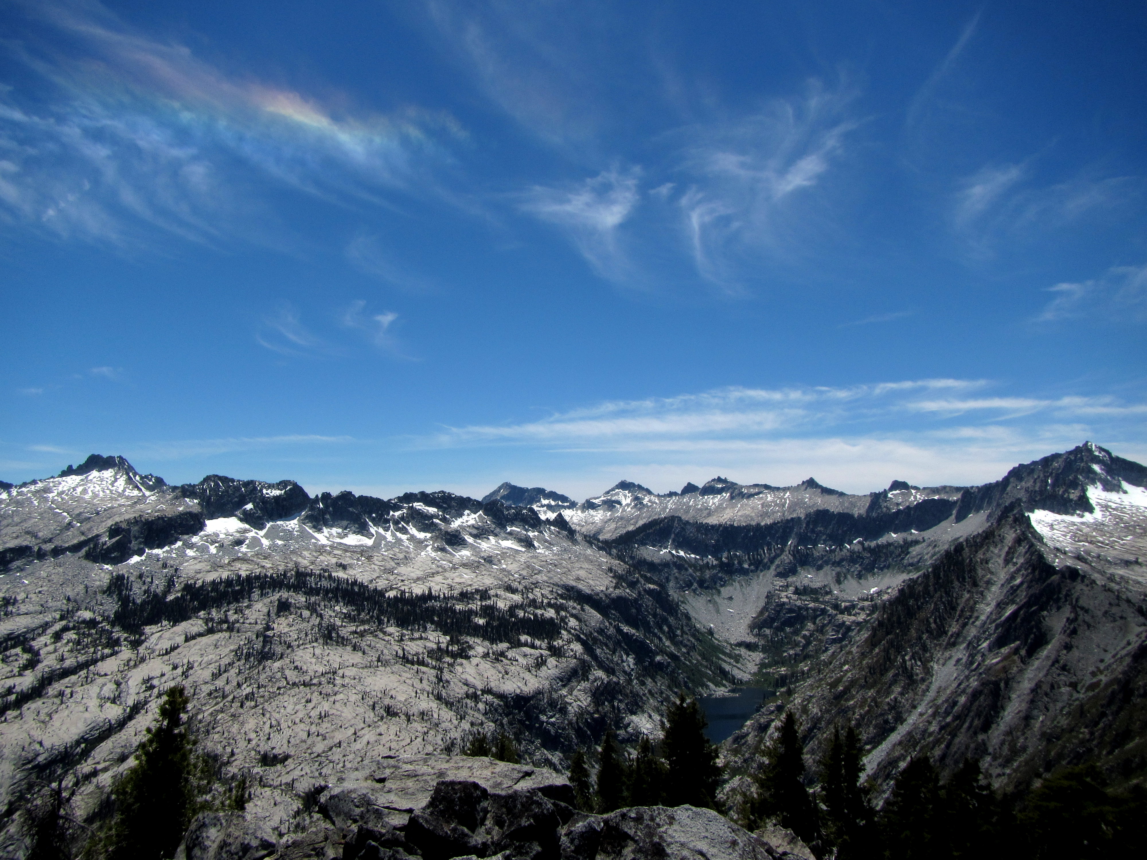 We saw a nice circumhorizontal arc from the minor peak.
 Heading back down the ridge to Upper Caribou, we stopped for this shot showing Caesar Peak behind us (far right). Whew!
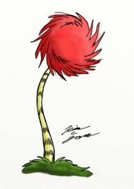
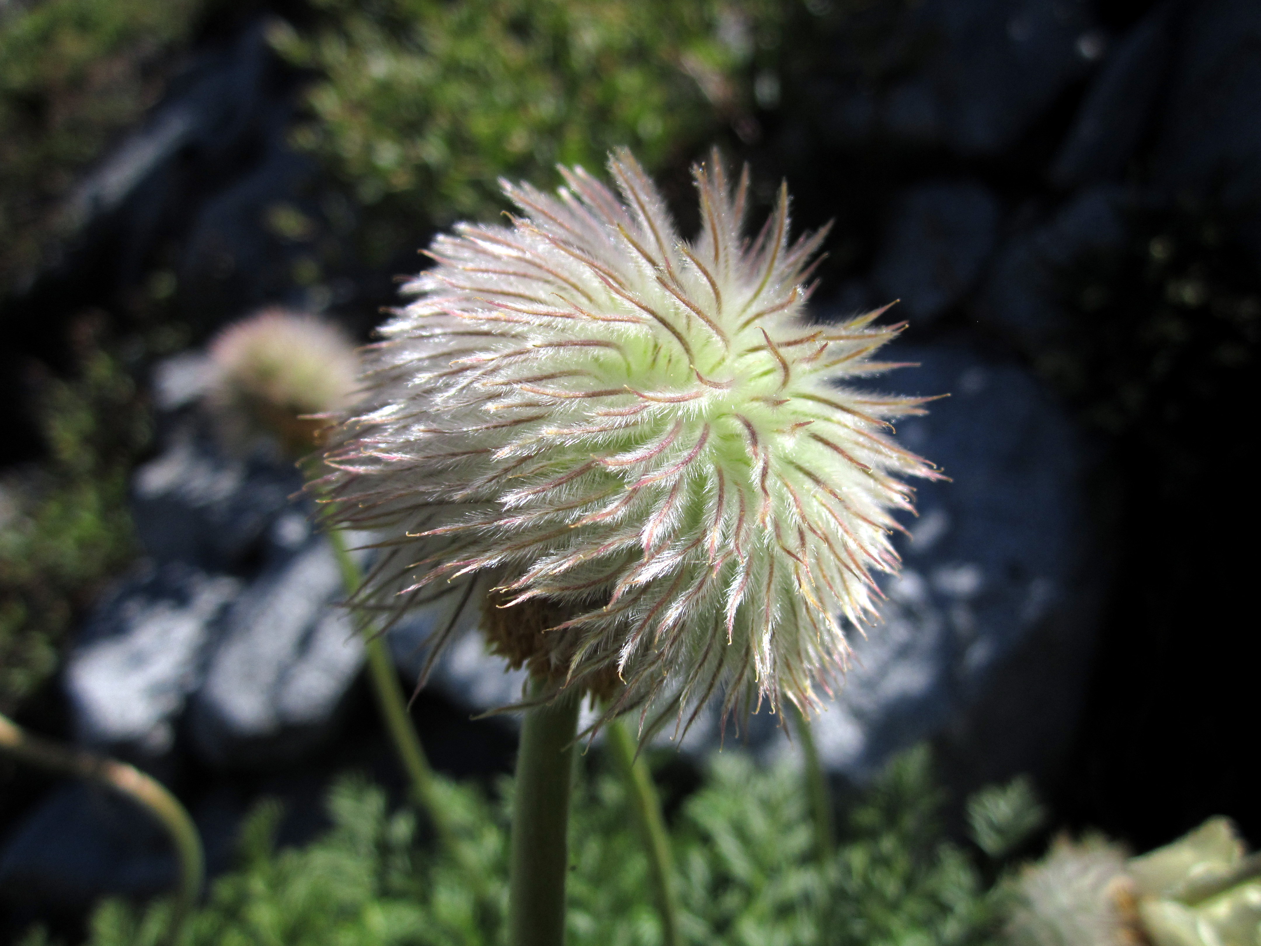 Blair pointed out these flowers to me on the way back.
I forgot what they are called (Blair knows), but they look like the Trufulla trees from Dr. Suess' Lorax.
Blair pointed out these flowers to me on the way back.
I forgot what they are called (Blair knows), but they look like the Trufulla trees from Dr. Suess' Lorax.
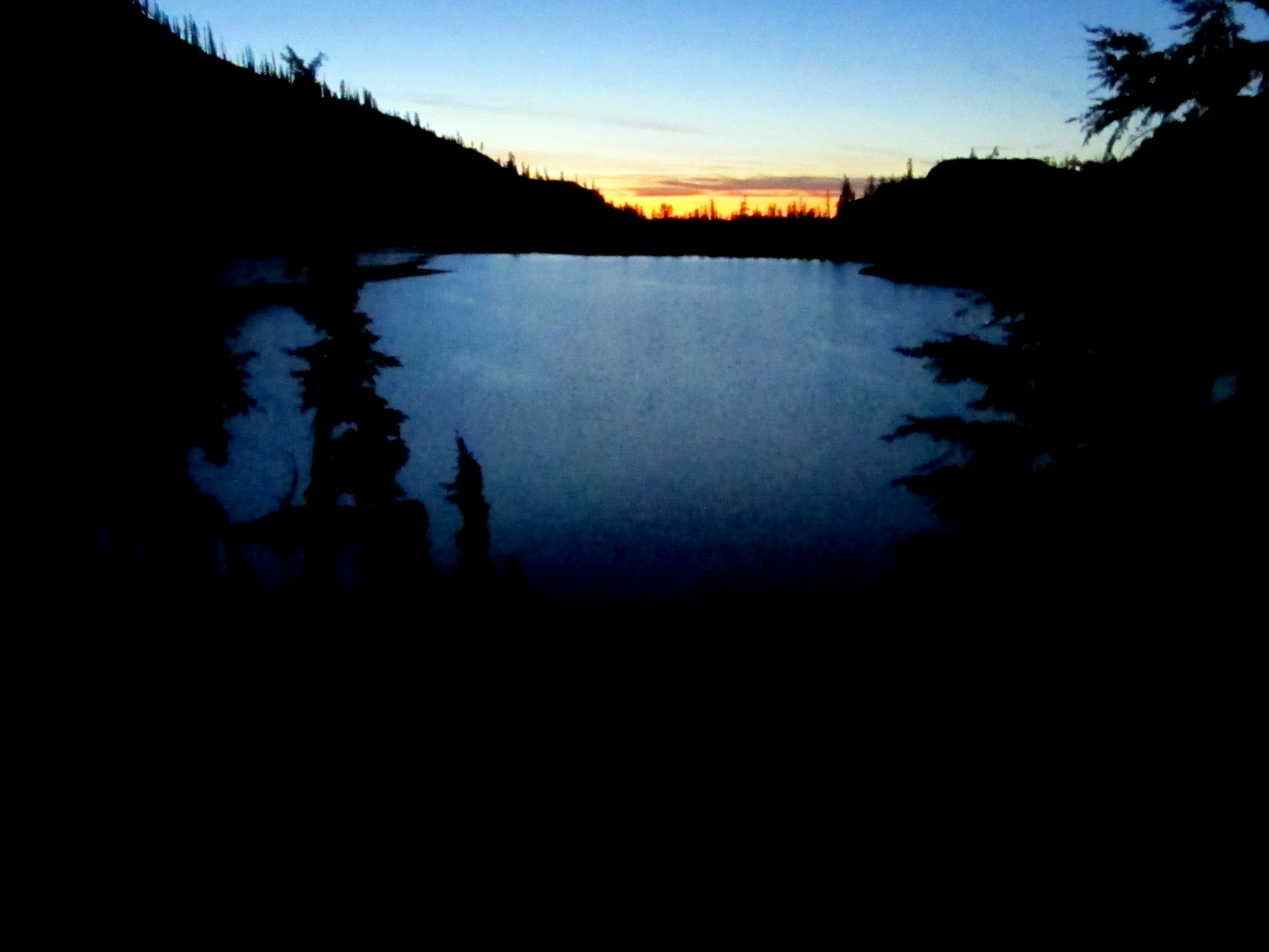
 Back at Caribou Lake, we were treated to some alpenglow.
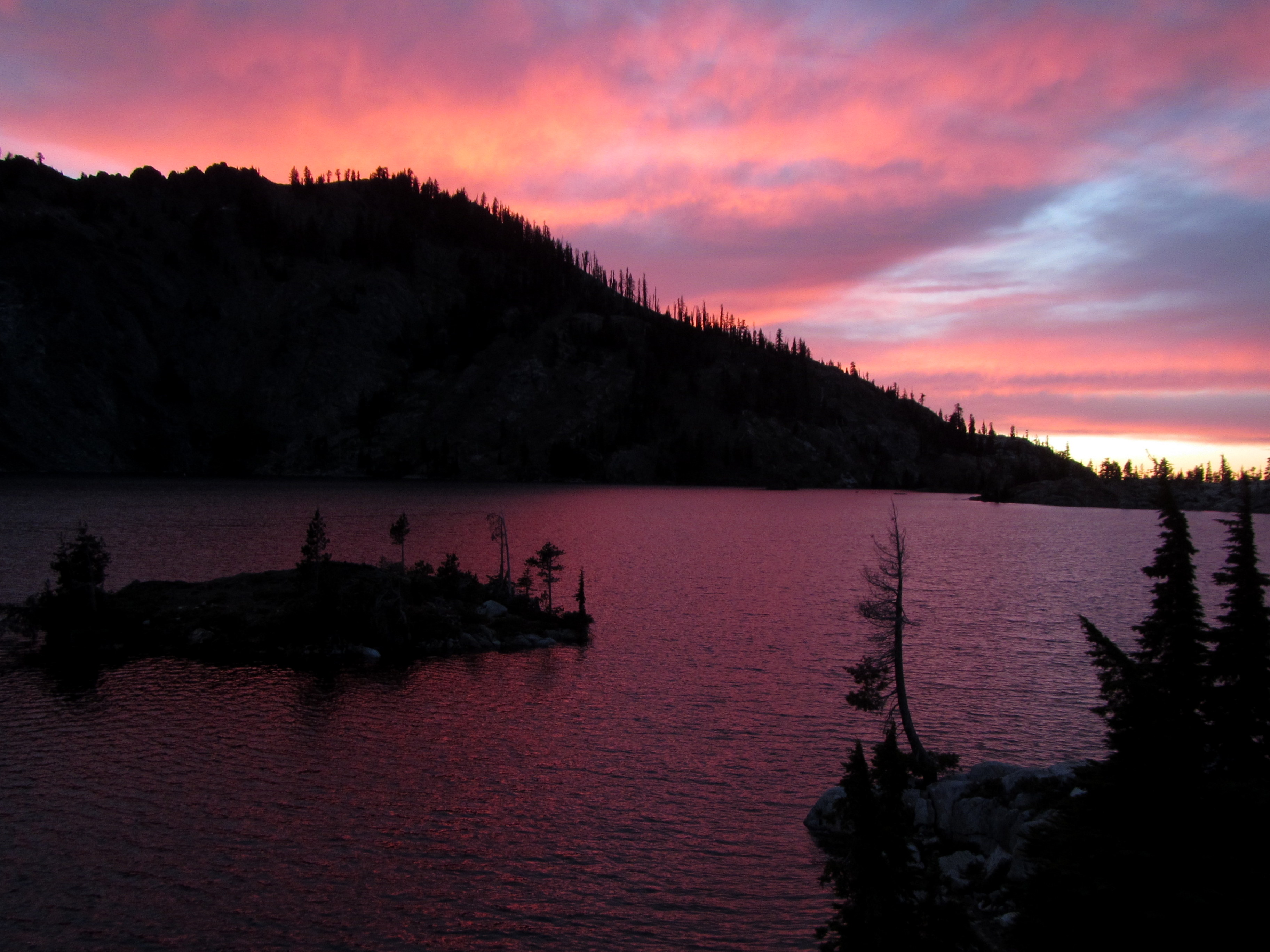 ..and an incredible sunset. Time to call it a day.
Day 5: Chill Day
 This is going to be a tradition with my hikes with Blair. The post-summit, pre-return, chill day.
 Here I am, fishing Upper Caribou Lake in my North Cascadian booties.
I gotta get my California wilderness fashion (see Blair's) dialed in before I come back here.
The fishing gear weighs about a pound, so we figured we better catch a pound of fish.
Here I am, fishing Upper Caribou Lake in my North Cascadian booties.
I gotta get my California wilderness fashion (see Blair's) dialed in before I come back here.
The fishing gear weighs about a pound, so we figured we better catch a pound of fish.
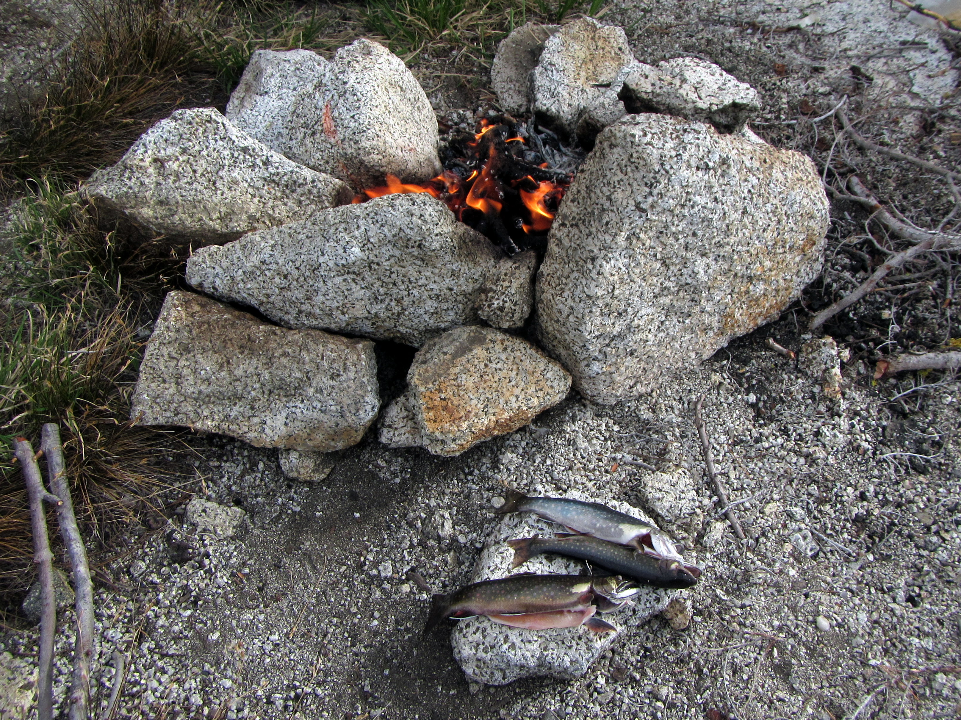
 We caught five trout in Upper Caribou Lake, well worth the permit I picked up in Yreka.
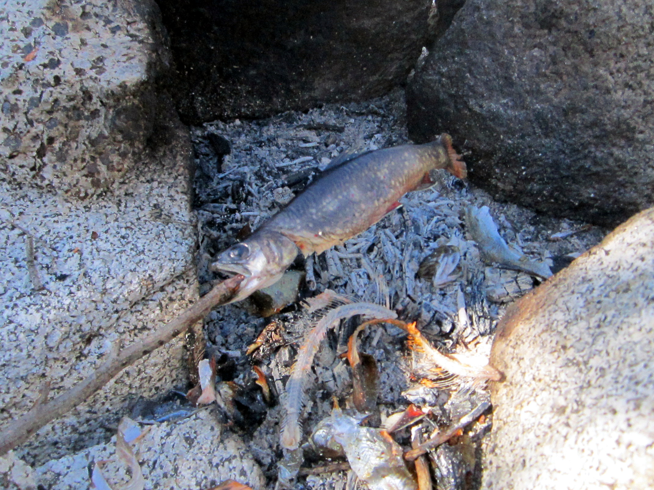
Blair showed me his technique for cleaning the fish and cooking them on a stick over a campfire.
We caught five trout in Upper Caribou Lake, well worth the permit I picked up in Yreka.
Blair showed me his technique for cleaning the fish and cooking them on a stick over a campfire.
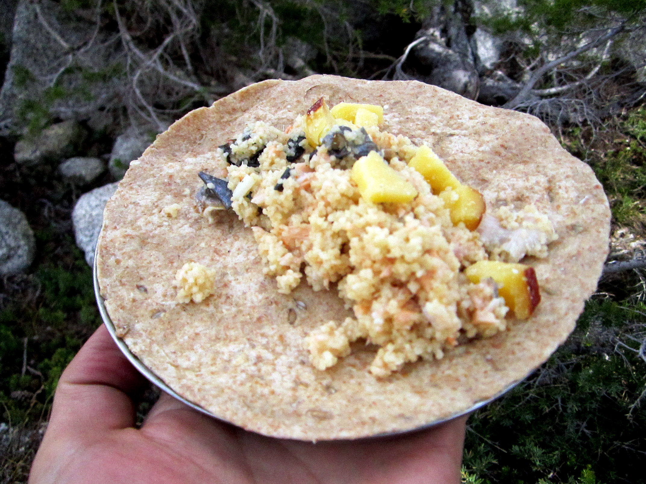 Trout burritos (with cous-cous and cheese) for dinner!
 The end of yet another great day in the Trinity Alps.
Day 6: Caribou Basin to Big Flat (and then the long drive home)
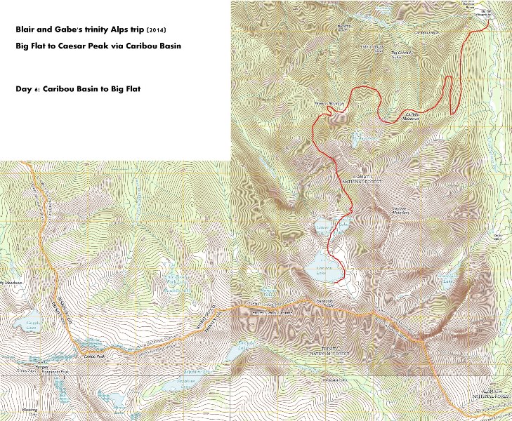
 We took an alternate trail (earlier dubbed the 'no-fun trail') out from Caribou Basin, because it was a little easier.
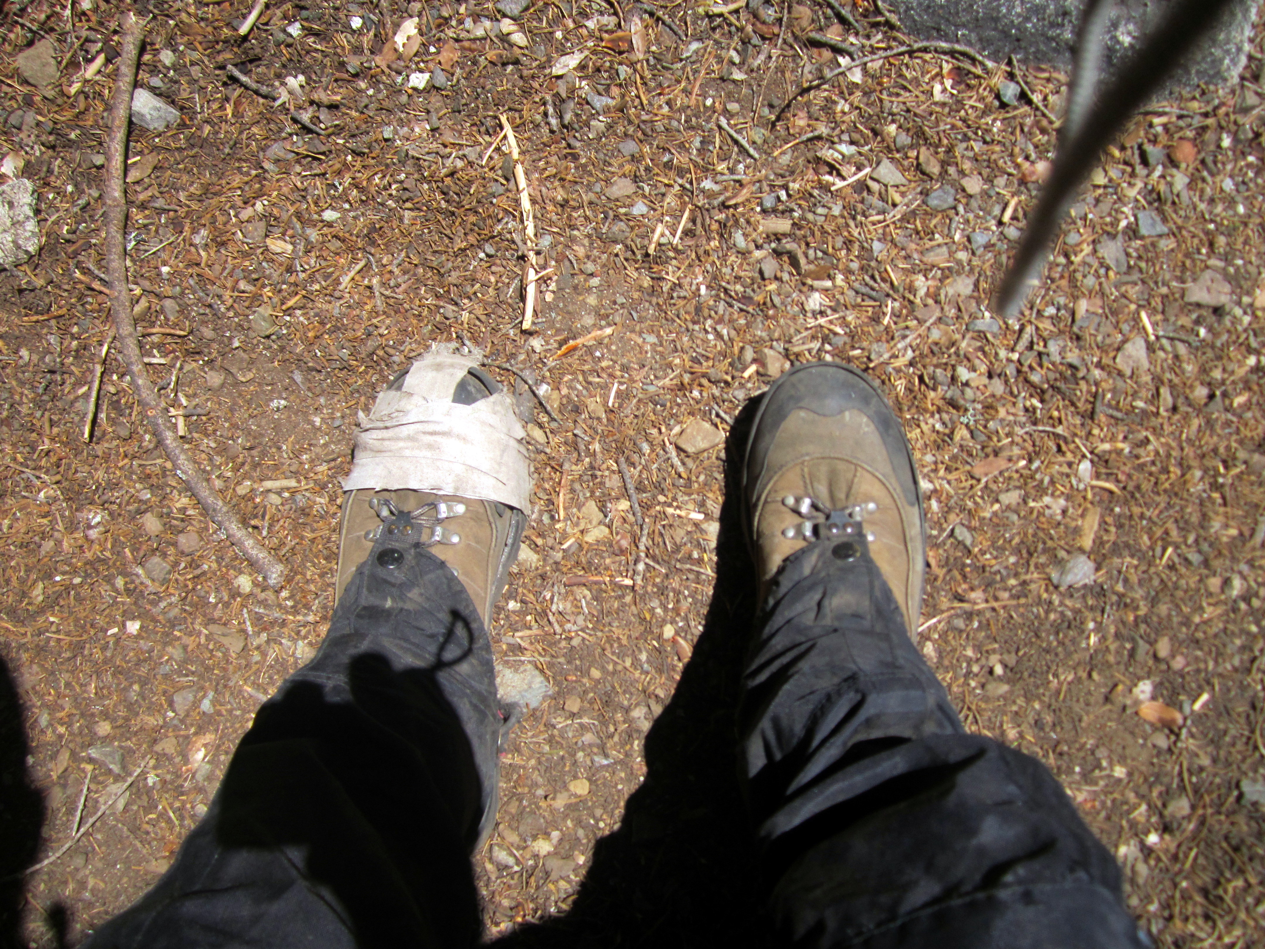 My left boot required a little more repair. The right one started to go as well...
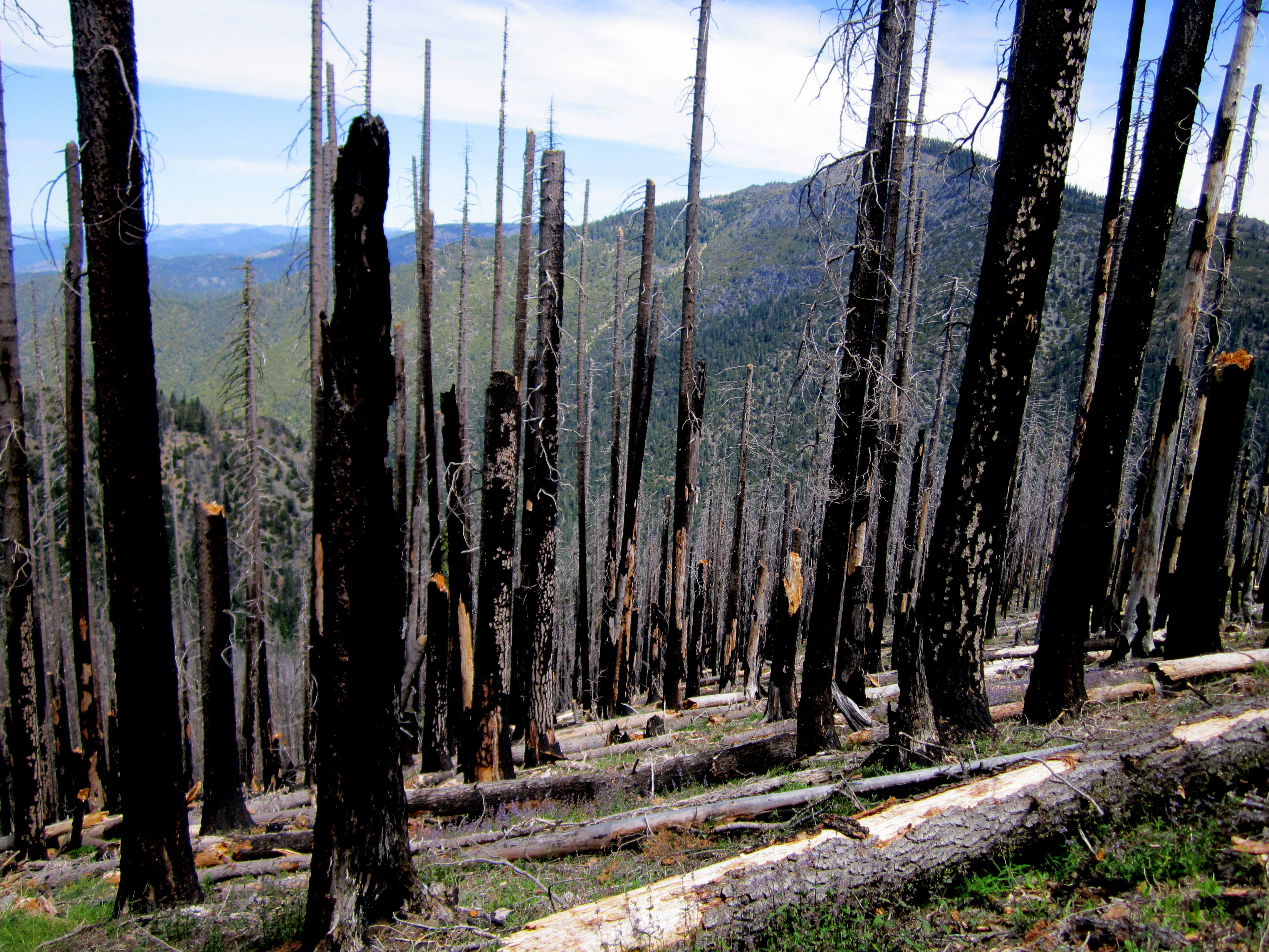 Lots of this in California these days. Devastation!
This picture reminds me of one of the untold tales of this adventure, which occurred up in the Granite Playground...
It's probably best left untold.
Lots of this in California these days. Devastation!
This picture reminds me of one of the untold tales of this adventure, which occurred up in the Granite Playground...
It's probably best left untold.
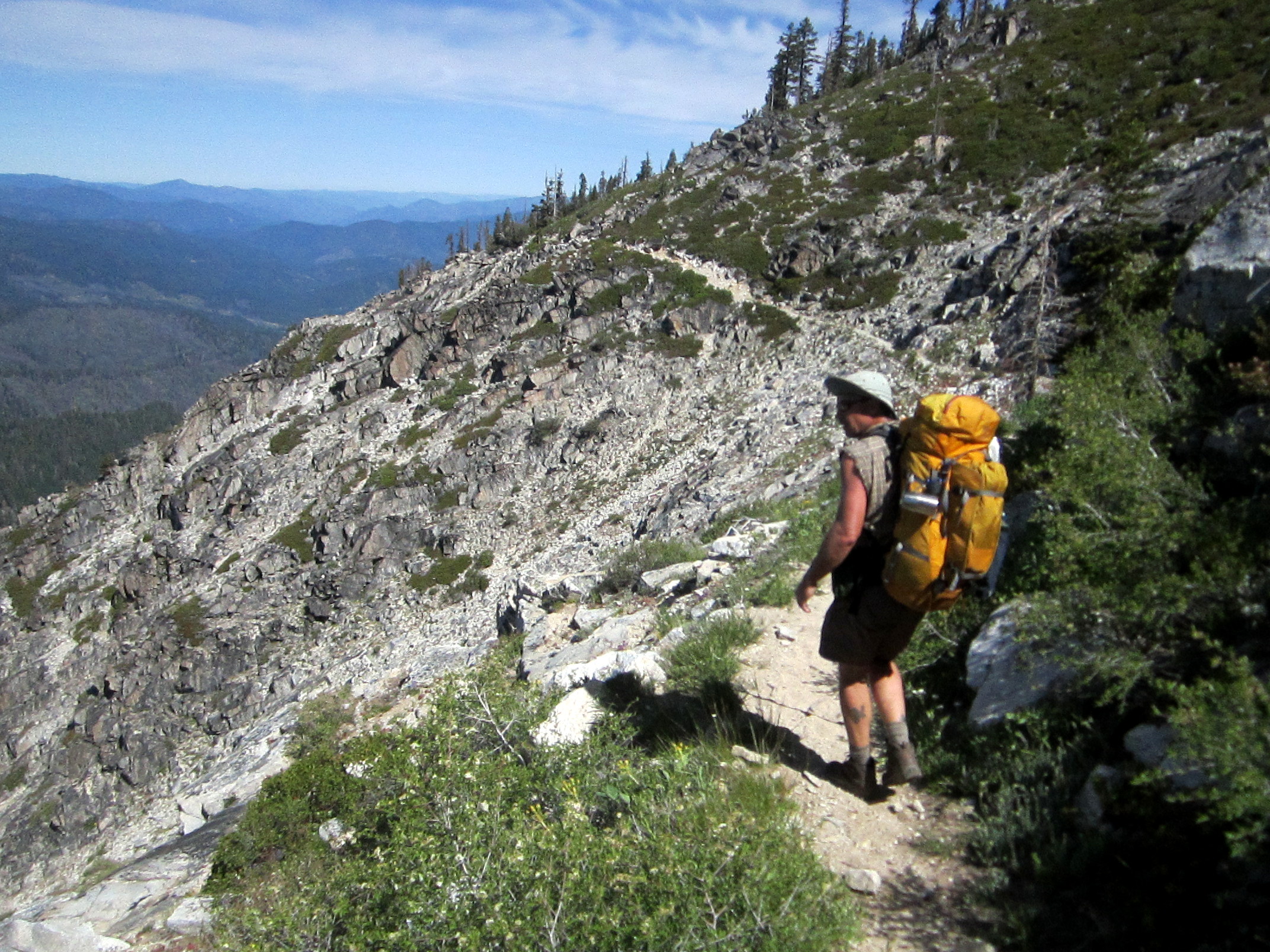
 The 'no-fun trail' turned out to be a really cool trail, with a final view of Caesar Peak on the way!
Well, we made it. Nine miles later, back at Big Flat, a few hundred feet from our vehicles, we recovered our beers from the hidden cache in the river. Ahhhhhhh.......
Video loading... Please be patient