Mt. Stone August 25, 2013
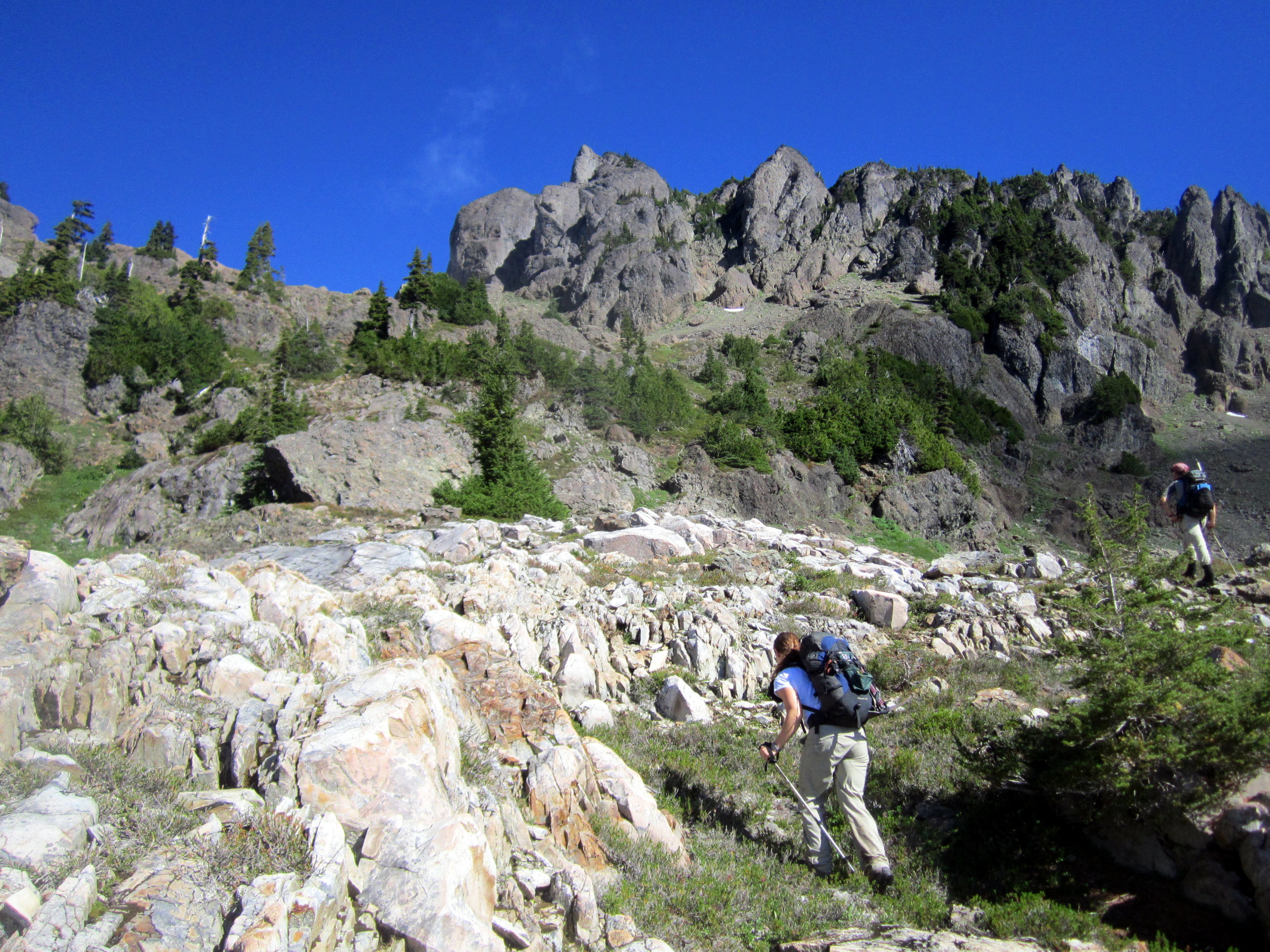
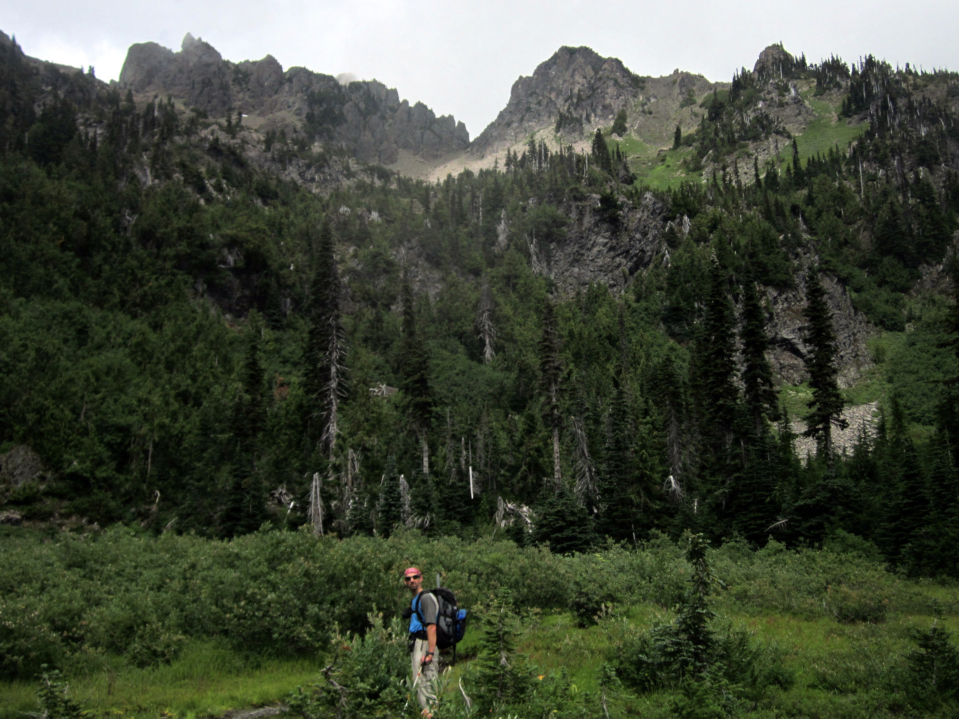
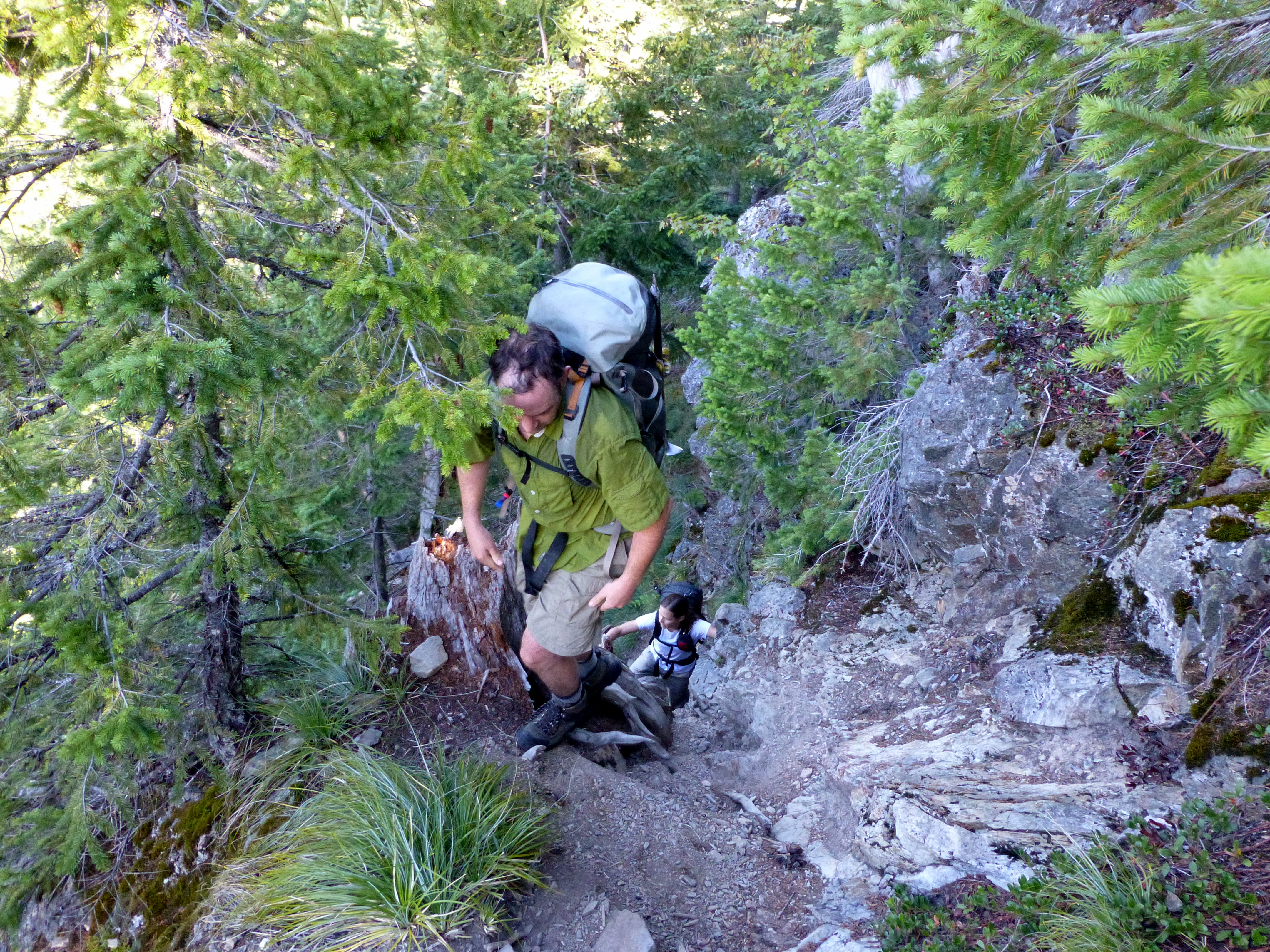 Mark turned around and took this photo (above) of Alice and me "hiking" up the "trail".
I've been on quite a few really steep trails, and this one ranks up there with the best of 'em.
Mark turned around and took this photo (above) of Alice and me "hiking" up the "trail".
I've been on quite a few really steep trails, and this one ranks up there with the best of 'em.
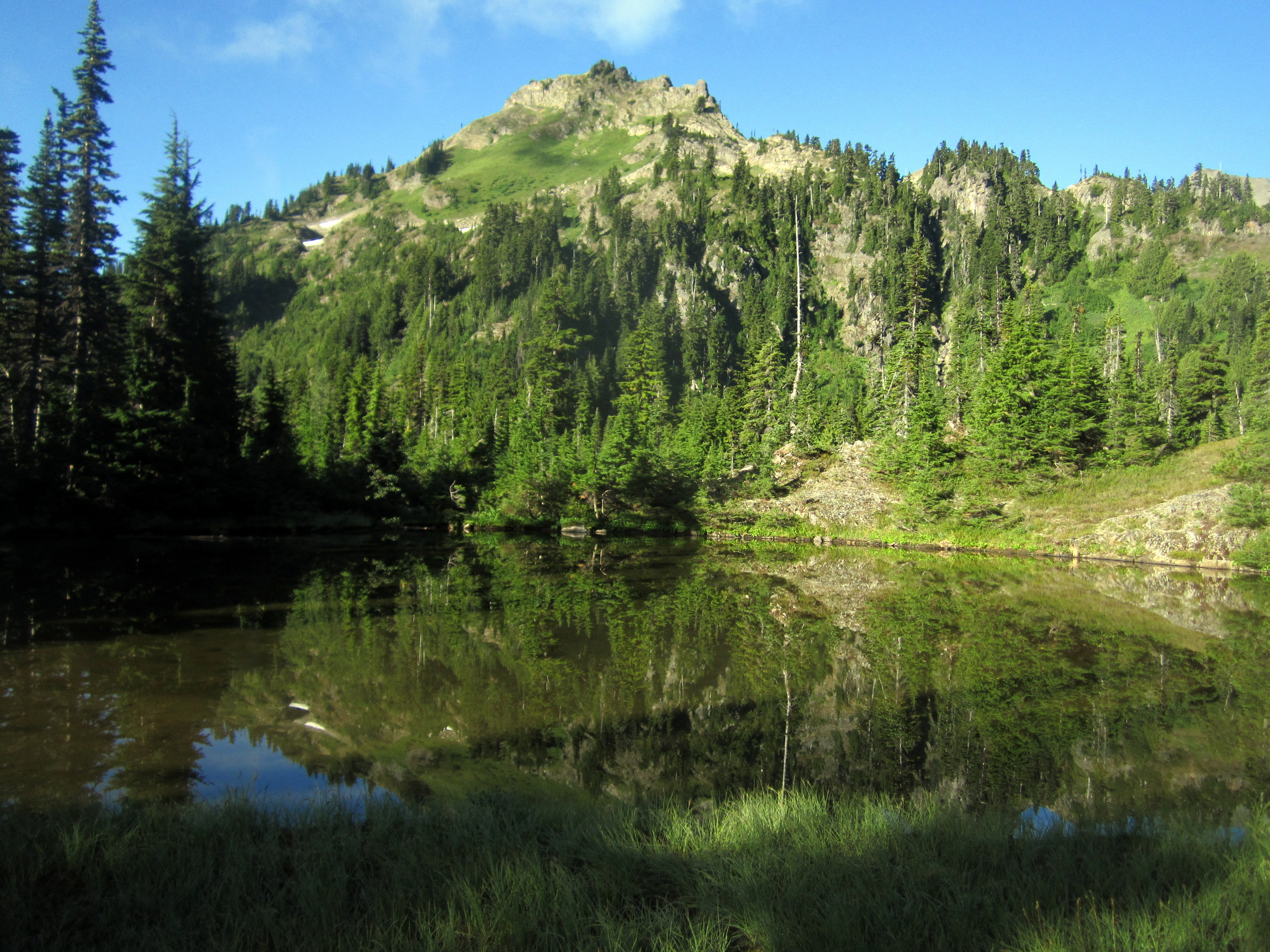 The approach trail relented a little after we broke out into the sub-alpine.
The trail leads past a litttle pond called the 'Pond of the False Prophets' (I know, awesome name).
The Pond of the False Prophets is about 3000 feet above the road. So by the time I took this photo, we had already put in some serious work.
Just in case you didn't hear me the first time, that trail is steep!
The approach trail relented a little after we broke out into the sub-alpine.
The trail leads past a litttle pond called the 'Pond of the False Prophets' (I know, awesome name).
The Pond of the False Prophets is about 3000 feet above the road. So by the time I took this photo, we had already put in some serious work.
Just in case you didn't hear me the first time, that trail is steep!
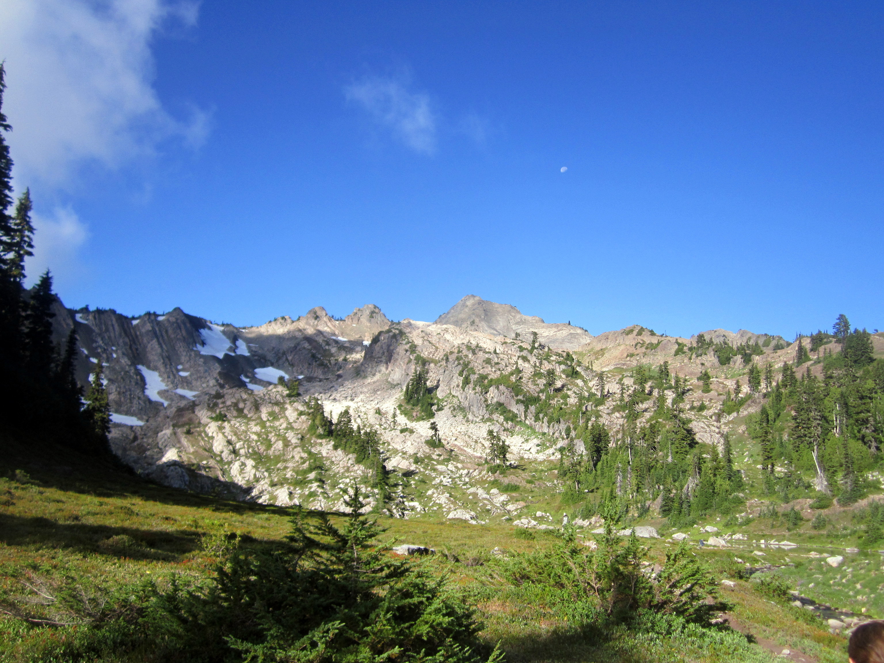
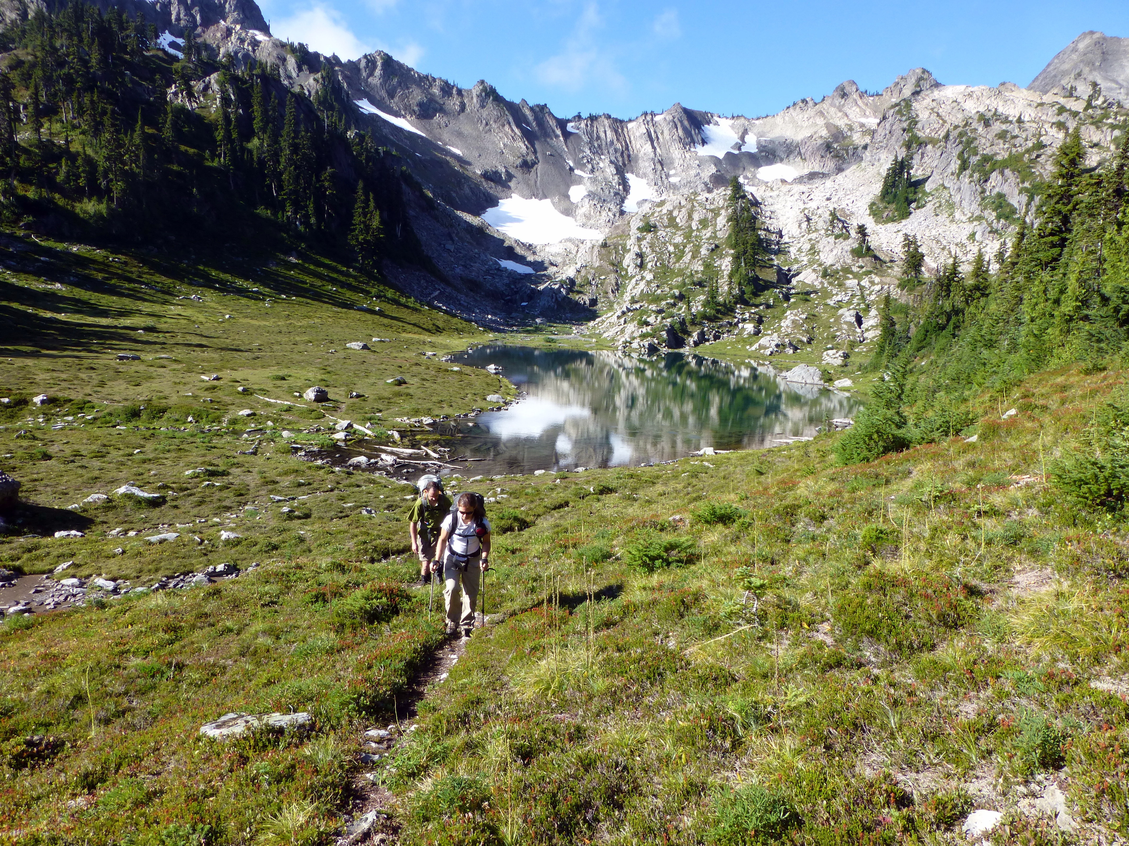
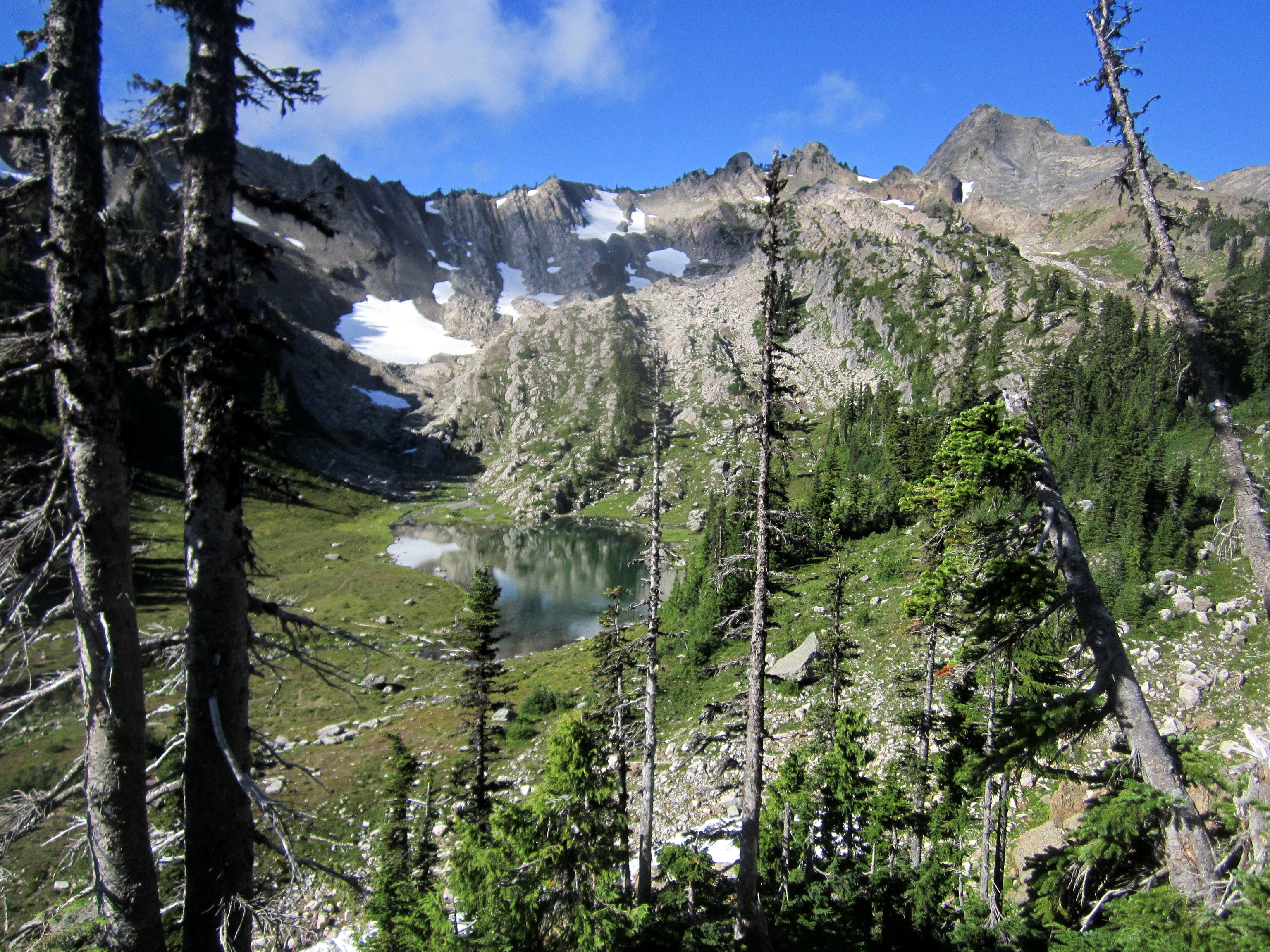
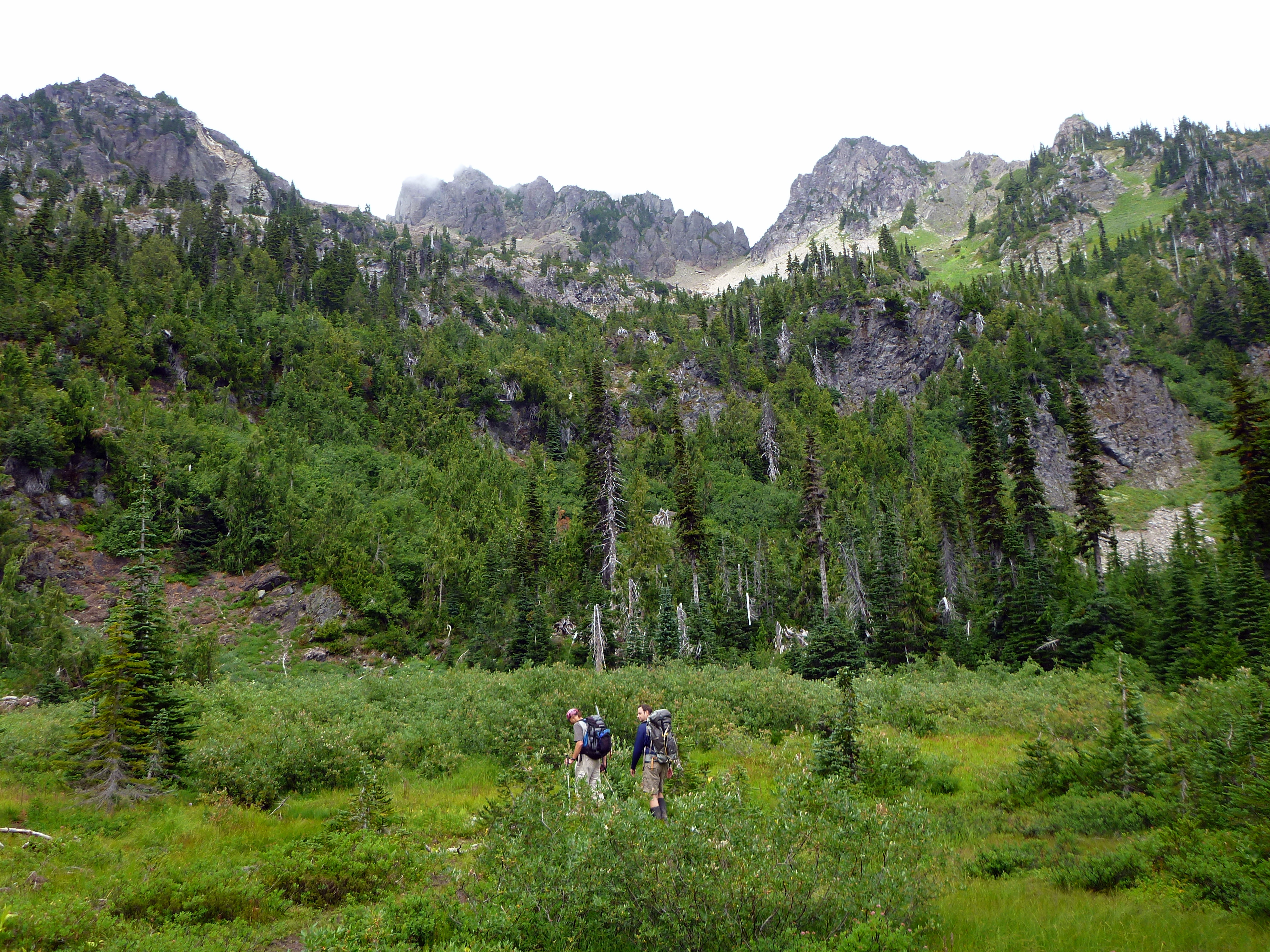
 The Pond of the False Prophets is situated below the Lake of the Angels (I know, again...great names)
Pictured above is the fairly steep climb up to the lake. That's Alice and I taking in the view (and a breath or two).
The Pond of the False Prophets is situated below the Lake of the Angels (I know, again...great names)
Pictured above is the fairly steep climb up to the lake. That's Alice and I taking in the view (and a breath or two).
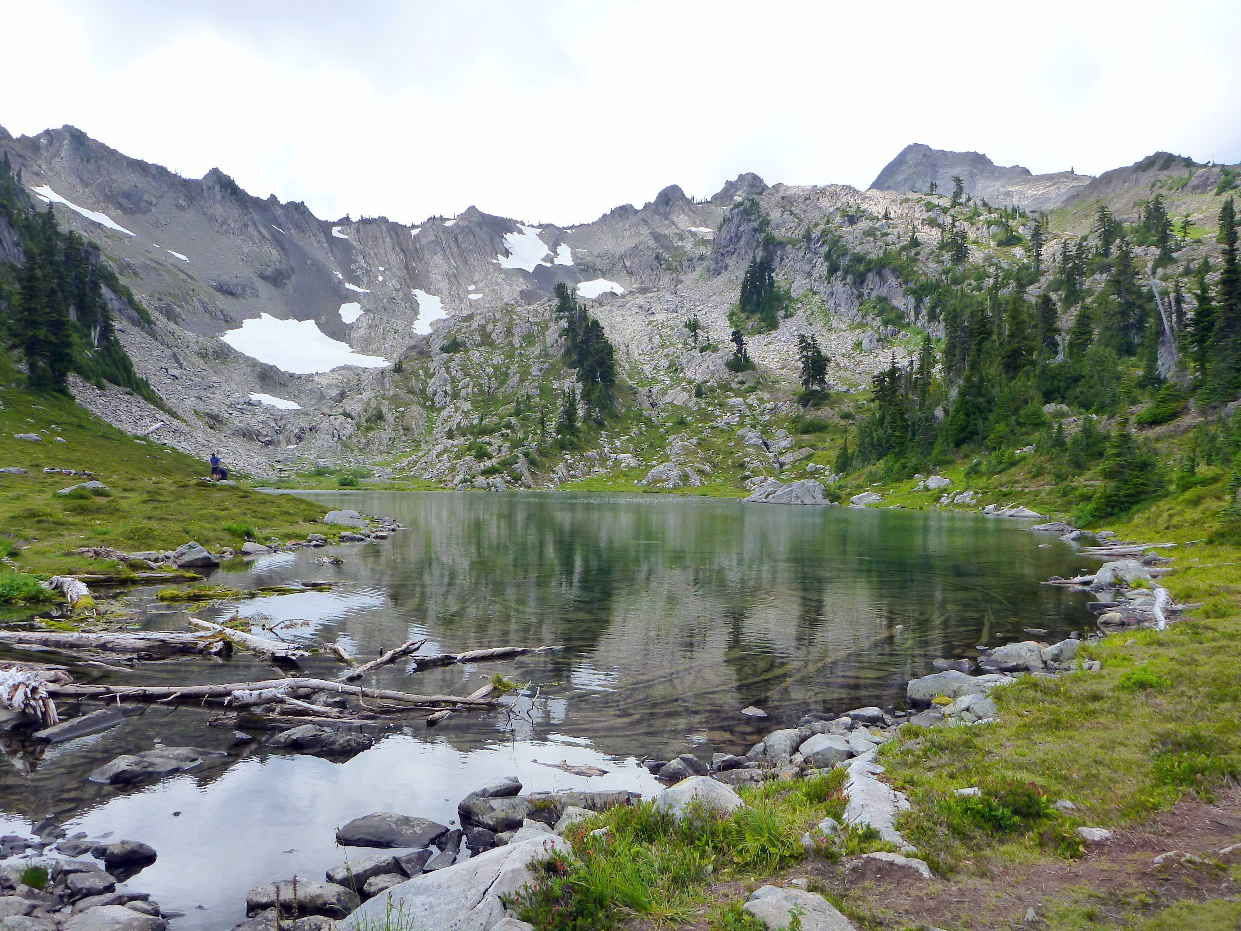
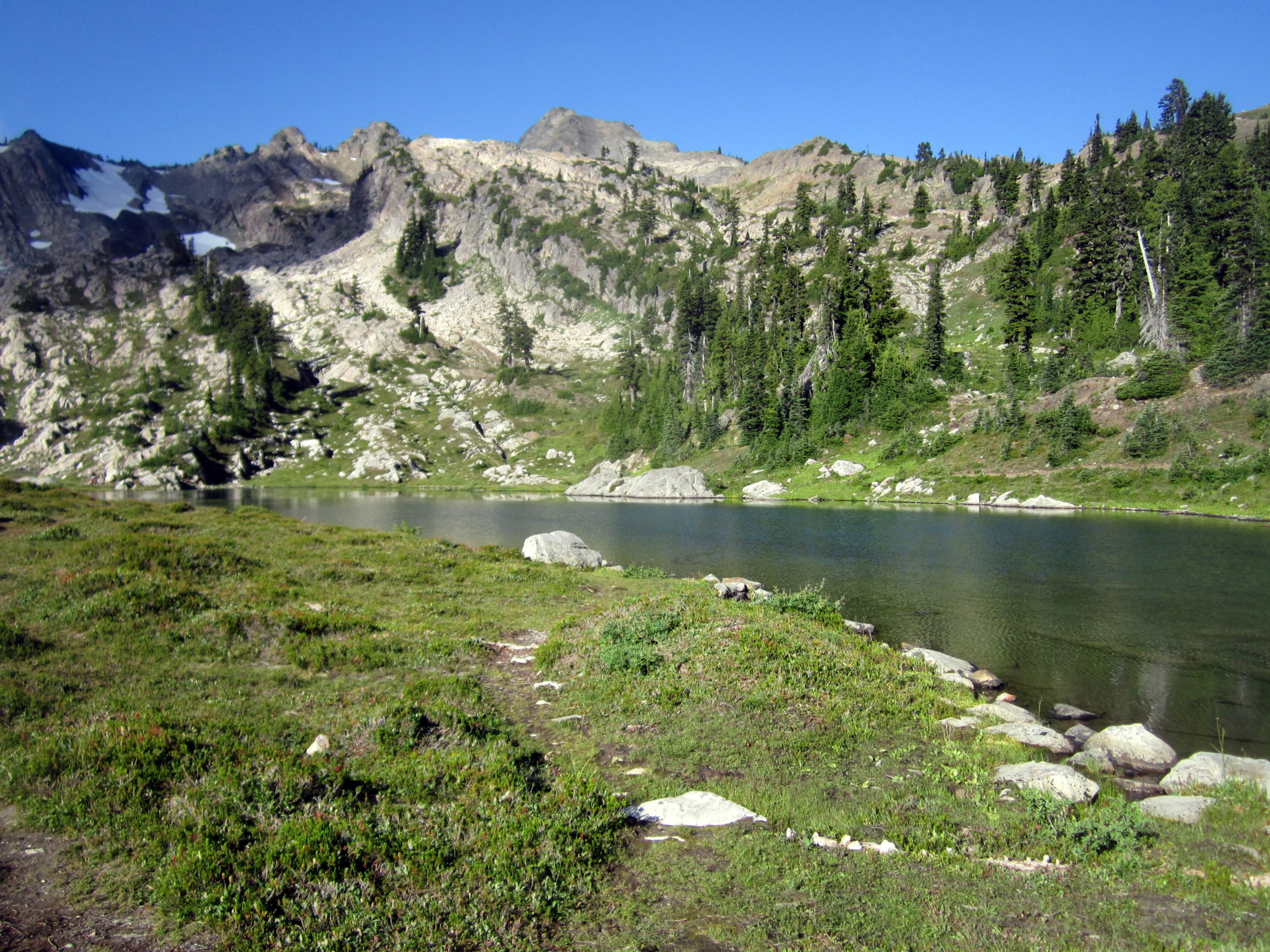
 We climbed up into the basin that contains the Lake of the Angels (~4900 feet).
Many people have told me that this lake is amazingly beautiful, and also that it is at the end of a really steep trail. I mostly agree.
Yes, the lake is intensely gorgeous and beautiful. Yes, the trail is really frikkin' steep. But, no, it's not at the end of the trail...
The trail keeps going up from there! (well, at least the climber's track does)
We climbed up into the basin that contains the Lake of the Angels (~4900 feet).
Many people have told me that this lake is amazingly beautiful, and also that it is at the end of a really steep trail. I mostly agree.
Yes, the lake is intensely gorgeous and beautiful. Yes, the trail is really frikkin' steep. But, no, it's not at the end of the trail...
The trail keeps going up from there! (well, at least the climber's track does)
 Yet another sub-alpine paradise.
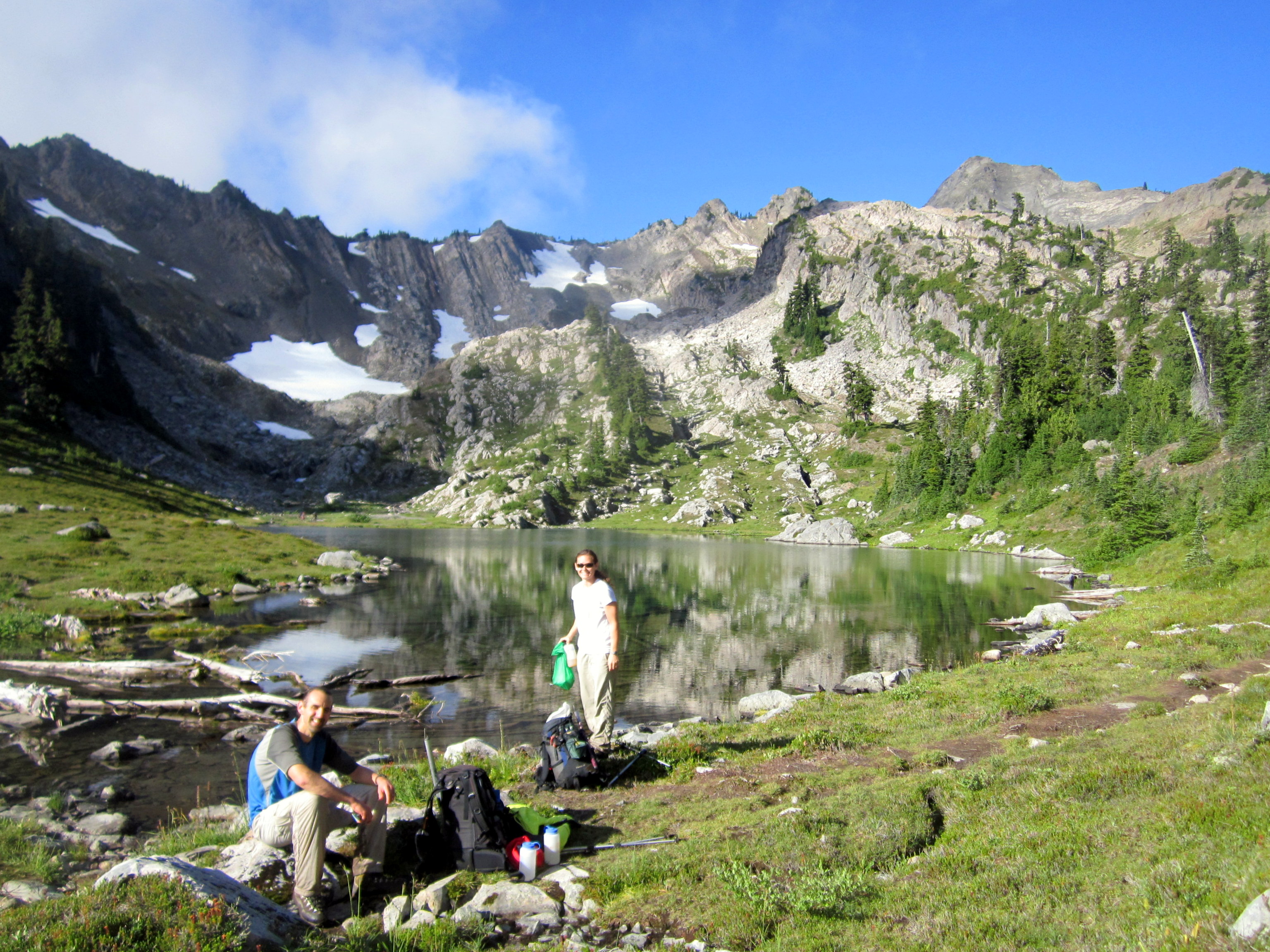 We stopped for a snack and filtered some water from the lake.
Mark and Alice pointed out the route up Mt. Skokomish for me, and we took a well-earned break from the trail.
Mt. Skokomish looks like a really fun one. As soon as I forget about how steep that trail was, I'll call Kevin and Dan and try to get us up here.
But not until I forget about that damn approach trail.
We stopped for a snack and filtered some water from the lake.
Mark and Alice pointed out the route up Mt. Skokomish for me, and we took a well-earned break from the trail.
Mt. Skokomish looks like a really fun one. As soon as I forget about how steep that trail was, I'll call Kevin and Dan and try to get us up here.
But not until I forget about that damn approach trail.
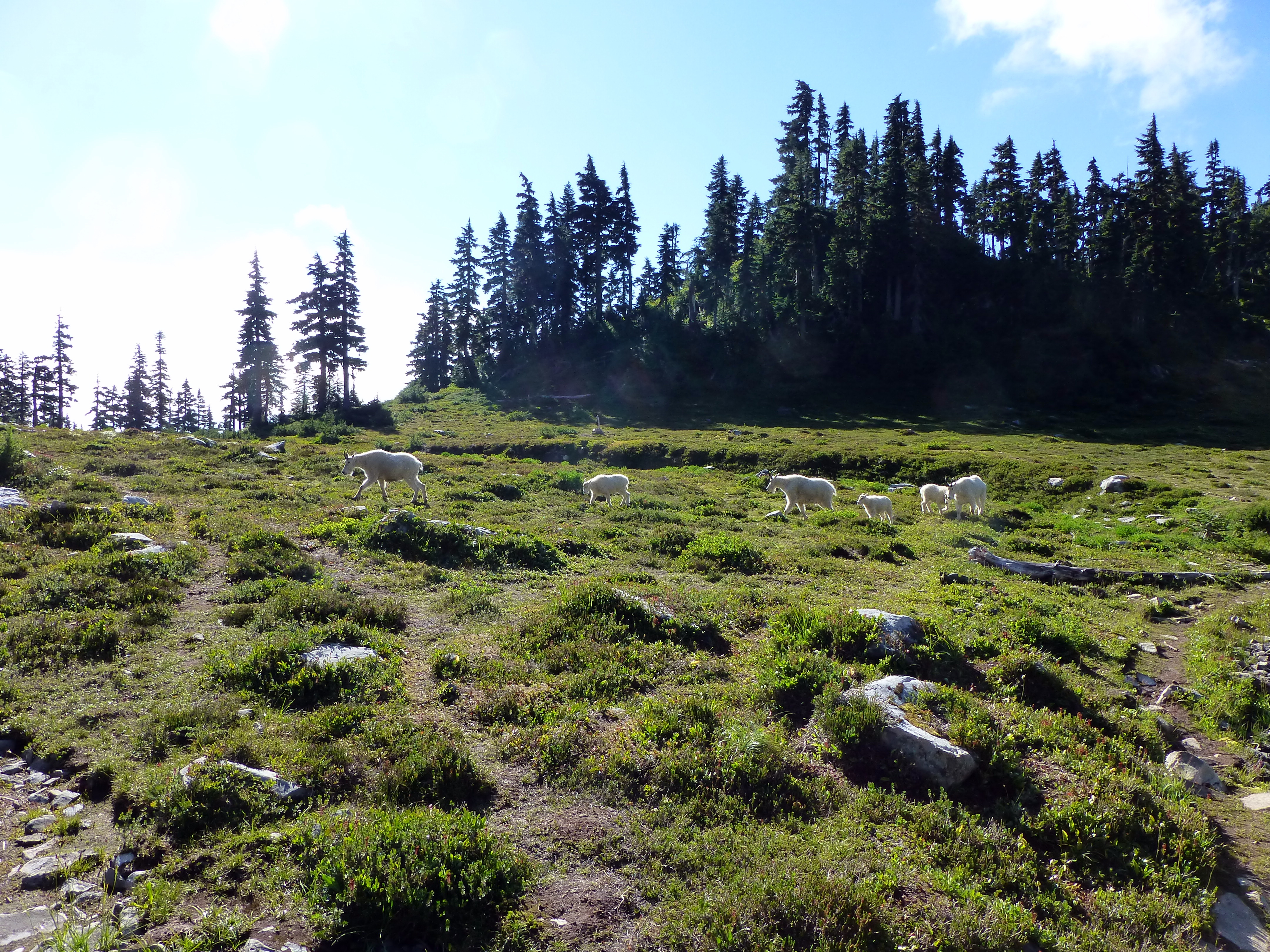 We saw a group of at least eight mountain goats congregating around some other hikers on the other side of the lake.
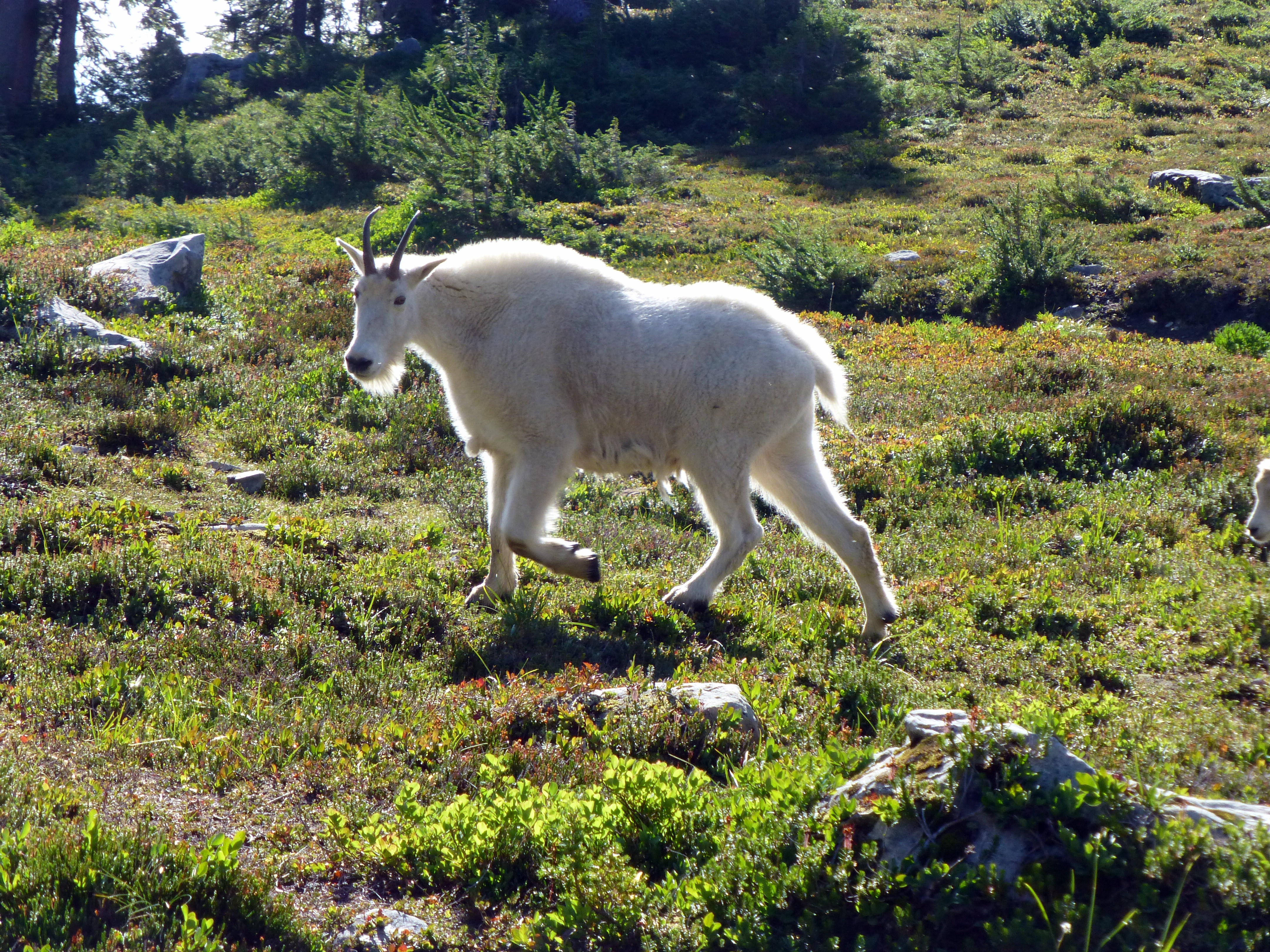
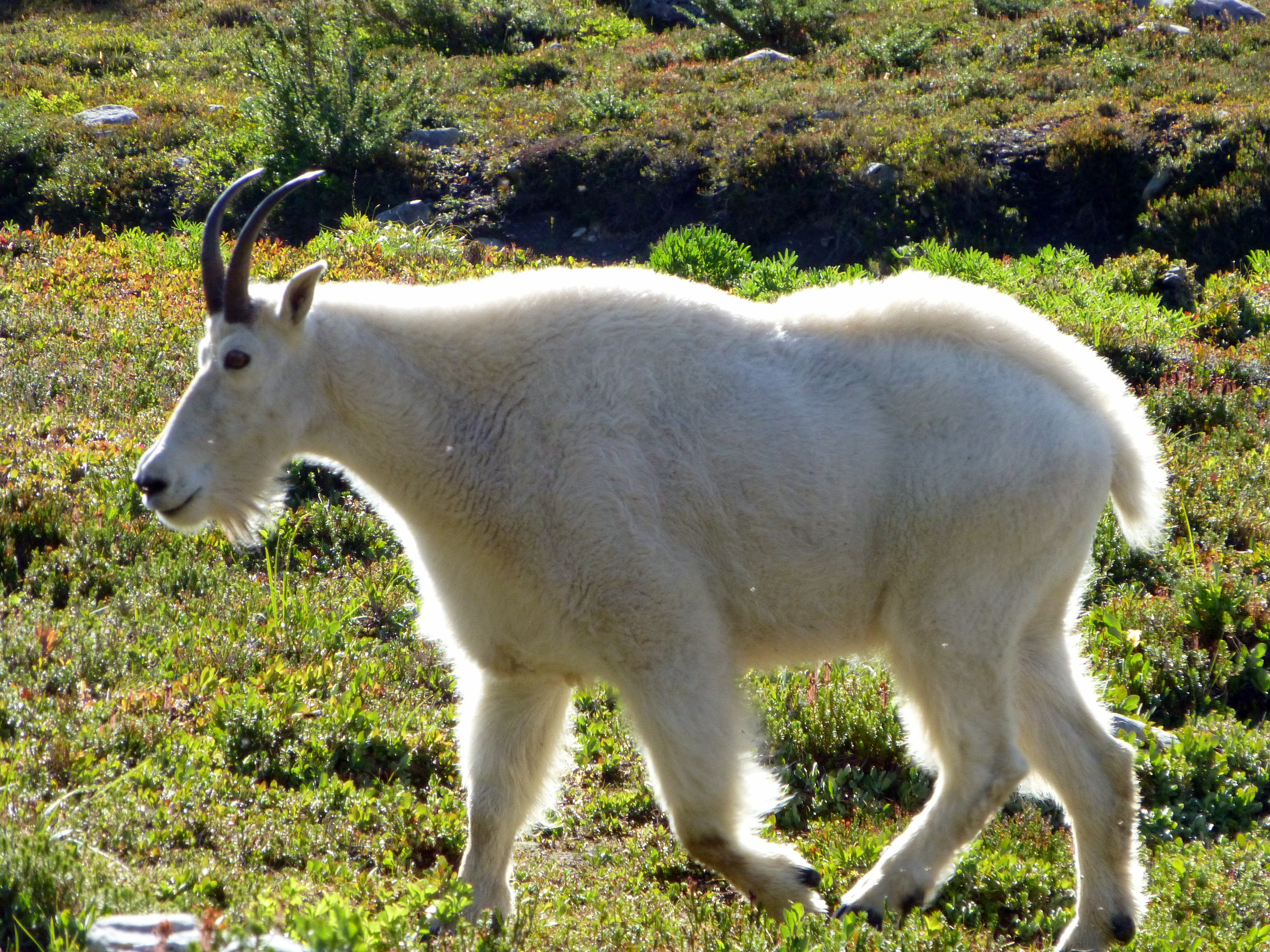 For some reason or another, they all started heading our way soon after we arrived.
We figured they were on their way over to check us out, but they all just walked right by us, barely taking notice.
For some reason or another, they all started heading our way soon after we arrived.
We figured they were on their way over to check us out, but they all just walked right by us, barely taking notice.
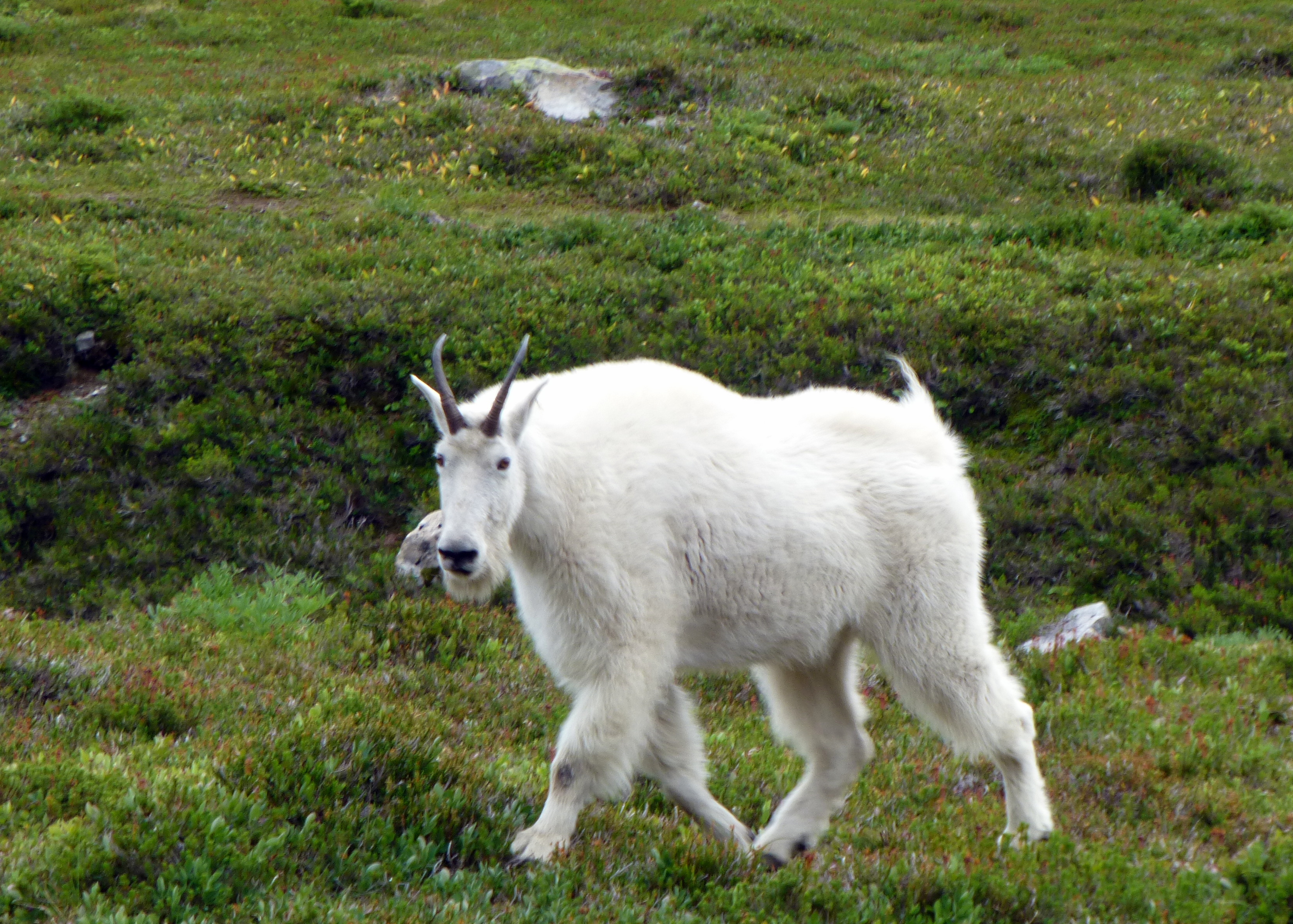
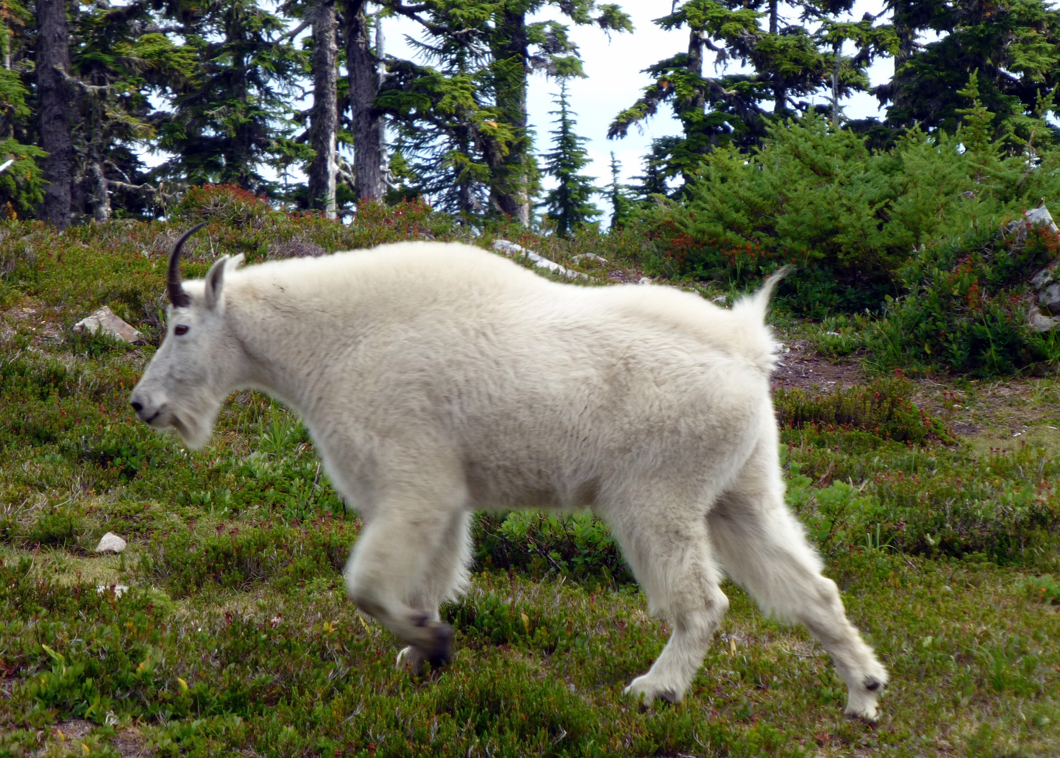 The lower two photos (directly above) were actually taken on the way back down from the summit, so apparently the goats like this place.
Mark had an interesting hypothesis, that this herd might actually be from the Mt. Ellinor area, which is not too far to the south.
The Mt. Ellinor trail was closed for a few months last year due to a gang of menacing goats. The rangers might have chased them over here. Who knows...
The lower two photos (directly above) were actually taken on the way back down from the summit, so apparently the goats like this place.
Mark had an interesting hypothesis, that this herd might actually be from the Mt. Ellinor area, which is not too far to the south.
The Mt. Ellinor trail was closed for a few months last year due to a gang of menacing goats. The rangers might have chased them over here. Who knows...
Video loading... Please be patient
Video loading... Please be patient
Video loading... Please be patient
 The route from the Lake of the Angels up to Mt. Stone is fairly labyrinthine. It's not at all suprising that we didn't make it back in 1999.
The climber's track starts out on a well-worn path, but quickly turns into a goat trail across scree and rock, marked by occasional cairns.
The route from the Lake of the Angels up to Mt. Stone is fairly labyrinthine. It's not at all suprising that we didn't make it back in 1999.
The climber's track starts out on a well-worn path, but quickly turns into a goat trail across scree and rock, marked by occasional cairns.
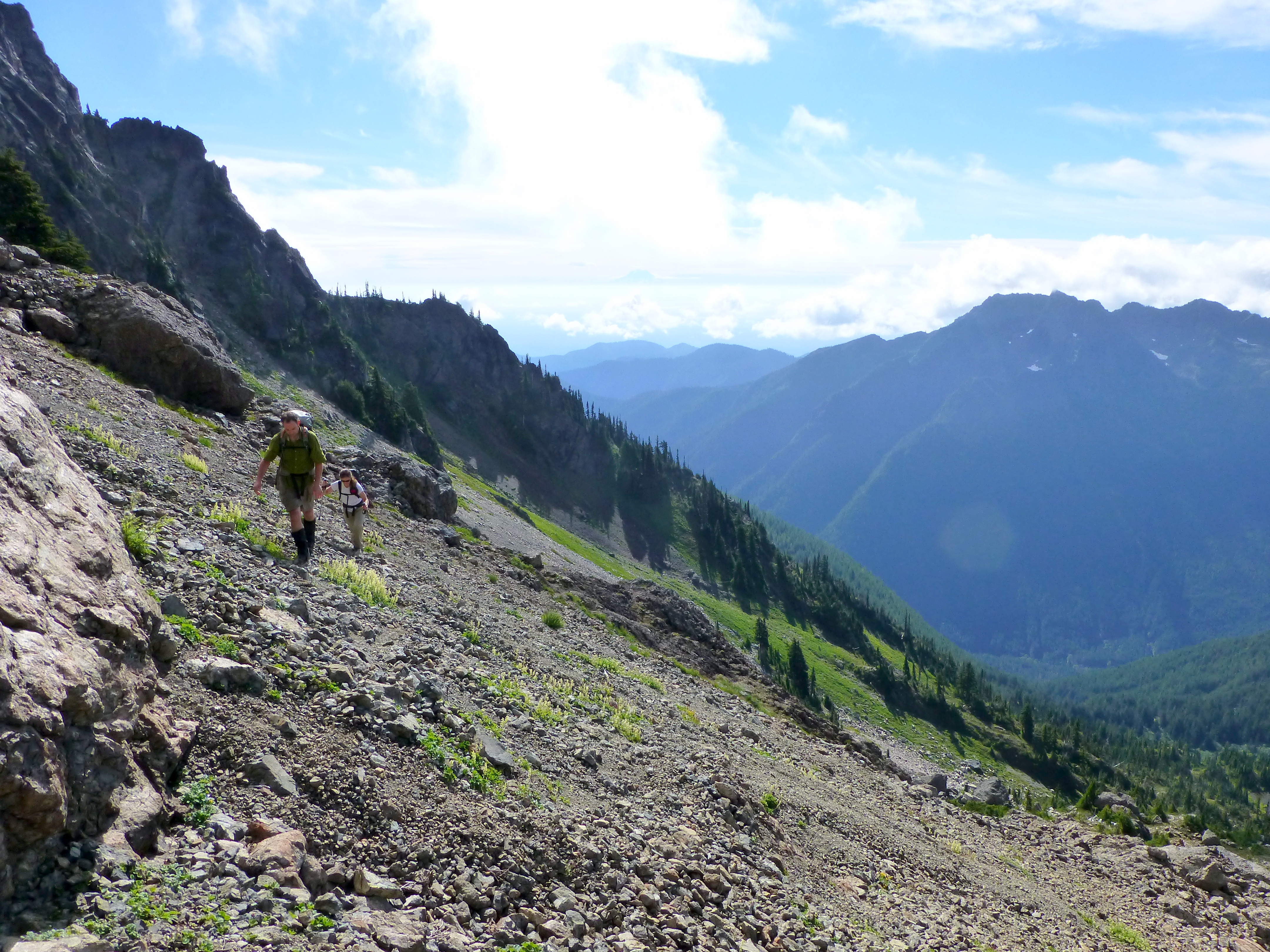
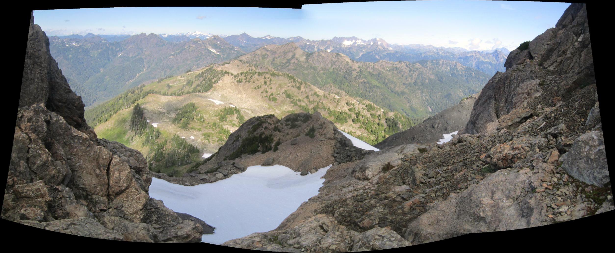
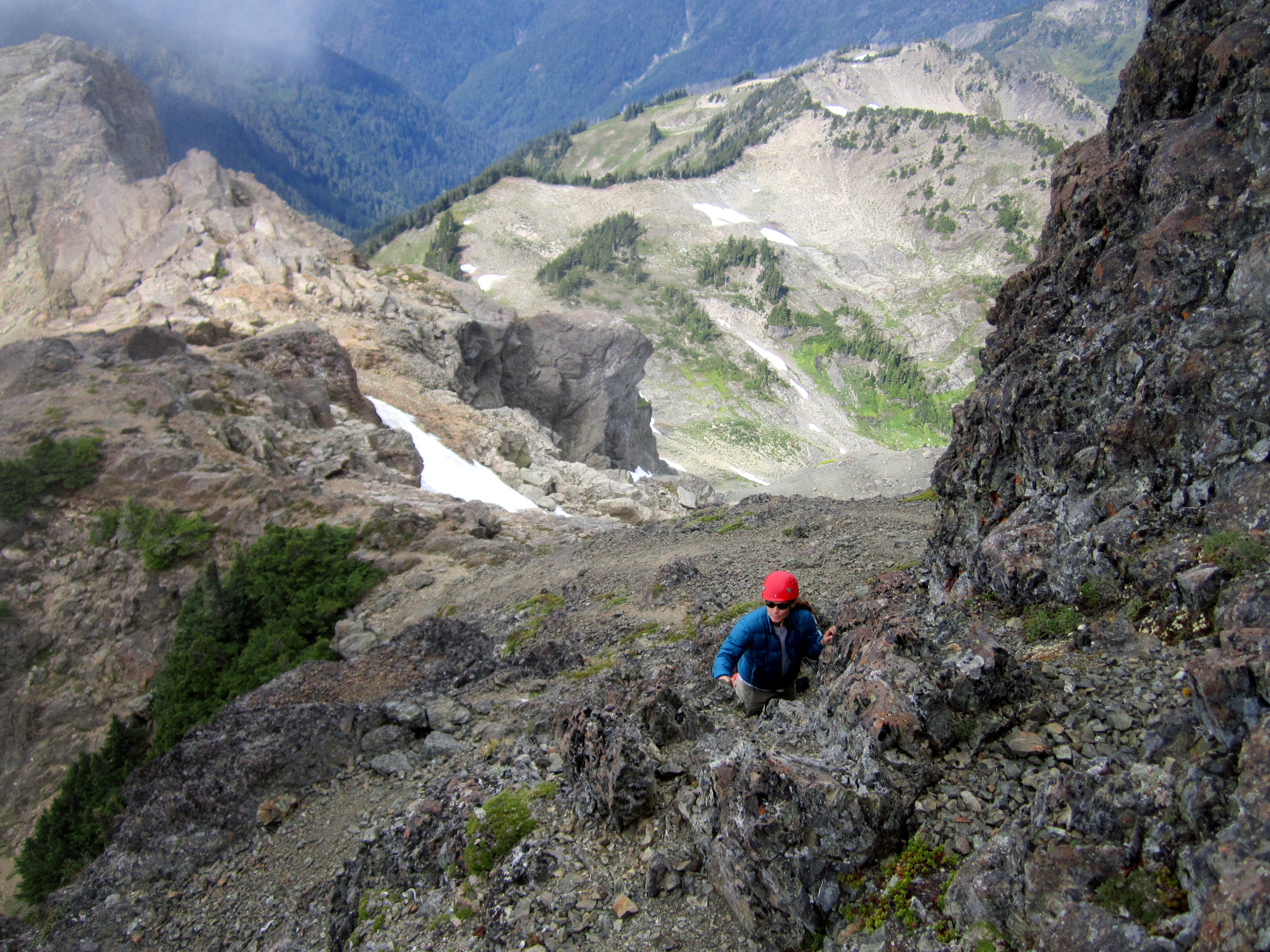
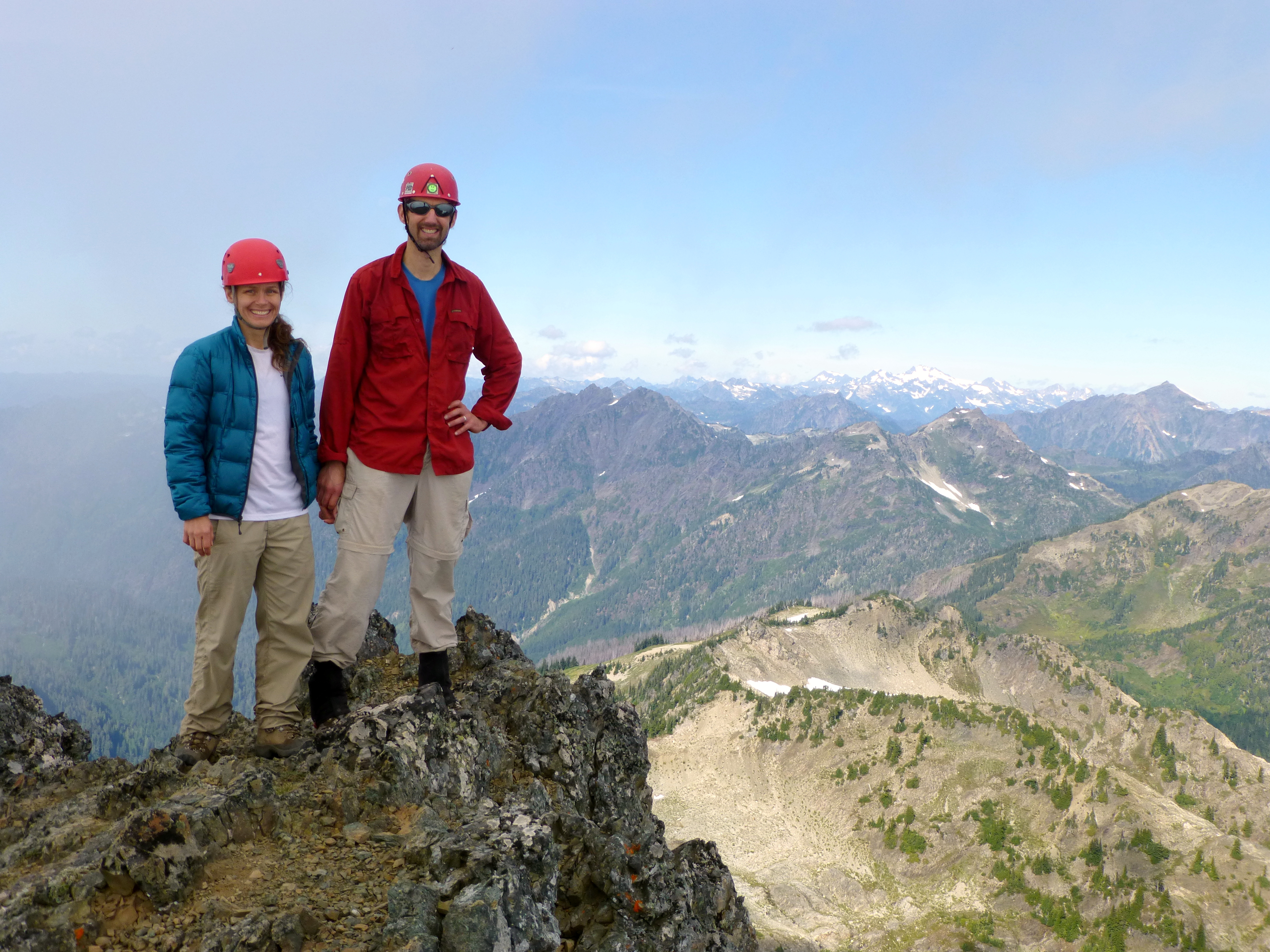
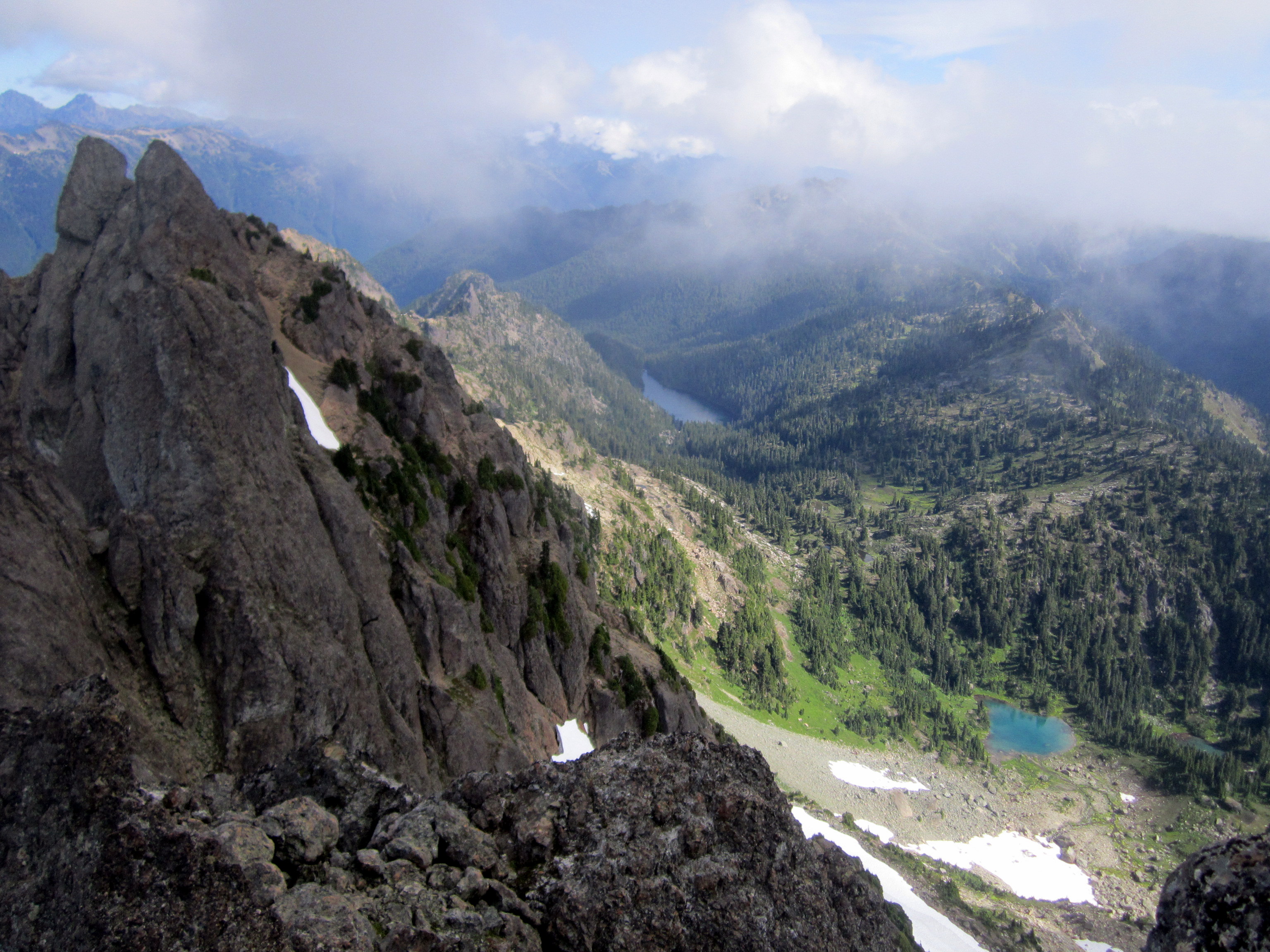
 (Above Left) Looking back down to the Lake of the Angels. That's Mt. Skokomish in the upper right.
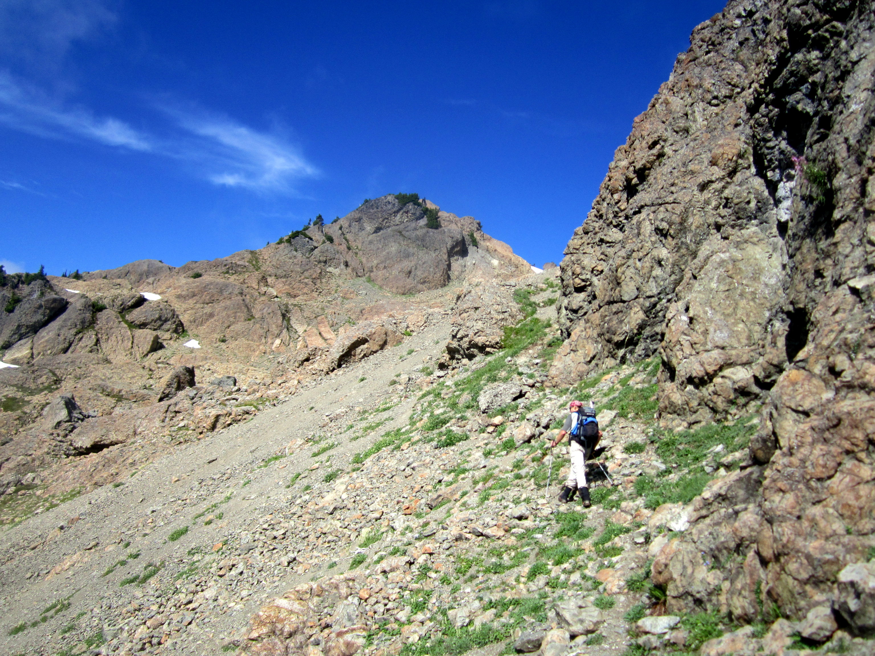
(Above Right) Climbing the ramp that leads to the cliffs that surround the summit of Mt. Stone.
(Above Left) Looking back down to the Lake of the Angels. That's Mt. Skokomish in the upper right.
(Above Right) Climbing the ramp that leads to the cliffs that surround the summit of Mt. Stone.
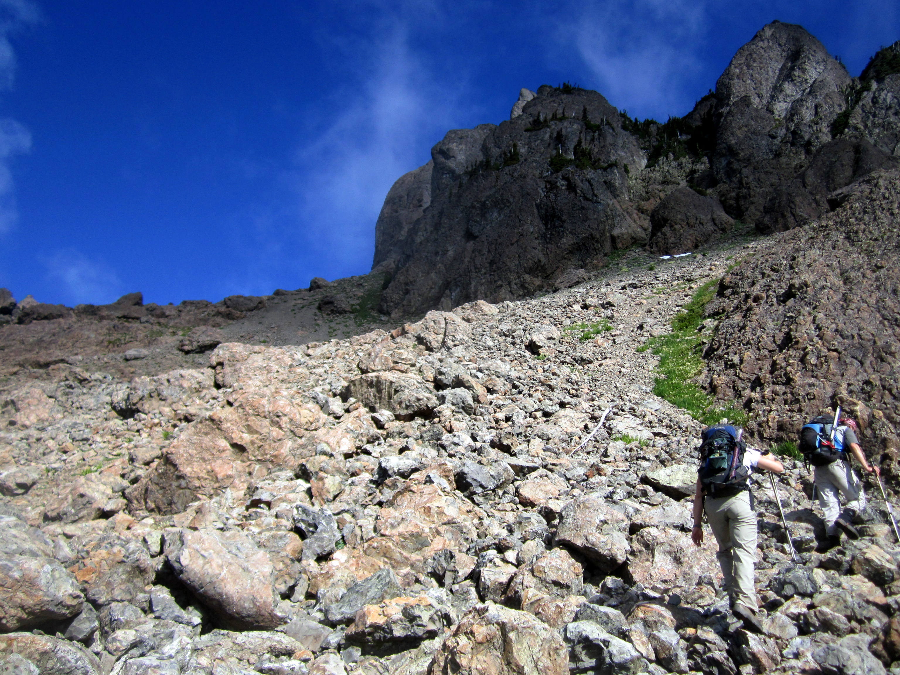
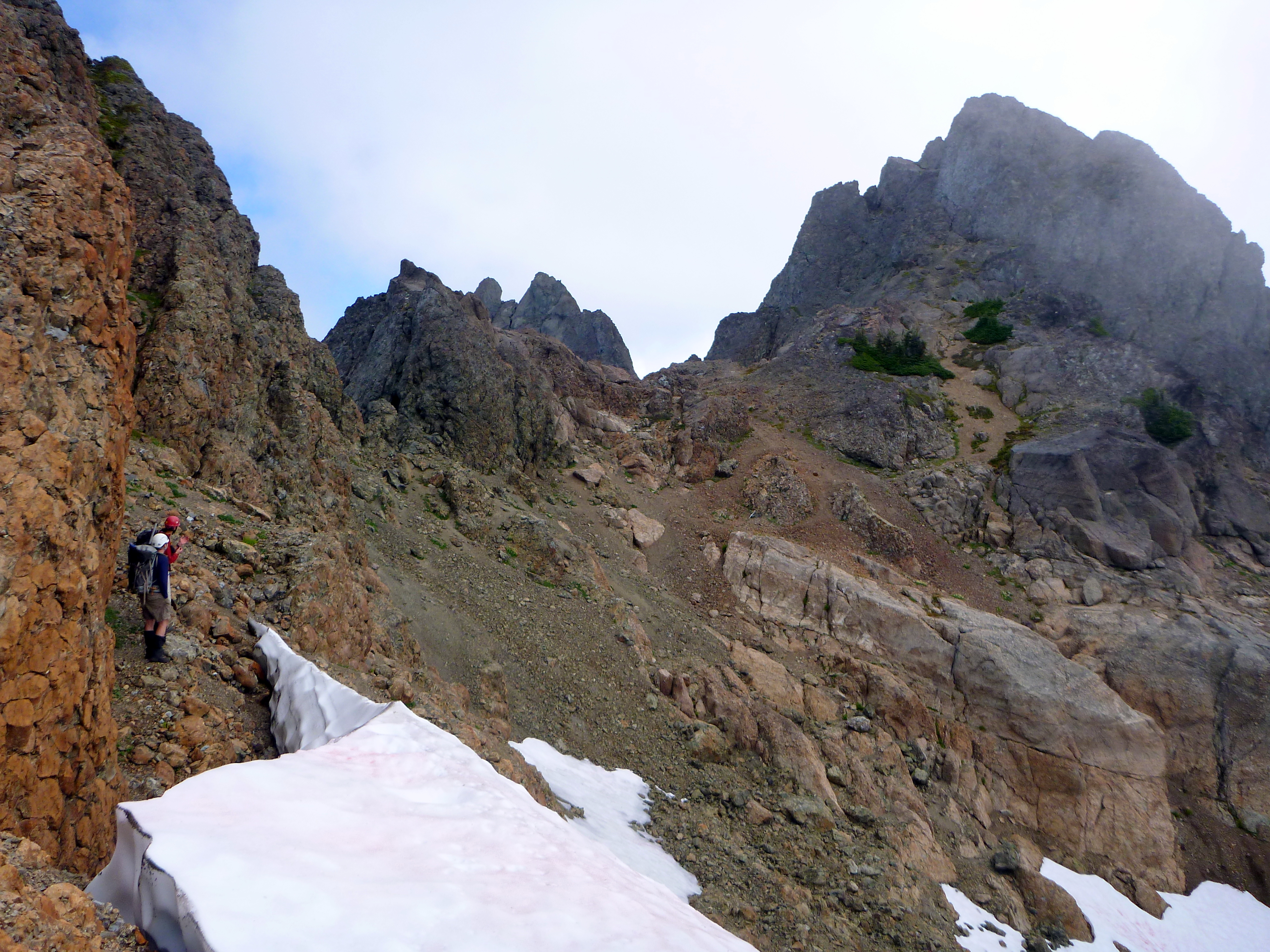
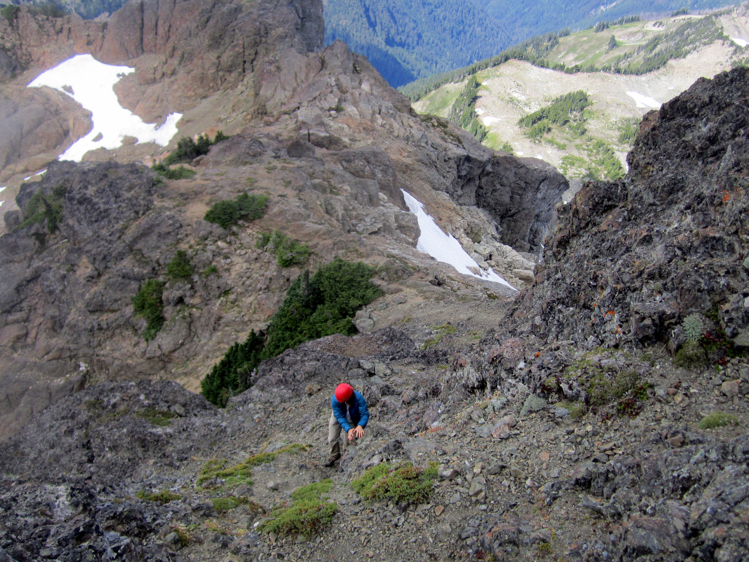
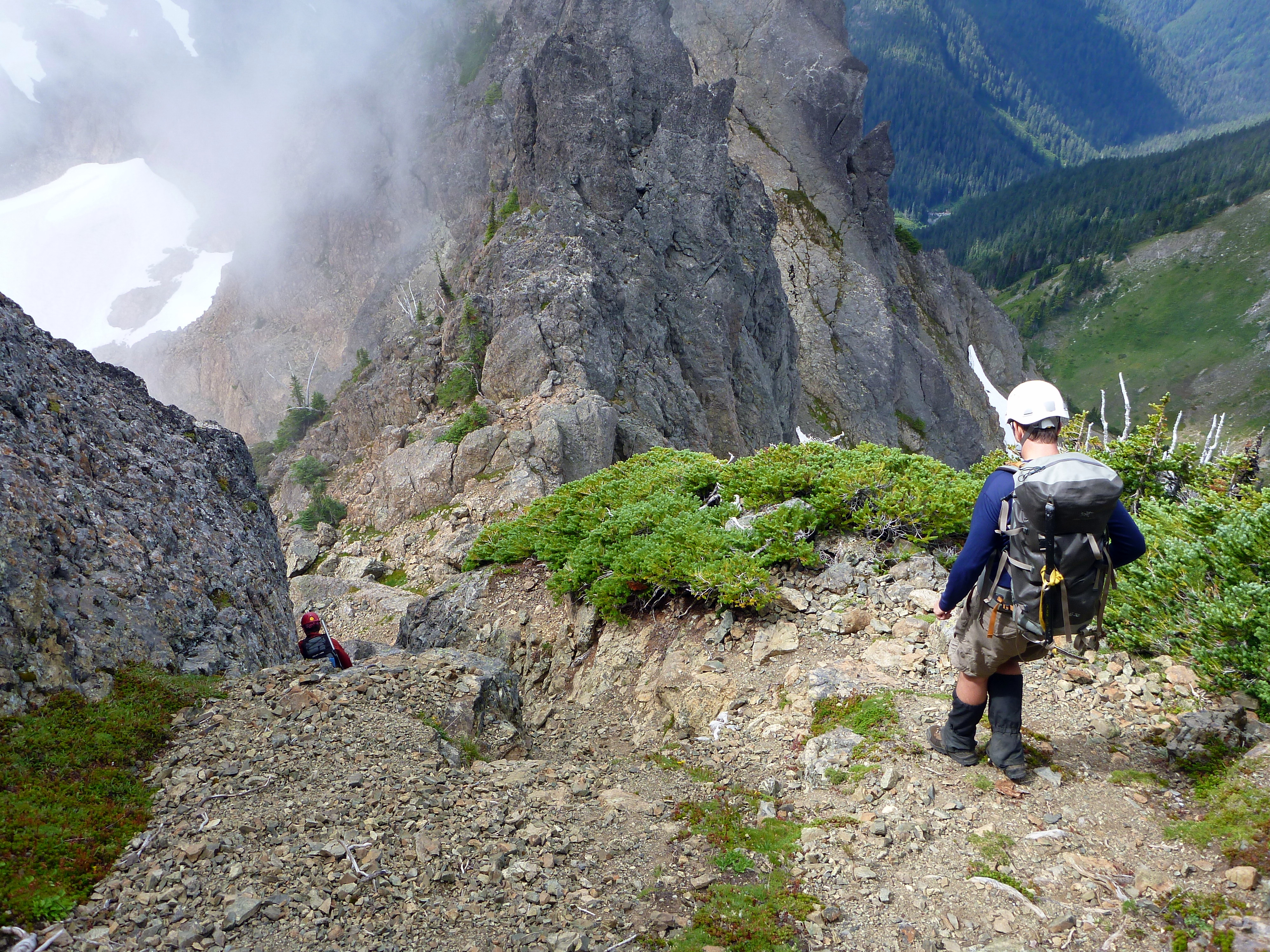
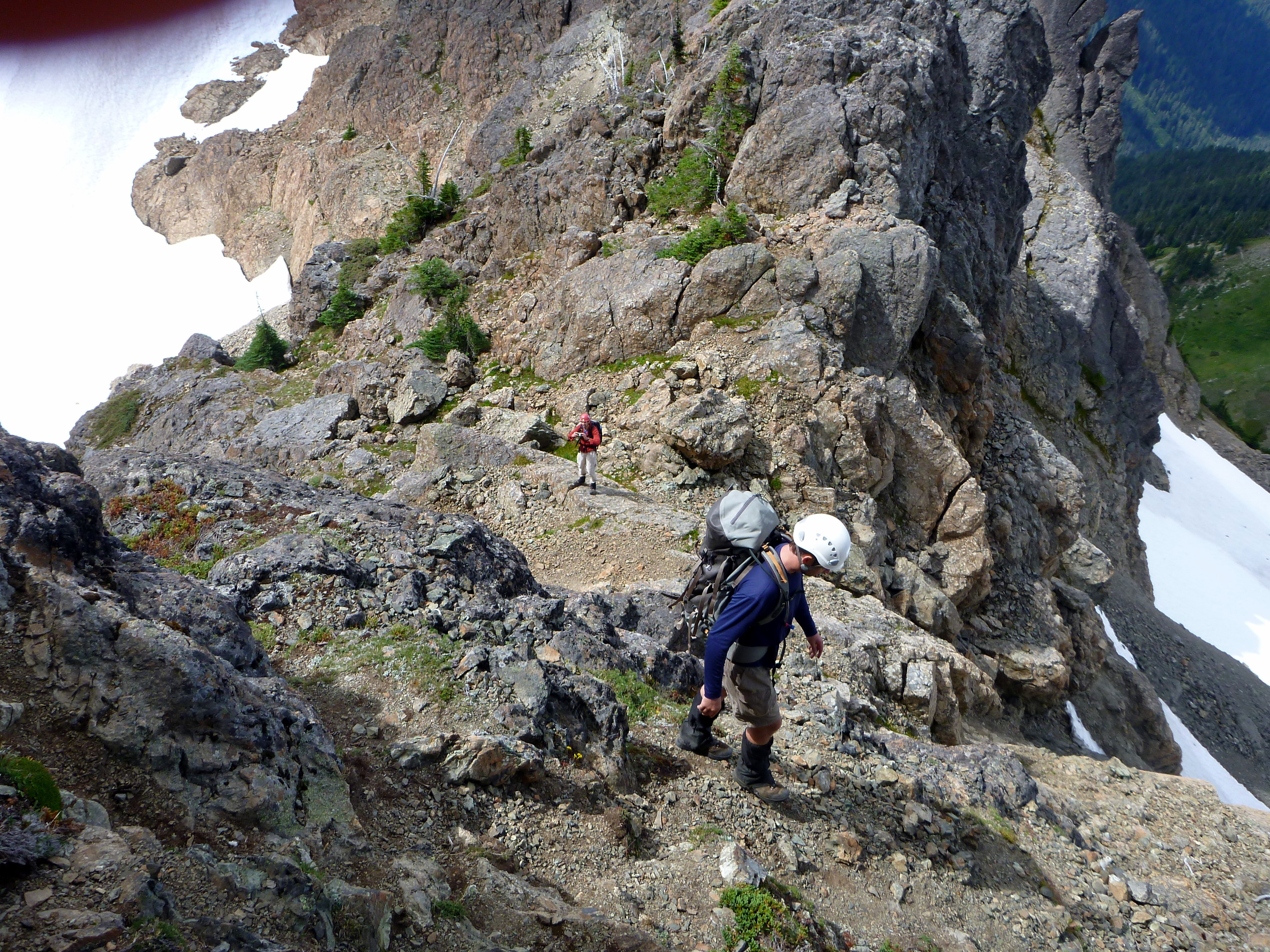
 (Above Left) The route takes you up to a talus slope at the base of a band of steep cliffs. It doesn't look passable from below.
(Above Right) Once you reach the base of the cliffs, you travel along the bottom of the rocky walls, hook around them (below), and continue up.
(Above Left) The route takes you up to a talus slope at the base of a band of steep cliffs. It doesn't look passable from below.
(Above Right) Once you reach the base of the cliffs, you travel along the bottom of the rocky walls, hook around them (below), and continue up.
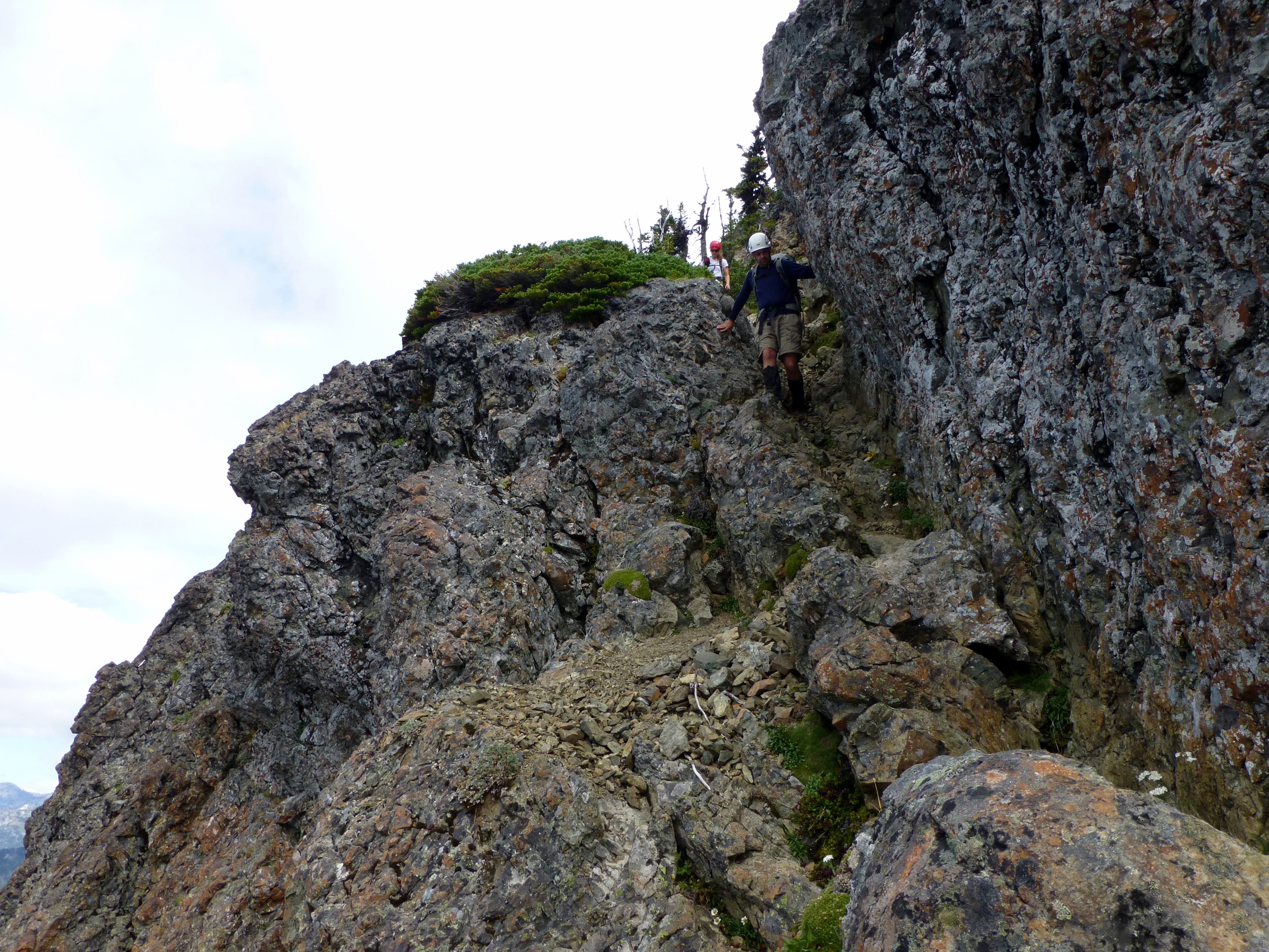
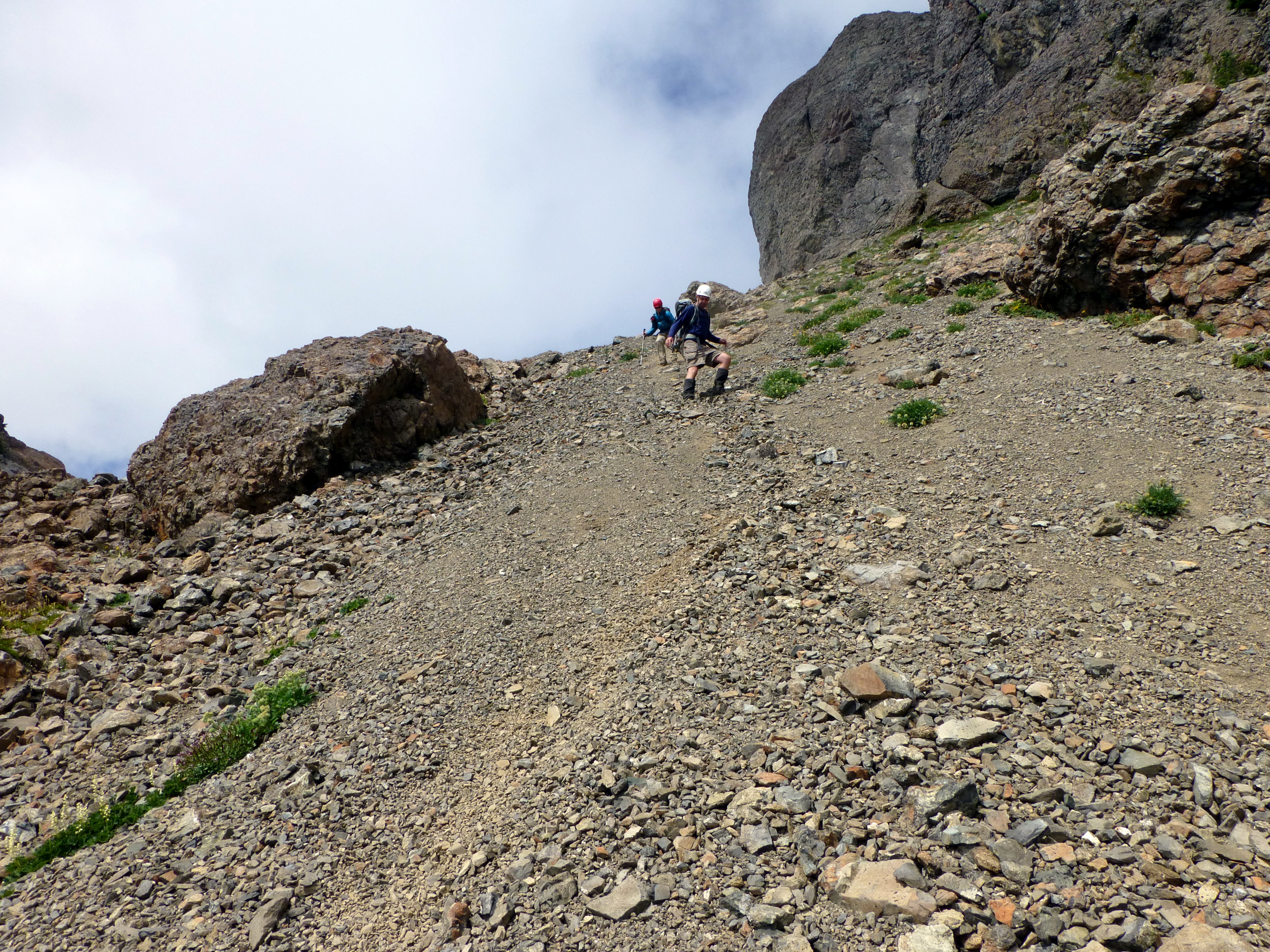
 ...and up
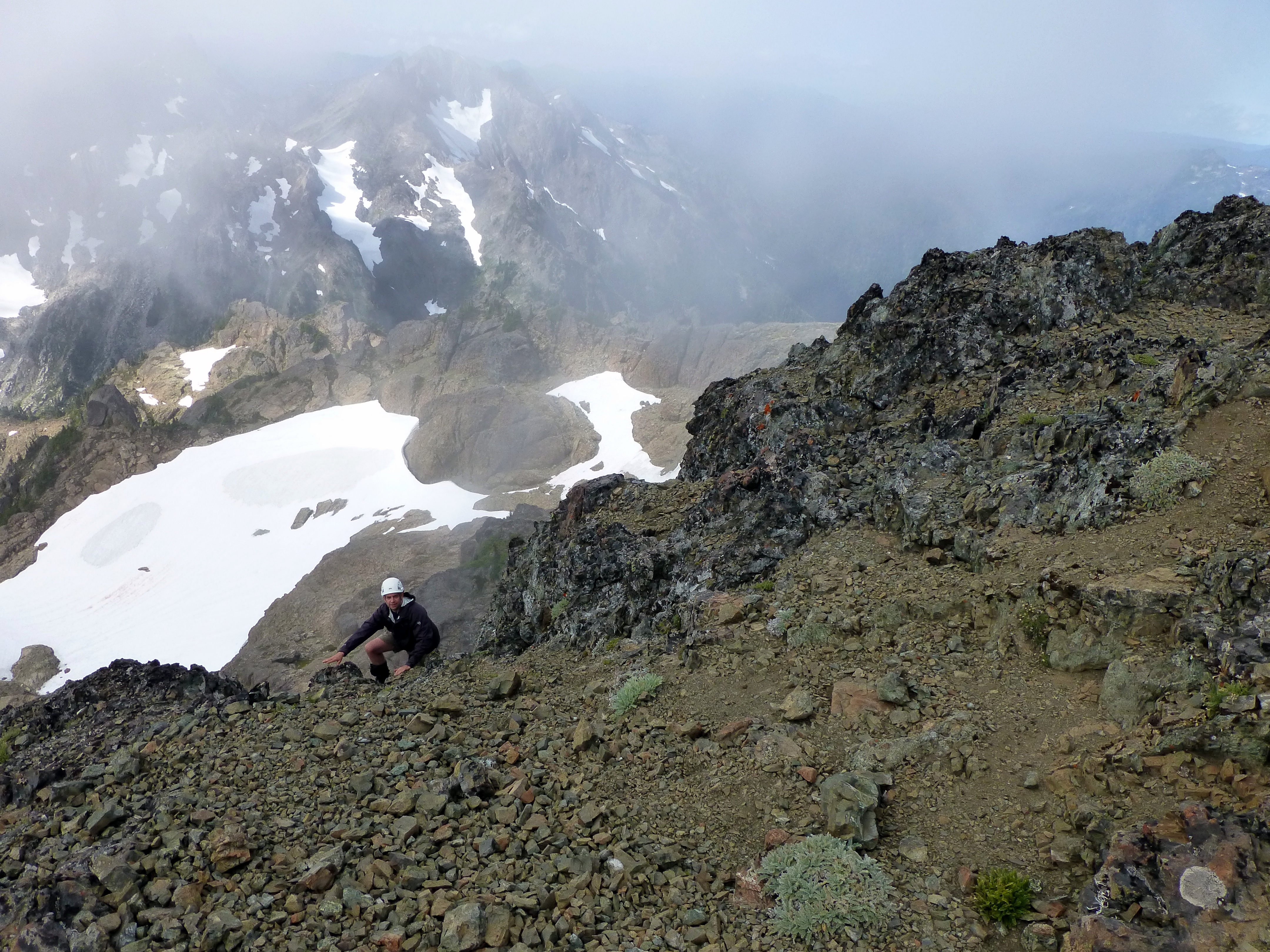
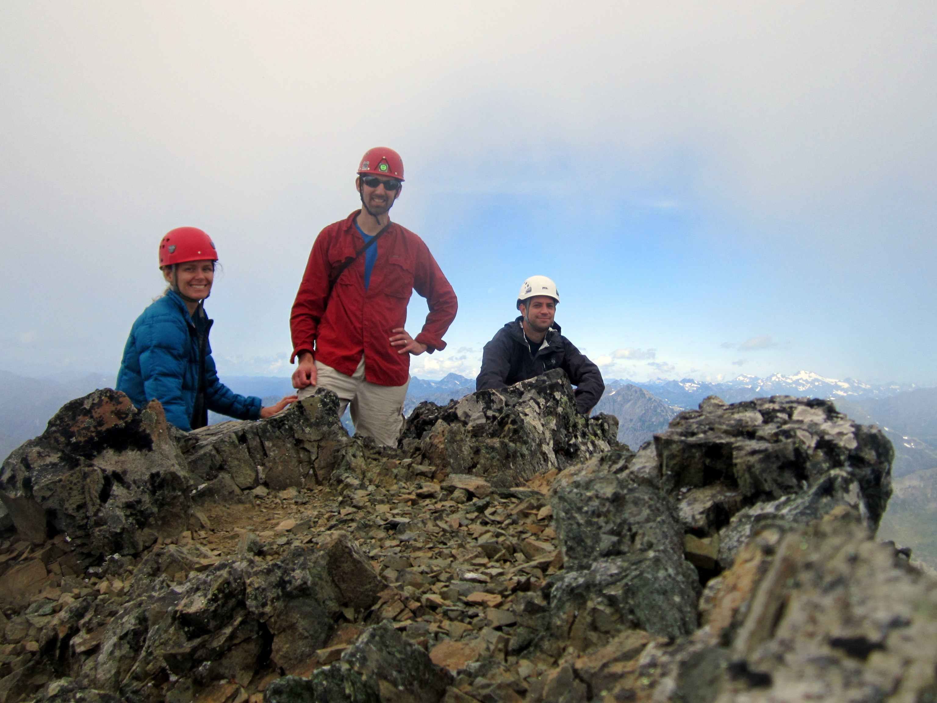
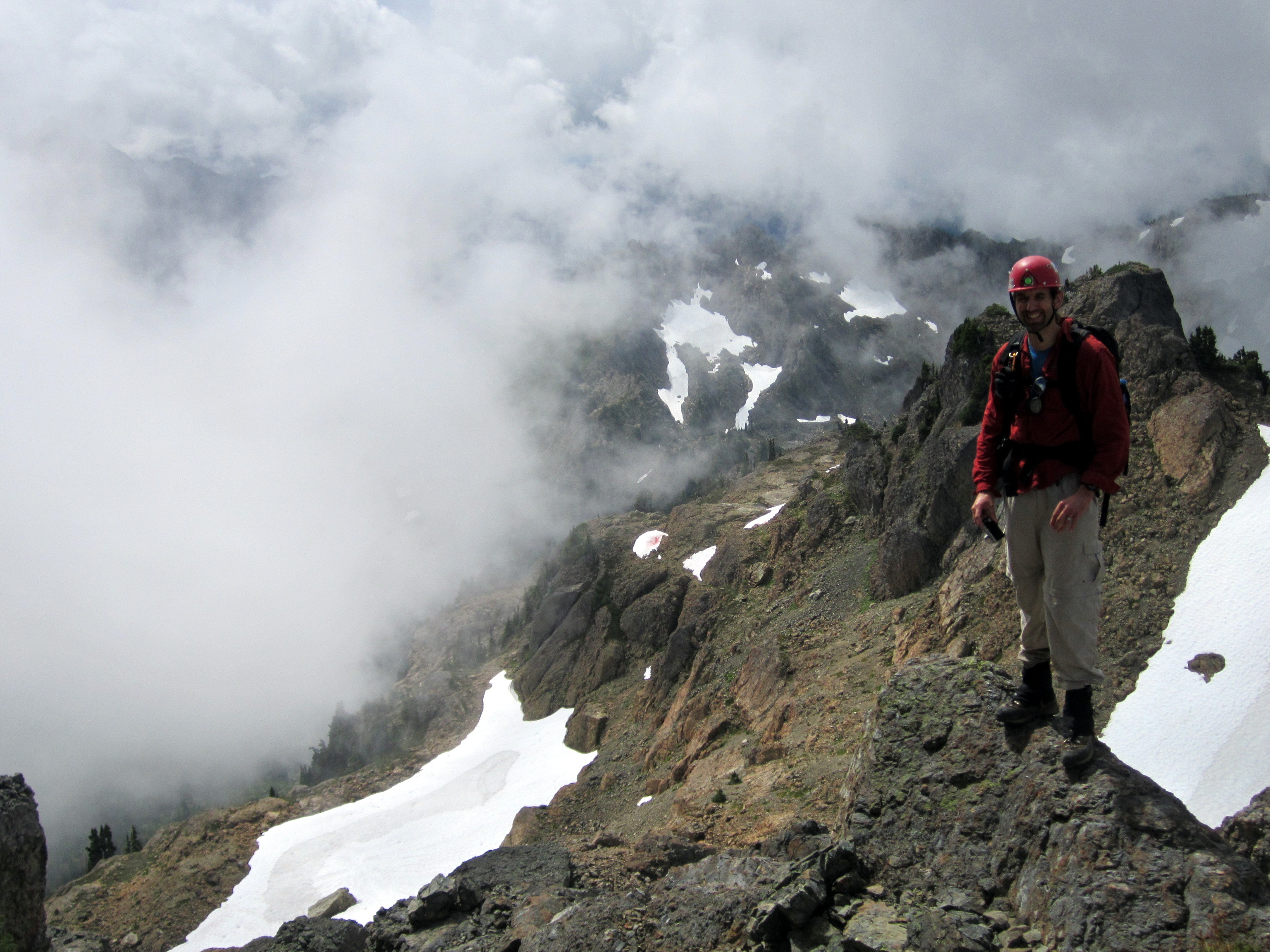
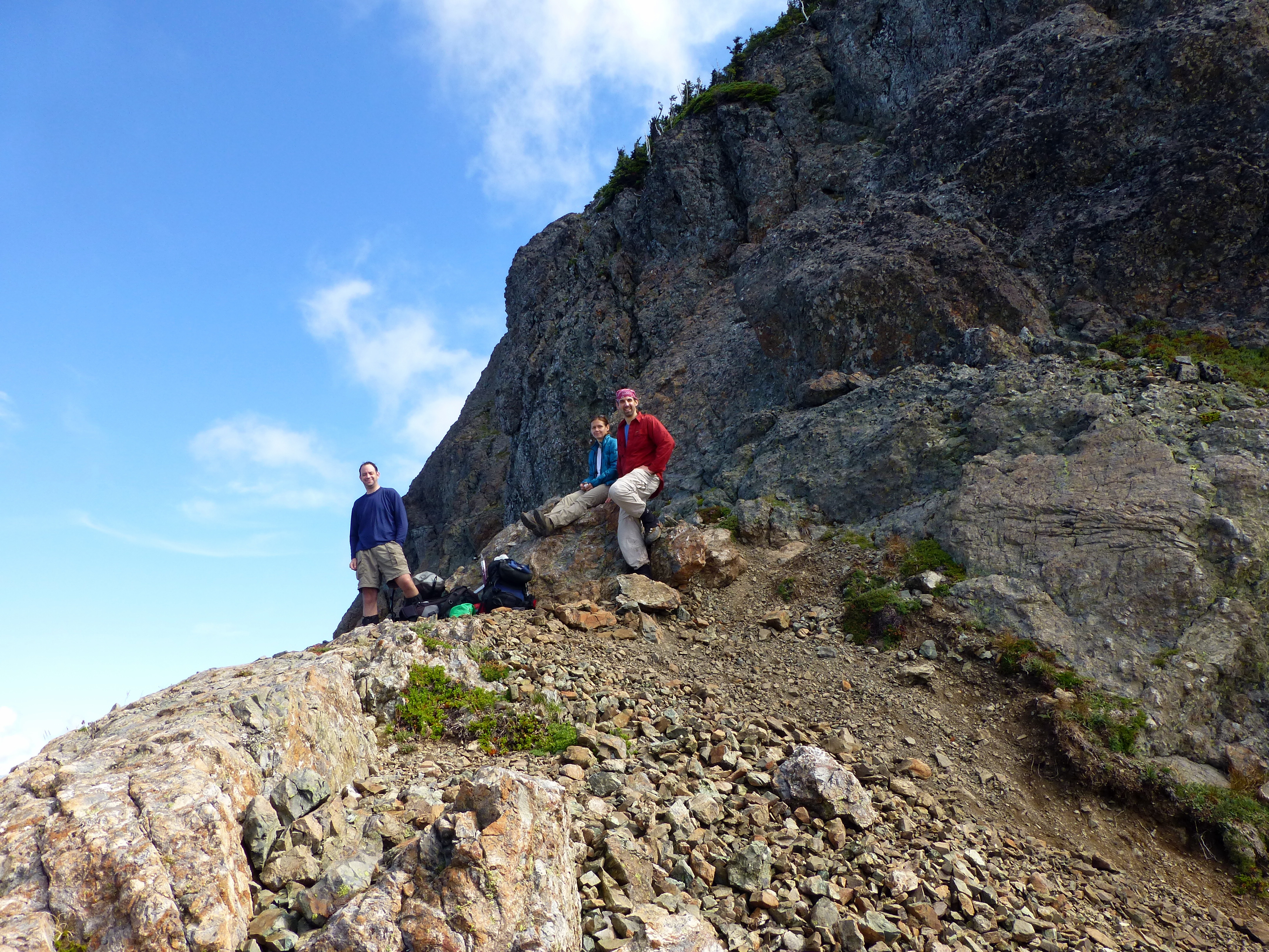 We reached a little col at the base of the cliffs and took in some views.
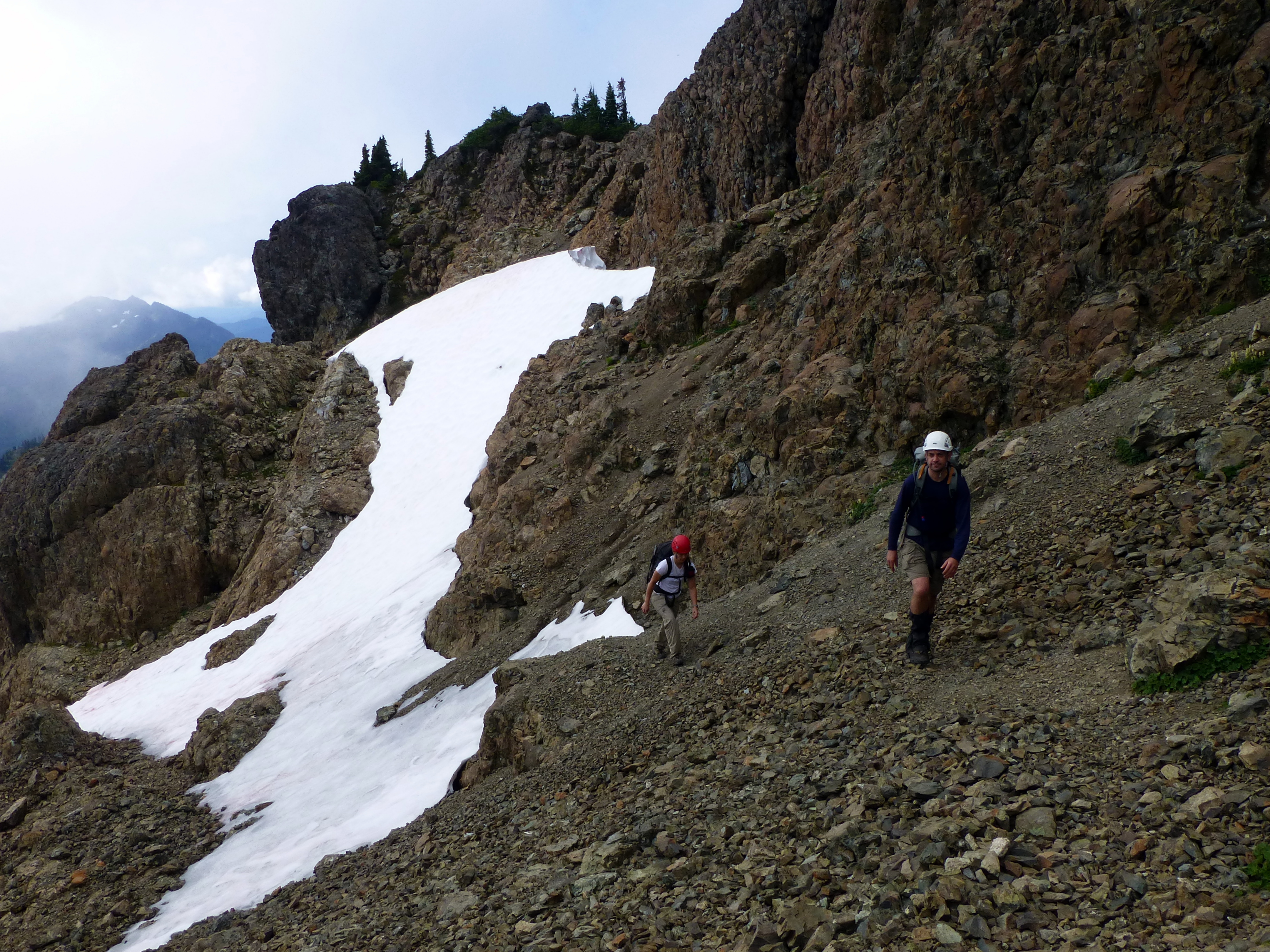
 There's a notch in the cliffs (not pictured), just past the col that leads to a small basin with a snow field.
Here's Mark near the top of the notch.
There's a notch in the cliffs (not pictured), just past the col that leads to a small basin with a snow field.
Here's Mark near the top of the notch.
 Once you are in the small basin, you traverse along the top toward the summit block (right).
There was so little snow by this time of the year, that we never had to (or got to) set foot on any of it.
Of course, we all brought our ice axes and crampons along, just in case.
Once you are in the small basin, you traverse along the top toward the summit block (right).
There was so little snow by this time of the year, that we never had to (or got to) set foot on any of it.
Of course, we all brought our ice axes and crampons along, just in case.
 We crossed the basin and climbed up to the base of the summit block.
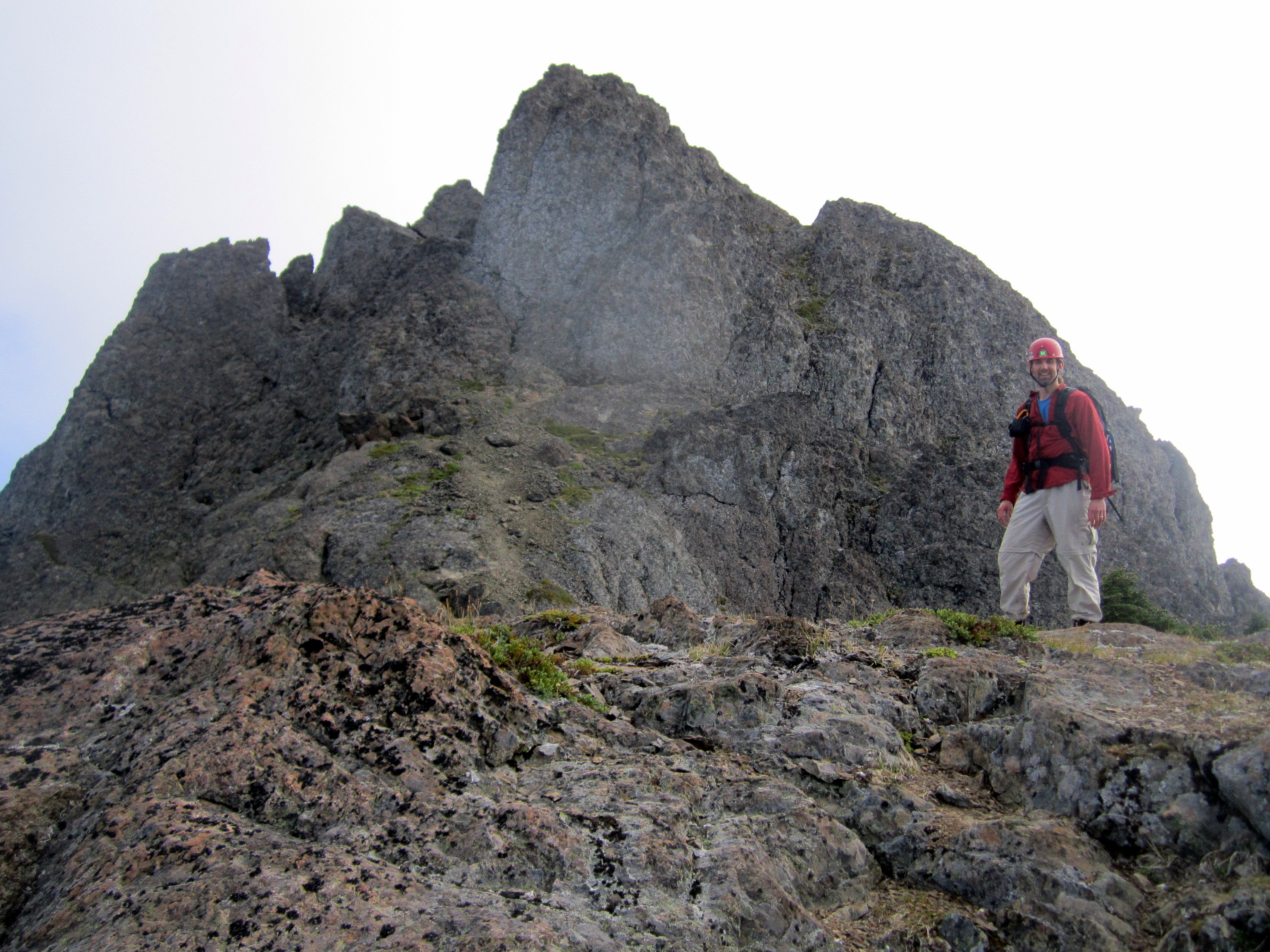 (Above) Mark with the summit block behind him.
 As we got closer to the summit block, I felt the weariness in my legs being replaced by adrenaline.
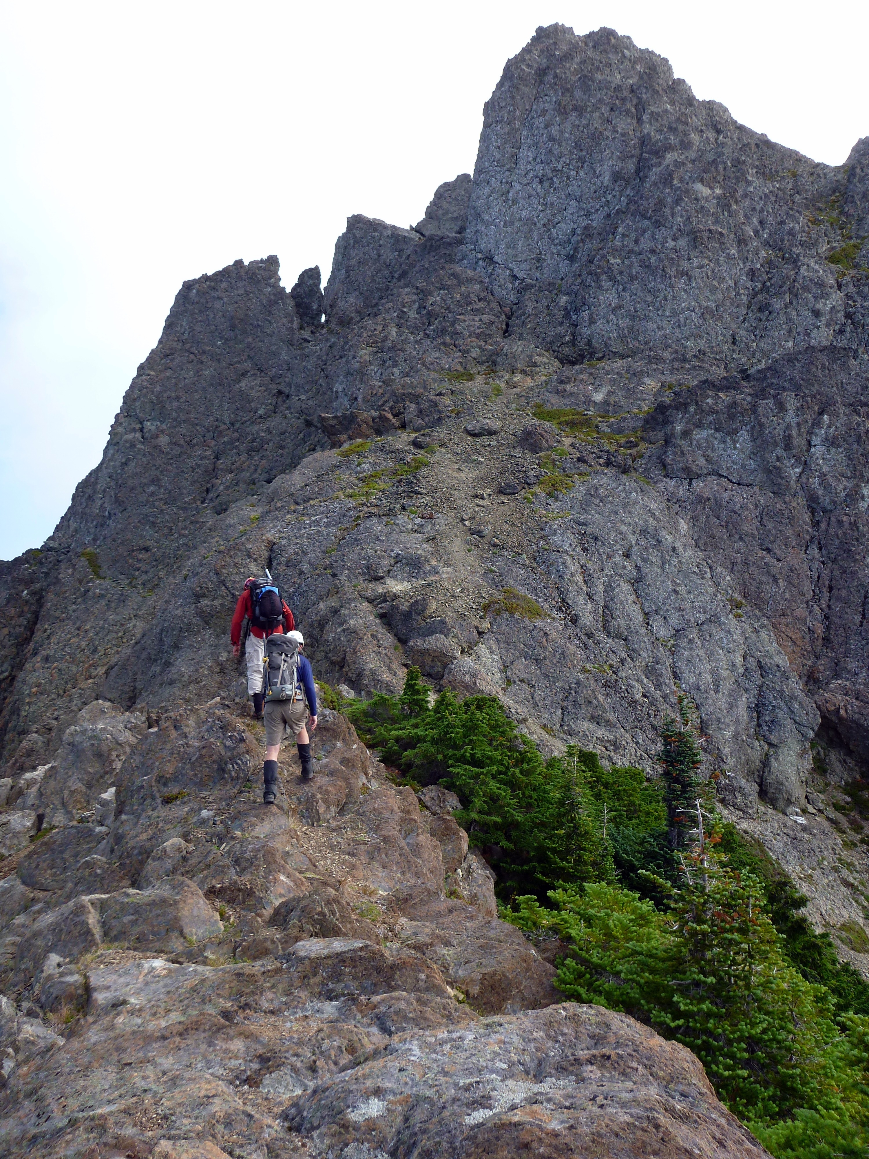
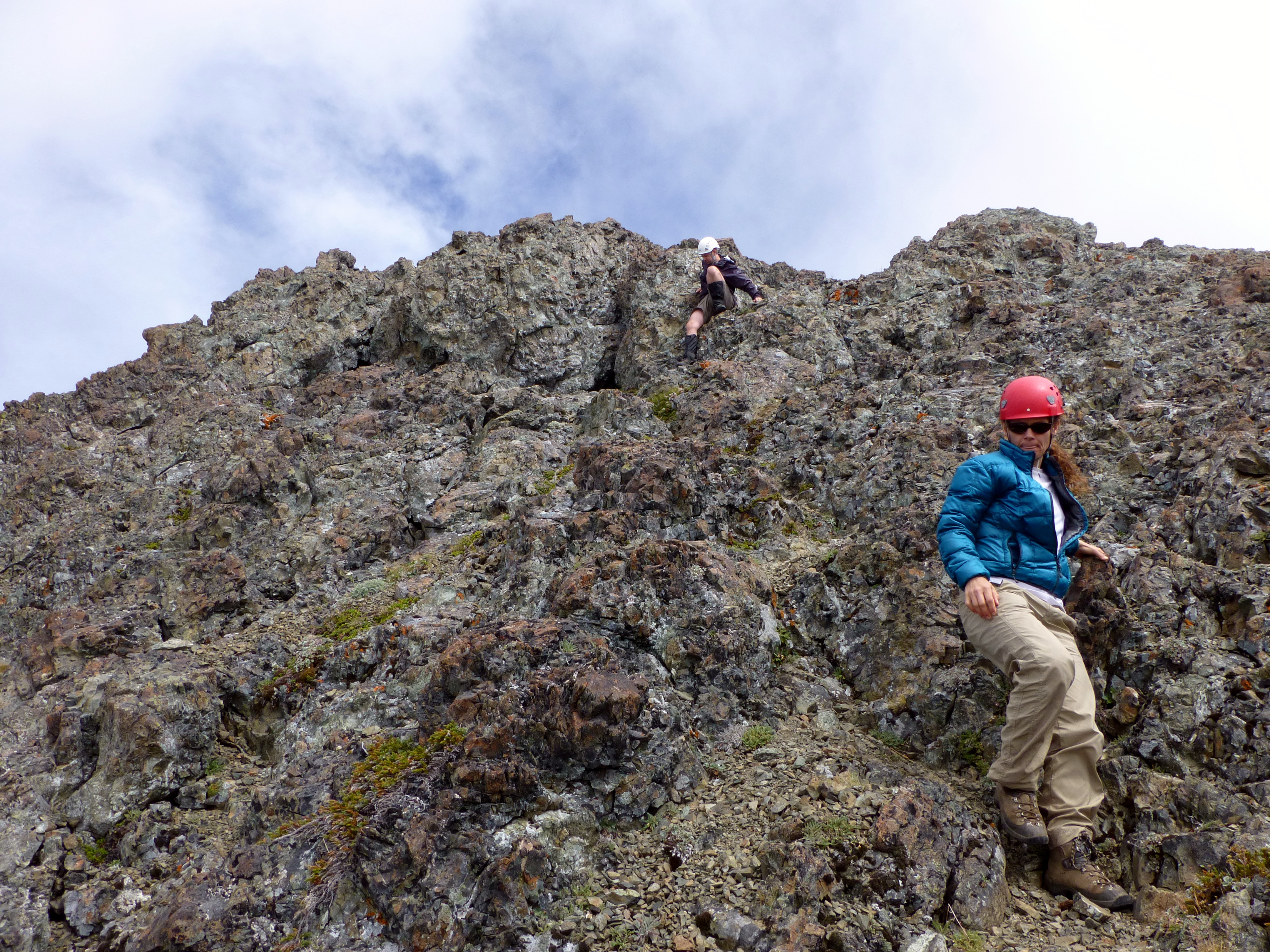
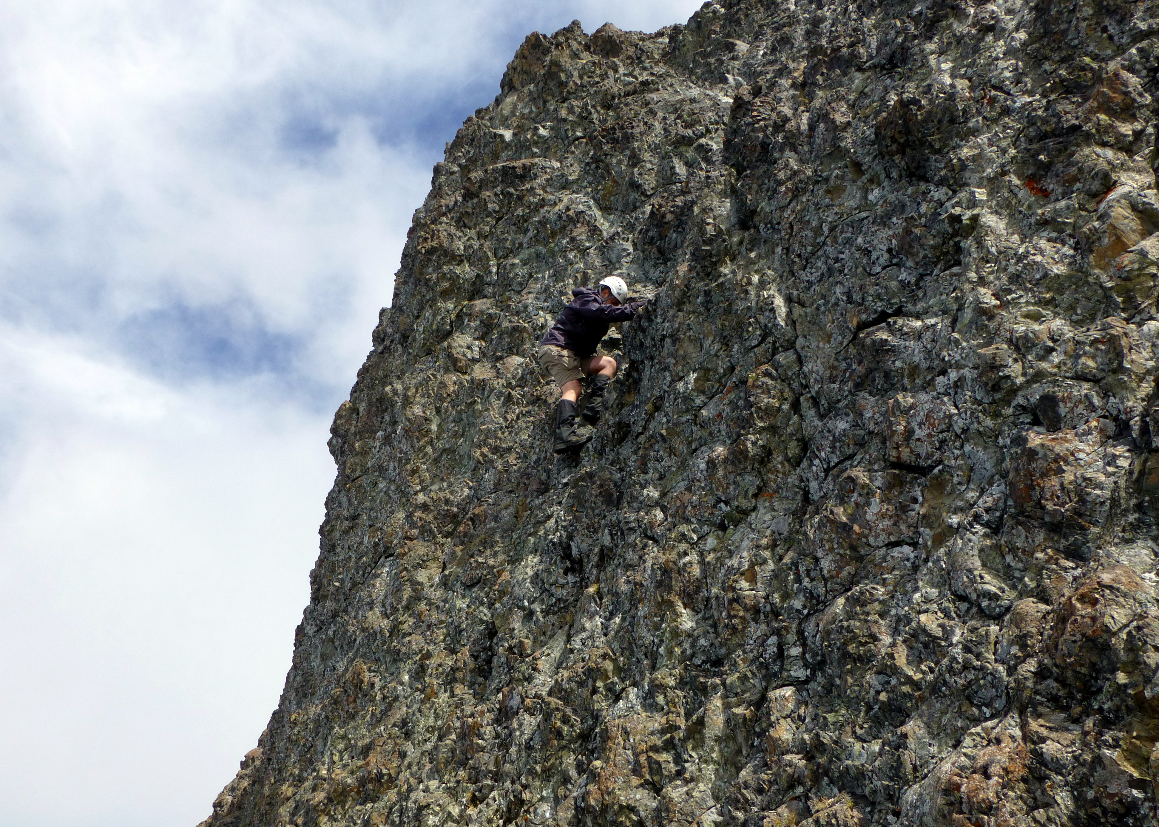
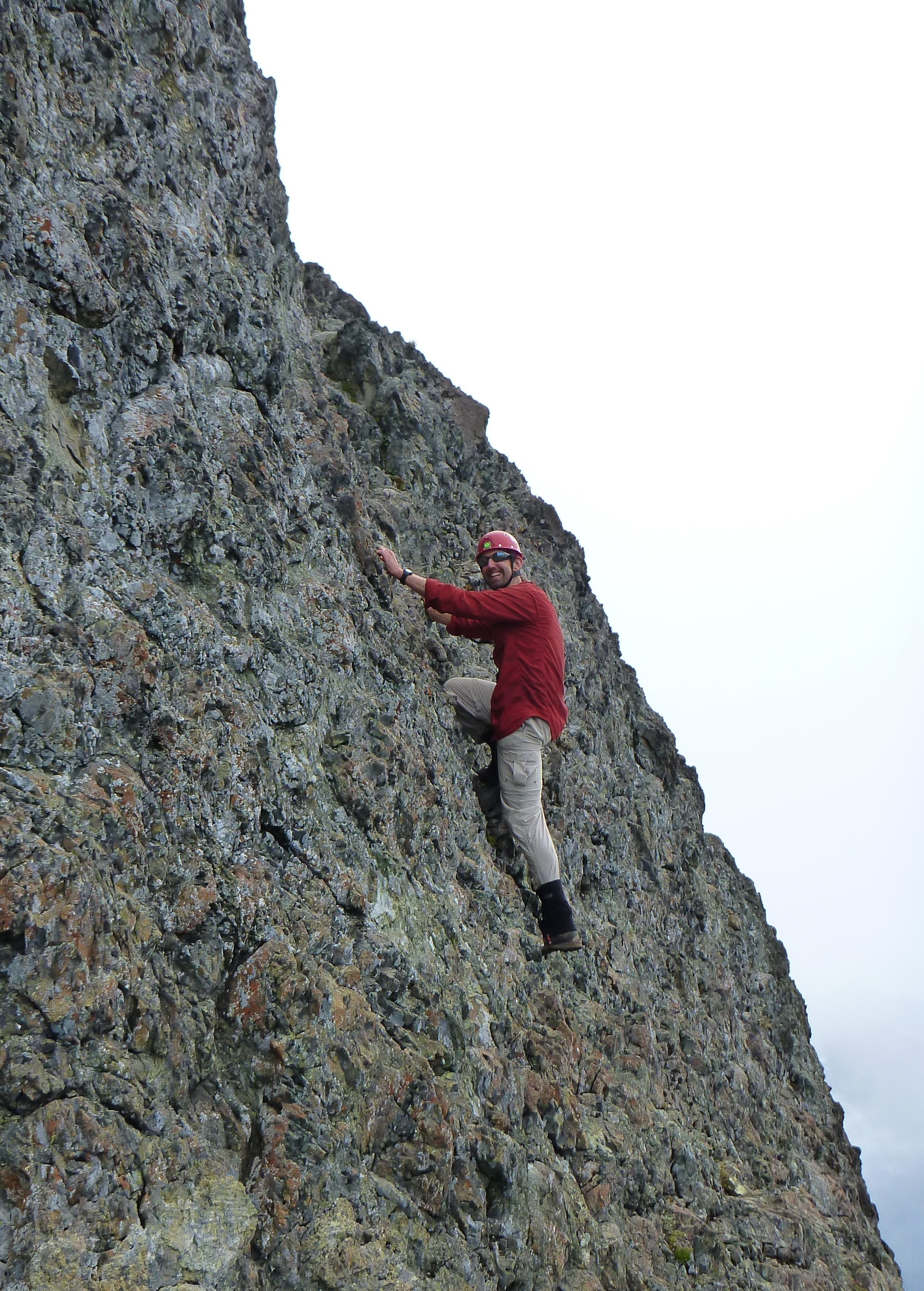 At the base of the summit block, we dropped our packs.
Mark led the way up to the top.
At the base of the summit block, we dropped our packs.
Mark led the way up to the top.
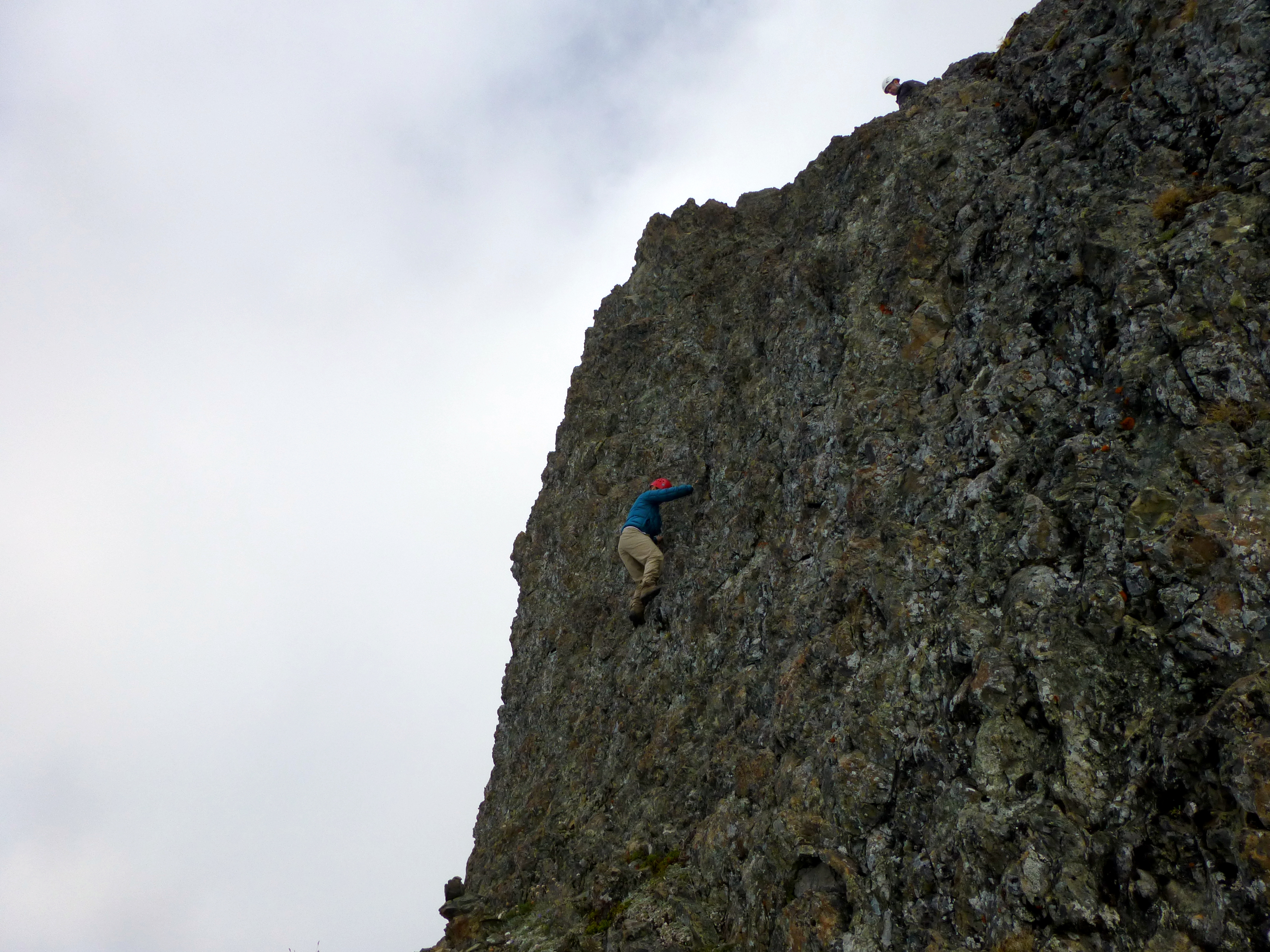
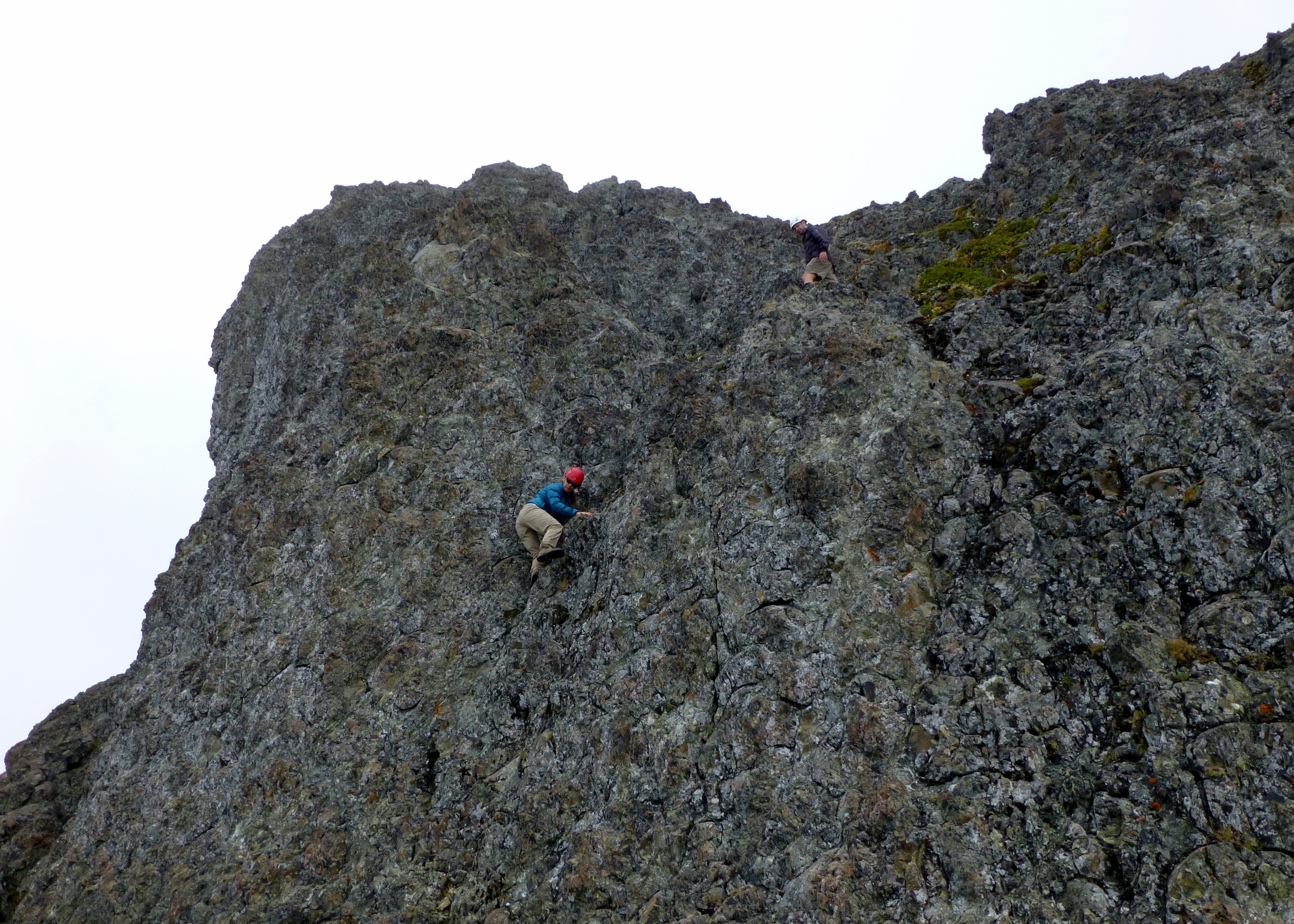
 Once Mark was on top of the summit block (and still about 50 feet from the actual summit), he turned around and took some shots of us climbing up to the summit behind him.
 (Above) Alice scaling up the summit block.
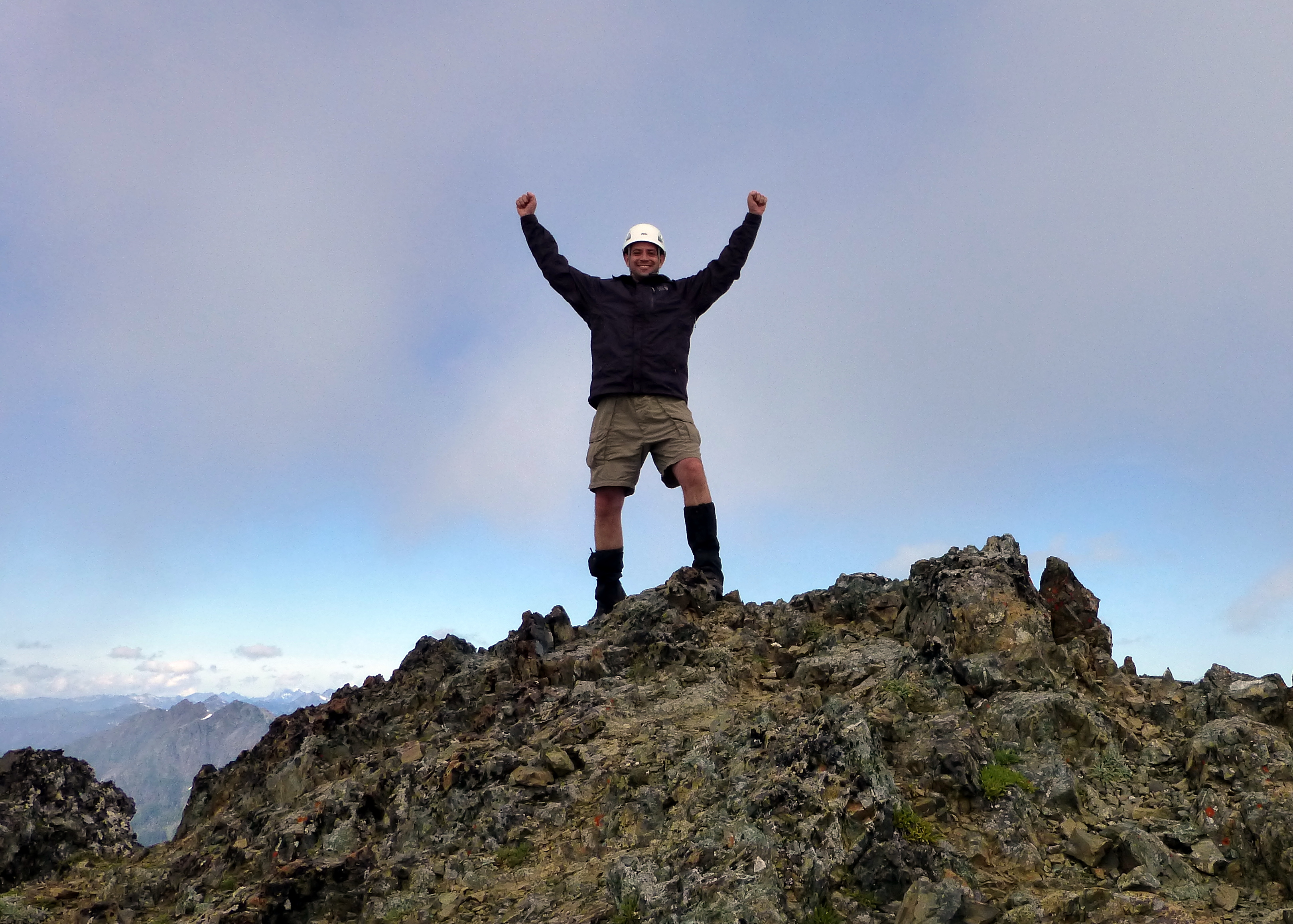 Oh yeah!
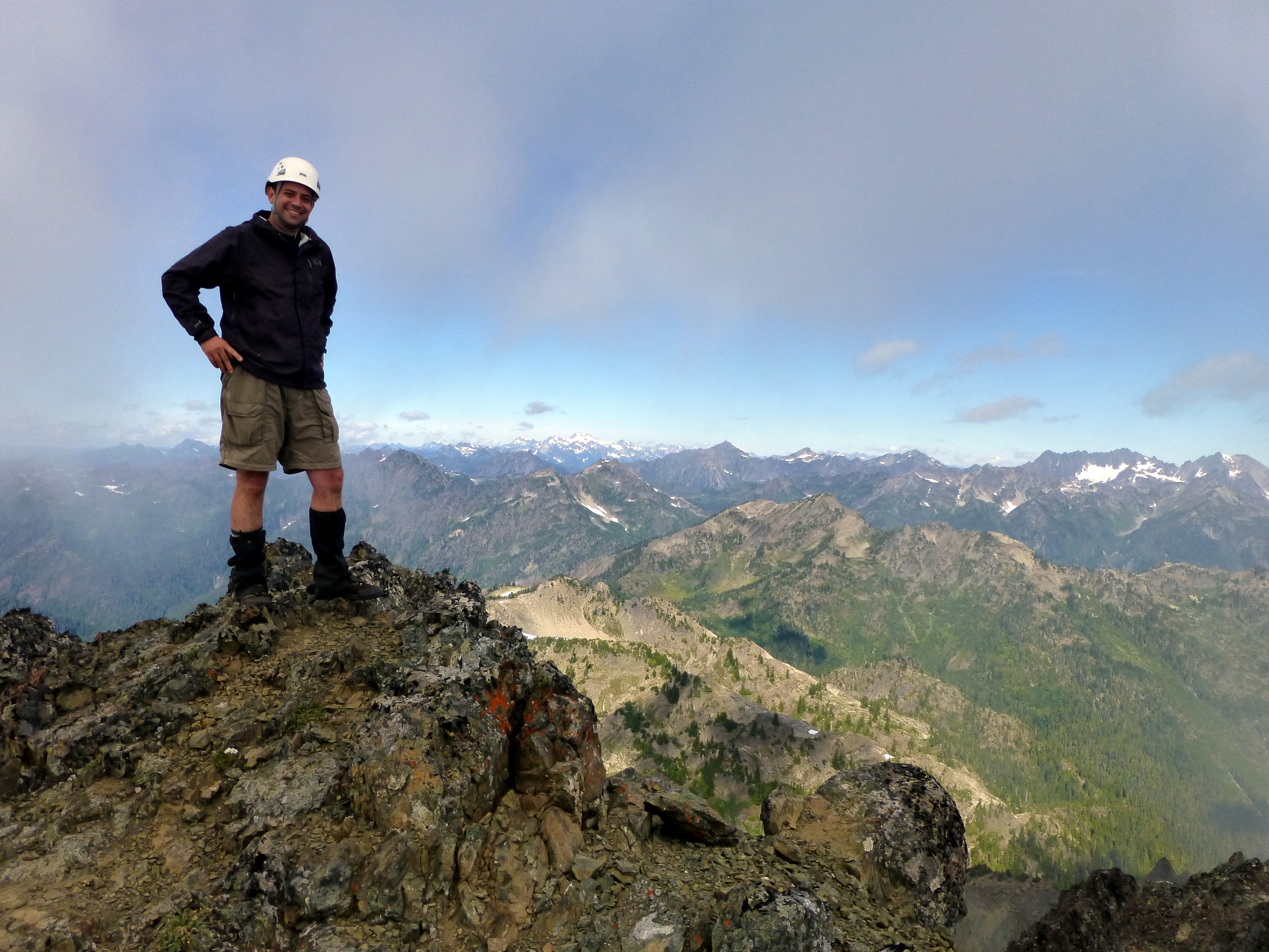
 A view to the northeast, with Scout Lake in the distance, near the upper center of the photo.
That rocky promontory on the left is the other summit of Mt. Stone. I probably won't be visiting that one.
A view to the northeast, with Scout Lake in the distance, near the upper center of the photo.
That rocky promontory on the left is the other summit of Mt. Stone. I probably won't be visiting that one.
Video loading... Please be patient
 Back down the summit block...
 All four limbs and a good sense of balance were required for the downward scramble.
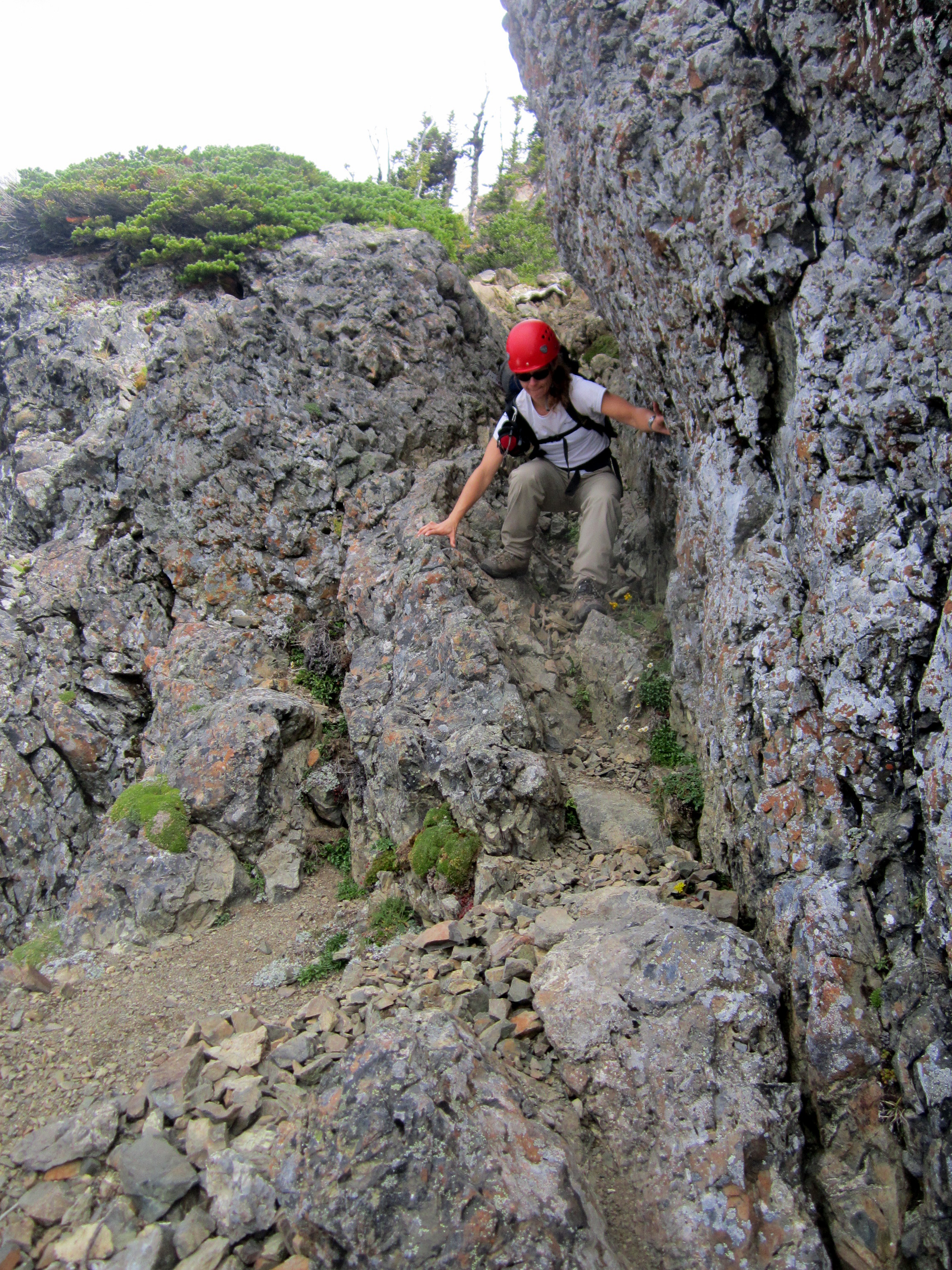
 Steep!
 Steep scree!
Deep (and steep) scree is kind of fun and easy to descend, actually. You can plunge-step, much like soft snow and slide down without too much effort.
However, every once in a while we would get to a spot where the scree was really shallow, and it was more like trying to walk on a thin layer of marbles.
Steep scree and talus can be kind of tricky. I might have to get myself some poles. I think I'm about the last climber I know (over the age of 30) who doesn't use poles.
Steep scree!
Deep (and steep) scree is kind of fun and easy to descend, actually. You can plunge-step, much like soft snow and slide down without too much effort.
However, every once in a while we would get to a spot where the scree was really shallow, and it was more like trying to walk on a thin layer of marbles.
Steep scree and talus can be kind of tricky. I might have to get myself some poles. I think I'm about the last climber I know (over the age of 30) who doesn't use poles.
 After a while we got back down to the benches that the Lake of the Angels and the Pond of the False Prophets are on.
We had a brief break and then began the (fairly agonizing) descent down the (insanely steep) trail.
After a while we got back down to the benches that the Lake of the Angels and the Pond of the False Prophets are on.
We had a brief break and then began the (fairly agonizing) descent down the (insanely steep) trail.
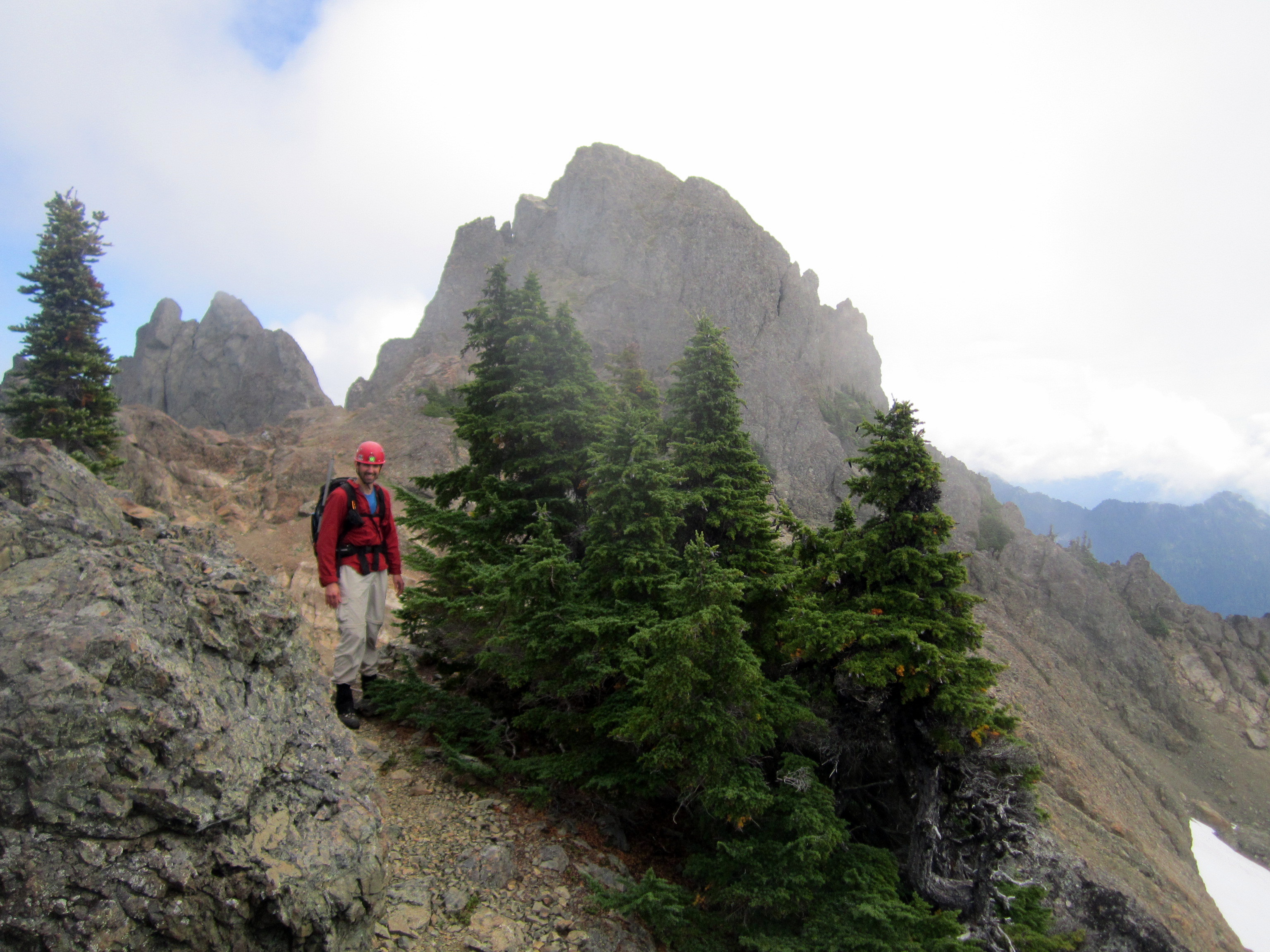
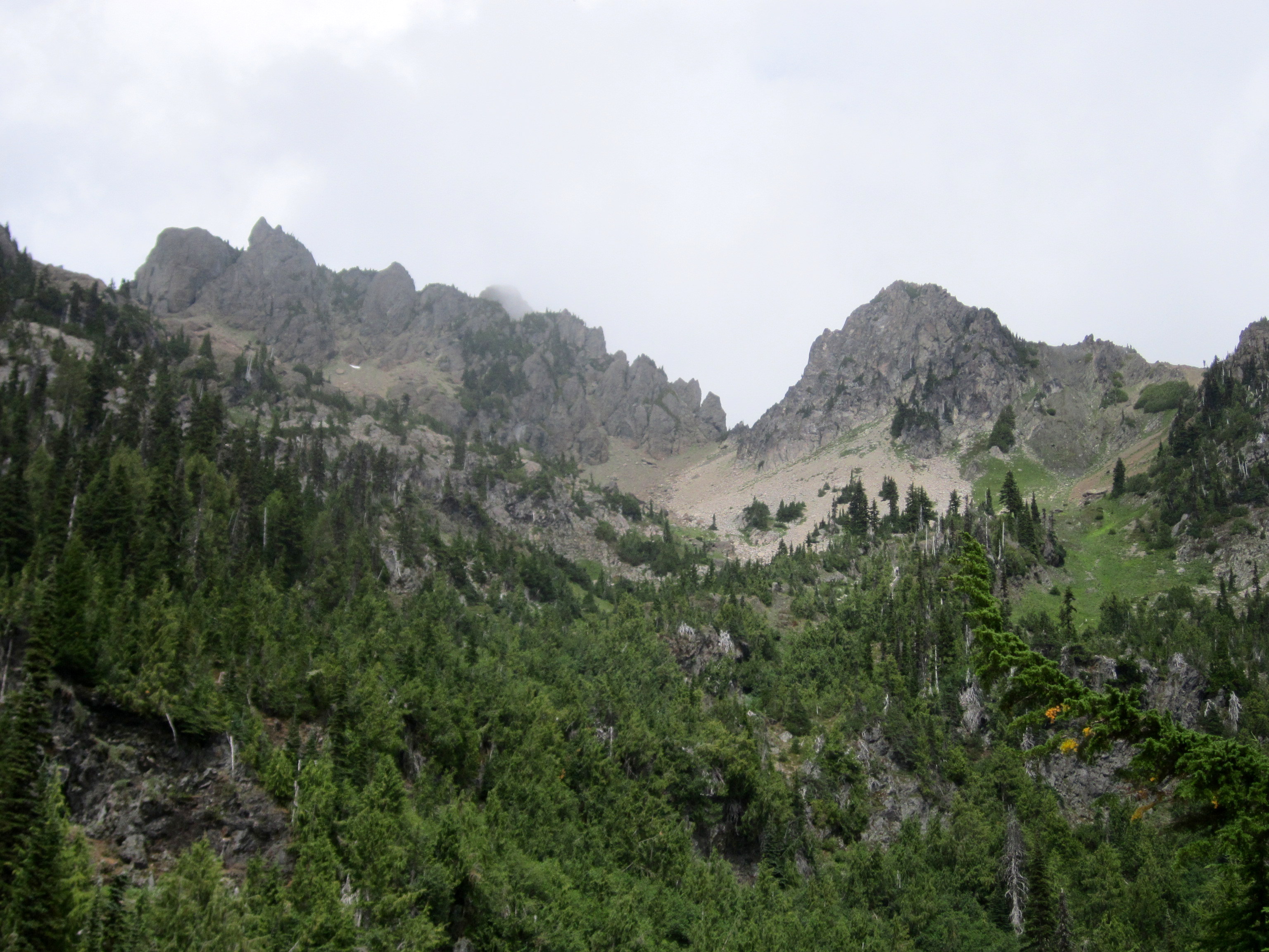 This photo shows the cliffs that wrap around the summit block, just on on the left side of the prominent saddle.
Better yet, the photo even shows the summit block, just barely peeking through the clouds behind the cliffs near the center-left of the photo.
We got back down to the car at about 4:00 or so. We did well. It was a long day, with over 5000 feet of climbing. Whew!
Big thanks again to Mark and Alice for showing me the way to the top of Mt. Stone and helping me tie up a long-neglected loose end!
This photo shows the cliffs that wrap around the summit block, just on on the left side of the prominent saddle.
Better yet, the photo even shows the summit block, just barely peeking through the clouds behind the cliffs near the center-left of the photo.
We got back down to the car at about 4:00 or so. We did well. It was a long day, with over 5000 feet of climbing. Whew!
Big thanks again to Mark and Alice for showing me the way to the top of Mt. Stone and helping me tie up a long-neglected loose end!