Colchuck Peak June 8-9, 2013
View Larger Map
 We spent the first day driving up to the Leavenworth area and hit the trail at about 5:30 PM.
We hiked the four miles up to Colchuck Lake and found a place to throw down our bivies just as the sun was starting to go down.
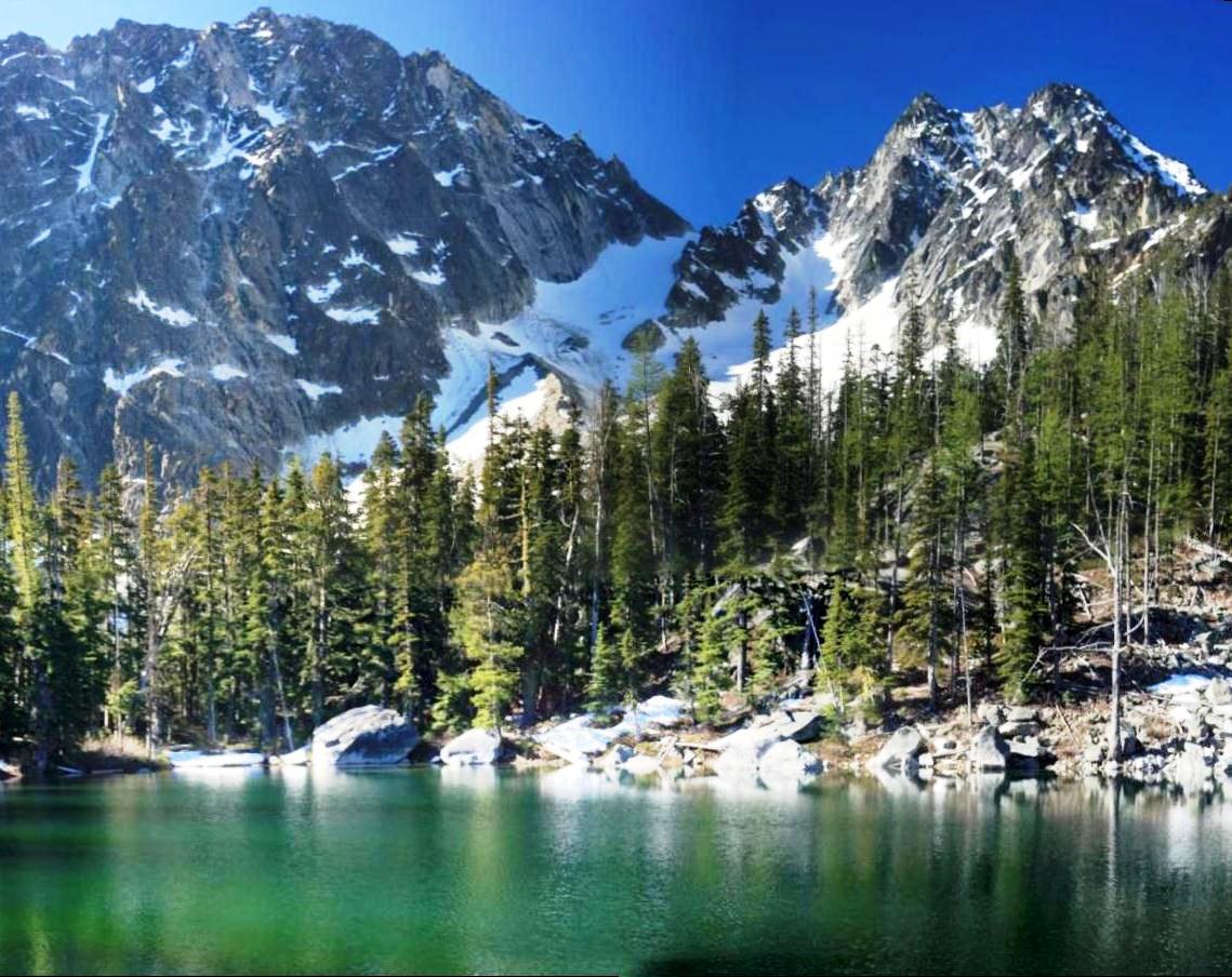
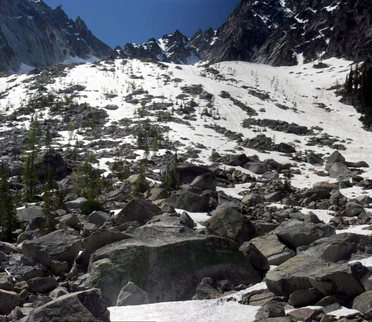
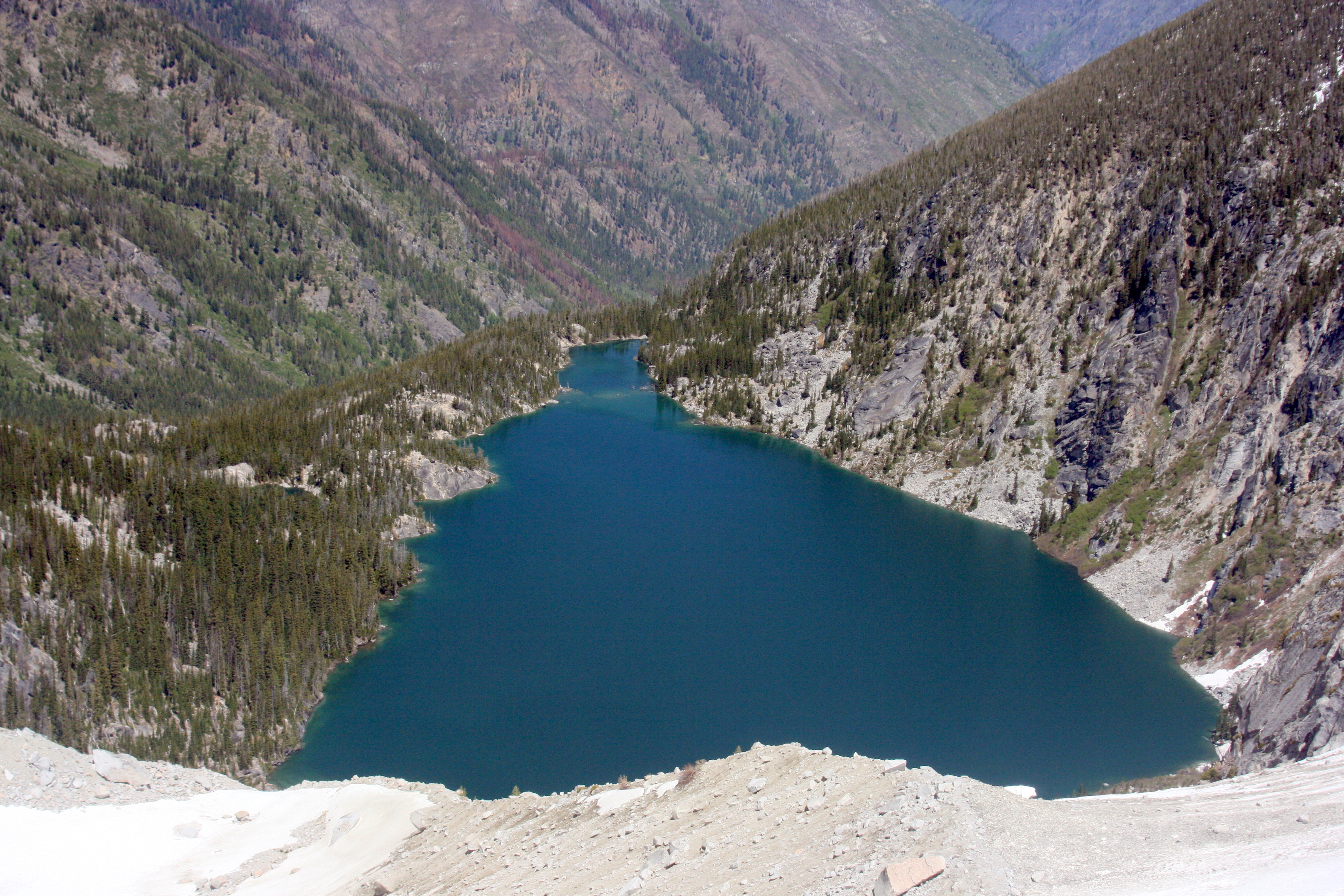
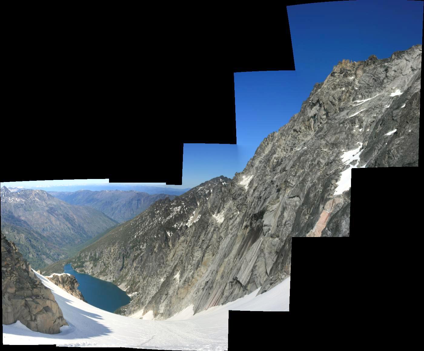
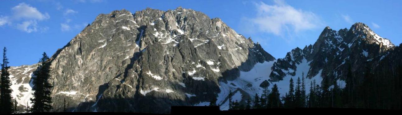
From our camp, we were able to see the route up to Colchuck Peak (shown above).
The route is up the snowy valley to the col (saddle), then to the right up to the top of Colchuck Peak.
We spent the first day driving up to the Leavenworth area and hit the trail at about 5:30 PM.
We hiked the four miles up to Colchuck Lake and found a place to throw down our bivies just as the sun was starting to go down.
From our camp, we were able to see the route up to Colchuck Peak (shown above).
The route is up the snowy valley to the col (saddle), then to the right up to the top of Colchuck Peak.
The peak on the left is the fearsome Dragontail. We'll save that one for another day.
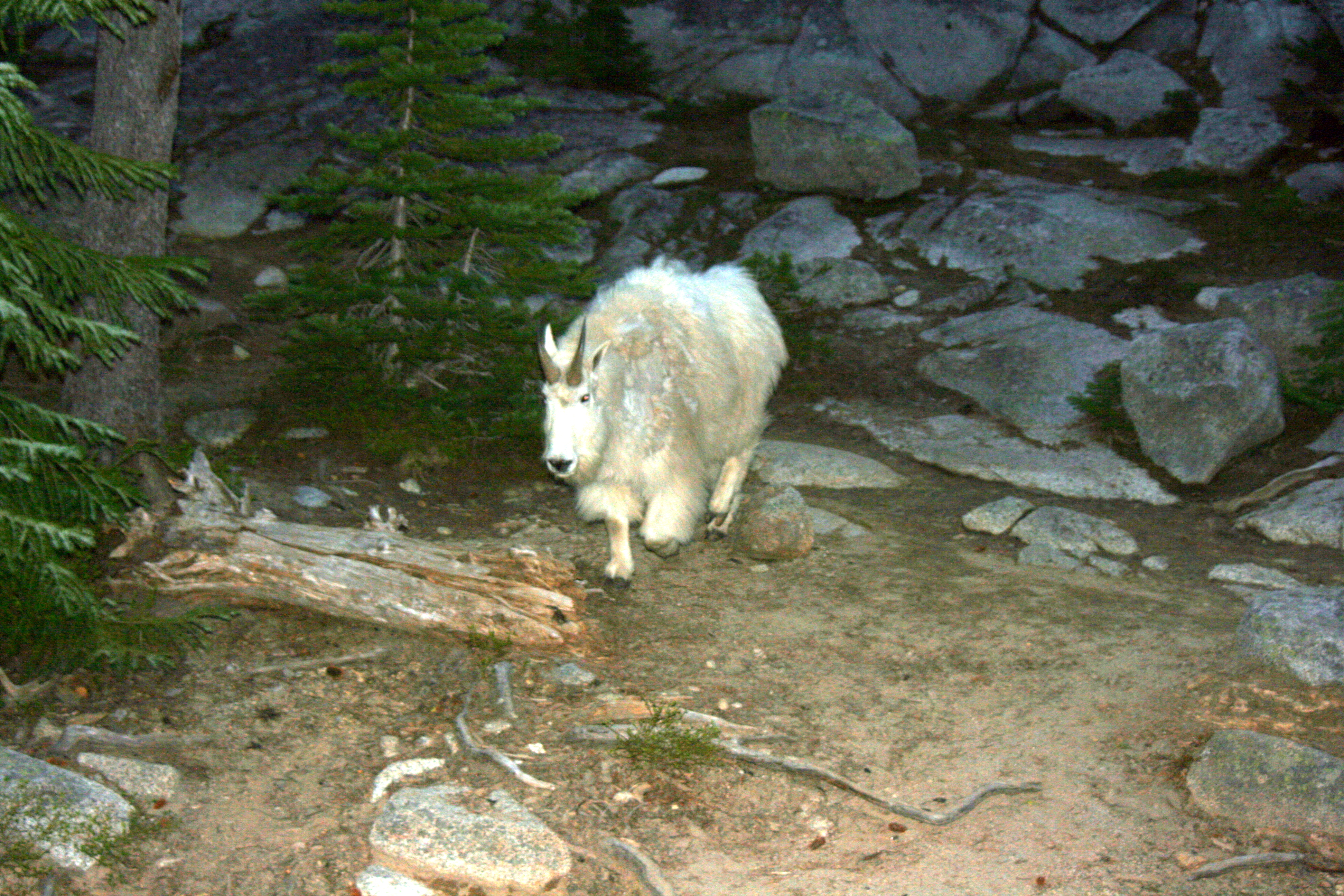
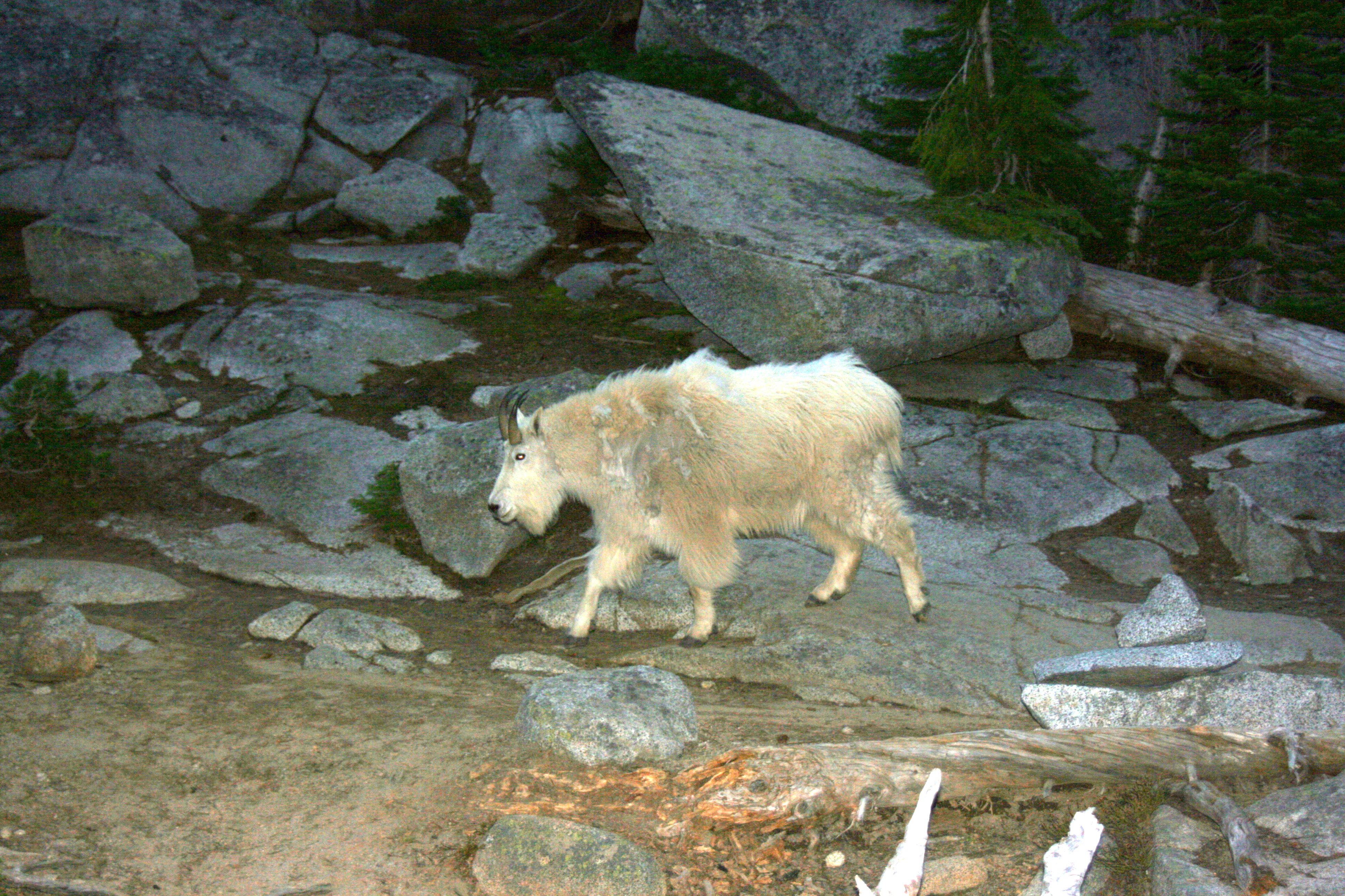 That evening, while we were scoping out the route, we were visited by a mountain goat.
He was losing his winter coat and looking kind of mangy.
I got fairly close to the goat and it ran past me, through our camp.
The hoofbeats on the ground were loud, reminding me of just how big these animals are.
That evening, while we were scoping out the route, we were visited by a mountain goat.
He was losing his winter coat and looking kind of mangy.
I got fairly close to the goat and it ran past me, through our camp.
The hoofbeats on the ground were loud, reminding me of just how big these animals are.
DAY 2: Up to Colchuck Peak and back
As we appraoched the south end of the lake, we started picking out our route through the snowy boulder field at the base of the 2400 foot tall slope.
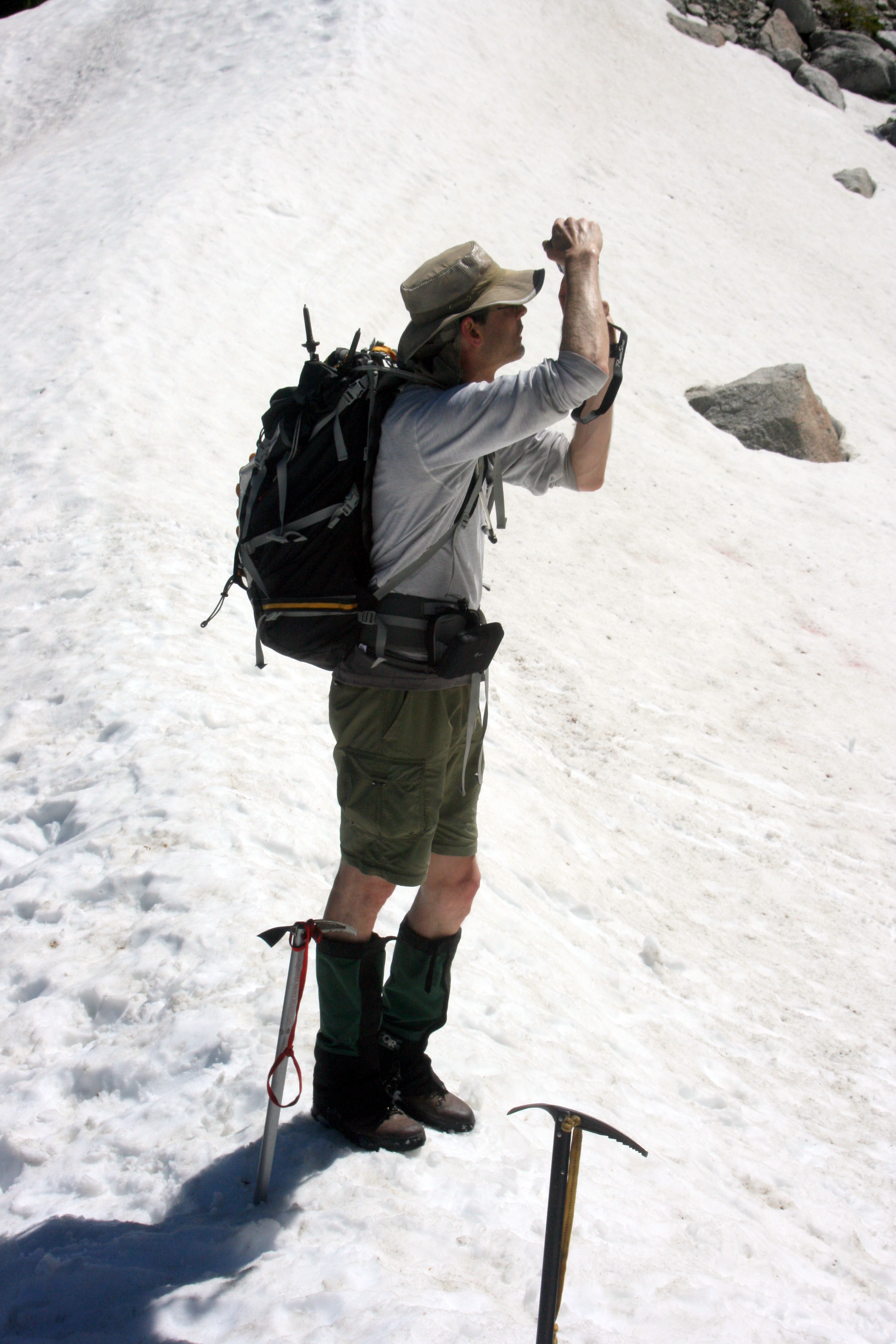 My ice axe in the fore-ground.
Kevin photo-bombed this otherwise great shot of my ice axe.
He was looking back and taking some pictures of the lake.
My ice axe in the fore-ground.
Kevin photo-bombed this otherwise great shot of my ice axe.
He was looking back and taking some pictures of the lake.
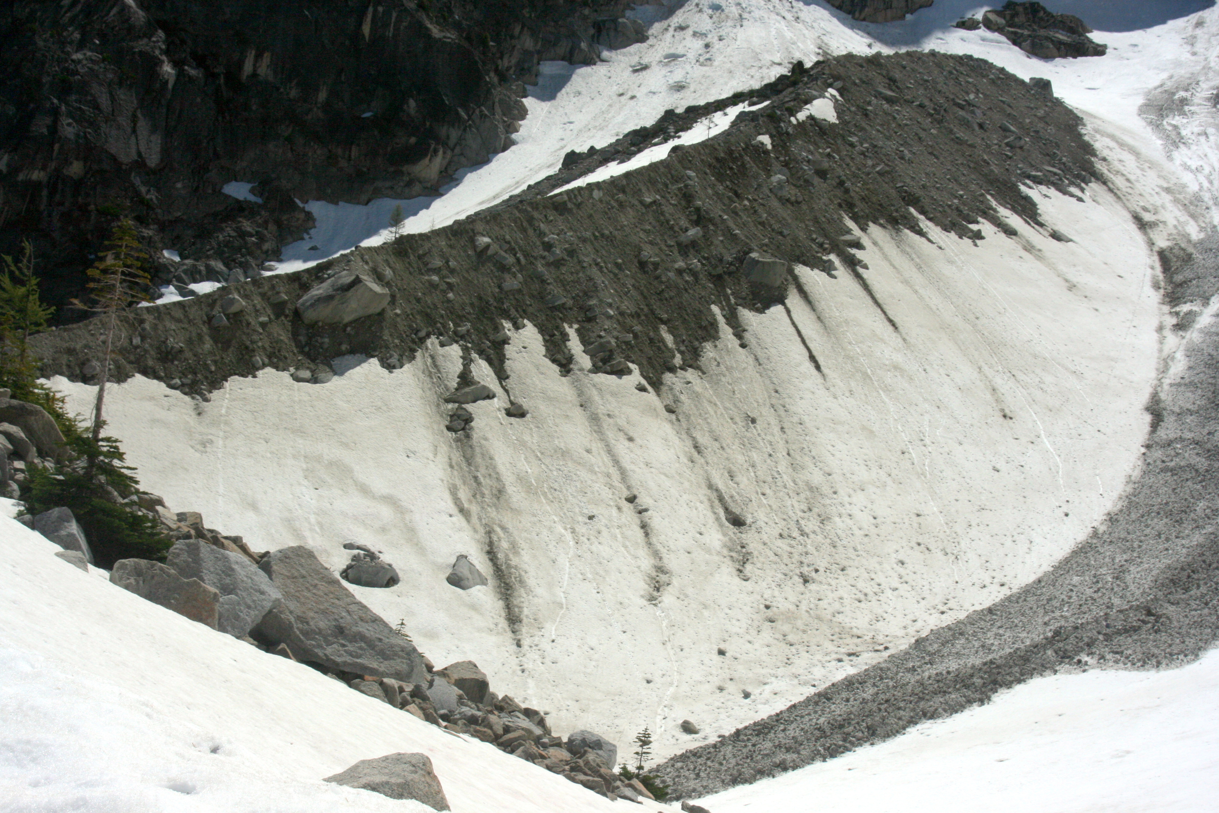
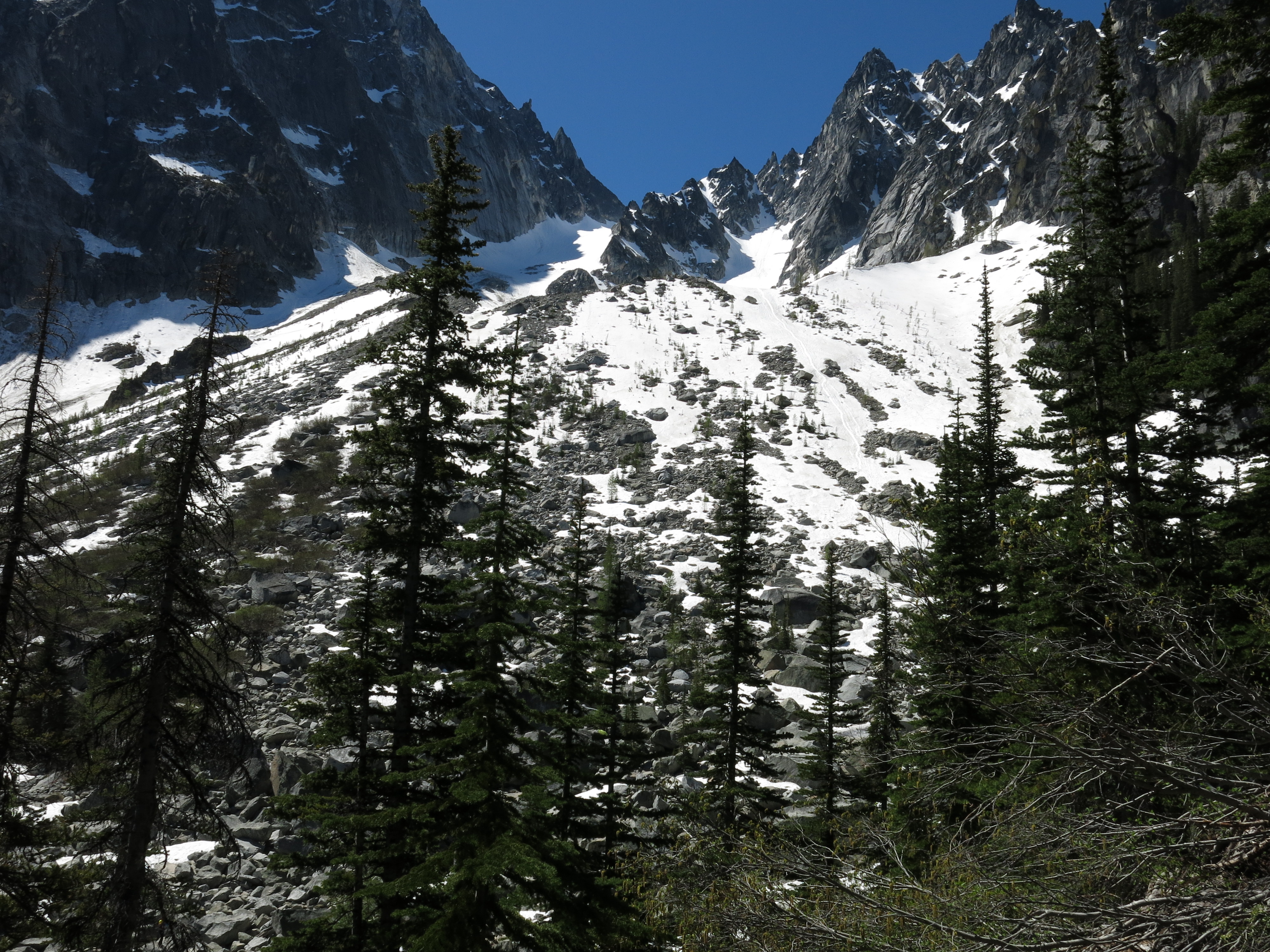
We climbed the first 1000 feet or so, and found a small basin mid-way up the slope. The moraine on the left was pretty impressive.
The route ahead was pretty long and steep. We could hear rocks falling off of Dragontail Peak almost continuously.
A look back to the lake.
We could just barely see our camp site on the left side of the lake, where the smaller lake was starting to peek out.
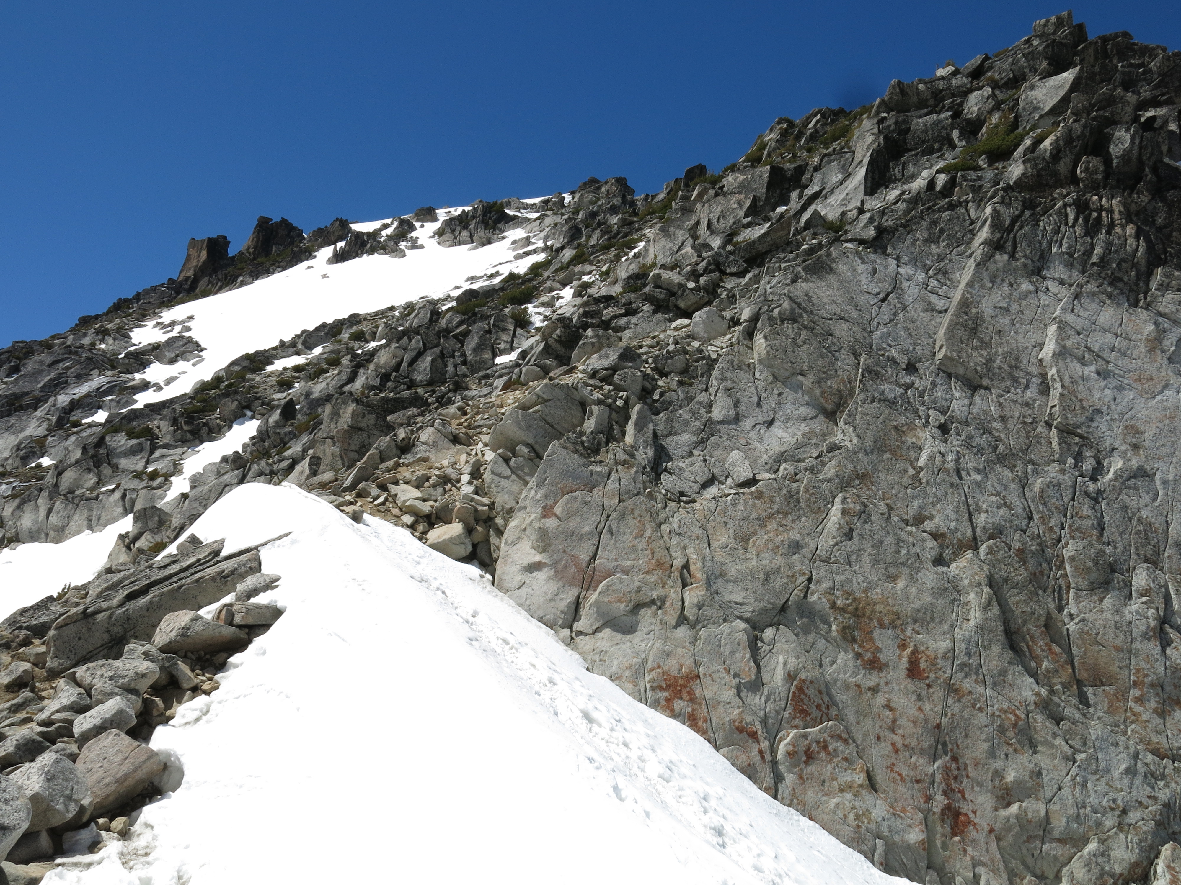
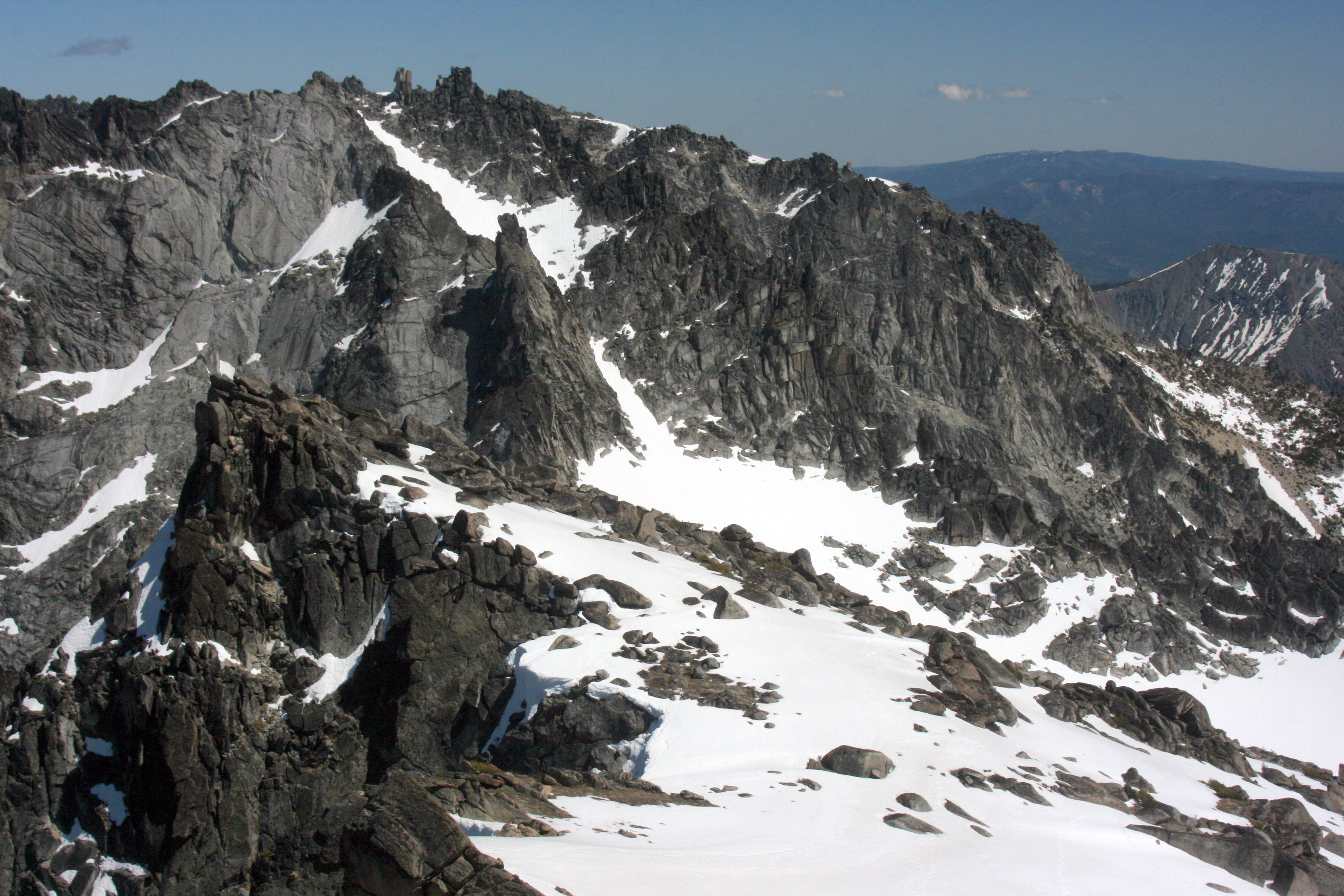
 Eyes ahead. That's our route.
We put on our helmets and continued.
Eyes ahead. That's our route.
We put on our helmets and continued.
 Made it! (About an hour later) That's me standing on the col, looking to the newfound views to the south.
Dragontail Peak is behind me.
Made it! (About an hour later) That's me standing on the col, looking to the newfound views to the south.
Dragontail Peak is behind me.
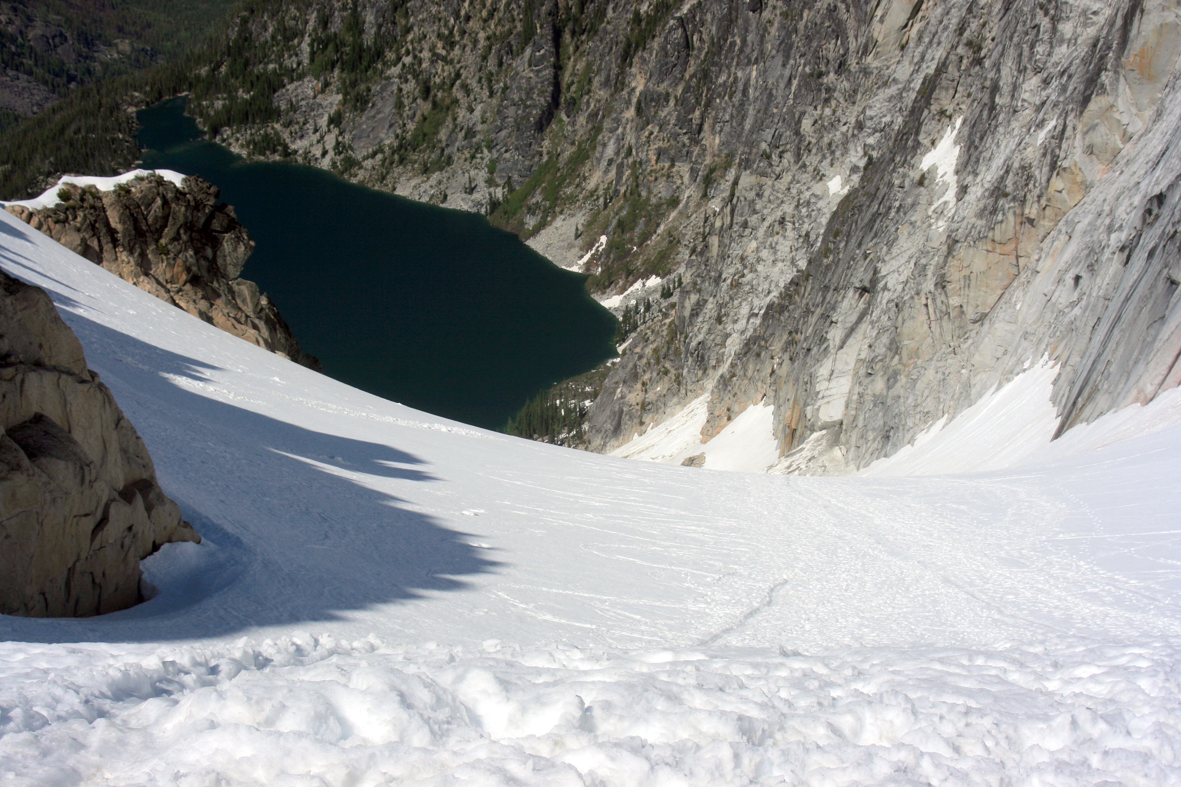 ..and looking back the way we came. That's going to be a great glissade!
The lake is about 2400 feet below.
 ..and looking up to the way ahead.
We'll stay to the right of that upper snowfield and pick our way up through the rocks toward the top.
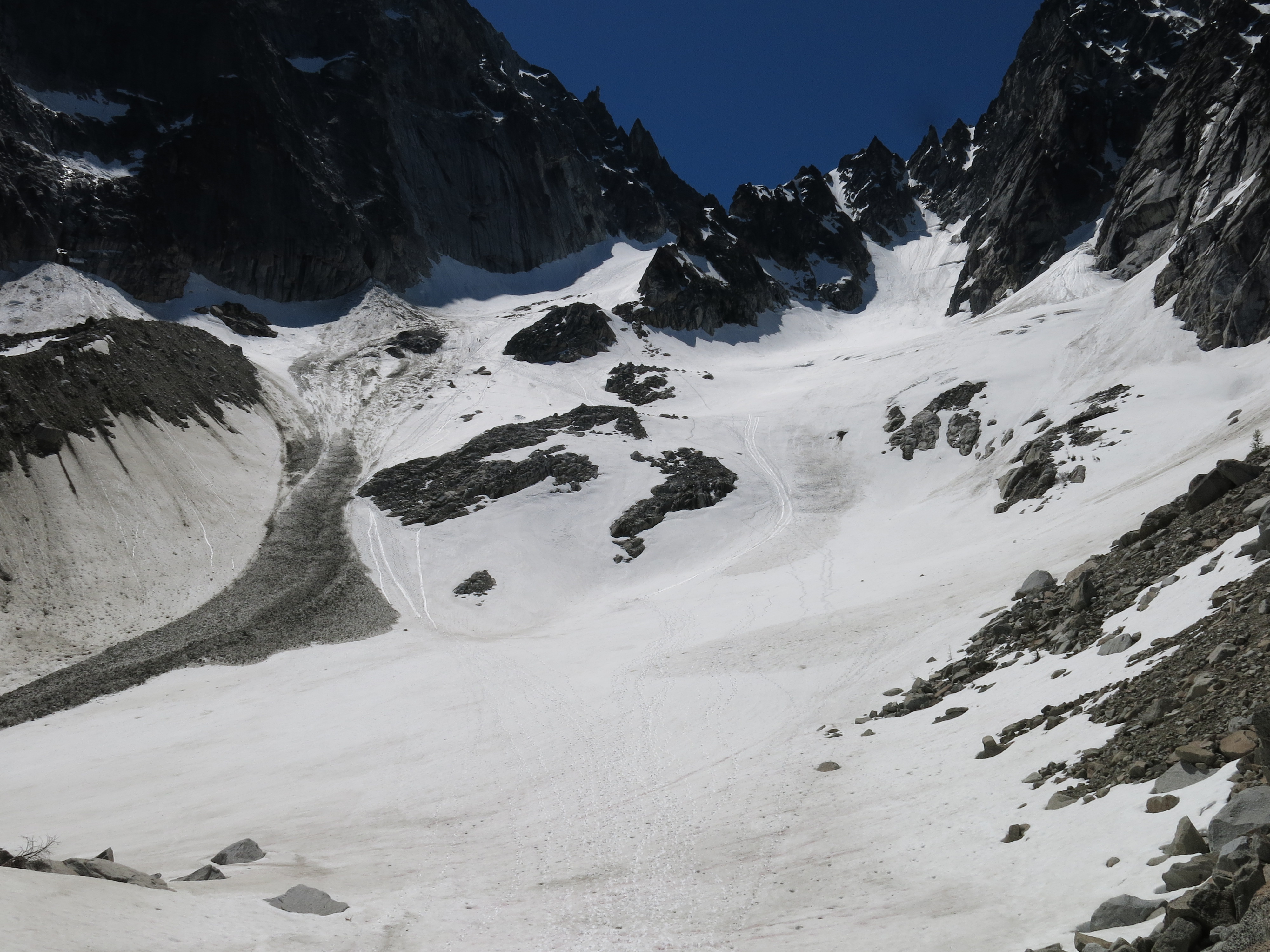
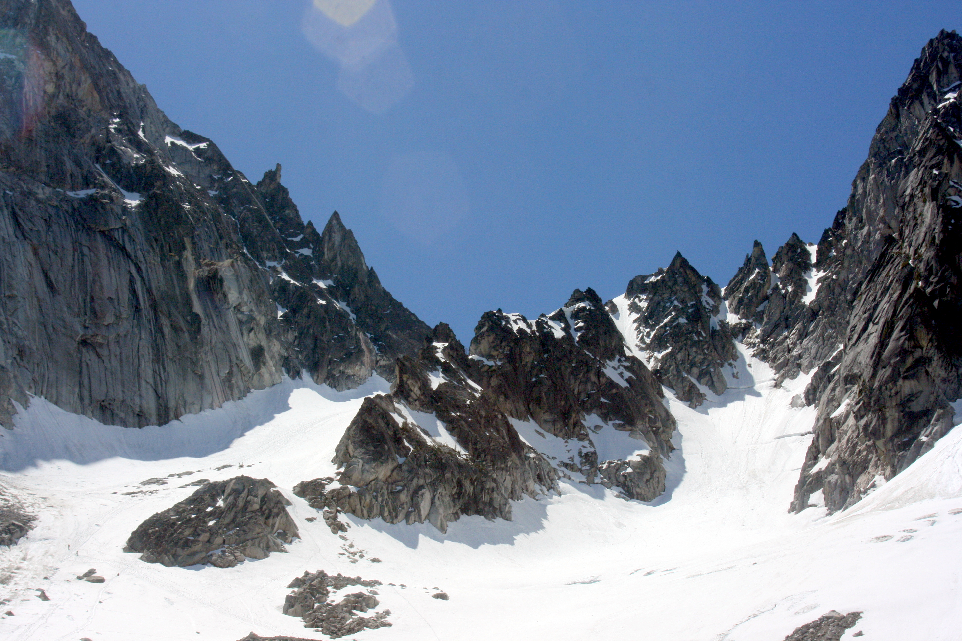
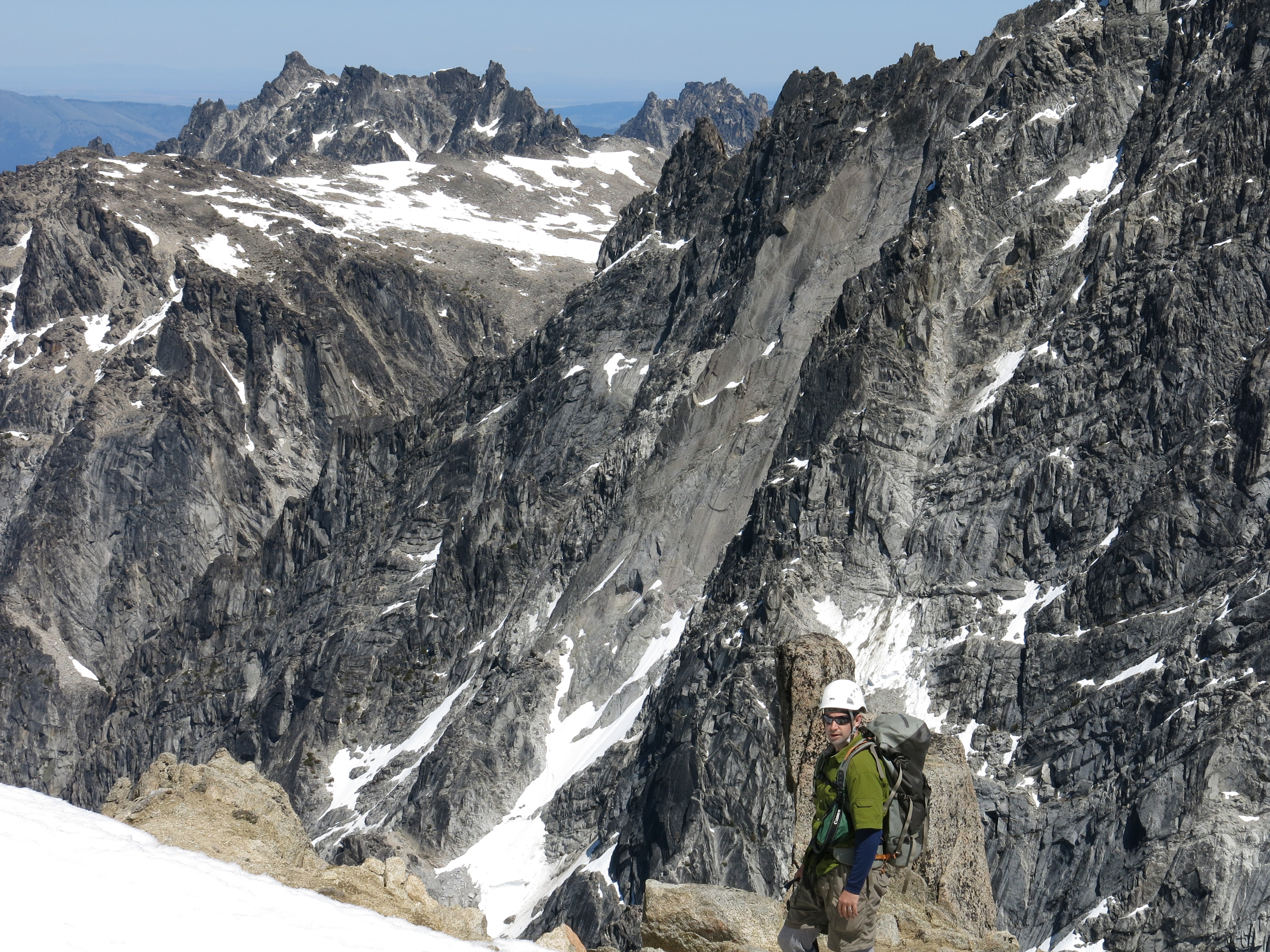
..and looking up to the way ahead.
We'll stay to the right of that upper snowfield and pick our way up through the rocks toward the top.
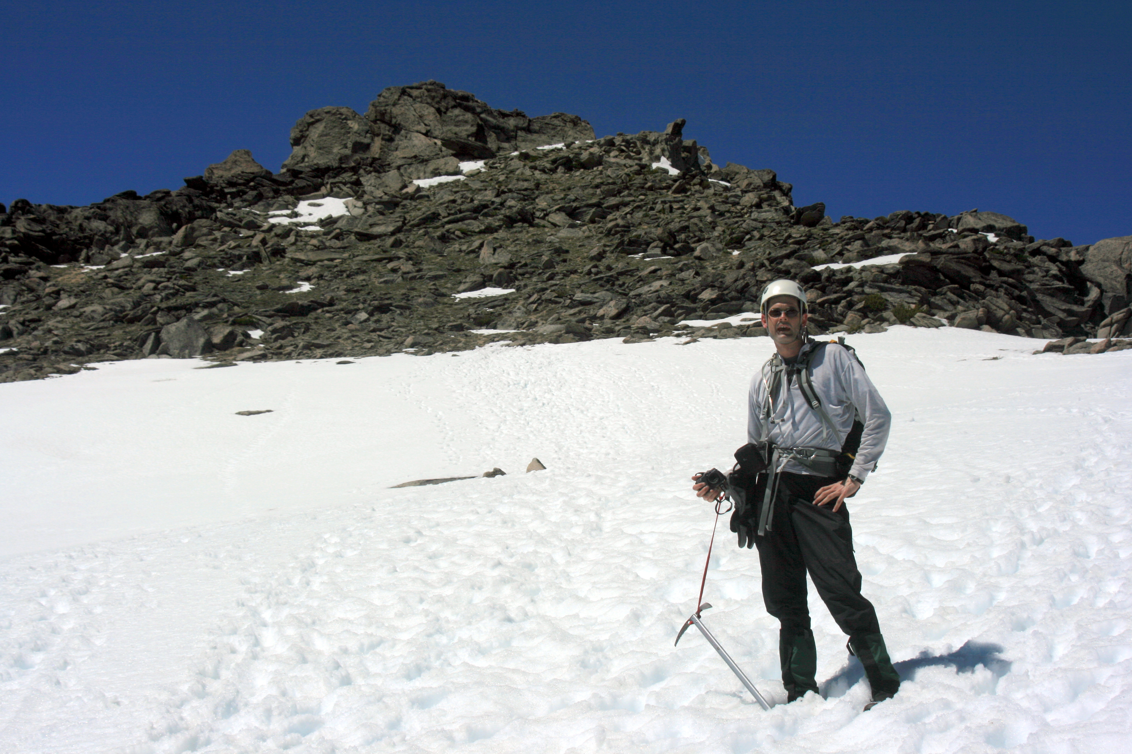
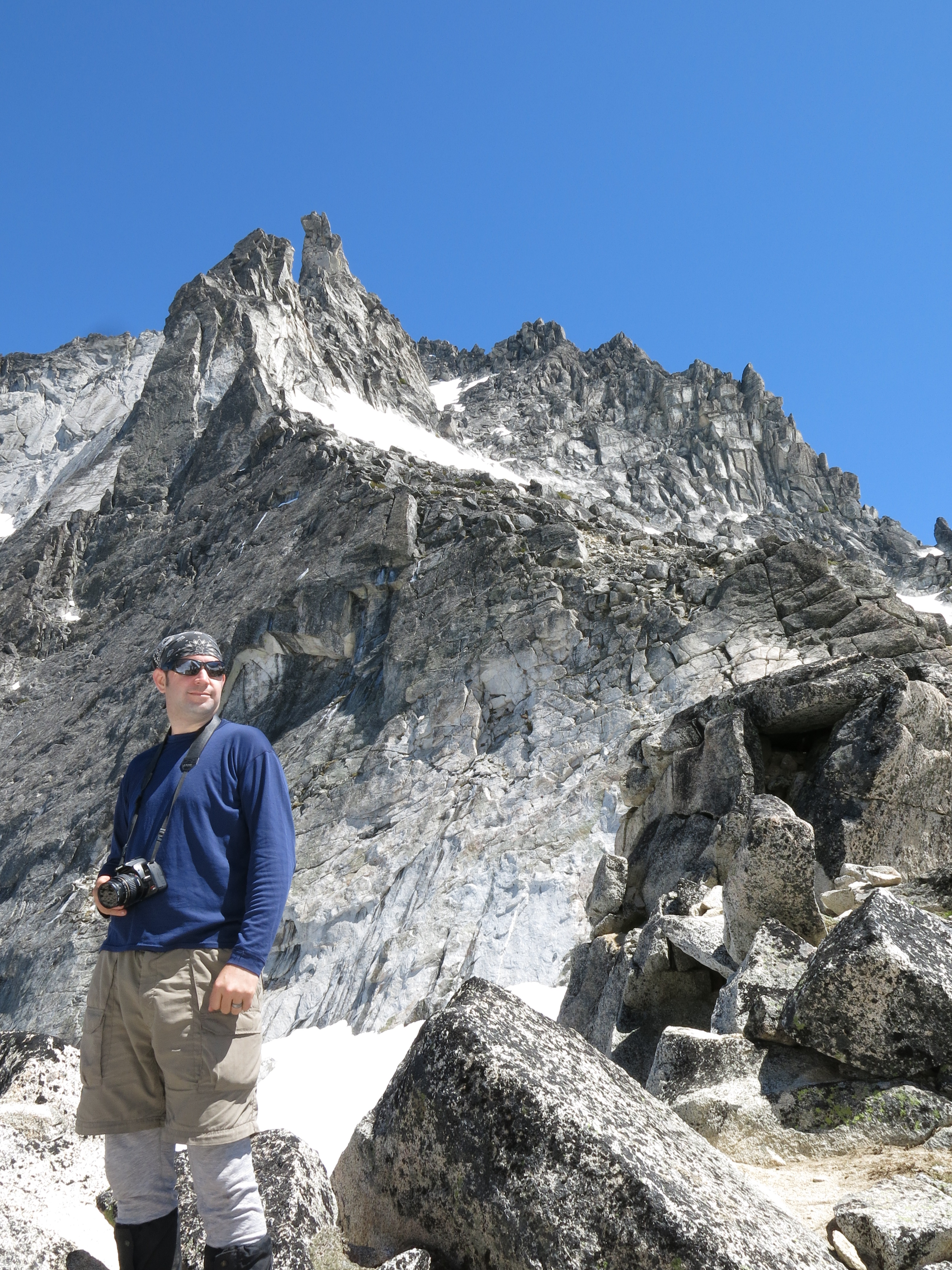
 A brief pause on the snowy bench right below the summit (pictured behind Kevin).
 Kevin is on the summit, taking some photos. I'm almost there...
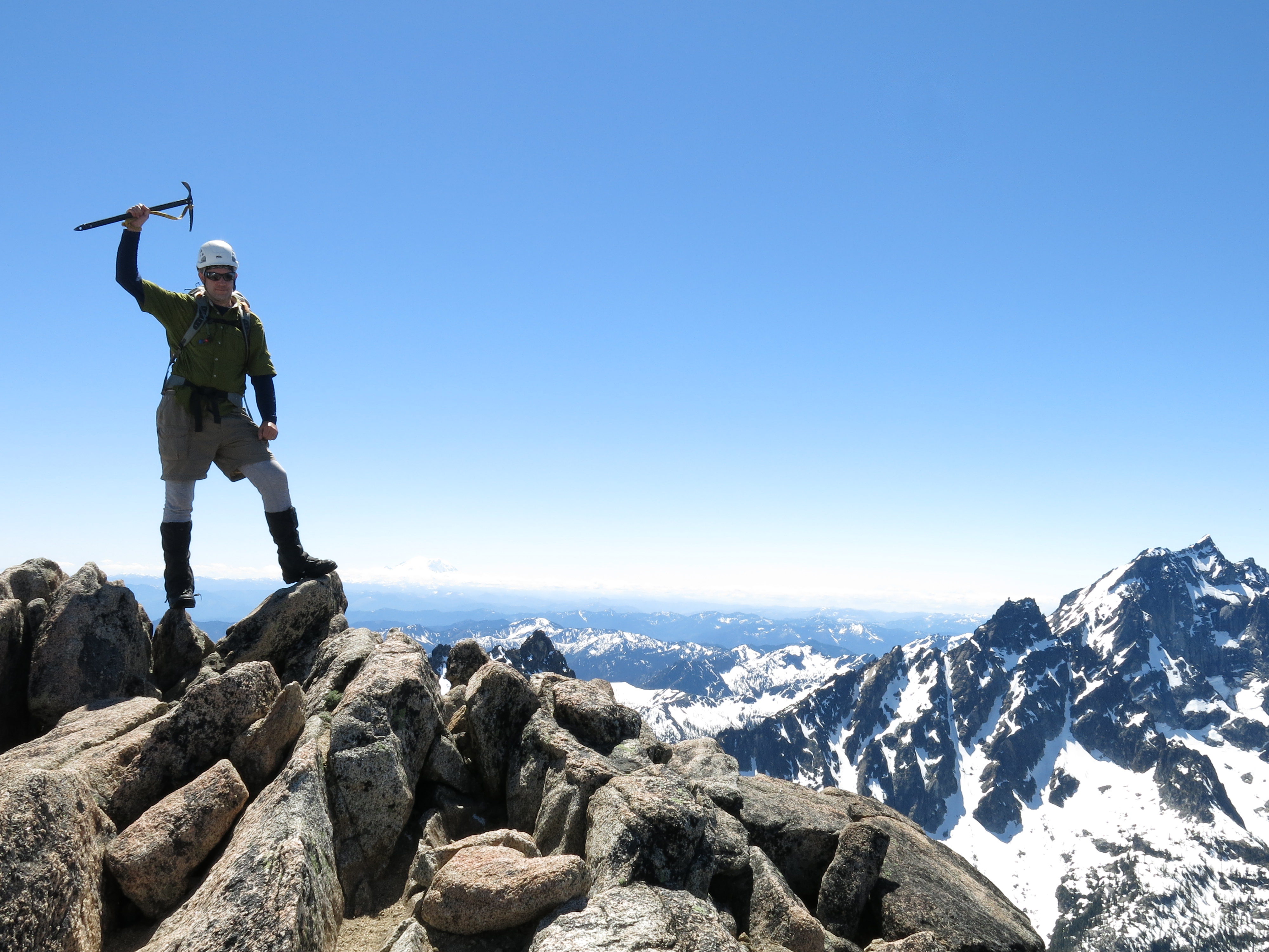 Rahhrr!!! Summit Glory!
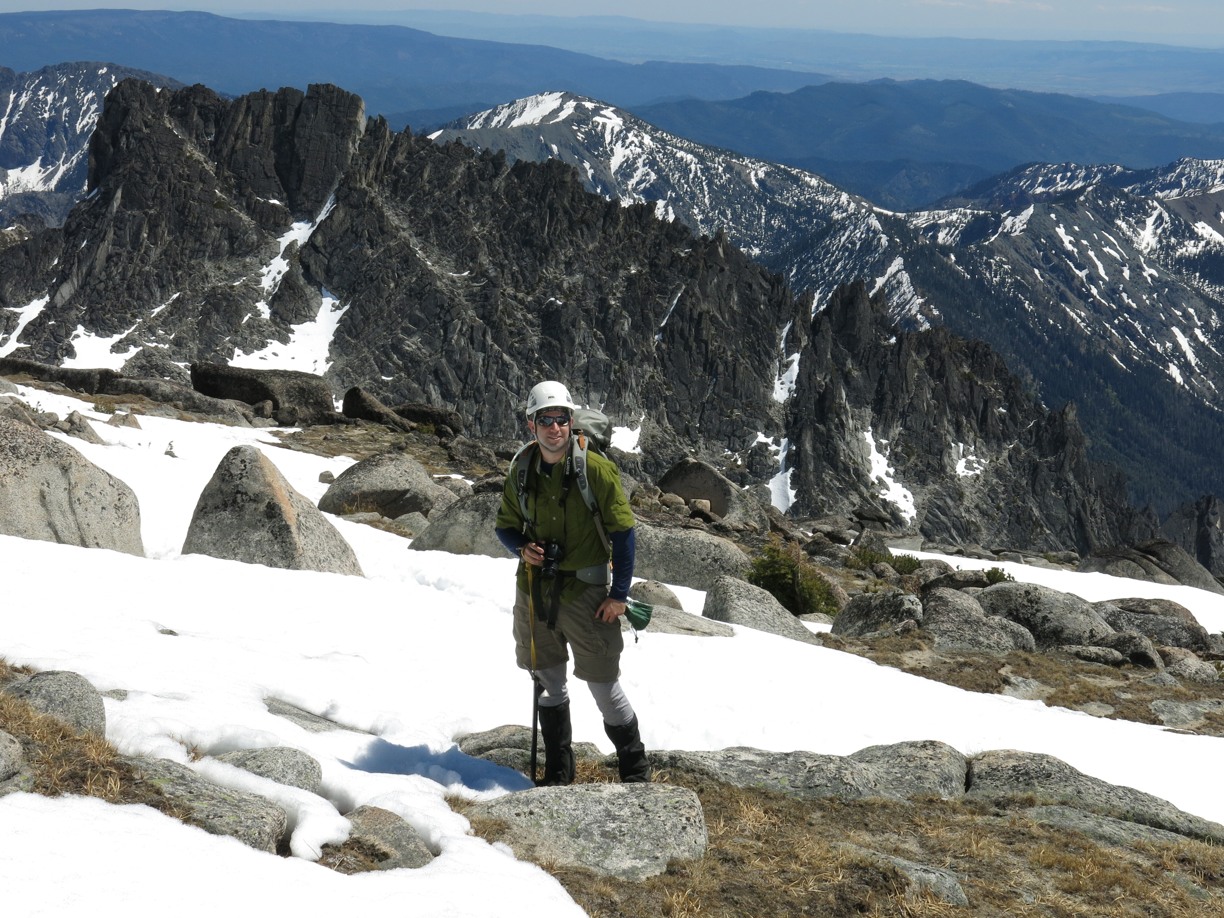
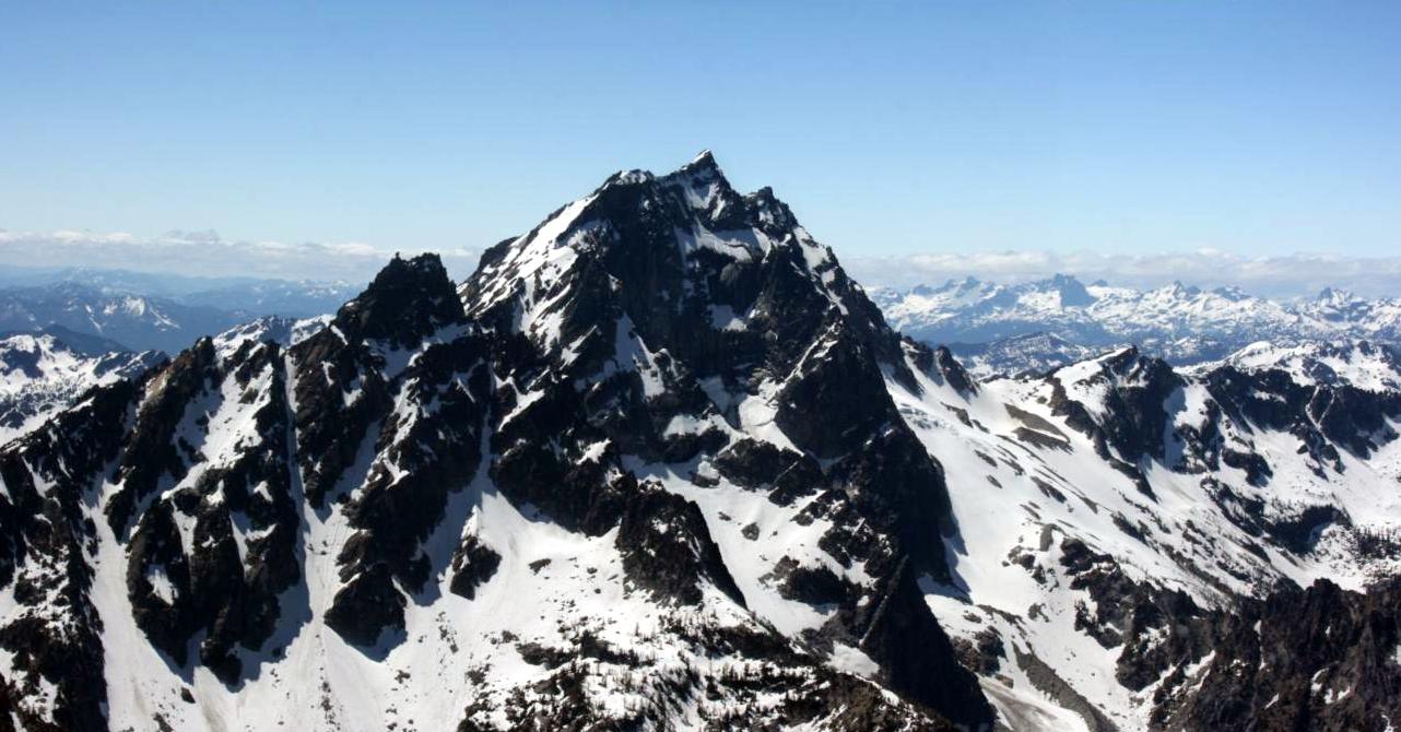 Mt. Stewart
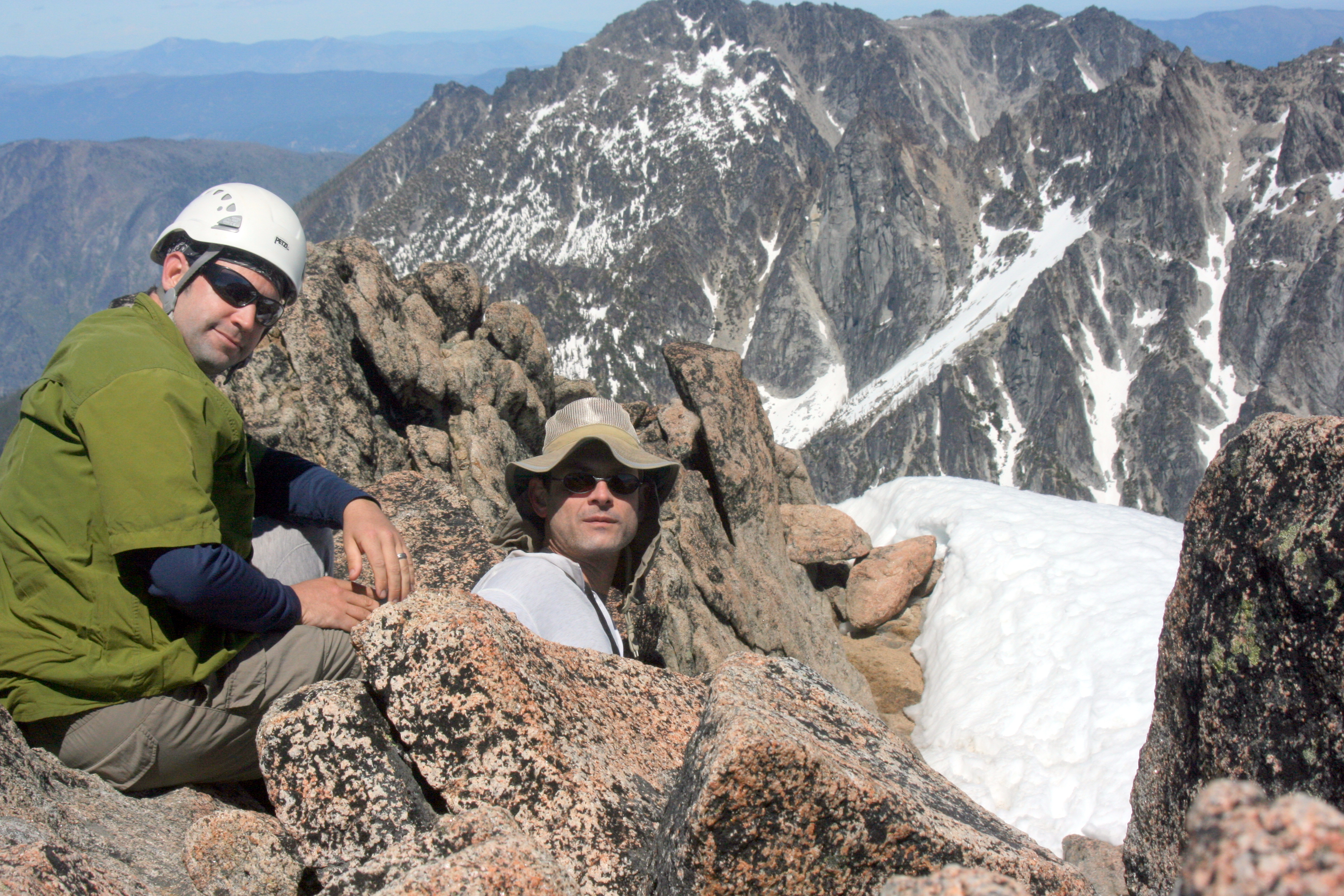 Lunchtime (a couple of bars) on the rocky summit.
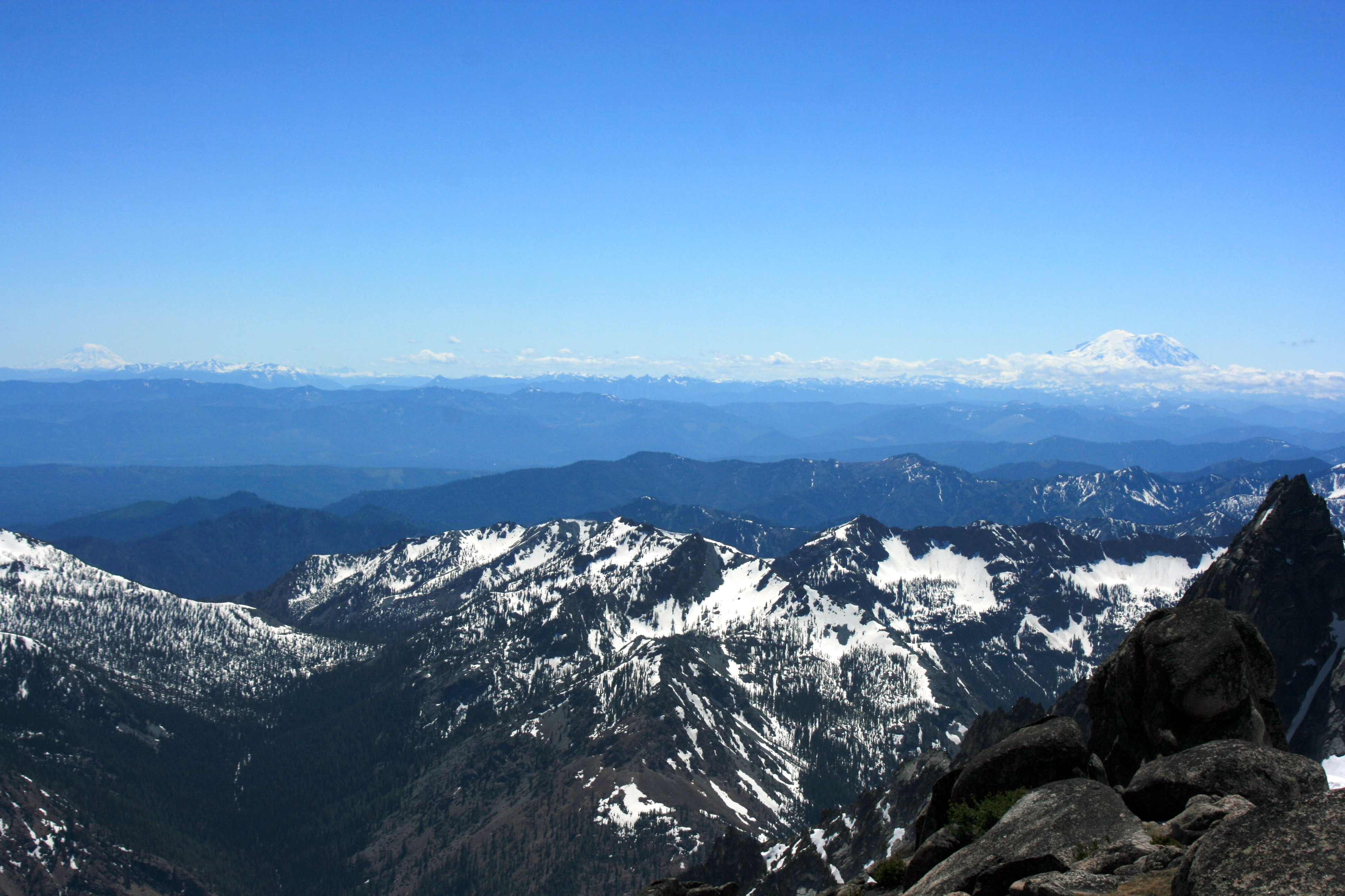
The Cascade Volcanos: Adams and Rainier visible to the south. Baker was visible to the north. (Side note: We have a looming date with Rainier. In a few weeks, we'll be attempting a summit!)
 Heading back down. OK, get on the rest of the snow gear, strap on the gloves, grip the axes, and glissade!
We dropped down the 2400 feet to the lake in about 20-30 minutes. Whew! It took 2-3 hours to climb it!
Heading back down. OK, get on the rest of the snow gear, strap on the gloves, grip the axes, and glissade!
We dropped down the 2400 feet to the lake in about 20-30 minutes. Whew! It took 2-3 hours to climb it!
 As we packed up our sleeping bags and camp gear at Colchuck Lake, I looked back and got another shot of where we had been earlier that day.
The car was still four miles away, and down a couple thousand feet.
We made it back to the parking lot around 7:00 PM. I was home just before midnight.
Whew! What a day.
As we packed up our sleeping bags and camp gear at Colchuck Lake, I looked back and got another shot of where we had been earlier that day.
The car was still four miles away, and down a couple thousand feet.
We made it back to the parking lot around 7:00 PM. I was home just before midnight.
Whew! What a day.